Hiked: 3/28/2021
Distance: 9.3 miles round trip on trail and cross country
Summit Elevation: 4680' (Chariot), Julian Ridge (4885')
Prominence: 600' (Chariot)
Elevation Gain: 2075'
Elevation Gain (in Empire State Buildings): 1.6
Round trip time: 4 hours 30 minutes
Recommended water: 72 oz.
Parking/Fees: Free on Sunrise Highway (S1)
Difficulty: Moderate
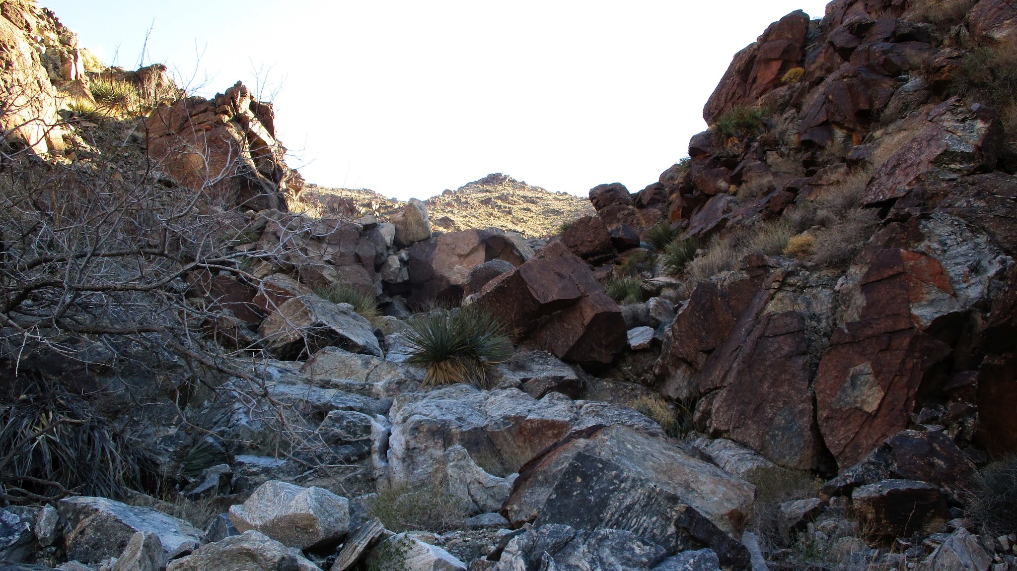
Chariot Mountain is a delisted SDC peak, but still popular with local hikers. The California Riding and Hiking Trail (CRHT) leaves from the monument as an alternating single track/dirt road through grasslands. It eventually links up with the Mason Truck Trail. It was flat for more than a mile before I reached the drop into the canyon. The trail drops about 850' before climbing up the road below Chariot. I followed the dirt road to the southeast ridge where a firebreak leads up the ridge. I followed the firebreak to the top, regaining all elevation lost dropping into the canyon. There were a couple of tiny bumps along the summit ridge. The farthest was the high point and location of the register. The oldest register was placed in 1995. The newest one only had a couple of empty pages left. It needs a new register the next time someone goes. At top, the views were nice in every direction, especially into Mason Valley. The weather was perfect, cool and sunny. I signed in and hung around for about 10 minutes before heading down. When I got back to the CRHT, I made a short side trip to the Julian Ridge Benchmark, less than half a mile away. I walked up the dirt road, then took a short use trail to the benchmark with a metal pole. I was surprised to find a register at Julian Ridge. A quick signature and I headed back. The side trip added about 30 minutes to the hike.
Hiked: 3/4/2021
Distance: 4 miles round trip cross country
Summit Elevation: 4504'
Prominence: 2844'
Elevation Gain: 1637'
Elevation Gain (in Empire State Buildings): 1.3
Round trip time: 4 hours
Recommended water: 64 oz.
Parking/Fees: Free on dirt road north of Bradshaw Trail
Difficulty: Moderate
I took a day off mid-week to tackle Black Butte (DPS #74), the high point of the Chuckwalla Mountains. It sports more than 2000' of prominence. The range is southeast of Joshua Tree and south of I-10. It is also directly north of the Chocolate Mountain Aerial Gunnery Range, a proving ground for the Navy. Driving to the start was a 22-mile dirt road excursion. The roads were in good shape and any vehicle should be able to make the drive, except the final 2 miles which require high clearance and 4x4. I followed the driving directions from the quality Summitpost page created by Adam Walker.
The primary route is a gully crawl ending just left (east) of the summit. Beware the cholla garden before reaching the gully. I'd honed my proficiency at desert gully crawls this year, and this one was standard class 2. There was one notable 40' dry fall obstacle with a bypass on the left. Black Butte appeared to be made of mostly black and dark red volcanic rock. Near the end of the gully, I angled up a steep slope more directly toward the long, flat, summit area.
The big dry fall
Summit ahead
I found three registers in the ammo box at the summit. The oldest went back to 1992 and looked kind of fragile so I didn't leaf through it. One was dedicated to the USS Cole, a destoyer that was victim of a terroist attack in 2000. I signed the newer register, where I found Adam's signature. For the return trip, I was trying to decide between the ridge east of the gully or a less steep gully farther east. I decided to take the other gully, so I drifted down the east ridge. The saddle above the gully was not visible until I crested the final drop to get there. The descent gully was not as interesting as the main one with only a couple of short dry falls. I had hoped to spot a chuckwalla and occasionally peeked into cracks between rocks, but it might have been too cold for them. Black Butte was one of the easier DPS peaks I've climbed. When I got back to the truck, I couldn't use my maps app to navigate back to I-10 so had to go on memory. It was three right turns, then a left. I got service back before the final turn and settled in for 4 hour cruise home.
Hiked: 2/26/2021
Distance: 12.5 miles round trip on dirt road and cross country
Summit Elevation: 2829'
Prominence: 800' (estimated)
Elevation Gain: 2528'
Elevation Gain (in Empire State Buildings): 2.0
Round trip time: 5 hours
Recommended water: 96 oz.
Parking/Fees: $3 OC Parks on Black Star Canyon Road (maybe?)
Difficulty: Strenuous
Update 3/23/2025: After years of trying to reach this summit, I was able to clip my way there after many attempts. There was an offical benchmark stamped Baker.
Looking at forest service topo maps in the Black Star area, I noticed a mark for Peak 2829, and wanted to find out if there was an official government mark there or if it was just a triangulated virtual mark on the map. Satellite images showed an overgrown dirt road going half way up the peak before curving across the middle then back down. I thought I could take that road partially up the ridge, then bushwhack from there. Because the approach on Black Star Canyon Road is long, I decided to bike in to the base. It would also save me time on the way back.
The bike part went smoothly. I pedaled up the gently graded road about 1200' over 5 miles to the local ridge high point, then stashed a water bottle behind a sign for the return. I dropped about 200' toward the base of Peak 2829. I took a use trail away from the road into a grove of oaks where I could lock/hide the bike. After chaining it to a medium sized tree out of sight of the road, I put on long pants for the bushwhack horror to follow. The start of the overgrown road was relatively easy to follow at first. When the road curved south across the belly of the beast, I continued up the ridge as the brush grew more dense. A small rock outcrop on the first bump was a good perch to look down into the otherwise hidden side canyon where strange conglomerites grew. Here the brush turned into a snarl. I kicked, smashed, crawled, stumbled, cursed, bled, and hammered my way near the top of the false summit. The little hope I had that the upper ridge would offer some relief faded. It had taken almost an hour to move a quarter mile. I had 3/10 of a mile to go and only 95' of gain. The final approach on the ridge turned out to be a half mile thick hedgerow. I had not planned on the physical effort required and didn't have enough water to continue. The descent was just as brutal until I reached the bump. I got back and removed my long pants, sporting scratches on all exposed skin including my face. Studying the post mortem, I have to admire how impregnable this peak is. Surrounded by a thick moat of brush on 3 sides, and a cliff into Baker Canyon on the other. If I ever go back -- and I have no plans -- I'd explore the Baker Canyon approach or maybe the East Fork of Black Star Canyon. The bike ride back only took an hour and I estimate biking saved me two hours round trip. After this trip, the odds of an actual mark being up there are probably very low.
Hiked: 2/12/2021
Distance: 5.7 miles round trip cross country
Summit Elevation: 4613'
Prominence: 2218'
Elevation Gain: 2338'
Elevation Gain (in Empire State Buildings): 1.8
Round trip time: 7 hours
Recommended water: 112 oz.
Parking/Fees: Free on Amboy Road
Difficulty: Strenuous
Sheep Hole Mountains HP (DPS #71) is a rough and tumble off trail boulder scramble near Twenty Nine Palms. The high point has over 2000' of prominence. I expected a lot of steep terrain like I found on Fish BM in January. Sheep Hole averages about 10 visitors a year. I chose DPS route A, the gully route, and parked on the shoulder of Amboy Road near the start. There was a surprising amount of traffic on Amboy Road, and I decided that was a net positive for the safety of my vehicle. [note: the new cheap camera I got only shoots at 4:3 aspect ratio, not pleased about that]
The first half mile up the gully was mellow with small dry falls and easy bypasses. I passed some old mining equipment but didn't see the mine. Higher up, the angle of the gully increased toward 45 degrees and boulders and falls got much larger. I drifted left above the gully and found a disjointed class 3 route over car-sized rocks. I backed off one spot where the next move was a 4' step over a 40' drop. Atop the main gully, it eased up a little before more big dry falls appeared. I left the gully and side hilled just below the ridge, eventually going over a crest and crossing a small drainage. Although the forecast called for sunny skies, gray clouds had moved in and dropped sprinkles on me. The wind was steady, gusting up to 25 mph. It didn't feel like the clouds were threatening a downpour. A hard rain would have ended my bid for the summit. The next section was a very steep climb on loose dirt to a small plateau below the final approach. I spotted several cairns on the slope and followed them to the plateau.
Sheep Hole Mountains at dawn
Fresh sheep scat, didn't see any sheep
Tough going near the top of main gully
Nearing the summit
Stellar views started to open up behind me. However, I still had not seen the summit. The final half mile required navigation through bus-sized boulders. I moved in and out of the boulders on a path of least resistance. After starting up a long class 4 chute, I scrambled down when I spotted an easier way around. Route finding in the rough terrain was a constant challenge. I stumbled across more cairns leading around a pinnacle. I was moving very slowly at this point, losing steam, but the clouds had started to clear. Passing the pinnacle finally revealed the summit block. I dropped my pack and evaluated possible ascent lines. I'd read mixed things about the difficulty of the summit block. The obvious way up was via slab on the northwest side. It was class 3, but only the first 10' required pure friction. There were chunky holds the rest of the way. It was far more challenging to get to the summit area than climbing the block. The register was in an ammo box on top. I was glad to find the register lived there and not below the summit. The wind was howling, so I only stayed long enough to sign in and snap a few photos of register pages, holding them down to keep the wind from blowing them around. Without the wind, I would have spent more time on the summit. I started down a little north of where I came up, leading to more class 3 down climbing and crawling under giant boulders. At the small plateau, I got back on course to descend the same route I came up. On the side hill section, I found what looked like some airplane or drone wreckage. When I got back to the steep upper gully, I spotted cairns I missed before. This led to an easy class 2 chute to bypass the worst of the upper gully. I got back to the truck to find it was undisturbed, then started the 3 hour drive home.
Hiked: 7/20/2018 to 6/20/2020
Distance: 73.8 miles
Summit Elevation: 6240' (Butterfly) to 8720' (Red Tahquitz)
Total Gain: 21,305'
Total Gain (in Empire State Buildings): 17
Total Hike Time: 47.7 hours
Parking/Fees/Fares: Adventure Pass
Difficulty: Moderate to Strenuous
The Desert Divide is an unofficial group of peaks that run north-south on a long ridge extending from the San Jacinto Mountains and are accessible from the PCT. The divide ridge cuts the desert in two with high alpine forest. Peak elevations range from 6240'-8720'. This list is somewhat arbitrary since Red Tahquitz might be considered part of the Tahquitz family and the San Jacinto mountains proper. Grey Tahquitz could be added due it's proximty with Red, the same with Rock Point, a popular peak south of Butterfly (I bagged both peaks while doing the divide). I stuck with Hikin' Jim's original list of twelve as the northern and southern boundaries, but added Little Desert Peak for a total of thirteen. Little Desert is a small bump just off the PCT but is an official peakbagger peak and fit all other criteria. Most of the peaks are on the HPS list.
I broke the divide into six hikes, summiting two or more on most trips. Antsell Rock deserves special mention for the difficult approach and solid class 3 finish. Antsell is the shining star of the divide. Cone Peak has an impressive and exposed class 3 summit block. Pine has an easy class 3 block and a monsterous 60' class 5 boulder that is rarely attempted (I didn't). The Palm View Peak summit is surrounded by trees and ironically has no view, the worst summit on the divide. Due to distance, brush, and route finding, it is unlikely all thirteen could be done in a single day.
Distance and Time in the table is for the round trip. Note: a zero (0) for distance, gain, and time means that peak was part of a multi-peak day hike and the stats were combined for one peak in the trip.