Hiked: 6/20/2020
Distance: 15.6 miles round trip on trail and cross country
Summit Elevation: 6423'
Prominence: 503'
Elevation Gain: 2876'
Elevation Gain (in Empire State Buildings): 2.3
Round trip time: 6 hours 50 minutes
Recommended water: 96 oz.
Parking/Fees: Free at turnout on Highway 74
Difficulty: Moderate
Ken Point (HPS #160) is the southern terminus of the Desert Divide ridge peaks. From the summitpost.org web site, "This name was informally given by the HPS, based on a benchmark named 'Ken' (1941). It was almost certainly derived from the infamous Kenworthy Mine which once existed, 2.3 air miles to the northwest."
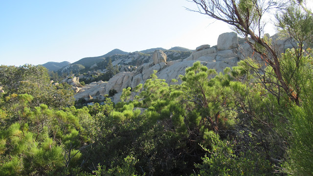
One possible route goes over Butterfly Peak, but I wanted a new experience, so I took the longer PCT route, starting from a turnout on Highway 74. I hiked a long gentle section of PCT, passing rocky cliffs on the ridge. It is such a well maintained trail that the gain is barely noticeable. I met a couple of parties on the trail and one southbound PCT through hiker. After a long approach, I reached the junction with a mining road and cut back toward Ken, which was not visible until I was almost on top of it.
The road was overgrown with manzanita in a few places, but you could still push through it. When I got below Ken Point, I left the road to climb through knee high shrubs. There was enough space between the shrubs to pick your way through. Part way up, I spotted some cairns and followed a faint use trail, but there were multiple paths to the false summit. From the false summit, it was a short trek to Ken Point where the benchmark and one reference mark were easy to find. The register was almost new with only a few entries. I enjoyed the wonderful views all around and loaded up on calories before starting back. Even though it was a lot of trail miles, there wasn't enough gain for it it to reach the level of a strenuous hike. The PCT made most of those miles a dream. When I got back, I packed up and drove toward Toro Peak for the second hike of the day.


No comments:
Post a Comment