Sunday, July 30, 2023

San Gorgonio and Northwest Slope via Dry Lake

HPS Star Emblem Peak
Hiked: 7/29/2023
Distance: 21.8 miles round trip on trail and cross country
Summit Elevation: 11501'
Prominence: 8294'
Elevation Gain: 4754'
Elevation Gain (in Empire State Buildings): 3.8
Round trip time: 10 hours 50 minutes
Recommended water: 176 oz.
Parking/Fees: Adventure Pass
Difficulty: Very Strenuous

Leisa and I drove to the South Fork Trailhead for a big training hike. I think San Gorgonio is the best Whitney training hike in SoCal. It is the highest and all routes are long with substantial gain. The sandy granite trails are also similar to the Whitney trail. The parking lot was mostly full when we arrived just before 7 AM. Temps were pleasant and stayed that way as our elevation gain offset the warming of the day. Several parties were on the trail. We caught one with six people taking a break at Poopout Hill. They caught up with us a mile later during our first break and we made a couple of stream crossings together. After that, we pulled away and met them heading to the summit as we were coming down. We took the junction to Dry Lake and it was full of murky green water. We decided we would filter water from one of the streams if possible on the way back. We passed Mineshaft Saddle and started the many switchbacks up the north side of Gorgonio. For our final break on the way up, we stopped at the C-47 memorial. There was still a lot of debris above and below the trail, but little to no snow. We continued up as the Sky High Trail cut into the south face, offering nice views of Bighorn Mountain and Dragonshead.


Gorgonio a long way off


Walking by the very wet Dry Lake

Memorial

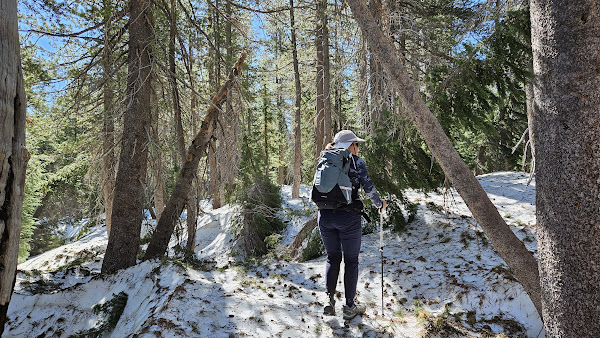
We were passing directly underneath Gorgonio where the Sky High Trail makes a final turn before intersecting the summit trail when we met a large snowfield. It covered the trail completely with a 100' run out into rocks, boulders, and trees. Footprints marked the trail through the snow so people had been using it. Even though we both had microspikes, it seemed an unnecessary risk. We had just caught up to a party of three and all of us agreed it looked better to go straight up toward the summit over sand and rocks. There were even a few braids of use trail indicating others had made the same decision. We led the way up and soon joined the busy summit trail. There were about twenty people milling around the summit, par for a summer Saturday. There was a destroyed ammo box with a missing register, also par for San Bernardino summits. The benchmark that used to be there was gone. The weather remained favorable, with some puffy, non-threatening clouds drifting by and no rain. We hung around on top for a while, then I made a short side trip to the Northwest Slope which has some geological significance (and a bonus PB point). I found two coils of wire, no marks, but another destroyed register box. I returned quickly and we descended the same way back to the trail and retraced our steps. We stopped at one of the streams to refill our water using squeeze filters, much more efficient that the hand pump variety. The final five miles seemed to go slowly, but we finished up in just under 11 hours. A great day and successful trainer in the books.

Debating whether to risk the snow

Off trail, avoiding the snow


Stream crossing, and where we refilled our water


Monday, July 24, 2023

Thunder Mountain West

Hiked: 7/21/2023
Distance: 7.4 miles round trip on trail and cross country
Summit Elevation: 9408'
Elevation Gain: 2060'
Elevation Gain (in Empire State Buildings): 1.6
Round trip time: 4 hours
Recommended water: 80 oz.
Parking/Fees: Free at Thunder Mountain trailhead on Highway 88
Difficulty: Moderate

A day after our hike of the formidable Deadwood, we set our sights on Thunder Mountain West in the Eldorado National Forest. Our hope was to evade the snowy obstacles that had challenged us on Deadwood. The trailhead had a large parking area and only two other vehicles. One was a US Forest Service truck. As we began our ascent, we crossed paths with the forest service crew, who were marking the trees claimed by death to be culled. A fire had swept through the area two years prior, leaving a layer of ash that blanketed the lower part of the trail and stirred up a cloud of dust as we passed. Upon reaching the main ridge, the trees began to thin, making way for towering black volcanic formations. Some of these formations bore names, such as Carson Spur and Two Sentinels. The landscape was a blend of intrigue and awe. Just before the Sentinels, we met our first significant snowfield. We managed to navigate around it by ascending a steep slope and rejoining the trail.


Kirkwood Lake


First snowfield

The trail led us to Glove Rock, another colossal volcanic structure. A critical part of the trail performed a switchback there, crossing a saddle to reach the mountain's southern side. However, another snowfield had claimed the switchback. We found ourselves hiking in a randkluft-like gap between the snowfield and the mountain. The only way to rejoin the trail was to traverse a steep, slippery slope, followed by a scramble up 30 feet of rock. I ventured ahead to confirm the route, discovering later that a less dramatic use trail hugged Glove Rock and rejoined the main trail. I left my pack on the trail above and returned to inform Leisa the trail continued above. She expressed discomfort following my path and suggested that I continue to the summit alone, promising to meet me below. The summit was about a half mile away. With a mix of hesitation and conflicting emotions, I promised to return in 30 minutes and scrambled back up.

Confidence booster!

Second snowfield

Glove Rock


Where the trail emerged after the switchback

Upon crossing to the mountain's southern side, I left my pack behind and began to jog. I could see one last snow patch ahead, but it did not intersect the trail. The summit was a sphere of volcanic rock, unmarked and without a register. The views were striking. Despite Leisa's disappointment, I firmly believe it is better to turn back when in doubt. Each year, I find myself retreating at least once or twice. If not, I am likely not challenging myself enough. The summit is not a necessity; a safe return is. We paused halfway down the ridge to enjoy lunch and the views into Kirkwood.

PS: I had clearly not done my research on Thunder Mountain, discovering after the fact that I had visited Thunder Mountain West, two feet lower than the Peakbagger official Thunder Mountain. OTOH, Google Maps shows the west peak as Thunder. The USFS topo doesn't label either point as Thunder, but the higher elevation breaks the tie. I had followed the trail to the end, blithely passing the higher Thunder Mountain. I now have a reason to return some day.


Thunder Mountain West summit

Silver Lake


Looking back at slightly higher Thunder Mountain and Glove Rock


PPS: We had part of the day left but didn't want to tackle a major project. We drove down Highway 88 to the "Potholes", a popular series of pools carved by a stream and only a mile and half round trip. We sat on the edge of a rock and soaked our tired feet in the brisk water. It was a nice way to wrap up our trip in the Kirkwood area.


Friday, July 21, 2023

Deadwood Peak

Hiked: 7/20/2023
Distance: 15 miles round trip on trail and cross country
Summit Elevation: Deadwood (9846')
Prominence: 1366'
Elevation Gain: 2750'
Elevation Gain (in Empire State Buildings): 2.2
Round trip time: 8 hours 45 minutes
Recommended water: 112 oz.
Parking/Fees: Free at Incline Drive parking lot
Difficulty: Strenuous (route finding, snow)

Leisa and I drove to Kirkwood, about an hour south of Tahoe, to continue our Sierra adventures. We believed that the snow there would be more forgiving than the harsher, higher Sierra. While our assumption held true in general, the mountains had their own tales to tell. Our inaugural hike led us to the summit of Deadwood Peak, standing proud at 9,846 feet. A trail from Upper Blue Lake meandered close to the mountain, but the final ascent to the peak was pathless. As if to foreshadow the challenges that lay ahead, we found the way to Upper Blue Lake barred, and were compelled to leave our vehicle at Lower Blue Lake. This added an unexpected 3.5 miles to our trip, but we were not to be deterred. We crossed a bridge over a babbling stream, and a sign guided us to the end of a berm. We searched for the trail's beginning, but found no signs, no traces of a path. GPS assured us that the trail began here, but it lay hidden beneath piles of snow. We were not disheartened. We strapped on microspikes and plunged into what I fondly referred to as "the moguls." We navigated through the snow mounds, some standing three feet tall, others reaching up to seven, weaving our way between the trees. In a twist of irony, we stumbled upon a sign that read "Hiking Trail." We were on the right path, but the trail was nowhere to be seen. The moguls proved treacherous, with the threat of collapsing snow near the trees and rivulets of water where the snow had melted. After half a mile of this challenging terrain, we emerged from the dense forest, the snow receding into sheets. Yet, the snow was not our only adversary. The trail, when we could find it, was littered with fallen trees and branches, or transformed into running streams. We reached Granite Lake and the snow wrapped around it. Beyond the lake, the trail was a little easier to follow.

Lower Blue Lake

Entering the moguls


Granite Lake


Start of the east ridge

Conditions began to favor us, and we found ourselves donning and doffing our spikes as the terrain dictated. The landscape unfurled around us, revealing mountains partially veiled by snow. Deadwood Peak loomed in the distance, its highest point elusive. As we neared the mountain, we were faced with a choice: to ascend via the eastern ridge or to aim for a gully closer to the summit. Both paths were adorned with snow. The eastern ridge appeared more navigable. We navigated just above the snow field, crossing it only where a break allowed. The ridge grew steeper, and we carefully made our way upwards, only to discover that we had not yet reached the summit. The true peak now lay before us, a quarter mile away. We persevered along the ridge, conquering the final few hundred feet to the summit, where a small cairn and a register jar awaited us. The last signature dated back to June of 2021. We added our names to the list and reveled in the panoramic views. Our descent led us down a gully on the other side, down to the saddle between Deadwood and a western spur that seemed almost as high. The spur intrigued me. Leisa waited at the saddle as I left my pack behind and embarked on a quick round trip. I had anticipated a class 3 block at the spur, but found it to be a class 1 climb. Another register awaited me at the top, and I signed my name once again. As we continued our descent, we navigated around the snow in the gully, hopping from rock to rock to rejoin the trail. We retraced our steps, donning our spikes as needed. The hike had taken us several hours longer than anticipated, and we found ourselves stopping at one of the lakes to filter water, of which there was no shortage. Leisa led us back through the moguls, and we breathed a sigh of relief as we returned to the road. We made our way back to Lower Blue Lake, celebrating our triumph with burgers and nachos at the Kirkwood Inn. The journey to Deadwood under such conditions, was a test of physical endurance and mental fortitude. I was particularly struck by Leisa's grit. She truly is a force.


Summit finally in view

Looking over at the west spur


West spur


Getting water