Tuesday, February 21, 2017

Jacumba Mountain

Hiked: 2/20/2017
Distance: 6 miles round trip cross country
Summit Elevation: 4512'
Prominence: 1272'
Elevation Gain: 2933'
Elevation Gain (in Empire State Buildings): 2.34
Round trip time: 5 hours 30 minutes
Recommended water: 88 oz.
Parking/Fees: Free at Mortero Palms
Difficulty: Moderate

The third and final goal of the day was Jacumba Mountain, #40 on the SDC list and #74 on the Desert Peaks list. There is a shorter route on the south side that seems to have gained favor recently, but I was already close to the northern trailhead at Mortero Palms and I needed the extra training. Note: time and elevation gain are higher than they should be due to mistakes I made on the way back. My first trip down Mortero Canyon road was in a sedan and I had to stop well before the train tracks because I could not make it over a large rock. This time, the 4Runner was able to cruise over the worst spots. Campers had several tents set up at Dos Cabezas as I drove by.

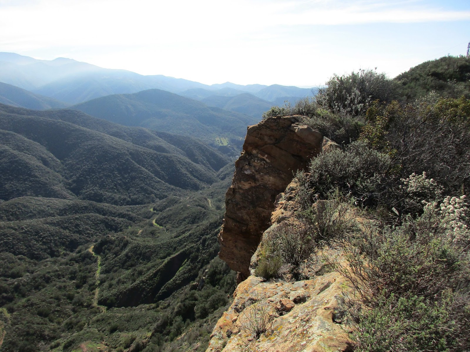
At the Mortero Palms trailhead, a group of six was gearing up for a hike to Goat Canyon Trestle. They asked me if I had been to the trestle and where the trail started. I told them I had been there, but from a different starting point. I gave them a few tips on finding the use trail once they got to Goat Canyon, but was concerned that none of them had a map or GPS. They looked young and fit, but unprepared. They started ahead of me into the south canyon, the way I was headed, instead of Palm Canyon. They were about 100 yards ahead of me, and started climbing in the direction of Palm Canyon, so I thought maybe they would be OK. The boulder scramble begins immediately with a mix of class 2 and class 3. I found the path of least resistance was usually left of center on the way up. The climb to the top was enjoyable and got my blood pumping. I exited the canyon onto a flat plain with several huge piles of rocks rising from the earth on both sides. I could see Jacumba at the top of a steep canyon on the left, while the ridge line formed a north-south wall. As I crossed the plain, one of the boulder piles caught my attention to the south. I could see two large caves in the formation and made a mental note to check them out on the way back.


Start of the south canyon


Hikers in the wrong canyon, heading to the trestle


Going up


Looking back


Caves!


Jacumba left of center

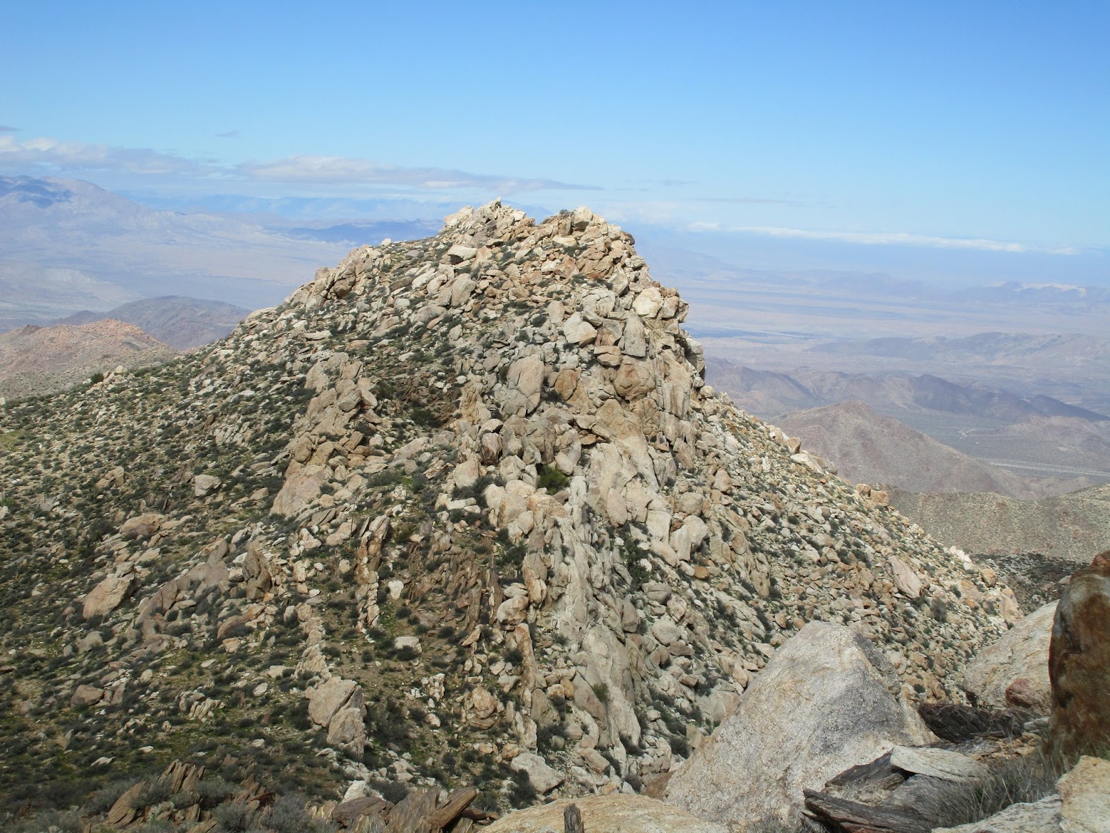
Instead of tackling the most direct canyon, I picked a spot on the ridge line and started in that direction. It was a long slog of steep class 1 to the ridge line. I took a break when I gained the ridge, knowing there were going to be major bumps and false summits along the way. I took aim at the first bump and plodded upward. From there, I could not see Jacumba, so I headed for the next. I skirted the flank of the highest bumps and found remnants of a use trail along the last mile. When I got close enough to see the summit, I spotted a crow or raven perched on the wooden pole jutting up there. I didn't take that as a good omen. It only flew off when I was just below the block. The Jacumba summit block was low class 2, and has a neat drop off on the west side. There was a benchmark and reference mark on the main block along with an ammo box containing several registers. I relaxed and took in the expansive views in all directions. After all summit rituals were complete, I started back with confidence I could descend quickly.


Looking down to the flat area


One of the bumps on the ridge


Jacumba in sight


Summit bird


Benchmark, placed 1935


Looking south


Looking northeast along the ascent ridge


Drop off on the west


Registers


It turned out I had too much confidence as I overshot the ridge line and started down a gully in the wrong canyon. As the landmarks started looking alien, I checked my GPS and tried to correct my course. This involved climbing back out of the gully and taking a side hill path back to the point I where I gained the ridge. I should have just descended, then headed back to the descent canyon. With extra effort, I got back on my original line, but gave up on the idea of exploring the caves I noted on the way up. I didn't have the energy for the cave exploration, but it might be worth a future trip. I was glad to get back into the descent canyon and scramble down to the trailhead. There I saw four of the six hikers I met at the start, waiting for the other two to return. They had gotten lost and abandoned their trip to the trestle, returning down Palm Canyon without even getting a look at it. Like me, they had been roughed up a bit, but were no worse for wear. Their other two companions had continued on, but they did not know if they had been successful. Jacumba was more of a challenge than I expected and a fun desert peak.


Obstacle on the way back


There will be blood


Interesting rock


More rocks


Brushy palm


Red Hill

Hiked: 2/20/2017
Distance: 3 miles round trip cross country
Summit Elevation: 1720'
Elevation Gain: 933'
Elevation Gain (in Empire State Buildings): 0.74
Round trip time: 1 hour 30 minutes
Recommended water: 32 oz.
Parking/Fees: Free on Sweeny Pass Road (S2)
Difficulty: Easy

Red Hill is part of the Volcanic Hills and #88 on the SDC list. It was another short hike, though the terrain was a little deceptive. The trailhead is a large circular turnout on the west side of Sweeny Pass Road. If you head directly toward the summit, you will have to traverse up and down several canyons. The easiest route is to head south, then approach it from the east.

I did not go far enough south and had to scramble down a crumbling canyon wall before starting up again. Heading up a small gully, I startled a jack rabbit, the only wild life I saw the whole day. I veered south to avoid a second down climb before starting my final approach from the east. As I got closer to Red Hill, the landscape became littered with smooth, red lava bricks. Larger volcanic boulders piled up on the slopes of Red Hill, requiring some easy class 2 in places. The summit plateau was very large with multiple possible high points. The closest potential high point lacked the trappings of a Sierra Club summit, so I moved on the next, finally reaching the summit on the third try. It was much closer to the west side of the plateau than the east. I signed the register and took some photos of the good, but less dramatic views compared to Mine Peak. I returned down the eastern slope, then followed a wash all the way out to the plain for an easy stroll back across the open desert. With the second peak of the day bagged, I drove to the Mortero Palms trailhead for a more challenging attempt on Jacumba Mountain.


Start


Looking back at the down climb, an unforced error by not going far enough south


Red bricks


Final climb


Summit


Register from 1982


Looking west


Looking north


Looking south


Exit path through wash


Mine Peak

Hiked: 2/20/2017
Distance: 1.9 miles round trip cross country
Summit Elevation: 1850'
Prominence: 670'
Elevation Gain: 707'
Elevation Gain (in Empire State Buildings): 0.56
Round trip time: 1 hour
Recommended water: 0 oz.
Parking/Fees: Free on Dolomite Mine Road
Difficulty: Easy

I have been lucky with weather on most days I planned to hike. 2017 reversed that with heavy rainfall throughout January and February, cancelling many planned outings. I was nearly rained out again over a 4 day weekend from a large storm that terrorized SoCal. Luckily, the Laguna and In-Ko-Pah mountains contained the remainder of the storm to the west allowing me to stay dry throughout the day. For my first outing of the month, I planned to sweep three of the most distant San Diego Peak List summits in the southeastern part of the county. First up was Mine Peak (#87).

To reach the trailhead, take the West Dolomite Mine Trail east from Sweeny Pass Road at mile marker 53.4. After 0.7 miles, turn left and drive to the abandoned mine or as far your vehicle will go. High clearance is needed for the last half mile, and one part of the road was nearly washed out. I didn't know what dolomite was (calcium magnesium carbonate). In powdered form, it is apparently used for roads, concrete, and asphalt. The hike to Mine Peak is short, even if you park farther down the road. The attraction is the commanding view into the Carrizo Badlands. In the half-light before dawn, I headed out with minimal supplies. I followed a dirt road at first, then went cross country up to the ridge, then over to Mine Peak. I got there in time for some nice sunrise shots of the badlands and mountains to the north. On the way back, I looked around the abandoned mine area, but found no adits. It was completely sealed. Without delay, I drove back to Sweeny Pass Road and headed a mile or two south to the Red Hill trailhead, a turnout on the west side of the road.


Glow


Remains of the dolomite mine


Looking back on the way to the ridge


Approaching Mine Peak


Summit


Unusual benchmark from the "Division of Beaches & Parks", 1958


Carrizo Badlands


Looking north toward Whale Mountain


Smoke grenade left at the summit


Wednesday, February 1, 2017

Peak 2600

Hiked: 1/31/2017
Distance: 7.8 miles round trip on dirt road and use trail
Summit Elevation: 2600'
Elevation Gain: 2297'
Elevation Gain (in Empire State Buildings): 1.83
Round trip time: 3 hours 30 minutes
Recommended water: 52 oz.
Parking/Fees: Free on Blackstar Canyon Road
Difficulty: Moderate (ISC-F3C2T4)

Peak 2600 sits between the main and east forks of Baker Canyon in the Santa Ana Mountains. Brad had been to this peak before and agreed to guide me. You can access this area as part of the Irvine Ranch Natural Landmark every couple of months.

The first part of the hike is along a dirt road that parallels Blackstar Canyon Road for a half mile as the road slowly climbs toward the first electrical tower. Views get better with the elevation, first into Limestone Canyon, then Hall and Baker Canyons. We got a good look at the giant cross near Star Benchmark. There is a four way junction at the first tower and we continued straight. The largest single chunk of gain was the climb to 2342', about 600' in a half mile. The rest comes in gentle, rolling angles. Irvine Lake looked full, a complete reversal from late last year when it looked ready to vanish. A little past 2342', we got to the second electrical tower. From there, a use trail leaves the road behind the right side of the tower along the east cliffs. It is not obvious at first, but can be seen by taking a couple of steps into the brush away from the cliff.


Start


Loma Ridge


Cross and Star Benchmark


Some kind of collapsed structure


Greenery, Peak 2342 behind


Climbing to 2342'


First cliff

The use trail hugs the cliffs, generally staying 2' to 20' from the edge. There are captivating views down the cliff faces as you climb to a local apex at 2473'. On the other side of 2473' was a fixed double rope, maybe 10mm, wrapped around two average sized trees, one living and one dead. Knots were tied expertly every two feet down the length of the rope providing good hand holds. The rope seemed solid, protecting a 10' class 4 section of decaying sandstone. Neither Brad nor I know who placed this rope. Once we were down, the slope dropped to a saddle as the use trail got more congested. Brad was doing some trimming as we went, but the bushwhacking was light in most places. We crested a small bump before reaching the summit of peak 2600, completely covered with brush blocking all views. No marks or register were found on the summit. I pushed out the other side for a great shot of peak 2829 backed by Mt. Baldy and the snowy Angeles National Forest. While the summit was nothing special, the trip out and back was a lot of fun. We used the rope on the return trip and jogged some of the downhills.


Peak 2473


Cliffs on the Baker Canyon side of Peak 2473


Fixed rope, the anchor fine for rappel, not fine for a fall


Brad descending


Looking back at the cliffs, second electrical tower on the left


On the way to Peak 2600


Overgrown summit of Peak 2600


Looking toward Peak 2829 and the snow covered Angeles National Forest


Ascending


Turkey vulture soaring overhead


Some video highlights


The GPS track shows us going over the cliff

Would you like to know more...?