Thursday, May 26, 2016

El Cajon South Arete

Hiked: 5/26/2016
Distance: 7.5 miles round trip on use trail, dirt road, and cross country
Summit Elevation: 3675'
Prominence: 1955'
Elevation Gain: 3275'
Elevation Gain (in Empire State Buildings): 2.62
Round trip time: 6 hours 45 minutes
Recommended water: 92 oz.
Parking/Fees: Free on El Monte Road
Difficulty: Strenuous

In 2013, I hiked the main El Cajon trail from Wildcat Canyon, but wanted to return for the south arete route. This mountain is notorious for scorching heat. The preserve is closed every year the entire month of August. We were having a cooler May than usual and that created a window to tackle this route. As we drove up, the south arete looked more and more impressive. Daunting and action packed. We parked on El Monte road and crossed the river heading toward the ridge line.

Despite a couple of online trip reports and a GPS track, the route finding turned out to be difficult. At the end of this post, I'll highlight some of the right and wrong decisions we made. It won't be the definitive post to guide future hikers confidently up the route, but it might help a little. At the start, I should have paid more attention to the track I downloaded, but instead we took a shorter cross country route with a bit of thrashing involved. Henry had worn shorts and the brush was already working his legs over. We headed toward the leftmost electrical tower and were soon on the use trail heading up the ridge. As we ascended, the loose dirt became steep and slippery. The route was pretty obvious all the way to lunch rock, almost half way up. The views were good and would have been spectacular without the overcast skies and low clouds.


El Cajon Mountain, the route starts on the ridge left of center


Henry climbing a slab


Lunch rock


Emerging from the cave above lunch rock

We went through the cave above lunch rock, though it can easily be bypassed on the left. The use trail continued above lunch rock for a little bit before hitting a wall of rock. There is a choice here. You can traverse left around a huge slab to head up the large gully, or continue up the rock. We traversed into the gully, but when we got there, doubted our choice. The rock might have been difficult, we don't know, but the gully was choked with brush and waist high grass. It was hard to see where you were stepping and whether the ground was solid under the grass. We went too far left and lost all traces of use trail. We picked our way slowly up the left side of the gully and reached a small flat area. There we found a cairn and picked up a use trail again. We followed it into a small gully that ended in a boulder overhang. I was looking for a way up and made an awkward move to get over it. I didn't account for the position and weight of my pack and it promptly dragged me back down. I fell about 4 feet and nearly crashed into Henry. Blood oozed from my elbow and thumb, but I am convinced I could make that move. Henry took a look and wasn't sure it was the best way forward. Before making another attempt, I returned about 20' down the gully, where I found the bypass on the left. I clambered up and skirted a ledge to confirm then yelled to Henry. We stayed on track for a few hundred feet, then wandered too far left below some nasty cliffs. We were only about 80' from the top. We backtracked, traversed right, and found the use trail again. It took us the final stretch to the top of the arete.


Climbing toward the next wall of rocks


Decision time. Stick to the rocks or traverse to the gully.


Traversing left into the large, brushy gully.
Will stick to the rocks next time.


Window rock, about 50' thick and several hundred feet long


Quick 360 about 2/3 of the way up


Upward ho!


Multicolored cactus bloom. If you find this beauty, you are off route and in danger,
descend and traverse right.


Henry nearing the top of the arete

Clouds were rolling over the top of El Cajon, hiding the top of the mountain. There were two campers on the plateau, drinking what I guessed was coffee. We waved and continued up the trail. It was an uneventful trip across the plateau and up the final use trail to the summit. There was a new wooden summit marker that was not there in 2013. I was very hungry by now and we settled down to kill our sandwiches. The sun was hidden, and now that I wasn't moving, I actually started to get cold, something I didn't think possible on El Cajon. We didn't find a register, but took a few summit photos and visited the summit block. As we started to leave, two other hikers arrived from the main trail, the only other party we saw on top. Henry and I talked about bushwhacking down another gully, but I persuaded him to return down the arete. I wanted to improve on the route we took going up. I carefully tried to follow the use trail down and it was far easier. However, we eventually lost it and suffered more bushwhacking to get back to lunch rock. From there, we stayed on trail down to the dirt road and found a nice trail back to the road near where we parked. I marked the trail location with a waypoint (get the track on peakbagger.com). The 2000' gain in a little over one mile might be the steepest sustained stretch I've climbed on any mountain. This trip was every bit as fun as expected, packed with a full RDA of adventure.


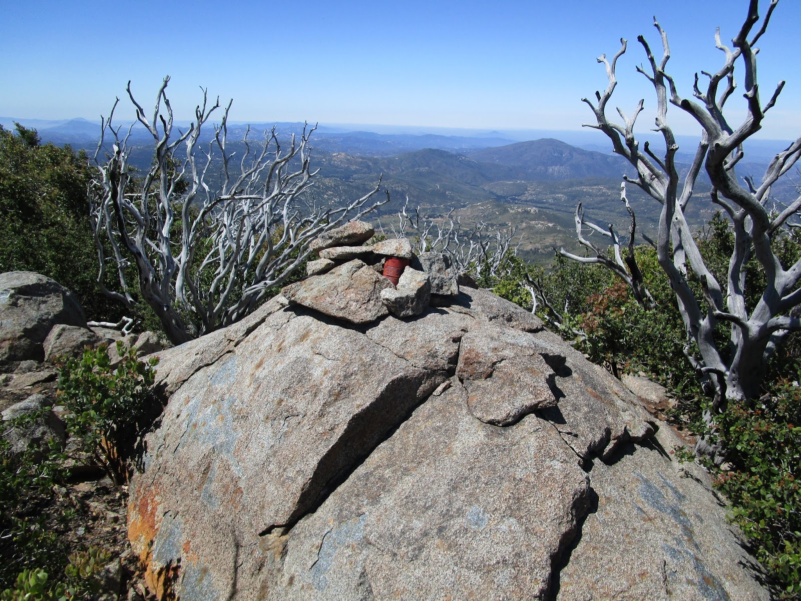
El Cajon summit and new wooden marker


Looking down through the low clouds


Returning on the trail toward the south arete


Looking back at El Cajon, just as the clouds were burning off


El Capitan Reservoir


Downward ho!


Back in the narrow gully


Looking west toward Silverdome and Iron Mountain


Follow the nice trail to the dirt road


Don't stray too far left, take advantage of cairns and any use trails you find

Other trip reports:
El Cajon Mountain South Arete (Benjamin Bauman)
El Cajon Mountain South Arete (Vista Seeker)
El Cajon Mountain South Arete (San Diego CA Photography)

Monday, May 23, 2016

Peak 2301

Hiked: 5/22/2016
Distance: 1.8 miles round trip on use trail
Summit Elevation: 2301'
Prominence: 361'
Elevation Gain: 1115'
Elevation Gain (in Empire State Buildings): 0.89
Round trip time: 1 hour 5 minutes
Recommended water: 16 oz.
Parking/Fees: Free on Silverado Canyon Road
Difficulty: Easy

Peak 2301 is in the Santa Anas on the north side of Silverado Canyon. To get there, head up Silverado Canyon Road and park in a dirt lot on the north side just before the post office, across the street from the Silverado Canyon Market. The vague use trail starts behind the telephone pole.

Because this hike is so short, I went without a pack or phone. I drank one bottle of water to hydrate, then started up. The trail is steep in places with patches of loose dirt. I slid backward a few times near the start. There was some light brush intruding on the trail and some yucca. Once you are a few hundred feet above the road, nice views open up 270 degrees to the south. Not far up the ridge are three white wooden crosses. A little higher up, across a small gully was a rusted car wreck. I was curious, but not enough to thrash over to it. Not far above that is a sign that marks the start of the Cleveland National Forest. It is not clear who owns the land between the marker and the road. At the summit is a register in a rusted box filled with loose notes. The oldest one I could read was from 2005. I found recent entries from Brad Stemm and Terry Flood. I was lucky to find a blank strip of paper to add my signature. The next time I visit, I'll bring a small book to add. On the north side, a clear firebreak drops to a saddle then ascends to peak 3011. I was very tempted to continue, but 3011 is currently in the Silverado Fire closure area. The south slopes were covered in crispy, charred brush. Looking at the topo, the firebreak could be followed over peak 3391 and peak 3423 all the way to the Silverado Trail and Bedford Peak once the area opens again. That will be a fun ridge traverse. I am looking forward to coming back.


Start behind the pole


Wooden crosses


Wrecked car, probably driven up Sunstag Run Road before it was overgrown


Peak 2301


Register box


Peak 3011 further up the ridge

See also:
Postal Ridge

Saturday, May 14, 2016

Cuyamaca, Middle Peak, Japacha, Stonewall Peak

HPS Star Emblem Peak
Hiked: 5/13/2016
Distance: 18.6 miles round trip on road, trail, and cross country
Summit Elevation: 6512' (Cuyamaca), 5883' (Middle), 5825' (Japacha), 5730' (Stonewall)
Prominence: 2855' (Cuyamaca), 803' (Middle), 25' (Japacha), 860' (Stonewall)
Elevation Gain: 3975'
Elevation Gain (in Empire State Buildings): 3.18
Round trip time: 8 hours 15 minutes
Recommended water: 184 oz.
Parking/Fees: $8 State Parks at Paso Picacho Campground
Difficulty: Strenuous (combined)

Cuyamaca is the second highest point in San Diego County after Hot Springs Mountain. It is the highest point on the Sierra Club San Diego peak list. I guess Hot Springs Mountain isn't on the list because it is on Los Coyotes Reservation land. Cuyamaca is visible from almost everywhere in the county and was on my to do list for years. I wanted to start at sunrise. It comes early this time of year. Cruising the nearly empty freeway before most of the west coast sprawl was awake, I had no real concerns about the agenda. I enjoyed the anticipation of the day ahead: the sweat, the grime, the brush, the rock, the trees, the sky. I didn't see any obvious parking on the side of highway 79 where I wanted to start, so I paid the $8 fee to park in Paso Picacho Campground. I was the first car there and had all facilities to myself. There were nice restrooms and picnic tables at the parking area.

First up was Middle Peak. I wanted to tackle it while I was fresh because the bushwhack at the top made it the hardest summit of the day. I wasn't quite sure which trail would get me there fastest, so I gambled on the Azalia Glen Loop trail. There was definitely a faster way because after a while, it sort of looped back as promised and intersected Azalia Spring fire road. The temperature was cool and pleasant in the morning and I saw about twenty deer in two different herds. They were curious about me and made sure I wasn't some kind of lion before they eased back into the forest. When I got to the base of Middle Peak, I missed the trail heading up not far from the road junction. Instead of turning back, I went straight up through knee deep grass until I hit the trail. I was concerned about snakes since the low sun made the ground hard to see, but I didn't get close to any, as far as I know. When I got near the top, I tried to pick the best spot for the bushwhack. I couldn't find a decent use trail. The brush was head high and thick. Occasionally, there was a small clearing where someone had planted pine seedlings to help recover from the burn damage. The trick was to find the least painful way between the clearings. I recommend advanced route finding skills to avoid a torture fest. I finally found a boulder with a large cairn on it, but the actual summit was about 25' further back. There I found the register and a surprising number of names. The previous group signed in only a month ago. I picked a different, slightly better way down and was back on a trail heading for Cuyamaca.


Middle Peak from the start


Deer from herd one


Deer from herd two


Starting the bushwhack to Middle Peak


In the thick of it


Cuyamaca from Middle Peak


Middle Peak register

I followed the road back toward Cuyamaca, then took the Conejos Trail as it split to the right. The trail was nice and small pines lined the lower reaches. As I climbed higher, larger pines appeared and soon pine needles were blanketing the trail. I savored the smell of pine until the trail hit the paved Forest Lookout road half a mile below Cuyamaca. I took the road to the top. The summit is long with towers and trees preventing a full 360 view. However, the views from both ends were wonderful. Some exploration turned up a reference mark pointing to the highest boulder. The boulder only had a tiny remnant of the benchmark, the disk was missing. I also found a NASA benchmark, a first for me. And there was another benchmark at the very end of the road along with an ammo box and large hardbound register. I signed in and relaxed a bit before checking my GPS for the trail to Japacha.


Conejos Trail to Cuyamaca


Junction with Fire Lookout Road, 1/2 mile to the top


View from the summit boulder


NASA benchmark


County benchmark at the end of the road, not the high point


Register ammo box


Stonewall from Cuyamaca


El Cajon in the distance

I descended from Cuyamaca along a connector trail to the Burnt Pine Trail, then turned right for the mile or so stretch to Japacha. Japacha was a small bump covered in brush and rocks. At first, I didn't see a way up. There was a use trail heading right toward a lookout point and I investigated. I spotted a cairn at the end of the trail and from that cairn saw another. There was a sparse use trail on the right side well marked with cairns. I was worried it was going turn out like Middle Peak but it wasn't bad. The use trail stopped at the summit and the classic dual red cans holding a register. The register was dedicated to Paul Freiman, a founder of the San Diego chapter of the Sierra Club and creator of the SDC list. I was three for three on registers and one for three on benchmarks. I did my register duty, then reversed course. I took the other part of the Conejos Trail back to Lookout Road and marched down through the campground and back to the car. I sat down at a picnic table and taped a few toes before heading to Stonewall. I was already at 14.6 miles. This was turning into a longer hike than I thought.


Japacha is the small bump ahead


Japacha summit and register


Cuyamaca from Japacha

According to the GPS, Stonewall was only a half mile away as the crow flies. When I crossed the road to start up, a sign said the trail was 2 miles one way. The trail was in great shape and frequent switchbacks took the edge off the ~800' of gain. At the top, the final part of the trail had stairs and railing installed, making a family friendly peak out of it. Otherwise, there would be some scrambling and an exposed part on the back side. The peak had some kind of stone monument but whatever was screwed into the top had been removed so I don't know what it was supposed to convey. The views were great and a couple of signs explained what was on the horizon. It's a nice little peak. There was no register or benchmark. I had hoped to have time to head to Little Stonewall as a bonus, but my wandering around and wasting time on Middle Peak didn't leave me with enough time. I headed back to the car to try to get a jump on the afternoon I-5 traffic.


Start of Stonewall


Stairs placed into the rock


Looking through the railing


Stonewall summit


Cuyamaca and Japacha from Stonewall Peak


North Peak and Lake Cuyamaca