Hiked: 6/27/2018
Distance: 2.4 miles round trip on trail
Summit Elevation: 8122'
Elevation Gain: 548'
Elevation Gain (in Empire State Buildings): 0.43
Round trip time: 1 hours 10 minutes
Recommended water: 16 oz.
Parking/Fees: $35 National Parks Fee (per car, good for 7 days), Glacier Point Road
Difficulty: Easy
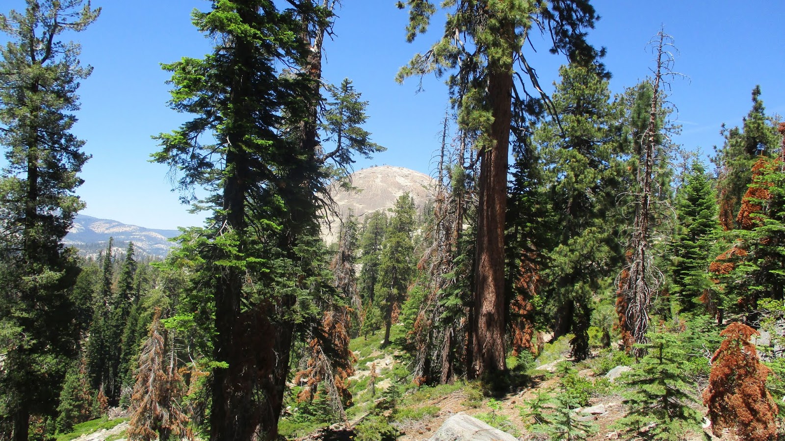
We drove to Yosemite on Wednesday and had a couple of hours to kill before our hotel was ready so we stopped to do a warm up hike to Sentinel Dome. This is a short hike to a small granite dome above Glacier Point. There is a wide, family friendly trail that leaves from Glacier Point Road. Parking was an issue at the busy trailhead but found a good spot when someone else left. It's still far less busy than Glacier Point. The trail goes around to the north side of the dome where the slope is gentle. The views are similar to those from Glacier Point, but with fewer people and no guard rails in the way. There was a silver disk set in one of the summit boulders with a map of various landmarks etched into it. It was worth the short trip for spectacular views.
Sentinel Dome through the trees near the start
Following the trail up the north side
Yosemite Falls
El Capitan, still astonished that people climb it
Half Dome, Clouds Rest, North Dome (left), and Basket Dome (left)
Looking east to Mt. Starr King, Nevada Fall lower left
When we checked in to the Disney Grand Californian Majestic Yosemite Hotel, we were in a cabin in a wooded area away from the main building. I joked with the bell hop about when the bears showed up. Less than an hour later, we heard a loud pop outside and some yelling. Leisa looked out the window and a medium sized black bear ran past. My immediate reaction was to grab my phone and open the door. Due to bad lighting and a running bear, I took a blurry photo of a brown smudge. My instinct was to give chase. I trotted after the bear as he left the hotel grounds into the sparse pine forest. He slowed to a walk and I saw two yellow tags in his ears. I took another photo, but he was in shade and still hard to see. I kept what I thought was a safe distance and started to take a video, following him at his pace. A few seconds later, a ranger jogged past me armed with a paint ball gun. He yelled "Get out of here, Bear!" in a harsh tone. The paint ball gun must have been the loud pop we heard earlier. With the ranger in pursuit, I backed off. On the way back, he admonished me not to approach the wild life. I nodded, but both of us knew I wasn't making any promises.
Hiked: 6/25/2018
Distance: 1.2 miles round trip on trail
Difficulty: Easy
The new camera location was much better. I grabbed some stills from the videos and broke them up by animal. Below the stills are all the videos. We named two of the animals that show up frequently. Babushka for the bobcat, and Vlad for the grey fox (that only shows up at night). Babushka eats some grass in one of the videos. Either she couldn't find any protein or is cleaning out her digestive system. There was a male and female coyote that I've seen before. The female is not looking so well. She looks a little emaciated. The male looks healthier. A doe visited the watering hole several times. This was the first time I've seen deer at this location. There was a skunk and some brand new birds as well, including a rarely seen California Thrasher. I combined the skunk and birds into one video.
HPS Star Emblem Peak
Hiked: 6/22/2018
Distance: 16.4 miles one way on trail and cross country
Summit Elevation: 10064' (Mt. San Antonio), 9988' (West Baldy), 8007' (Iron)
Elevation Gain: 5646' (Gain), 9817' (Loss)
Elevation Gain (in Empire State Buildings): 4.51 (7.85 loss)
Round trip time: 16 hours 15 minutes
Recommended water: 252 oz.
Parking/Fees: Adventure Pass at Heaton Flat and Manker Flat
Difficulty: Very Strenuous
This checked off a bucket list hike for me. I had been trying to arrange this hike for nearly 3 years, but the stars never aligned. It was a one way trip from Manker Flat near Mount San Antonio to Heaton Flat below Iron Mountain #1. In addition to the ridge traverse, we wanted to drop off the ridge to Gold Dollar Mine as a side trip, but because of high heat, it was a game time decision. Henry and I met at Heaton Flat at 1:00 AM and he drove to Manker. Due to heavy fog, we missed the turn on Glendora Ridge Road and didn't get to Manker until 2:30 AM.
It was cool in the middle of the night as we climbed the Ski Hut trail. A lot of new signs have been installed on the trail since I was last there. We climbed at a steady pace and reached the summit at sunrise. Low clouds covered the LA suburbs and foothills thousands of feet below. Mt. San Antonio imposed a long shadow on the horizon. It wasn't surprising that we had the mountain to ourselves. We refueled, then walked over to West Baldy and began to descend the ridge in shadow. There was a very good use trail down the steep ridge. Plenty of cairns marked the way. There was a great view into Cow Canyon. As we got further along the ridge, we met thickets of buckthorn. Some of it had been trimmed back and the use trail bypassed some of it. Other parts we had to plow through taking a few hits to our legs. In some places, we followed what looked like a way through only to backtrack when they ended in walls of thorns. Overall, this part of the ridge was easier than expected. I was watching the GPS to figure out where we needed to drop off the ridge to find Gold Dollar Mine. It was the final bump before Gunsight Notch. We stopped there to rest and decide what to do. Ultimately, I didn't think I had enough water to make the side trip in the heat. I vowed we would make a separate trip to the mine when the weather broke in the fall.
West Baldy and Baldy's shadow
Santa Ana Mountains surrounded by clouds
Starting down the ridge, both Baldy and West Baldy casting shadows
Looking back
Approaching Gunsight Notch
Next up was Gunsight Notch and the tricky part of the ridge. We started toward it down a narrow section of the ridge before Henry remembered the approach to the base was around to the left. We backed up and found a good place to head up left of the tree in the middle of the notch. There were plenty of holds but they had to be tested since some of the rocks were loose and would pull free. There was a lot of airy exposure on both sides. The final move was a traverse left of the high point that Sean Green calls Sniper Point. It looked worse than it was. My mistake was assuming that once I passed Gunsight Notch, the ridge would get easier. I thought the second notch was more difficult. There is a semi-stable tree that you need to climb over and we spent some time trying to figure out the best way over the top of the second notch. There was a way up on the left side of the jutting rocks, but it was very exposed with a starting foothold above a 100' drop. I started down the right side to explore a gully, but everything I touched slid and gave way. I clawed my way back up sending handfuls of rotten debris down the gully. We returned to the left side and scrambled up. A little higher, Henry made a dangerous direct ascent over some rocks where an easier route was 5' to his left. Thankfully, he made that move without any of the rocks breaking. There was a third scrambling section made of white rock maybe 500' below Iron Mountain. Bypasses were available for some parts of the rugged terrain, and there were several class 2 sections. I was startled that some of the class 2 sections also had crazy exposure to huge drops. Just when I thought we could walk up to the summit, Iron had one more F-you in store. The ridge dropped and we had several hundred feet of hands and feet scrambling up loose dirt before it mellowed out. Like Mt. San Antonio, we had Iron Mountain to ourselves. By this time, the sun was cooking us. We signed the register and took a few quick photos before starting the long descent down the south ridge of Iron.
Glorious Gunsight Notch
Looking down from the side of Gunsight
Top of Gunsight from the dead tree
The 2nd notch
Top of 2nd notch. Best way up is left.
More work ahead to get to Iron
Henry making a difficult and scary move on loose rock
Final section, use trail climbs the left side
About 100' below the summit of Iron, we stopped in some shade to rest and take inventory. Henry still had a lot of water left. I was down to 64 oz, which I thought was enough. I had recently been treated for an actinic keratosis (AK), a pre-cancerous spot on my left forearm. For this reason, I was not only slathered in sunscreen, but had been applying it frequently along the hike. That was also the reason I had a long sleeved base layer on and long pants even though the high at Heaton Flat was forecast to be 96F. I chose to deal with the heat to protect my skin. I pushed hard down the mountain, Henry behind taking his time. We took a few breaks in the little shade we found on the way down to Allison Saddle. Just past the saddle, the heat overwhelmed me. I had a mild case of heat exhaustion. I finished off my last bottle of water trying to cool down and not puke my guts out. It was a bad situation since it got hotter with every step down and we had four miles to go. I laid down under some brush to get out of the sun. Had I been alone, my only option would have been to stay put until the sun went down. I had to minimize not only my heat generation but anything that retained heat. Skin be damned. I zipped off the lower half of my hiking pants, changed the long sleeved shirt to a short sleeved and even took off my underwear. Henry generously offered me a liter of his water. After ten minutes or so, I was back on my feet moving at a glacial pace up the ridge. With about a mile to go, I finally felt recovered. The heat episode cost us an hour and was a harsh lesson. I cranked the AC until I was freezing and drove Henry back to his car. The first ten hours of this hike rank among the most fun I've had, and soon I'll forget the rest. Iron Mountain continues to impress me in every way. There are a lot of people I want to thank for providing beta: Sean Green, Dima Kogan, Willie Price, Ze, Aar Jay Soria (kicks_rocks), Scott Richardson, and Headsizeburrito. If I forgot someone, it was unintentional.
Sidebar on distance and gain: No method of calculating distance and gain is perfect. GPS tracks are notorious for errors. I usually upload my track to caltopo.com and let it calculate the stats and accept the inaccuracies, but this track was too big for caltopo to digest. First, I used Google Earth and came up with 15.9 miles, 7414' of gain and 11585' of loss. Then, I used GPS Visualizer and used digital elevation modeling, plus horizontal and vertical thresholds to smooth out the track and eliminate noise. The published stats which are much more accurate but still have a margin of error. This will be my default way to compute stats in the future.
Hiked: 6/17/2018
Distance: 7.2 miles round trip on dirt road and use trail
Summit Elevation: 5496'
Elevation Gain: 2704'
Elevation Gain (in Empire State Buildings): 2.16
Round trip time: 3 hours 45 minutes
Recommended water: 56 oz.
Parking/Fees: Free on Maple Springs Road
Difficulty: Moderate
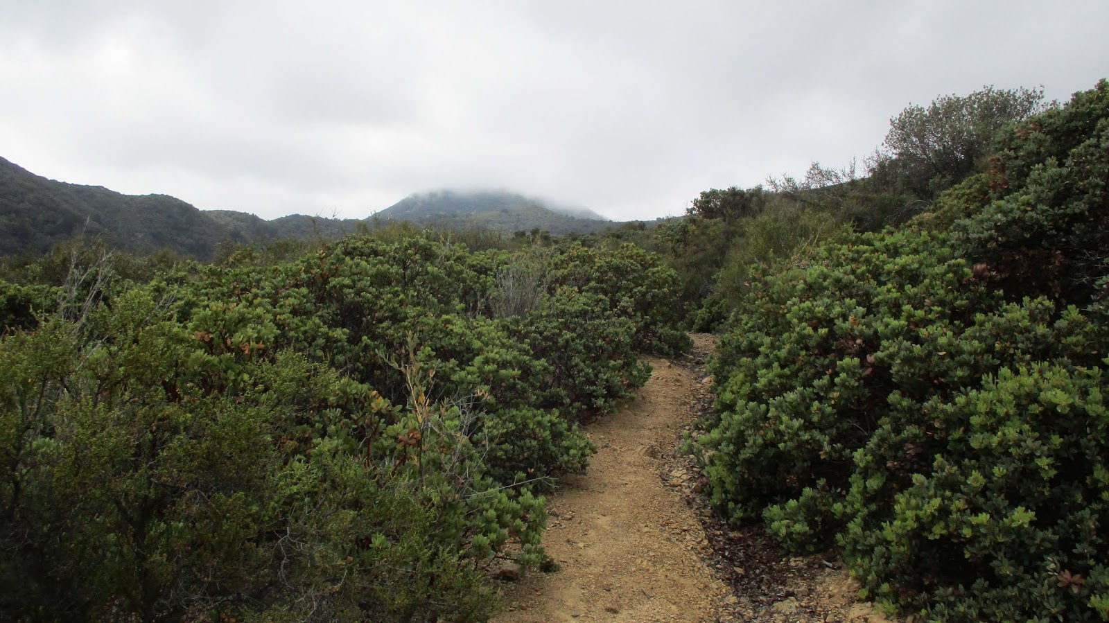
This was a training hike for Leisa and I. We planned to follow the Sierra Club HPS route 4 to Modjeska starting at the end of the paved part of Maple Springs Road. It's usually too warm this time of year for this hike, but we had some June gloom and a forecast high of 65F. Nice hiking weather. We were the only ones parked at the bottom of Maple Springs Road. Before we got to the use trail, some dirt bikes passed us. We ended up seeing a dozen bikes and an equal number of 4x4s along the road. The first use trail looks like a drainage ditch and has not been maintained in a while. There was some poison oak and other light brush intruding into the trail. I made an effort to clear some of it as I passed. Modjeska was still shrouded in low clouds. We crossed the road to the second section, short and steep. The third section was fairly overgrown before we reached the major road intersection, though the trail was still visible. The brush was light and easy to push through for now, but this part of the trail could use some maintenance. Several trucks, jeeps, and motorcycles were gathered at the intersection talking their off road game. We descended the use trail from the ridge and walked on by to Main Divide Road. We took a short break before starting up the next part of the use trail cut into Modjeska proper.
Use trail start
1st road crossing
Modjeska hidden in clouds
2nd road crossing
Modjeska emerging from clouds
Looking back down the ridge
The upper use trail was clear and showed signs of recent clearing. The clouds has mostly burned off and Modjeska stood against a blue background. When we reached the road, we turned left then finished the climb up the ridge use trail. The OC benchmark and geocache that used to be on top were both gone. A wooden summit sign placed a couple of years ago was also cut and taken. Because this peak can be driven, it is more vulnerable to vandals, although the OC benchmark had been up there for years. Leisa was not interested in following me over the main summit to the USGS topo mark on the map, about 150' further. I didn't find any marks at the location, but there was another cluster of short, jagged boulders. I even continued down the other side of the boulders to look around, but there wasn't anything there. We decided to take the road down to meet the main use trail, then returned the way we came. This was my fourth summit of Modjeska and my fourth different route.