Hiked: 10/12/2018
Distance: 16.6 miles round trip on trail and cross country
Summit Elevation: 8007'
Elevation Gain: 8223'
Elevation Gain (in Empire State Buildings): 6.57
Round trip time: 16 hours
Recommended water: 216 oz.
Parking/Fees: Adventure Pass at Heaton Flat
Difficulty: Very Strenuous
Gold Dollar Mine is one of the most inaccessible mines in the San Gabriel Mountains. It was built near Iron Mountain about 500' below San Antonio Ridge, high on a very steep slope. "Hardcore" Henry and I planned to start at Heaton Flat, take the unmaintained trail above Widman Ranch, go cross country to Gold Dollar Mine, loop over the spicy part of the San Antonio Ridge up to Iron #1, then return down the south ridge trail.
We met at 4:00 AM and started out in the dark, reaching Allison Saddle just about sunrise. From the saddle, we took the unmaintained Coldwater Trail on the right. The first mile was Washout Alley, with several somewhat dangerous washouts that must be passed. Then, the trail got much better passing above Widman Ranch with notoriously unfriendly residents. Dima Kogan and other people have trimmed back the yucca in places, but I managed to get a yucca needle broken off in my pinky toe. At the end of the trail, we dropped about 40' into Dry Gulch using a hand line someone had left there a long time ago. The rope wasn't in great shape, but we tested it and used it to aid our descent. Dry Gulch was relatively open without many obstacles. We continued up the gulch until we found a slope on the Gold Dollar Ridge that looked relatively free of brush. The slope was surprisingly steep and we spent a fair amount of time on all fours (mountain climbers) to make progress. Fortunately, the soil was soft and full of pine needles so we didn't slide back as much as we would have on hard dirt.

One of many washouts on the Coldwater Trail

Widman Ranch

Henry dropping in to Dry Gulch


Climbing the slope to Gold Dollar Ridge

Iron Mountain with an amazing vein of white rock

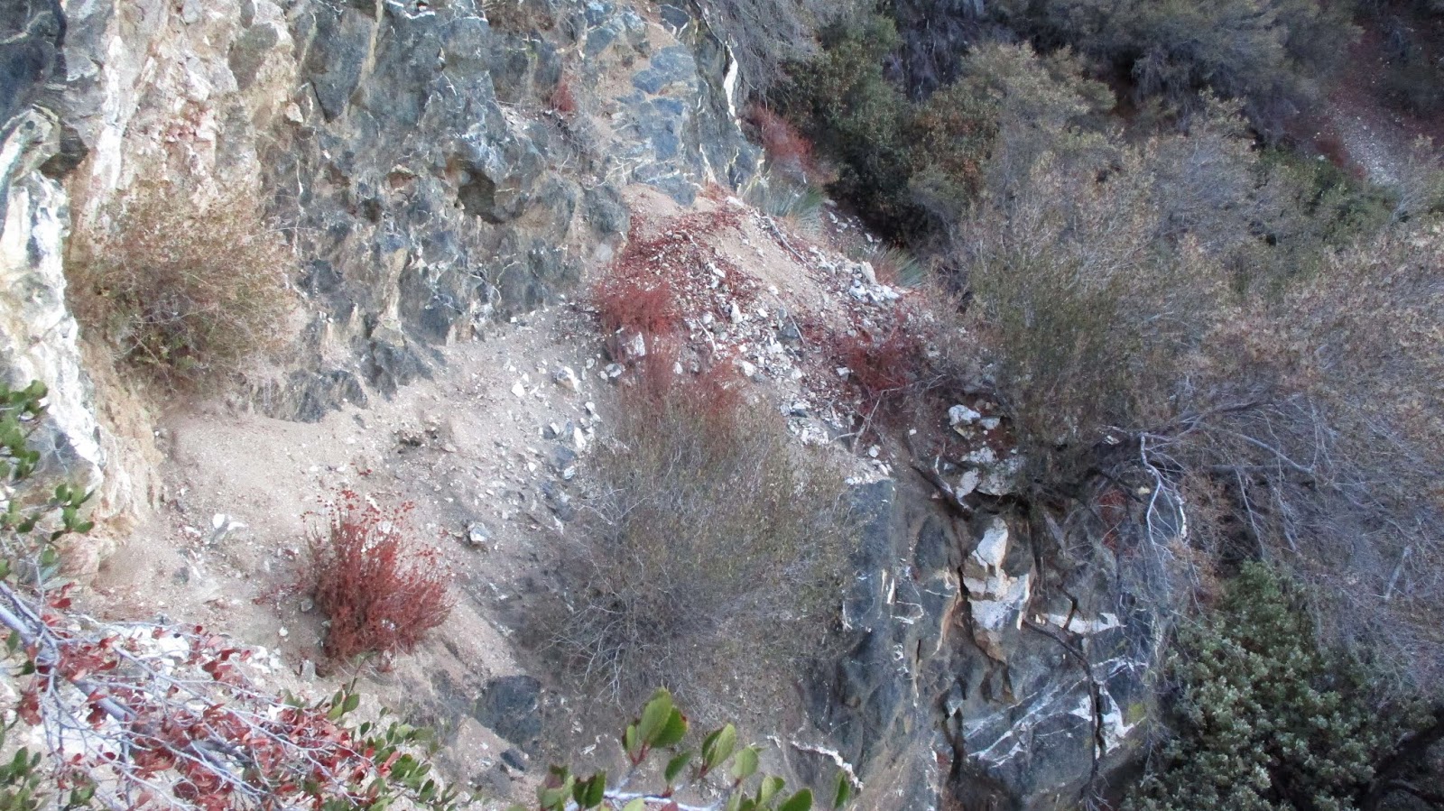
Looking back into Dry Gulch
We had Ze's GPS track (from the San Gabriel Forum) which showed us where to head toward the mine. We didn't follow the track exactly, going parallel a little higher on the ridge along an old trail. Where we intersected Ze's track was the first site of Gold Dollar ruins. Part of an ore hopper was there and some equipment I couldn't identify. Steel cables ran up and down the mountain from the site. From reading Dima's report, another major ruin site was below. The Garmin GPS had marked the mine higher up than our location. We decided to follow the steel cables up looking for the mine and more ruins. We used the cables in some places to assist our climb. About 300' up, we found a second site of ruins. It had some kind of sorter and mine car rails. The GPS mark for the mine was east of our location and we had to decide whether to head toward the Garmin mark or continue following the cable up. In the end, we decided to follow the cable. It was slow going but we followed it to the origin, anchored to a large dead tree. We didn't find any more ruins along the way. We were left wondering if anyone had found the mine. It is possible the mine itself is east of the steel cables or maybe all the adits have collapsed.

First ruin site


Henry following the cable up

Second ruin site


Origin of the steel cable that runs about 1000' down the mountain
On the way up to San Antonio Ridge, we got intriguing views of Gunsight Notch and Big Iron. There is a huge vein of white rock running down from Iron that is not fully visible except from below. We took a break to fuel up before tackling Gunsight and the ridge for the second time this year. Henry and I were in agreement that the second part of the notch is the most difficult, even though the exposure is not as great. The rock on the second part seems much more loose. I took a few more photos of the third scrambling section consisting of white rock, sometimes called the Witch's Backbone. While it demands full attention, the ridge didn't seem as scary as the first time I did it. When we topped out on Iron, my stomach wasn't feeling great. I think maybe something in the sub sandwich I bought the day before had gone bad. In any case, I couldn't eat anything but a few cheezits and a butterscotch. Because of the cool weather, I had plenty of water and the descent was uneventful if slow, ending in the dark. We picked up 4 mylar balloons for the day. There may still be some missing pieces to the Gold Dollar Mine story.

Gunsight and Iron

Almost to San Antonio Ridge

From below

From above


Looking up from the Witch's Backbone

Big Iron

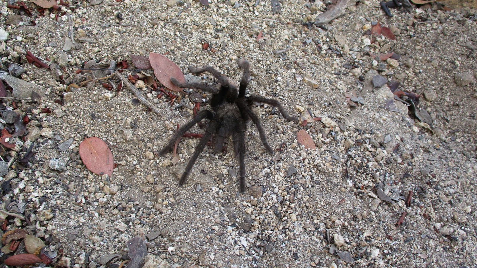
One of three tarantulas we saw on the way back


i think the goons at widman ranch dymamited sections of trail on purpose
ReplyDeletebeasthiker,
DeleteHaha, you may be right. Every story I've heard about them is unfriendly and sometimes involves guns.
We hiked through Widman Ranch back in September 1992 when our attempt to complete a Mt. Baldy to Iron Mtn route failed. There was no trail whatsoever from West Baldy to Iron back then and the buckthorn destroyed our legs (no pants on either of us three Cal Poly Pomona hikers). When we reached the nasty section, just north of Gold Dollar Mine, we were too tired to attempt a climb up. So, we decided to head south into the canyon below and find the trail back to your 2nd vehicle at East Fork parking lot. We found Gold Dollar as well as Eagle and Widco Mines on our descent, but couldn't find the trail (8W16) that bypassed the Widman Ranch to the north. There was a huge sign saying no trespassing allowed at the north end of Widman Ranch, but as it was now early evening and we had school the next day, we decided to run through the ranch and act dumb if someone caught us. At that time, there were some old cabins and some trucks in the area and they were covered in cobwebs. We didn't see a soul, but did hear some people panning in the river and we just kept on running, until we passed through. We followed the creek for miles, all the way to pavement and finally reached the parking lot at about 1AM.
ReplyDeleteBy the way, I've always wanted to repeat this hike and see if I can complete it. It's now been over 30 years later and I'm curious to see if there is any trail whatsoever or if it is still just as nasty as it once was. I've seen many hikers complete this on social media, so I'm curious to see the trail conditions.
DeleteBoyfester,
DeleteThat's a great adventure story! I have a friend who got lost on the way back from Eagle mine and went through the ranch. They were stopped by one of the gates and scolded severely. They apologized and got out. I've been over the San Antonio Ridge twice and there was a decent use trail from West Baldy across most of the ridge. Less of a trail after gunsight notch. There was no avoiding the buckthorn in several places, you had to wade through it. It should be easier than when you went in 1992, but it's still a brutal hike either direction.