Monday, November 28, 2022

Elephant Benchmark

Hiked: 11/26/2022
Distance: 11.7 miles round trip on trail and cross country
Summit Elevation: 3392'
Elevation Gain: 3311'
Elevation Gain (in Empire State Buildings): 2.6
Round trip time: 9 hours
Recommended water: 108 oz.
Parking/Fees: Free at Elephant Trees Trailhead
Difficulty: Strenuous

Elephant BM is the elephant in the room when you visit the Split Mountains by Ocotillo Wells. It dominates the local area and was named after the rare elephant trees that grow nearby. Elephant trees are mostly found in Baja, Mexico. The trailhead was the Elephant Trees Discovery trail, a one mile loop that has a couple living trees along the trail. And a couple of dead ones. "Hardcore" Henry Chen joined me on this excursion. I had mapped a route up the major gully north of Elephant to Starfish Cove, a confluence of five drainages. Then, up a long gully to a ridge behind the summit. Facts on the ground made us abandon part of the plan.

We hiked to the end of the Discovery trail, then continued cross country toward the major gully. The flood plain was filled with rocks and braided washes. We followed a path of least resistance until we entered the gully. Before reaching the gully, we passed a healthy elephant tree and found another on the way back. Once we got to the gully, the going was easier, with a sandy floor and easy dry falls. We made steady progress as we snaked our way up. When we reached Starfish Cove, I was expecting a wide, sandy flat. Instead, it was turbulent and chaotic, with criss-crossing washes full of boulders and mud walls. We made the turn into the ascent gully and took our first break. The gully was passable, but full of obstacles and low visibility. We decided the ridge looked more appealing and headed up. Rocks on the ridge were solid, cactus and agave were abundant, and nothing exceeded class 2. We had some concern the ridge would not connect, but after two false summits, we saw the path to Elephant.


Elephant tree we found near the gully


Henry climbing the ridge out of Starfish Cove

False summit, but top is not much further

A small boulder marked the summit and we found a register dating from 1980. Elephant gets an average of 2 visits per year. The last one was in March, 2022. We signed in and read the entires of the adventurers from last 42 years. Views were great in all directions. It had taken us longer to reach the summit than we expected and we decided to take one of the ridge lines down. We picked a ridge south of the ascent gully, but were confident it was unbroken. We scrambled down the class 2+ ridge slowly, dodging cactus. When we reached the top of the final ridge section, we decided to drop into the major eastern gully. That section was sketchy and loose. Henry waited for me to get most of the way down before following, since both of use were creating rock slides as we went. We joined up in the gully and made our way back to the ascent line. In hindsight, it might have been faster to stay on top the ridge to the end. By our lights, most of the eastern ridge lines will go, and more efficiently than going up from Starfish Cove. When we got back to the trail, we took the other part of the loop, finding the largest and healthiest elephant tree of the day. A fine day in the desert.

Split Mountains (near) and Fish Creek Mountains (far)

Summit


Descent ridge, we bailed into the gully on the last segment

Largest elephant tree was along the discovery trail

Final look back


Friday, November 11, 2022

Monserate Mountain

Hiked: 11/11/2022
Distance: 3.3 miles round trip on trail
Summit Elevation: 1567'
Prominence: 607'
Elevation Gain: 1260'
Elevation Gain (in Empire State Buildings): 1.0
Round trip time: 1 hour 20 minutes
Recommended water: 16 oz.
Parking/Fees: Free on Horse Ranch Road
Difficulty: Easy

I had been saving Monserate Mountain in northern San Diego County as a possible bonus peak coming back from Anza-Borrego, but I never found the right time to do it. I planned to do the long loop over Monserate, hitting the lesser, provisional peaks along the way. It was a short drive (based on my recent history) to the gravel parking area at the trailhead. There were 20 other cars there and 4 doggos. I packed ultra-lite and began an earnest clip up the moderately sloped trail. The lower section was rocky but it smoothed out toward the top. There was a memorial bench about half way up. Near the top, I took a 200' use trail to Little Red Hill (1530'), one of the lessers. A small pile of boulders made up the summit. I immediately returned to the main trail and continued to the top of Monserate. There were a couple of other parties on top. A large metal box held multiple registers and I took a photo of the benchmark. The Fallbrook Fire Department climbs this mountain every 9/11 as a tribute to the victims of that day. One of the books in the metal box was a print out of all the names. A nice tradition. When I got back to the loop trail, I spotted an orange sign stating the other part of the trail was under construction until December 2022. My desire to get the other lesser peaks was no match for my rule following nature. I continued down to the truck. It was a short day, but enough to feel like I got a little cardio done.


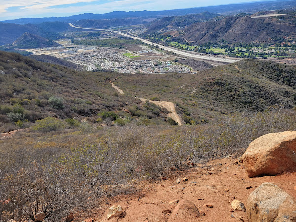
Monserate from Little Red Hill


Snowy Gorgonio in the distance


Sunday, November 6, 2022

Mount Lawlor and Barley Flats

Hiked: 11/4/2022
Distance: 10 miles round trip on trail and cross country
Summit Elevation: 5957' (Lawlor), 5626' (Barley)
Prominence: 757' (Lawlor)
Elevation Gain: 2464'
Elevation Gain (in Empire State Buildings): 2.0
Round trip time: 5 hours 15 minutes
Recommended water: 72 oz.
Parking/Fees: Adventure Pass at Red Box Gap
Difficulty: Moderate (combined)

Until the night before, my plan was to attempt Lizard Head in Santa Barbara County. But the 9 hour round trip drive for the somewhat plain looking peak made me look for something closer. My friend Madison wrote a glowing review of Mount Lawlor (HPS #190) and it's one I hadn't hiked. I got a late start and made it to Red Box Gap around 9:30 AM. The air was cool and crisp. I started up the Strawberry Peak trail and soon passed under the infamous south face firebreak. I continued on toward the Strawberry-Lawlor saddle, meeting several parties on their way back. The west ridge had a nice use trail and one short section of class 2. Some of the granite had a black and white marbley look. On the summit, I found neither marks nor register. There was a wooden pole and dozer tracks. I snapped a few photos, then started down the east firebreak toward Barley Flats.

South face firebreak

Strawberry before the saddle

West ridge to Lawlor

Mount Wilson and Occidental from Lawlor

North to Granite Mountain from Lawlor

The firebreak was overgrown in spots, but easy to follow. Some gutsy dozer operator drove up the ridge at high angles to clear it. A faint use trail came and went. Just after the firebreak met a dirt road, I stayed left onto another overgrown firebreak to reach the Barley Flats High Point. A poor use trail cut through grass and dead vegetation leading to the water tower. There wasn't much of a view. Also no marks and no register. I returned to the road and continued up toward Barley Flats. A paved road leading up was gated, locked, and signed. I expected it to be an abandoned military site, but the cabin was occupied by at least two people I heard talking. I followed an ungated road around the back, then some animal trails up to the heliport. The heliport sat a little higher than the cabin so I don't think I was noticied. I got a photo of the large LA Sheriff rescue helicopter, then started back.

East firebreak and Barley Flats at the end


Barley Flats high point


I took the dirt road back, not knowing a section of it was feral. Instead of a boring road walk, I got more than a mile of washouts, rock slides, yucca, buckthorn, and deadfall. Some of the yucca had been cut back, so other people had been using the abandoned road. For one of the washouts, I had to down climb about 10' into a gully, then back out. It was actually kinda fun. It intersected the Strawberry Trail at a major switchback, then it was a short hike to Red Box.

Lawlor (left) and Strawberry (right) on the way back

Feral road


Big washout