Saturday, September 29, 2012

Lookout Mountain

Hiked: 9/28/2012
Route 1
Distance: 4.5 miles round trip on use trail and cross country
Summit Elevation: 6812'
Prominence: 132'
Elevation Gain: 2900'
Elevation Gain (in Empire State Buildings): 2.32
Round trip time: 3 hours 30 minutes
Recommended water: 80 oz.
Parking/Fees: Adventure Pass
Difficulty: Moderate

Lookout Mountain #2 is a smaller peak near Mount San Antonio that was used in measurement experiments of the speed of light in the 1920’s. There is no official trail up the mountain, just firebreaks on two of the ridge lines and a use trail. The use trail is in fair condition, but I found it washed out in several places on the first leg, increasing the danger of a slide. Although the total distance is short, the elevation gain is severe in spots. I wanted to do this one to improve my navigational skills. I had to backtrack a couple of times on the way down, but never wandered too far off course. I was hoping to spot some bighorn sheep on the back side of Lookout, but saw none. Like Smith Mountain, I was the only human around. No one else was within miles.

The yucca plants drew blood twice and I lost my prescription sunglasses along the way. The back side of the bump is shaded and I put my sunglasses up on my hat. At my first rest stop, I noticed they were gone, and didn't find them on the way down. This was an expensive hike!


Lookout Mountain on the left from Cow Canyon Saddle


Use trail traversing the side of the first bump


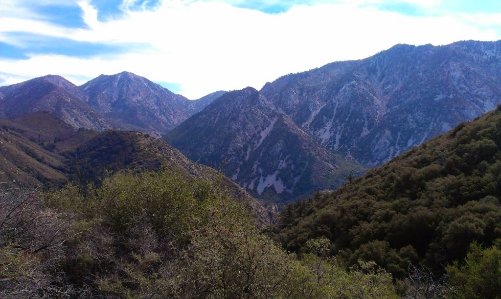
Sugarloaf (center) from the side of Lookout


Mighty Ontario Peak from the summit


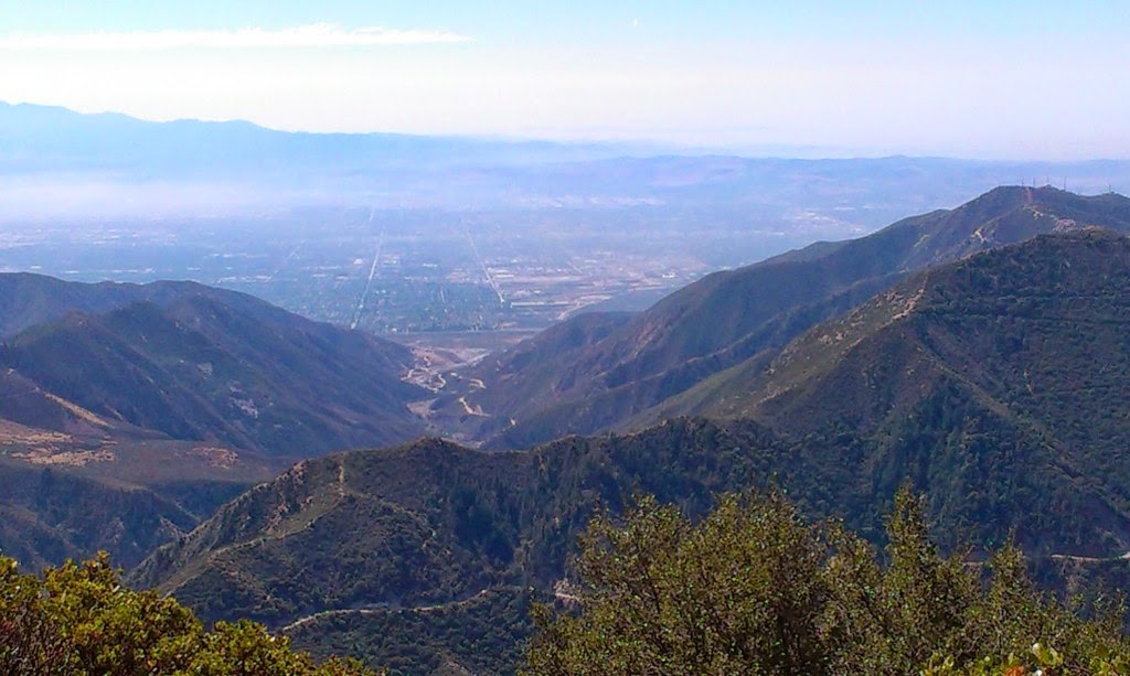
San Antonio Canyon from the Lookout summit

Saturday, September 22, 2012

Smith Mountain

Hiked: 9/21/2012
Distance: 7 miles round trip on trail and use trail
Summit Elevation: 5111'
Prominence: 831'
Elevation Gain: 1900'
Elevation Gain (in Empire State Buildings): 1.52
Round trip time: 3 hours 15 minutes
Recommended water: 64 oz.
Parking/Fees: Adventure Pass
Difficulty: Moderate

Smith Mountain is a remote peak in the front range of the San Gabriel mountains. The fun and challenging part of the hike is the final half mile scramble to the summit, gaining over 800'. The scramble goes through several rocky sections but does not require any special equipment. The descent from the peak requires attention and poles would be useful (I didn't have any). I saw black bear scat in a few places but encountered no wildlife other than the usual lizards and birds. I cleared a few brown widow spider webs from the path. The use trail was in very good condition and previous hikers left helpful rock cairns where multiple paths were possible. I signed the summit log and noted that the last person to sign it was a full month earlier.


San Gabriel River on the drive up


Approaching Smith Mountain


Use trail up the ridge to Smith Mountain


Looking down the steep ridge


The heart of the San Gabriels. Rattlesnake Peak, Iron Mountain, and Baldy


Trailhead parking from the summit


The benchmark is stamped "HEALEE" or something close to that

Saturday, September 15, 2012

Santiago Peak

HPS Star Emblem Peak
Hiked: 9/14/2012
Distance: 18 miles round trip on dirt road (from Maple Springs Road)
Summit Elevation: 5689'
Prominence: 4387'
Elevation Gain: 2721'
Elevation Gain (in Empire State Buildings): 2.17
Round trip time: 6 hours
Recommended water: 128 oz.
Parking/Fees: Adventure Pass
Difficulty: Strenuous

Santiago is the highest peak in Orange County, CA, and the highest of the two peaks called Saddleback (the other being Modjeska). Because of the distance and mild grades on the road, the elevation was hardly noticeable. The peak is crammed full of radio towers and equipment so you can't get a panoramic view. It was satisfying to climb it because I see this mountain every day on my commute.


Approaching Santiago Peak


Impressive array of communication towers


Looking down into the OC and Pacific Ocean


View into Riverside County


Modjeska Peak, the other half of Saddleback


San Gabriel mountains in the distance


Santiago Peak reference mark


See also:
Santiago Peak via Holy Jim Trail
Santiago Peak via Telephone Ridge

Saturday, September 1, 2012

Mount San Antonio (Baldy)

HPS Star Emblem Peak
Hiked: 8/3/2012
Route 2
Distance: 8 miles round trip on road, trail, and use trail
Summit Elevation: 10064' (3067m)
Prominence: 6224'
Elevation Gain: 3900'
Elevation Gain (in Empire State Buildings): 3.12
Round trip time: 4 hours 20 minutes
Recommended water: 96 oz.
Parking/Fees: Adventure Pass
Difficulty: Strenuous

The highest peak in the San Gabriel mountains and Los Angeles County is Mount San Antonio, also known as Mount Baldy. This is a steep climb, especially the second half on the south ridge. I took a short break at the Ski Hut, which is roughly half way from Manker Flat. The trail spiders into many confusing use trails near the summit. My first trip up left my calves burning for three days. I also had trouble catching my breath on the first trip because I pushed myself too hard above 9000' . I paced myself better the second time after learning some respect for the elevation and it was much easier.

Update: 11/17/2013
Looking back at my very first trip report, I realize it doesn't have much information. This was before I had a GPS so I can't show the track or elevation profile. The statistics came from the Trails of the Angeles hiking book.

Update: 1/9/2019
I added a Google Earth GPS Track view from a winter ascent.


Looking down San Antonio Canyon


Approaching the Ski Hut


The Baldy Bowl


Passing under the Bowl


Looking down the ridge above the Bowl


View to West Baldy


Devils Backbone Trail sign on the summit


Summit plaque


See Also:
Mount San Antonio North Backbone
Mount San Antonio Winter Ascent
Mount San Antonio via Devils Backbone