Sunday, November 26, 2023

Odell Benchmark

Hiked: 11/25/2023
Distance: 5.3 miles round trip on dirt road
Summit Elevation: 5220'
Prominence: 1822'
Elevation Gain: 1060'
Elevation Gain (in Empire State Buildings): 0.9
Round trip time: 1 hour 30 minutes
Recommended water: 20 oz.
Parking/Fees: Free on Telephone Road
Difficulty: Easy

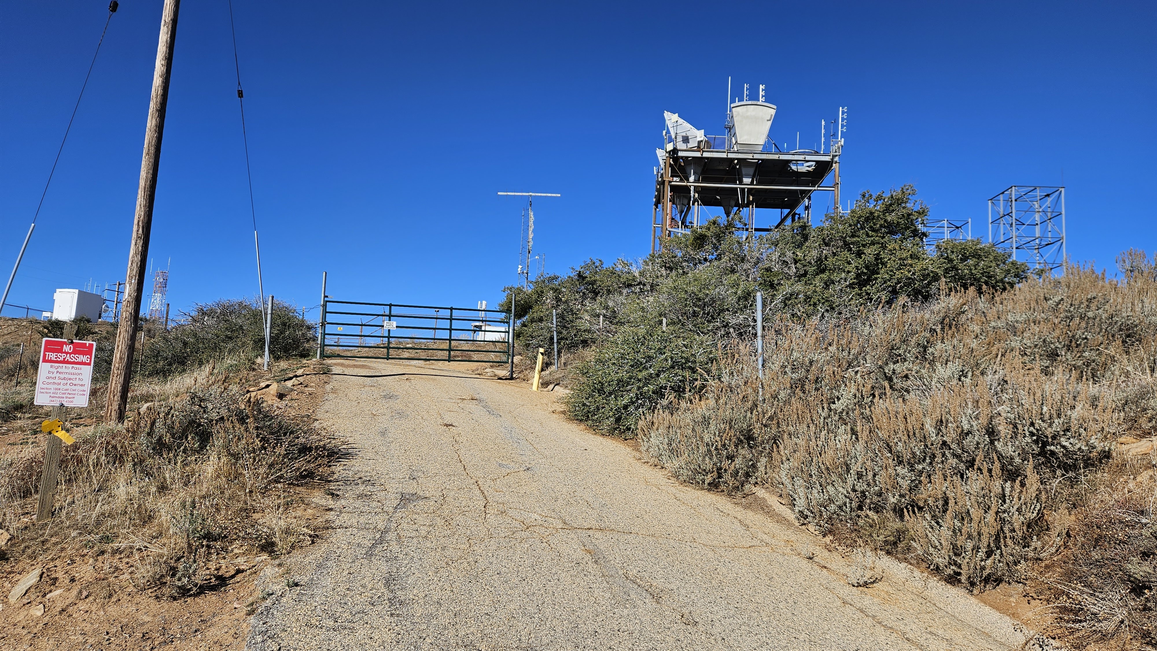
My plan was to mountian bike to Magic Mountain in the western San Gabriels. I wanted to start at a road junction several miles up Indian Canyon Road. I did not know the status of the gate and found it to be closed right at the trailhead. That meant the round trip would have been around 18 miles, a much bigger affair for which I was not prepared. I drove back to highway 14 to get cell service, then looked at Peakbagger to find something easier and nearby. I settled on Odell Benchmark, only 7 miles away.

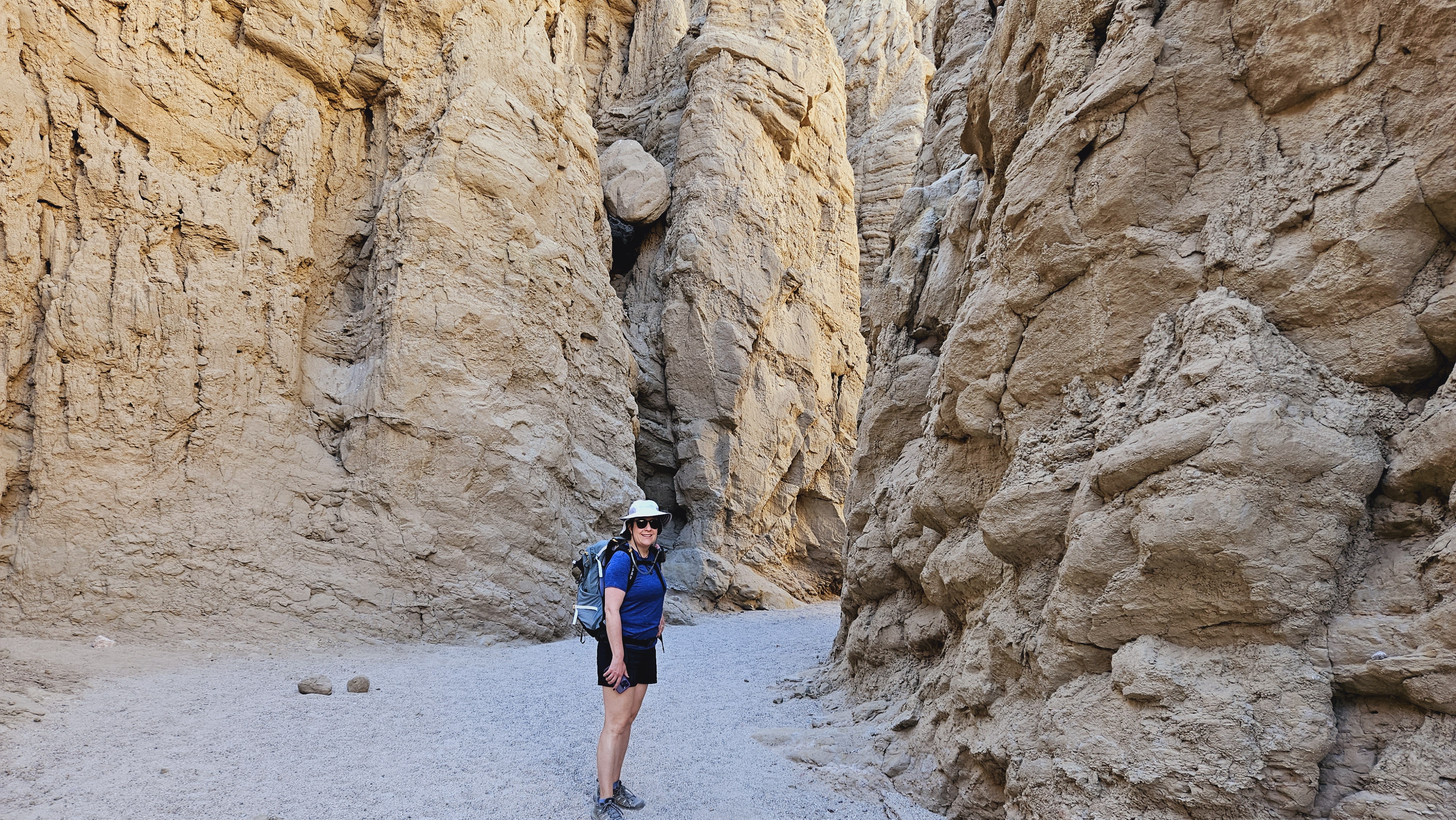
I parked at a turnout and unloaded the bike. It was 43F but I was blasted by a 25mph wind sinking the wind chill to around freezing. I expected the wind and cold weather, but it was still a shock to the system. While I was getting ready, a dirt motorbike zoomed up the road, the only other person I saw all day. I started climbing the first hill, steep but paved. I made it about half way up the hill before switching to hike-a-bike push mode. Near the top of the first hill, I got back on and pedaled past the Hauser benchmark, surrounded by barbed wire and warning signs. The road turned to dirt but was in good shape. It would have been possible to drive all the way to Odell. I enjoyed the dirt road section and got minor breaks from the wind. By then, my face and hands were fairly frozen. When I arrived at Odell, the views were decent. I found a small mark but no register. I rode the brakes hard on the way down but was nearly blown over by the wind. This was hardly a dream outing, but at least I salvaged a prominent point and worked up a lather on the bike.


Hauser Benchmark


Odell ahead

Small USGS mark


Thursday, November 16, 2023

Slot Loop

Hiked: 11/11/2023
Distance: 6 miles round trip on trail and cross country
Summit Elevation: 900' (trailhead)
Elevation Gain: 960'
Elevation Gain (in Empire State Buildings): 0.7
Round trip time: 3 hours
Recommended water: 32 oz.
Parking/Fees: $10 State Parks Fee
Difficulty: Easy

Leisa and I spent our second day hiking "The Slot" loop. The slot is a semi-famous family friendly slot canyon in AB. There are other slot canyons at the base of Travelers Peak, and dangerous canyons around the Arroyo Tapiado mud caves. My last visit here was ten years ago. At the time, parking was just a turnaround on a dirt road. Now, there was a parking lot, overflow parking, and a bathroom. Also new was a $10 day hike fee. We got started around 8 AM and passed a couple of large parties on our way through. We continued out the back and followed dirt roads toward Borrego Mountain. We left the road to get a close look at some interesting wind caves and formations. Leisa had a GPS track that looped just under Borrego then back to the parking area. However, we missed the cairns where we were supposed to climb out of the canyon and continued in the general direction of our starting point. We hit some short scrambles and narrows but I thought we could get back to the main slot. Unfortunately, we hit a 50' wall only a couple of hundred feet from the main canyon. I crawled to the top of a ridge to look over and saw no safe way forward. We had to return to where we left our track and spotted the cairns. Another short scramble and we were out of the canyons and onto a trail leading to Borrego Mountain. The summit was another half mile but we opted to return on trail to the parking area, having managed to add an extra two miles to the loop. We returned to a zoo of 40 vehicles and dozens of people milling around. Rangers were also set up to collect the day use fee as people drove up. The crowds were a drag.


Cool chock stone


Monday, November 13, 2023

Maidenhair Falls

Hiked: 11/10/2023
Distance: 5.4 miles round trip on trail
Summit Elevation: 1883' (at the falls)
Elevation Gain: 1140'
Elevation Gain (in Empire State Buildings): 0.9
Round trip time: 2 hours 30 minutes
Recommended water: 32 oz.
Parking/Fees: $10 State Parks Fee
Difficulty: Easy

Leisa and I camped at Palm Canyon in Anza-Borrego State Park for the weekend. Our first hike was to Maidenhair Falls. The trailhead is off S22 just outside Borrego Springs and had signs requesting a $10 day hike fee. There was a restroom there and well maintained parking area, but the fee was a surprise. I'd done several hikes from there in the past and didn't remember a fee.

The trail started from the lot and was smooth. A couple of joke graves were set up on the side of the trail to remind people to take enough water. The first couple of miles were easy going with minimal gain. All the native desert plants and cacti were on display. Shortly, we reached a palm grove and palms dotted the canyon the rest of the way. In the last half mile, the trail braided, boulders got larger, and some light scrambling was required to continue. Both of us picked up some scratches from rough rocks and pokey plants. We reached the waterfall and were disappointed with the lack of flow. There was barely a trickle from the falls and a stagnant pool of dark water sat at the base. I heard a loud buzzing around the water that at first sounded like flies, but was instead a swarm of bees. Because of the bees, we didn't linger or take a break, just turned around and started back down. There were quite a few tarantula hawks along the trail. Cool insects that pack a serious sting. It was easier going down and we made it back to the truck quickly.


First palm grove


Barely a trickle at Maidenhair Falls


At camp


Saturday, November 4, 2023

Old Woman Mountain

Hiked: 11/3/2023
Distance: 6.7 miles round trip on dirt road and cross country
Summit Elevation: 5325'
Prominence: 2733'
Elevation Gain: 2950'
Elevation Gain (in Empire State Buildings): 2.3
Round trip time: 6 hours 35 minutes
Recommended water: 116 oz.
Parking/Fees: Free on Danby Road
Difficulty: Strenuous (route finding)

Old Woman Mountain (DPS #64) is the high point of a small remote range in the southern Mojave. The drive was over 4 hours from home, requiring a 1:30 AM alarm for a 2:30 AM departure. The trailhead was at the end of Danby Road, a dirt road typically reached from a closed section of Route 66. The road is closed because of multiple bridge failures. From I-40, I took Kelbaker road south to Route 66 and drove around the close road barriers. I crossed several open bridges, then took a dirt bypass around one that had collapsed. Google Maps suggested I follow Skeleton Pass Road, a dirt road that runs south of and parallel to the train tracks. That road had pockets of deep sand that required 4x4 mode. I reached Danby, then turned south for another 7 miles of good dirt road, stopping at an open gate.

The weather was clear and cool. The high point of the Old Woman Mountains was not visible from the start. I hiked south on the road to the first of two very steep gullies. The standard route follows along the left shoulder of the gully. I kept moving further left around a giant outcrop since it seemed easiest. I kept closer to the gully on the way back, but thought my ascent route was better. The slopes of Old Woman were lush with vegetation, junipers, knee high grass and cactus. Also an occassional cat claw. The crux of the hike was the steep side hill traverse into the second gully. Fortunately, there was a line of cairns marking the traverse. A fall on the sidehill section would lead to a long, unpleasant tumble over very sharp things. I drifted wide right in the second gully, then it was about a half mile on the ridge to the summit.

Drove around the barriers


On the ridge, summit ahoy


Multiple registers lived in the metal ammo box. There was a good reference mark but I didn't find the benchmark. It might have been hidden under a pile of rocks. Views were dramatic toward the western peak that was only 12' lower. I unpacked my Flame Broiler bowl for lunch and sent the drone up for a few minutes. I intended to fly it in one of the ascent gullies, but felt the terrain demanded too much attention. After a 20 minute stay, I started down. I found some cairns marking the standard route down the second gully and followed. I did the same in the first gully. Although most of the route was class 2, I did get into some short class 3 sections. In between some boulders, I found the skeletal remains of either a bighorn or a deer. Out of the gullies, I detoured to the Florence mine ruins. The main shaft looked like it went back a good distance, but I didn't explore it.

Abandoned shack, busted solar panels on the ground

The spiky peak is only 12' lower than the summit


Following cairns back through the sidehill traverse

Descending the first gully

Bones

Florence mine