Hiked: 8/19/2018
Distance: 2.8 miles round trip on trail and road
Summit Elevation: 1800' (Falls)
Elevation Gain: 715'
Elevation Gain (in Empire State Buildings): 0.57
Round trip time: 1 hour 15 minutes
Recommended water: 32 oz.
Parking/Fees: $6 Monrovia Parking Fee
Difficulty: Easy
Leisa and I went for a leisurely hike to Monrovia Falls. We were in no hurry and arrived at Monrovia Canyon Park at 10:00 AM. We parked at the upper parking lot area by the nature center for the short hike to the falls. There were clean restroom facilities and plenty of picnic tables. It was somewhat busy as expected with many families getting outside for the weekend. The trail is well groomed and surprisingly shaded almost the entire way. This time of year is not ideal for a waterfall hike, but Monrovia Falls still ran in a weak but continuous stream. On the way back, I was scouting out areas where I might to go off trail in the future to get above the falls to place a trailcam. The Monrovia Falls area was my 2nd choice for bear camera trapping. We completed the 1.5 mile round trip (330' gain) to the Falls in less than an hour. We decided to walk down to Sawpit Canyon Road and up to the dam. We dropped down, then climbed up the moderately graded paved road to get a good view of the dam.
Start from the upper parking lot
Shaded trail
Sawpit Dam
When we got back to the truck, Leisa spotted a black bear sitting on the ground, legs spread out in front of him just off the road. I started slowly approaching him while taking pictures and video with my phone. He got up and walked to the turnaround at the top of road, sniffed a tree, then started walking back toward the parking lot. We didn't want to bother him (more than we had) so we left. We informed the rangers at the gate on the way out and they were unconcerned. They said he had been hanging around a couple of weeks. Long term, it is probably safer for the bear if he learned to stay away from people. Some of the pictures are pixelated from digital zoom.
HPS Star Emblem Peak
Hiked: 8/17/2018
Distance: 10.7 miles round trip on dirt road and use trail
Summit Elevation: 6533' (Hot Springs), 6407' (Corral)
Prominence: 2613' (Hot Springs)
Elevation Gain: 2755'
Elevation Gain (in Empire State Buildings): 2.2
Round trip time: 4 hours 45 minutes
Recommended water: 80 oz.
Parking/Fees: $10 Los Coyotes Reservation (per car day use)
Difficulty: Moderate
Hot Springs Mountain is the San Diego County high point with more than 2000' of prominence. I had been to Los Coyotes Reservation pursuing interesting and remote desert peaks so I was familiar with the area. My understanding is you can pay a higher off road fee to gain access to Hot Springs Mountain Road and with a 4x4, drive all the way to the top. I intended to hike from the campground, 2.7 miles past the gate.
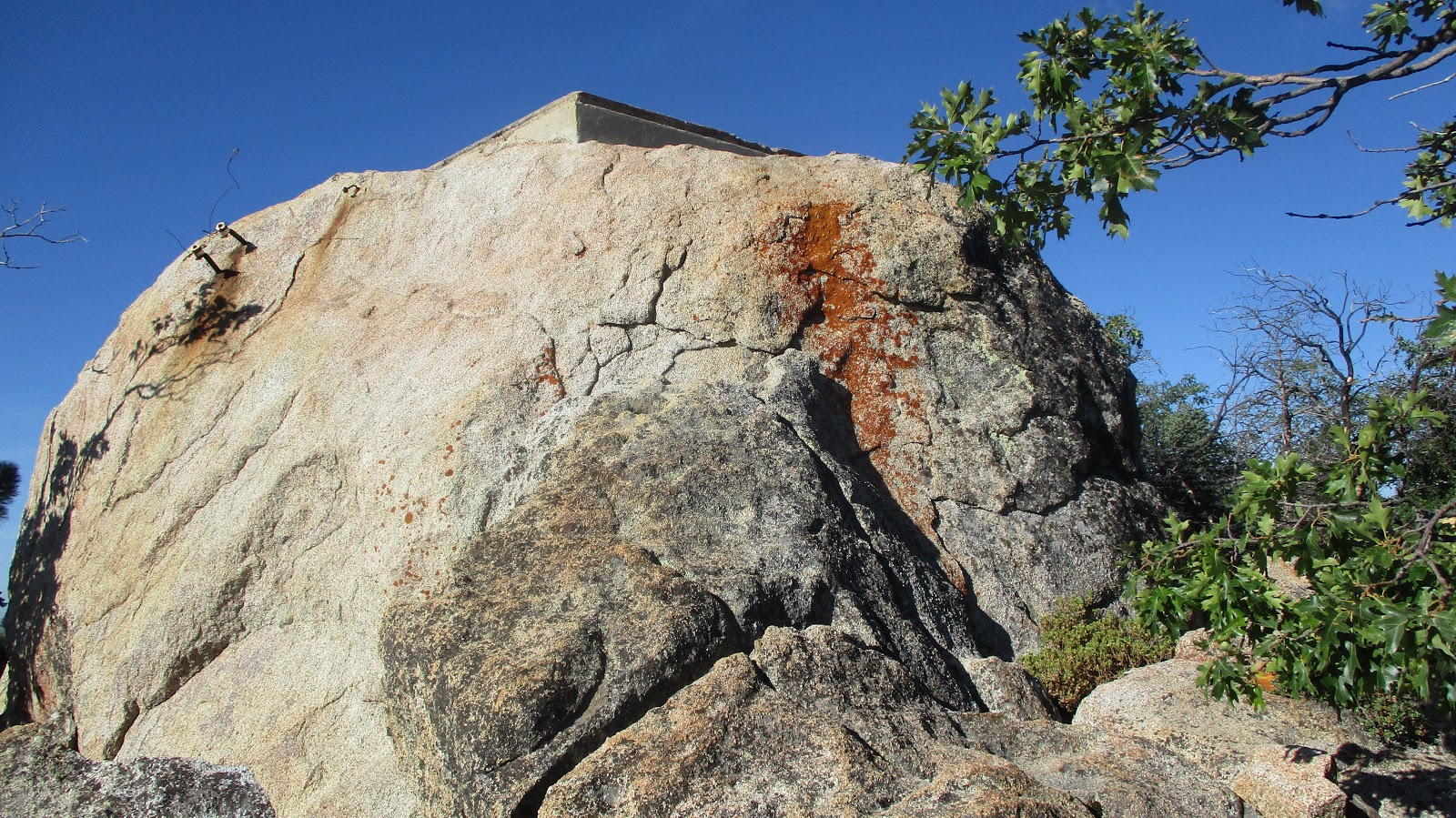
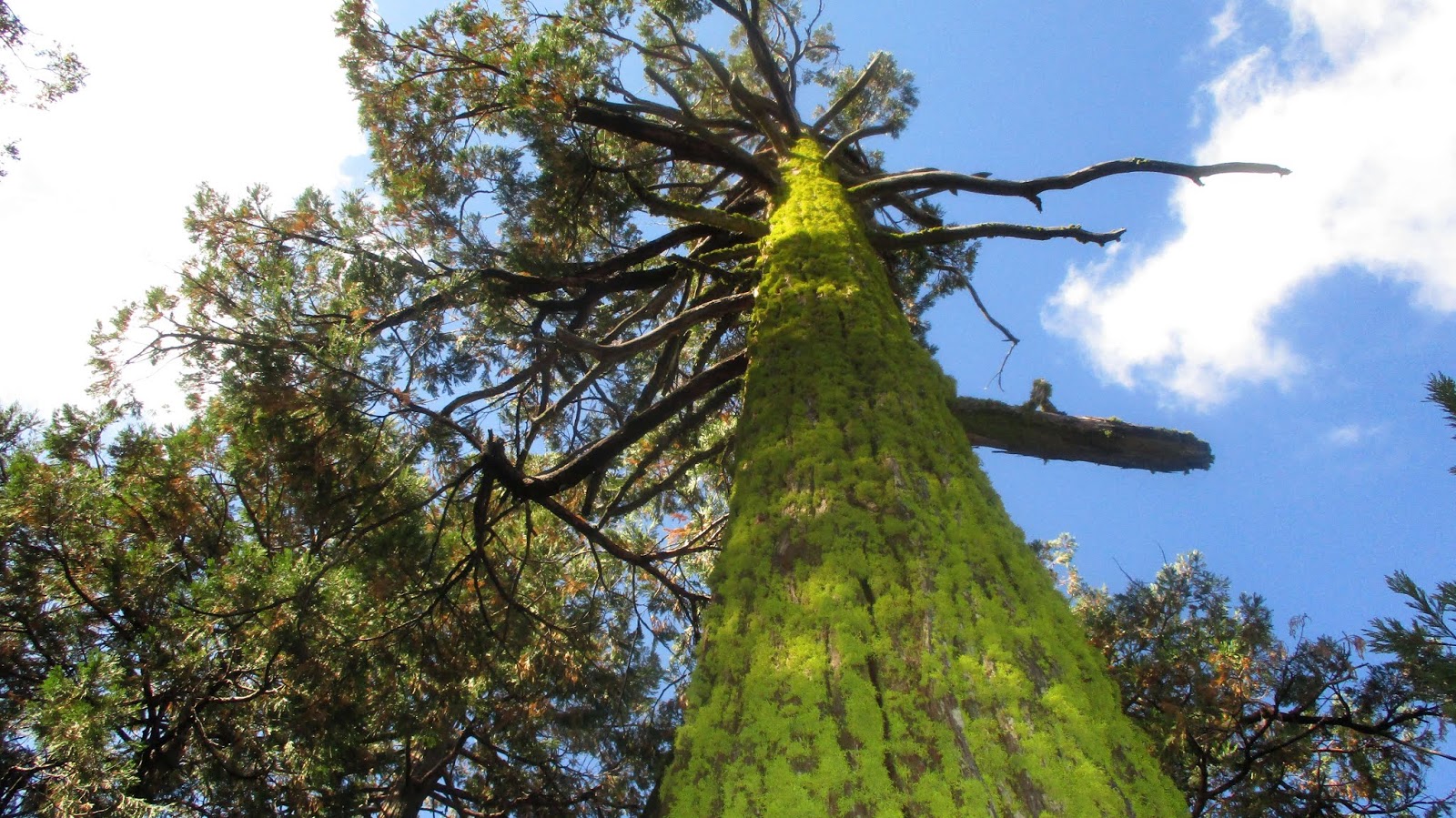
When I got to the ranger station at 6:15 AM, there was no one there, so I put my day hike fee in an envelope and taped it to the door with my license plate number. Then, I continued on to the campground and started up Sukat Road. It had rained here the day before and the road was damp, but not muddy. It kept the dust down but made it humid. The vegetation was aromatic with a pleasant smell I couldn't identify. There was no warm up as the road climbed moderately from the start. Most of the gain is done in the first 2 miles, then there are some ups and downs but only about 800' of gain the last 3 miles. Once I got up into the forest, it was very pleasant among the tall cedars, pines, and oaks. Some shade and higher elevation kept the temps under control for August. Sukat ends at a junction with Hot Springs Mountain Road and I turned right to continue toward the summit. I broke out my bug net for the final mile, but the summit area was bug free. It took about 2 hours to make it to the burned out lookout tower on Hot Springs Mountain. Mark Allen left fresh painted cans and a new register under the tower only two days before and I was the second party to sign it. The official Sierra Club register is normally kept at the high point below the summit boulder a few hundred yards away. I didn't think about moving it to the high point until I got home. After checking out the tower and the views, I followed a use trail marked with orange flags to the high point for some scramble action.
Driving to Hot Springs Mountain (right)
Start
Celestial sunbeams
Abandoned tower
Looking north
The summit boulder was about 20', maybe a little less. Below it were two registers. The Sierra Club register did not have a bottom and the pages were ruined. The second was a geocache register in capped PVC. Red and blue webbing hung to the ground from the summit. There were several ways it could be climbed without the webbing. I went around to the northeast side and found a class 3 route. There is a lower adjacent boulder (with a reference mark) that I climbed, following a ledge to the end, then surmounting it. Then, I jumped 3' over to the summit boulder and made a class 3 move with a thin foothold to reach the top. Flat cement covered much of the summit area and a benchmark was in a 2' rectangular hole in the cement. Views were great, about the same as from the tower. I inspected the webbing and determined the red was in better shape than the blue. Each one was anchored with knots around bolts that were designed for something other than climbing. They felt solid enough, but it was safer to scramble down the way I came up rather than try to arm rappel with the webbing down a 10' vertical drop at the end. With the county high point in the bag, I started down the road.
Registers
Webbing from the bottom
Lower block left, I followed the ledge then mounted it
The final class 3 move on the main summit block
Benchmark in the hole
Webbing from the top
Looking across to the tower
Descending
I had forgotten to load the GPS track or bring a map before I started. That was not an issue for Hot Springs Mountain because I could follow the road all the way. But I also wanted to do Corral Benchmark and without a map, I wasn't sure where it was. I knew it was east of the road, and I thought there was either an old road or use trail to follow, but I had to guess which to try. I was going to make one attempt and if my guess was wrong, skip it. With a little luck, I guessed the right old road and followed it up to Corral. There was a small register in a glass jar apparently placed by Richard Carey dating to 2011. It was not visited often and a nice bonus. When I got back to the truck, I had a note from the Los Coyotes Police asking me to stop on the way out to pay hiking fees. I did stop, but again, no one was at the police station or ranger station. I called the number on the card and left a voice mail explaining that I had left the hiking fees in an envelope that was no longer on the ranger station door. I also left my phone number in case they had questions. Since I didn't hear back, I am guessing we are square.
Climbing up to Corral
Corral summit, Hot Springs Mountain in the background
Hiked: 8/3/2018
Distance: 1.6 miles round trip on use trail and cross country
Summit Elevation: 5507'
Prominence: 547'
Elevation Gain: 624'
Elevation Gain (in Empire State Buildings): 0.5
Round trip time: 1 hour 30 minutes
Recommended water: 32 oz.
Parking/Fees: Free on Pilot Rock Truck Trail (2N33)
Difficulty: Easy
Mount Marie Louise is often climbed together with the Pinnacles. The trailhead is only 3 miles away from the Pinnacles on Pilot Rock Truck Trail (forest road 2N33). It took 20 minutes to get there because the last 2 miles are over rough dirt road. High clearance was required for large rocks in the road and 4x4 is recommended. Sierra Club directions can be found here.
I parked close to the start of the use trail that is marked with cairns on the right. Although the route is mostly cross country, I spotted a cairn every 50'. The first half of the route heads up a gully filled with small to medium sized boulders. It was a fun balancing act hopping from boulder to boulder. Eventually, you reach a clearing and the summit comes into view. From the clearing, a use trail with fewer cairns wove through dense brush. Losing the route at this point would lead to tough bushwhacking. The use trail through the brush was very steep with only a few short switchbacks. Half the gain on this hike comes in the last 0.2 miles. I was able to the follow the use trail to the top cluster of rocks fairly easily, then circled around to the east and scrambled to the summit. The highest boulder was class 2 and had no benchmark and neither did the others. The boulder pile immediately south of the summit held a pair of red register cans. I signed in and put them back in a crevice. Marie Louise had similar views to the Pinnacles. The boulder problems seemed different going down and I lost the trail. I back tracked and consulted the GPS to find the trail again. Once I got back to the clearing, it was easier with frequent cairns to guide me out. It was a fun boulder hop. While the stats place Marie Louise solidly in the easy category, a route finding mistake could make it a lot more difficult.
Cairns marking the start
Boulder hopping...
...and more boulder hopping
Summit block
The Pinnacles from Marie Louise
On the way down
I was curious about the name and found this from the Sierra Club web site:
Seemingly named for French Emperor Napoleon's second wife Marie-Louise von Habsburg (1791-1874), an Austrian princess whom he married in 1810. However, what (if any) connection exists between this peak and the Empress remains a mystery. It could have been named after an unknown surveyor's sweetheart, since there is no record of any early resident's wife or daughter being given this name. More likely it was a recent addition, given as a whim by a fire-boss.
HPS Star Emblem Peak
Hiked: 8/3/2018
Distance: 3.7 miles round trip on trail
Summit Elevation: 5737'
Prominence: 897'
Elevation Gain: 1144'
Elevation Gain (in Empire State Buildings): 0.91
Round trip time: 2 hours 10 minutes
Recommended water: 32 oz.
Parking/Fees: Adventure Pass
Difficulty: Easy
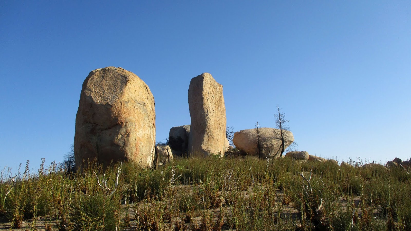
I had 4 different hikes planned in the San Jacinto and San Bernardino Mountains, but both areas were closed due to recent fires. Instead, I decided to bag a couple of peaks north of Lake Arrowhead. The Pinnacles was first. The trail starts on highway 173. Getting there was a little tricky. Sierra Club directions can be found here or use your favorite mapping program.
I started at dawn and caught some golden hour shots of the false summit rock formations visible near the start. The area was much more beautiful than I anticipated, with low scrub, pines, and stellar granite. The first mile or so is mostly level until you reach the base of the false summit. I followed the trail up near the saddle below the false summit. This area had burned and poodle dog bush had a firm foothold. At the saddle, I was lured onto a climbers trail that ended at a 35' sport climb, one of many rock climbing routes in the Pinnacles area. I realized the summit was still some distance away and started a cross country correction to get back on the main trail. Unfortunately, I had shorts on and had to wade through some thick poodle dog. Contact was unavoidable so now I am bracing for the consequences. Once I was back on the trail, I reached the base of the true summit and began climbing. Some light scrambling was required on the way up. The summit block was stiff class 2 and capped with a battered metal pin. Whatever had been stamped on the pin was illegible. The register was below the summit block in an ammo box next to an odd pot. I climbed two other boulders at the summit to see if there were any other marks, but didn't find anything. The views were great. I looked for Lake Arrowhead but the Pinnacles is not high enough to see over the intervening mountains. While I was on the summit, I began hearing the pop, pop, blaow of gunshots from the firing range a couple of miles away. Gunshots became the soundtrack for the rest of the hike. I scrambled down and managed to stay on trail the rest of the way. At the truck, I reloaded my water and drove toward Mount Marie Louise.