Hiked: 8/26/2022
Distance: 1.7 miles round trip on trail and cross country
Summit Elevation: 8379'
Elevation Gain: 730'
Elevation Gain (in Empire State Buildings): 0.6
Round trip time: 1 hour
Recommended water: 16 oz.
Parking/Fees: Free on Forest Road 3N14
Difficulty: Easy
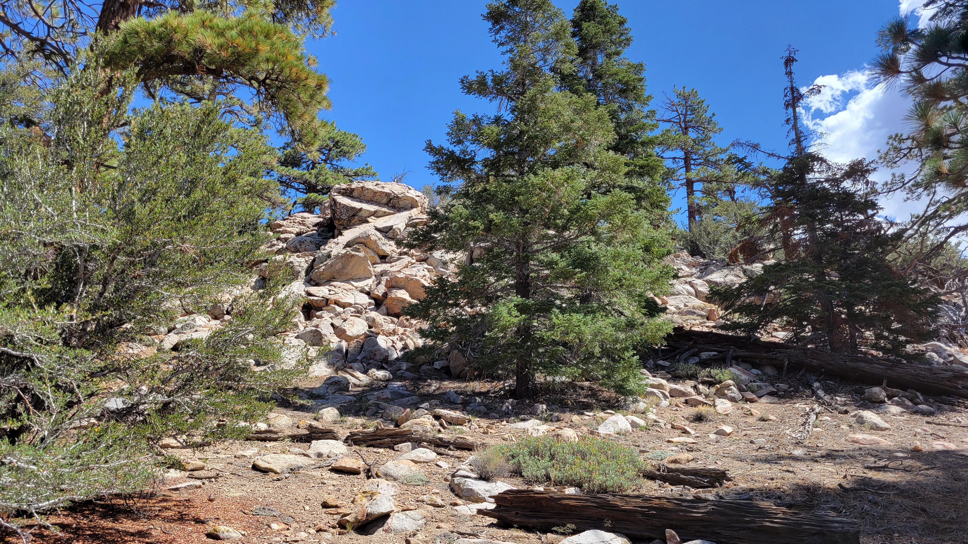
The second peak of the day was Delamar Mountain (HPS #51). From Fawnskin, I drove north on Rim of the World Drive to 3N12. The road climbs to the north side of Delamar Mountain and was in good shape. I drove until I reached the intersection with the PCT where there was a large turnout. At the start, I thought I'd explore a fire break going steeply up the side of the mountain, but when I got 100' up decided to side hill back to the PCT. I looked for a clear use trail heading toward Delamar, but didn't find one, so turned uphill and followed some animal trails. I felt like I was wandering all over the mountain until I stumbled into a good use trail that must have met the PCT farther east. It was easy going after that. The summit of Delamar was a 20' pile of boulders. I didn't find a benchmark and didn't find a register. Like Arctic Point, most of the views were blocked by large trees. On the way down, I found a second use trail that was more direct. However, it ended half way down and I took a gully back to the PCT.
Hiked: 8/26/2022
Distance: 2.8 miles round trip on dirt road and cross country
Summit Elevation: 8336'
Elevation Gain: 935'
Elevation Gain (in Empire State Buildings): 0.7
Round trip time: 1 hours 40 minutes
Recommended water: 24 oz.
Parking/Fees: Free on Forest Road 3N07
Difficulty: Easy
Storms in most of the higher local mountains left me few choices. Blue skies were on tap for Big Bear, so I located some lesser HPS peaks. First up was Arctic Point (HPS #54). Doing this one in the hottest month of the year felt incongruous. I drove a series of dirt roads from the east side of Big Bear Lake to the starting point: 3N09 to 3N16 to 3N07 to the intersection with 3N23. The roads were not bad, but I did have to drive through 4 mud puddles at the end with 4x4. I followed the next dirt road (3N43) on foot to a drainage on the right where the cross country route started. A faint use trail came and went, but I mostly followed cairns. The path appeared to go through several boulder piles, but there was always a ramp or bypass. I did a little scrambling by choice. The summit was a walk up set of boulders. I found a register in HPS red cans, but it was water soaked and I couldn't sign it. I poured water out of the cans and found a dead baby scorpion. The views were mostly blocked by large trees. I was prepared for disappointment with Arctic Point, but I quite enjoyed the walk through open forest. On the drive out, I stopped at Wilbur's Grave. Legend has it that Wilbur wanted to be buried in that exact spot by the side of the road.
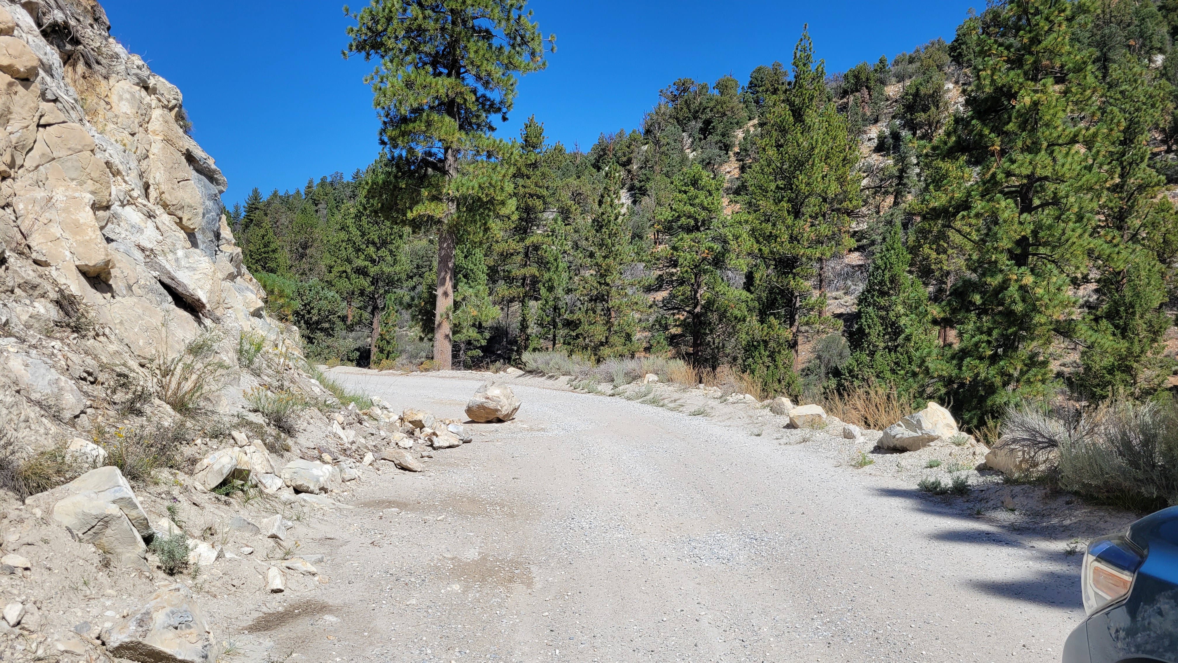
Rockfall on the unmaintained 3N09, but not blocking
Hiked: 8/13/2022
Distance: 9.2 miles round trip on trail
Summit Elevation: 11682' (Blue), 13085' (Dingleberry)
Elevation Gain: 2338'
Elevation Gain (in Empire State Buildings): 1.8
Round trip time: 6 hours
Recommended water: 64 oz.
Parking/Fees: Free at Sabrina Lake
Difficulty: Moderate
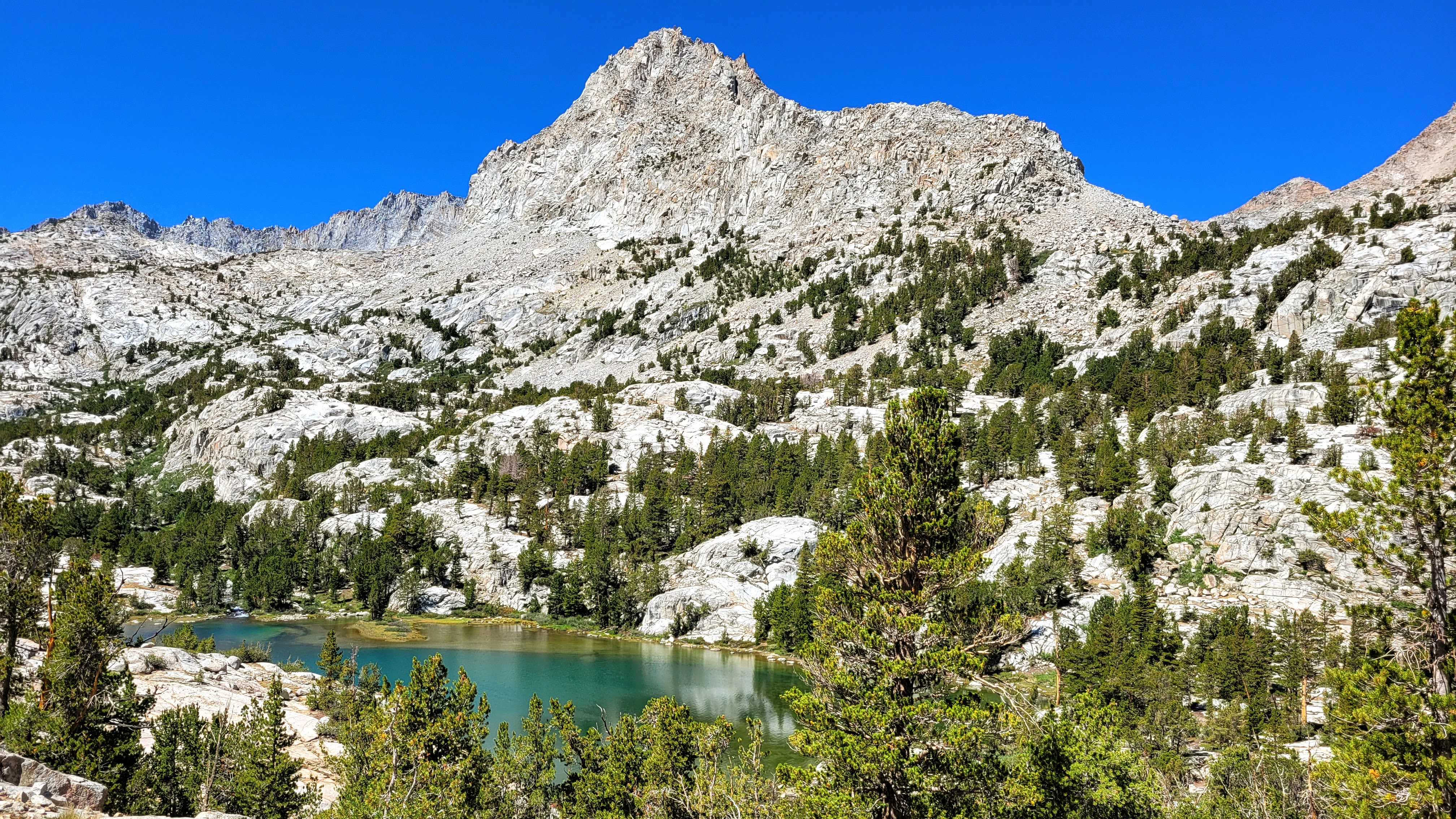
Our second day hike in the Bishop area started at Lake Sabrina. We were headed for two of the dozen or so lakes in the area. The trail followed the east side of Lake Sabrina, then climbed about 1600' in three miles to reach the more level basin. A few large mountains were visible along the way, but also some prominent unnamed features that probably deserved names. The trail was busy with hikers, backpackers, and people fishing. Blue Lake was large and beautiful. There were a couple of easy stream crossings along the way, with water levels slightly below normal. We spent a few minutes at Blue Lake before continuing along the trail toward Dingleberry.
Blue Lake
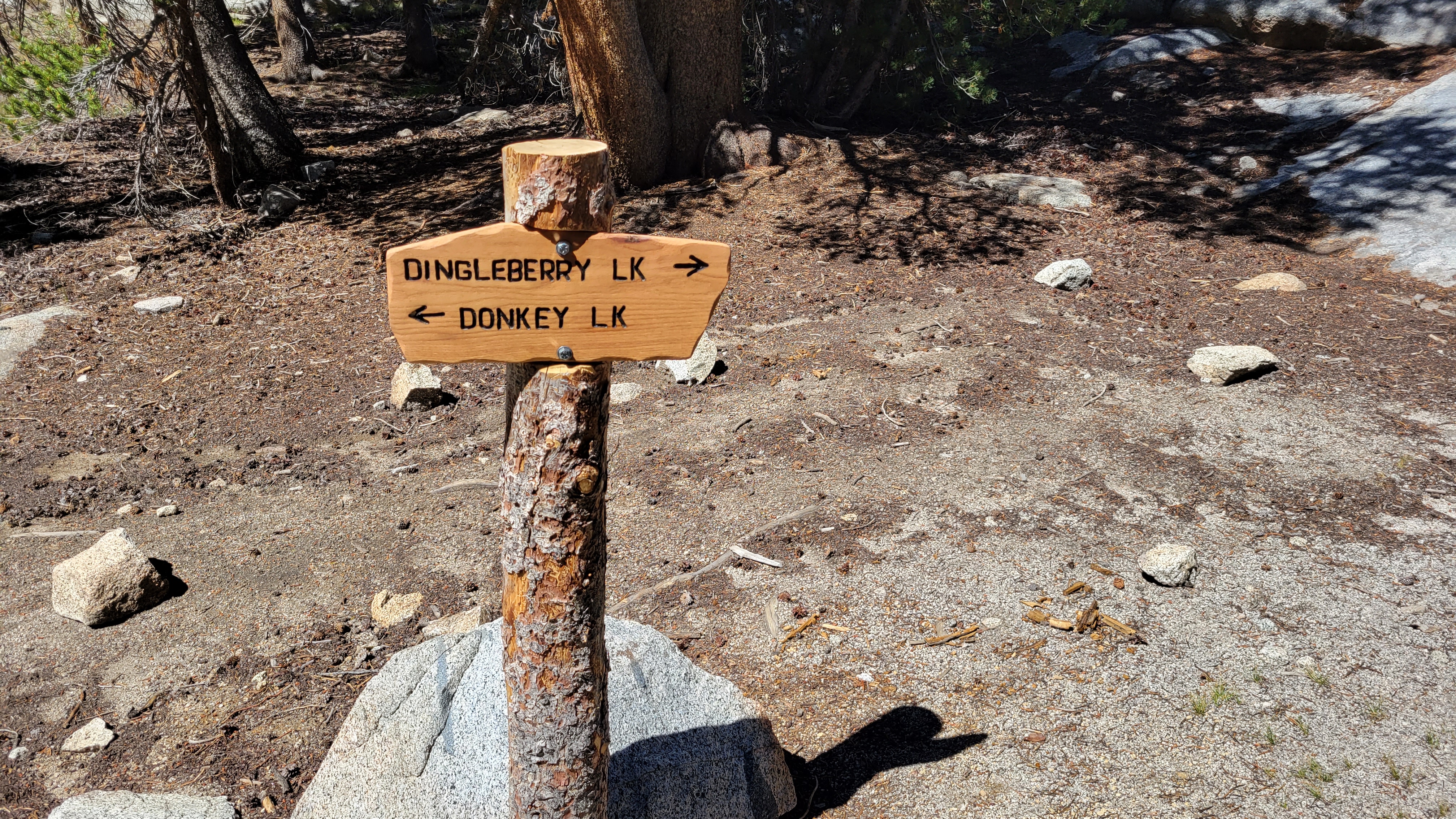
At Blue Lake, we carefully crossed a stream over a pile of logs and reached a signed junction with Donkey Lake in one direction and Dingleberry the other. The basin was filled with granite slabs and odd boulders, with plenty of tall trees and ground cover. It seemed like ideal bear country, but we saw no wildlife other than birds and lizards. Dingleberry was a large lake with cliff jumping options if you were into that kind of thing. With the warm sun on us, we took a nap on the granite before a mule train came down the trail. Two riders and six mules rode past us toward an unknown destination. The mules left plenty of evidence of their passing on the trail. After a while, we returned the way we came.
Hiked: 8/12/2022
Distance: 13.6 miles round trip on trail and cross country
Summit Elevation: 11682' (Chocolate), 13085' (Goode)
Elevation Gain: 4924'
Elevation Gain (in Empire State Buildings): 3.9
Round trip time: 10 hours
Recommended water: 164 oz.
Parking/Fees: Free at South Lake
Difficulty: Strenuous
Leisa and I spent a long weekend at Parcher's Resort outside Bishop and planned our first hike from South Lake. Leisa was still recovering from her broken pinky toe, but felt well enough to attempt Chocolate Peak. We took Bishop Pass trail south toward Bull Lake, wandering through lush meadows and forest until we caught our first glimpse of Chocolate. The north slope looked sharp and we took the Ruwau Lake junction to wind around to the south slope. The official trail doesn't go to the summit so I led us off trail where the going looked easy. Our path led us through some minor brush and boulders. Soon enough, we were on the summit with wonderful views of the surrounding lakes and towering 13ers. We found and signed the register in some PVC tubing, but did not find any benchmarks. It was windy on top so we didn't loiter. We returned on a better defined use trail, then caught the Ruwau trail back to the junction with Bishop Pass trail. Four and a half hours was my estimate to make it from there to the top of Mount Goode (SPS #97) and back. We planned a pick up time, then to avoid pushing her foot too far, Leisa headed back.
First look at Chocolate
Picture Puzzle above Ruwau Lake
Chocolate Lakes near the summit of Chocolate Peak
Looking over at Mount Goode
The trail ran past the rest of Long Lake, Spearhead Lake, and Saddlerock Lake. I filled a water bottle from Saddlerock, then left the trail at 11200' to cut between Saddlerock and Bishop Lake. Bishop Creek runs between and I crossed some marshy ground before the creek itself. Now I faced the broad east flank of Mount Goode. The first obstacle was a low set of cliffs and small trees. There were multiple ways through and I dropped my trekking pole anticipating the boulders to come. Next was 400' of steep sand and a second set of trees. I stumbled on a use trail in the sand and followed it. Above the second set of trees was a long basin. Multiple high points were visible along the ridge line and it wasn't easy to tell which was Goode and which was No Goode. I stuck to the use trail and slogged along as it curved up. I expected more boulders, but the slope remained mostly sand and scree as it got steeper. I slid back every third step as Goode drained my energy. When the boulders finally arrived, 400' below the top, it was a relief. I was tired, but the rock was solid, and much more fun to climb. At the summit, I met two young men who had come over from No Goode. We chatted about Goode and the other nearby mountains. They planned to hit Cloudripper the next day via one of the west chutes. I found no register and no benchmarks. The views were among the best. The Inconsolable Range was east. To the south, Agassiz, North Pal, and Mount Sill. North was Chocolate and all the lakes. To the west, the high peaks of Kings Canyon. After resting a while on the summit, I made quick time coming down. I skied the scree down to the tree line and tried to make up time when I got back on trail. My water held out and I got back to South Lake 15 minutes after the pick up time. Leisa thankfully was waiting for me. Saul Goode, man.