Saturday, June 27, 2015

Mt. San Antonio North Backbone, West Baldy

HPS Star Emblem Peak
Hiked: 6/26/2015
Distance: 9.2 miles round trip on trail
Summit Elevation: 9648' (Pine #1), 9575' (Dawson), 10064' (3067m, Mt. San Antonio), 9988' (West Baldy)
Prominence: 848' (Pine #1), 424' (Dawson), 6224' (Mt. San Antonio)
Elevation Gain: 4725'
Elevation Gain (in Empire State Buildings): 3.78
Round trip time: 6 hours 45 minutes
Recommended water: 168 oz.
Parking/Fees: Adventure Pass
Difficulty: Strenuous

The north backbone is a less frequently used route to climb Mt. San Antonio (Baldy). The ridge is a high altitude roller coaster starting on Blue Ridge Road and running over Pine Mountain #1 and Dawson Peak, each towering over 9000'. The northern slopes usually retain snow late into the year, but since there wasn't much snow this winter, the route was clear. The gate past Guffy Campground was open so we drove to the trailhead at a small turnout below Wright Mountain. The weather was perfect. While it was scorching at sea level, it was pleasant in the high country. The north backbone trail starts by dropping a short distance to a saddle, then climbing up to the first bump along Pine Mountain #1 ridge. Beyond the first bump is the more difficult section of Pine ridge. It is loose with tiny scree and a few class 2 sections where both sides of the ridge drop away more than 500'. However, the trail is in good shape and the danger is low unless you are careless. The mountain itself is almost completely covered with pines, ranging in age from new to ancient. There were a couple of bighorns hanging out on an adjacent ridge. When we arrived at the Pine summit, we got a good view of the rest of the backbone. Dawson hovered on the left and Mt. San Antonio blocked out the north, dwarfing the normally imposing Iron Mountain #1 (8007'). There were great views of everything within 50 miles. I could even make out the white dome of the Mt. Wilson observatory.


Start of the north backbone trail


First bump on Pine Mountain ridge


First view of Pine Mountain #1


Sean working through a class 2 section


Bighorns on Pine


Strangely curled trees


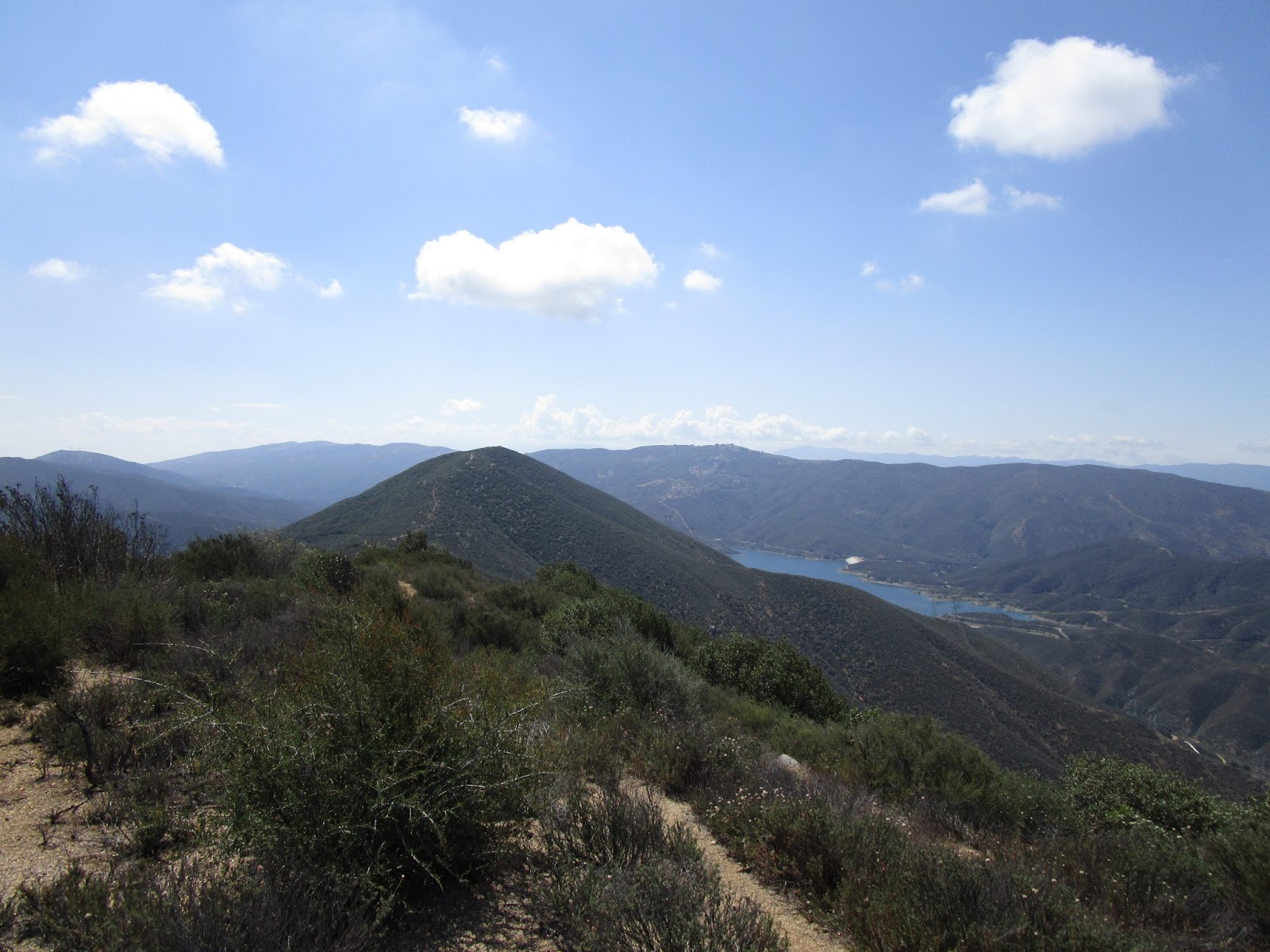
The remaining goals from the Pine Mountain summit

We descended Pine and started up the Dawson ridge. As we passed over the top of Dawson, we spotted a second, larger group of bighorns. We got a couple of photos before they bolted down the southwest side. Dawson was also covered mostly in pine trees. I think the high back country is the nicest part of the range. We took a short break on Dawson Peak before gearing up for the third segment up Mt. San Antonio. From the north, you get a better sense of the incredible size of Baldy. We started down Dawson and cached some water in a hollow log. The drop down to the Dawson-Baldy saddle is about 700', followed by a 1200' climb in just over a half mile with practically no shade. The elevation and early morning kept the heat in check. On the summit, one group was hanging out in a wind break, and soon other singles and groups made their weary way to the top. Sean decided to skip West Baldy, but I had never made the side trip so I dropped my pack and took off. I brought binoculars to look around for the plane wreck from West Baldy, but left them in my pack. There were no official marks or register on West Baldy, but I got a different perspective and a great view down Cattle Canyon. Then I returned to Baldy and we hung out on the summit for about 45 minutes before heading back.


Sean on the Dawson Peak summit


Dawson register


The bulk of Baldy


Bighorns near Dawson Peak summit


Sean got this shot of the bighorns


Sean climbing Mt. San Antonio


Knocking on Baldy's back door


The lone North Backbone trail sign, several hundred feet below the summit


Looking toward West Baldy from just below the Mt. San Antonio summit


Mt. San Antonio summit


Sean and I on the summit


West Baldy 360

Unlike the other three main routes to Mt. San Antonio that approach from the south, the north backbone exacts a price on the return trip, about 1400' of gain. As we got to the Dawson-Baldy saddle, we met the first group of people that were not on the Baldy summit. Three hikers were on their way up the north backbone, having started a couple of hours after us. Sean had met one of them before. We chatted about the trail and other adventures for a while before wishing them well and moving along. We picked up our water cache on Dawson, finished that climb, then continued the roller coaster up the south side of Pine. The final challenge was surfing the scree down the north side of Pine. Though difficult to reach, the remoteness and unmatched views make this my favorite route up Mt. San Antonio.


View to Claremont from West Baldy, Saddleback distant left


Iron Mountain #1 and Rattlesnake Peak from Dawson ridge


Descending the tricky part of Pine Mountain


Friday, June 26, 2015

Blue Ridge

Hiked: 6/26/2015
Distance: Drive up
Summit Elevation: 8480'
Prominence: 360'
Elevation Gain: 0'
Elevation Gain (in Empire State Buildings): 0.00
Round trip time: N/A
Recommended water: N/A
Parking/Fees: Adventure Pass
Difficulty: Easy

This was an unplanned side trip from the real hike up the North Backbone of Mt. San Antonio. A road veers before the Guffy Campground leading to the Blue Ridge high point filled with communication towers. I remembered from the topo map that the Frost Benchmark was also nearby. Sean and I parked at the high point and searched around the towers and on the south side of the road looking for Frost without luck. Looking at the GPS track later, it appears Frost was a little further up the road. Lack of preparation showed.


A couple of the many towers on Blue Ridge

Thursday, June 11, 2015

Jupiter Mountain and Juno Peak

Hiked: 6/10/2015
Distance: 4.0 miles round trip on trail
Summit Elevation: 4498'
Prominence: 1077'
Elevation Gain: 1485'
Elevation Gain (in Empire State Buildings): 1.18
Round trip time: 2 hours 15 minutes
Recommended water: 48 oz.
Parking/Fees: Adventure Pass (not sure)
Difficulty: Easy

Jupiter Mountain lies well north of Santa Clarita, just north of bright blue Bouquet Reservoir. It would be my second hike of the day. It's hard to believe the Angeles National Forest stretches this far north. Jupiter stands out with a clean prominence of more than 1000'. The trailhead starts on Spunky Canyon Road near mile marker 2.68. There are no facilities at the trailhead, but there is a bench on the summit, so I don't know if you need the Adventure Pass for parking or not. I usually don't take chances. The hike starts up a dirt road to the left of the parking area. You can continue up a steep, wide firebreak on the left, or follow the road to the right where it intersects with a single track trail taking a less aggressive angle to the saddle between Jupiter Mountain and the slightly lower Juno Peak. Trails go to each peak from the saddle. I headed up the firebreak, taking the most direct approach to Jupiter. I wanted to test out some new video technology called hyperlapse, so I decided to record video of the entire hike. This was a little distracting and inconvenient. I had to break the video into pieces whenever I wanted to take a photo. Views of Bouquet Reservoir got better as I gained altitude. On the summit of Jupiter was a register can with three nearly full books stuffed into it. Quite a popular peak. There is also a bench if you want to just sit and rest or enjoy the panorama. I didn't find a benchmark.


Jupiter Mountain with over 1000' of prominence


Trailhead off Spunky Canyon Road


Bouquet Reservoir from Jupiter Mountain summit


Jupiter Mountain summit, Juno Peak in the background

About a mile away and only 67' shorter is Juno Peak (also called Jupiter Mountain West) on the other side of the saddle. When I finished looking around Jupiter, I started down toward the saddle, then steadily climbed up to Juno. Again, I took video of the entire segment. There is nothing on the flat, sandy Juno summit. I found a pole marker northeast and just below the summit. No benchmarks or registers, but fine views just as on Jupiter. Having reached all my summits for the day, I took a food break and enjoyed the sunny views. I followed the single track trail down from the saddle to the car. My camera battery gave out on the way down so I don't have complete video of the hike. I did get enough for a good test of the hyperlapse software (linked below). The goal of hyperlapse is to speed up and smooth out choppy movement oriented video. My raw footage made that very difficult. Microsoft has a free beta version for the Windows desktop, and they also have a version for Android phones (but not Windows phones yet!?). There are other good software choices for iPhones. Phones might have trouble processing large videos, both in terms of CPU and storage. My test used the Microsoft desktop version which is still in beta mode. I think the hyperlapse video turned out OK. Regardless, it was a fun little hike after Mendenhall and another one crossed off the list.


Jupiter Mountain from Juno Peak


Juno Peak summit pole marker, Green Valley below


Climbing Jupiter Mountain


From Jupiter Mountain to Juno Peak


Wednesday, June 10, 2015

Mendenhall Peak

Hiked: 6/10/2015
Distance: 7.7 miles round trip on trail and use trail
Summit Elevation: 4636'
Prominence: 276'
Elevation Gain: 2280'
Elevation Gain (in Empire State Buildings): 1.82
Round trip time: 3 hours 10 minutes
Recommended water: 80 oz.
Parking/Fees: Adventure Pass
Difficulty: Moderate

I started early with with plans to bag two Lower Peaks. Mendenhall was up first, the second goal being Jupiter Mountain north of Santa Clarita. Some spirited driving and minimal traffic got me to Dillon Divide about 30 minutes faster than predicted. It was still about 40 minutes before sunrise, so I geared up with lighting and started up Mendenhall Ridge Road in the dark. The Pinnacle loomed over me, but I could not see much past end of my flashlight beam. Frankly, there isn't much to see on this part of the road. After the sun came up, the bugs started bugging, but they became a non-issue when I put on my $3 bug net. I learned something from Eagle Crag. I found myself nearing Highline Saddle much sooner than expected. The electrical towers were buzzing and crackling. I decided to shave distance off the hike by heading directly up the ridge on the firebreak instead of following the road all the way around Mendenhall and back. It was kind of a fun climb and I was glad to be off the road. Yucca were the only nuisance on the firebreak, the bugs had disappeared. Just before reaching the first major bump, about 30 minutes after sunrise, I heard the distinct roar of a mountain lion coming up from somewhere far below. I tried to capture the sound with my camera in video mode, but the only sounds it captured were the wind and my heavy breathing. The lion roar was kind of a slow moan, not like the sound of fighting. It went on for about 15 seconds and was very impressive. That was my only encounter with wildlife for the day, however indirect.


Dillon Divide in the dark


Approaching Highline Saddle, ascent route up the firebreak shown


Highline Saddle water tank


Nearing the first bump on the ridge


Rock throne on peak 4403


Approaching Mendenhall Peak

One of the ridge bumps, peak 4403, has a chair/throne built out of rocks. At first, it looked like a large cairn, but there was a rock seat facing south to nice views. A very fine piece of rock work. I continued over the next bump, across the road, and up to the Mendenhall summit. The ruins of the lookout were prominent and there were several other abandoned structures in various states of disrepair. There was also a lot of trash, way too much to pack out. The apparent high point was a clump of dirt in the middle of the long summit. I could not find a benchmark or register anywhere. I checked the many cairns and each structure but no luck. After a short break, I started back down the firebreak to Highline Saddle, then back to the car. I was ahead of plan, and I suspect it is because the Sierra Club write up overestimated the distance by a good margin. I know I cut some distance going up the firebreak, but my round trip distance was significantly shorter. Regardless, I was feeling pretty strong and ready to drive further north to Jupiter Mountain.


Lookout tower ruins on Mendenhall Peak


Looking back at the ascent ridge


Looking across the long summit from the high point


Ugly summit trash


The shadow of Peak 4403 on the clouds


Misty mountains of the front range

Photosphere from Mendenhall Peak


Monday, June 8, 2015

Juan Rancho SM

Hiked: 6/5/2015
Distance: 1.9 miles round trip on use trail
Summit Elevation: 1824' (Juan Rancho SM), 2003' (False summit of Peak 2040)
Elevation Gain: 1300'
Elevation Gain (in Empire State Buildings): 1.04
Round trip time: 1 hour 15 minutes
Recommended water: 32 oz.
Parking/Fees: Adventure Pass
Difficulty: Easy

I dropped my son off after school at Howie's Game Shack for a birthday party for one of his friends. That left me a couple of hours to kill. What to do? I could have watched an overpriced movie or wandered around the mall. I thought it might be healthier to scout something in the nearby Santa Ana Mountains. Caltopo showed the Juan Rancho Survey Mark at 1824' above the San Juan Fire Station just off Ortega Highway that was close enough to be tempting. Factoring in traffic, I would have no more than 90 minutes to make the round trip. It was oddly placed on a ridge, about 200' below Peak 2040. It was too far to come up the San Juan Trail and descend to it, so I decided to see how far I could get using the firebreak.

I parked in the single day use parking spot behind the fire station. The fire crew was out front doing some kind of activity and I wondered if they would mind me crawling up their break. If they saw me, they didn't say anything. The firebreak was loose dirt gaining about 1300' in less than a mile. Half way up, I checked my time and as I continued to grind, a rocky outcrop came into view that I guessed was the SM. The outcrop looks like it had been cut in half. Just above the outcrop was a metal pole marking the Juan Rancho SM. I didn't find any traditional discs, just the pole. Another time check showed I had a few minutes before my turnaround time, so I resumed my climb toward what I thought was Peak 2040. I stopped when I found a large plastic jar holding a register. I quickly flipped through it, seeing that it went back to 2005. Most entries were more recent, but there weren't many. I signed it, feeling a small sense of accomplishment, then started back. I realized when I got home that I stopped 40' vertical away from the true summit of Peak 2040. I would have to be content bagging only the SM. I went against traffic on the way back to the party and arrived with 45 minutes to spare.


A little afternoon cardio


Rocky outcrop just below the SM


Juan Rancho SM, Ortega highway below


Plastic jar register on false summit of Peak 2040


Looking southeast toward Sitton Peak from the false summit at 2000'