Hiked: 6/10/2015
Distance: 7.7 miles round trip on trail and use trail
Summit Elevation: 4636'
Prominence: 276'
Elevation Gain: 2280'
Elevation Gain (in Empire State Buildings): 1.82
Round trip time: 3 hours 10 minutes
Recommended water: 80 oz.
Parking/Fees: Adventure Pass
Difficulty: Moderate
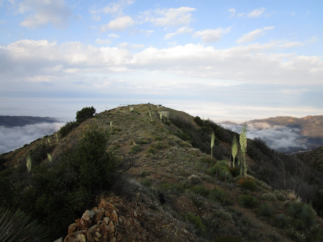
I started early with with plans to bag two Lower Peaks. Mendenhall was up first, the second goal being Jupiter Mountain north of Santa Clarita. Some spirited driving and minimal traffic got me to Dillon Divide about 30 minutes faster than predicted. It was still about 40 minutes before sunrise, so I geared up with lighting and started up Mendenhall Ridge Road in the dark. The Pinnacle loomed over me, but I could not see much past end of my flashlight beam. Frankly, there isn't much to see on this part of the road. After the sun came up, the bugs started bugging, but they became a non-issue when I put on my $3 bug net. I learned something from Eagle Crag. I found myself nearing Highline Saddle much sooner than expected. The electrical towers were buzzing and crackling. I decided to shave distance off the hike by heading directly up the ridge on the firebreak instead of following the road all the way around Mendenhall and back. It was kind of a fun climb and I was glad to be off the road. Yucca were the only nuisance on the firebreak, the bugs had disappeared. Just before reaching the first major bump, about 30 minutes after sunrise, I heard the distinct roar of a mountain lion coming up from somewhere far below. I tried to capture the sound with my camera in video mode, but the only sounds it captured were the wind and my heavy breathing. The lion roar was kind of a slow moan, not like the sound of fighting. It went on for about 15 seconds and was very impressive. That was my only encounter with wildlife for the day, however indirect.
One of the ridge bumps, peak 4403, has a chair/throne built out of rocks. At first, it looked like a large cairn, but there was a rock seat facing south to nice views. A very fine piece of rock work. I continued over the next bump, across the road, and up to the Mendenhall summit. The ruins of the lookout were prominent and there were several other abandoned structures in various states of disrepair. There was also a lot of trash, way too much to pack out. The apparent high point was a clump of dirt in the middle of the long summit. I could not find a benchmark or register anywhere. I checked the many cairns and each structure but no luck. After a short break, I started back down the firebreak to Highline Saddle, then back to the car. I was ahead of plan, and I suspect it is because the Sierra Club write up overestimated the distance by a good margin. I know I cut some distance going up the firebreak, but my round trip distance was significantly shorter. Regardless, I was feeling pretty strong and ready to drive further north to Jupiter Mountain.
Photosphere from Mendenhall Peak


I did this today. took your firebreak up. It was a lot of fun. kind of like the devils backbone.
ReplyDeletejoe schmoo,
DeleteI remember the ridge being fun as well. A nice break from the road.
I did this yesterday. I did the opposite route. I went the long way. Once past mendenhall saddle its overgrown with a few washout sections but we managed. On the return, I took the ridge route down to highline saddle which was fun. The road was too long and boring but on a positive note there were quite a few shady spots to take a break.
ReplyDeleteHiker Girl,
DeleteCool loop. Was there still a lot of trash up there?