Monday, August 19, 2019

Devil's Chair, Peak 5270, Devil's Punchbowl

Hiked: 8/18/2019
Distance: 8.6 miles round trip on trail and cross country
Summit Elevation: 4980' (Devil's Chair), 5270' (Peak 5270)
Elevation Gain: 2450'
Elevation Gain (in Empire State Buildings): 1.9
Round trip time: 3 hours 50 minutes
Recommended water: 72 oz.
Parking/Fees: Free at Devil's Punchbowl parking lot
Difficulty: Moderate

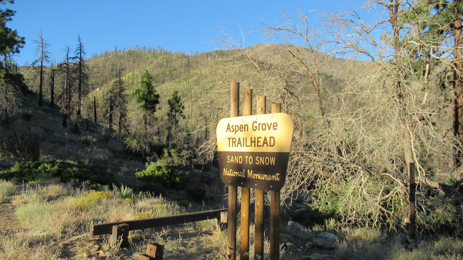
Devil's Punchbowl is a Los Angeles County Park north of the San Gabriel Mountains. It is mind boggling that LA County extends into the high desert. The park itself has plenty of parking, restrooms, and a visitor center. The park formations were created by the San Andreas fault and other faults. It features massive slab uplifts like the more famous Vasquez Rocks. There are two trails from the parking lot. One does a one mile loop through the slabs, and the other heads into the mountains to the Devil's Chair.

I started at 1:00 PM, a potential idiot move at the hottest part of a 90 degree day. The trail heads south rising gently into the foothills. At 0.9 miles, the Burkhart Trail comes in sharply from the right. From there, it's 6.2 miles to Burkhart Saddle. I stayed on the Devil's Chair trail, meeting parties on their way down. When the trail turned east, I was in pleasant pine forest with a fair amount of shade and my concerns about roasting in the sun eased. Phantasmagoric geology was on display the rest of the way. Rocks and clay were varied in colors and formations in dark green, red, pink, tan, and white. The photos don't capture the richness of the color. While the trail undulated between 5200' and 5300', it felt mostly flat until the 400' drop at the end to the Chair. The Devil's Chair is a ramp of white rock into the open air above the Punchbowl. A fence is built around it on both sides to keep people from falling off. It's easy to get outside the fence if you desire, but not recommended on the crumbling rock. The views were worth the effort. I sat on the Chair about 10 minutes enjoying the views and wind gusts. There were still some stragglers on the trail on the way back and even a few very late starters. I did see two large bear scats on the trail. I didn't expect that. There's plenty of bear food at this elevation. I took a 10-minute side trip to peak 5270 on a use trail on the way back. I'm not sure the diversion was worthwhile, though someone had left a lawn chair on the summit for lounging. The round trip for Devil's Chair alone is 7.6 miles and 2150' gain.


Greens and browns, the photo doesn't do it justice


The upper white protrusion below is the Devil's Chair


Crazy geology below the Chair


Looking out over the Punchbowl from the Chair


Lawn chair on top of Peak 5270

I couldn't leave the Punchbowl without a quick scramble on some of the slabs. I headed for the highest slab in the park, which meant leaving the loop trail and taking one of the many criss-cross use trails down to the rocks. I climbed over a lower slab to get to the base of the big one. Several other people were climbing on neighboring slabs, and a couple of people were trying to climb the vertical side of the big slab with a rope. The slabs appear to be mainly sandstone conglomerate with small rocks sticking out of the surface. Think cookie dough ice cream hardened to rock. I started up the main crack facing the road which was a mix of class 1/2/3. Half way up the crack, there was a landing where I dropped my pack. I followed the crack the rest of the way to its terminus just below the peak, but could not find a way up the final 12'. I backtracked down the crack to a lone bush. The way up there was tough class 3 and required trusting your weight to one or two inch holds on the rocks sticking out of the surface. The first 10' above the bush was the crux. I tested the first couple of rocks and they held, then I worked my up to the top. The big slab is about 150' high. I saw no sign of the rock climbers. It was tricky coming down and I ended up sliding the last five feet of the crux section back to the main crack. It was a fun way to end the hike.


The biggest slab


Found this weird county mark on a lower slab on the way


Dropping off the lower slab to the base of the big one


Some class 3


Dropped my pack on the landing below


Would you like to know more...?

Monday, August 12, 2019

Ten Thousand Foot Ridge and Lake Peak

Hiked: 8/11/2019
Distance: 18 miles round trip on trail and cross country
Summit Elevation: 10094' (10000' Ridge), 10161' (Lake)
Elevation Gain: 4000'
Elevation Gain (in Empire State Buildings): 3.2
Round trip time: 9 hours 40 minutes
Recommended water: 142 oz.
Parking/Fees: Adventure Pass on Fish Creek Road
Difficulty: Strenuous

My original plan was to attempt a loop from Fish Creek by going up to Hell For Sure Peak, then traversing the ridge and returning on Fish Creek Trail. My plan blew up as soon as I turned onto Fish Creek Road. Before I got far, I was blocked by a locked gate. I decided to park at the gate and hike the extra miles to at least come away with Ten Thousand Foot Ridge. The name refers to a particular peak along a ridge that has multiple 10,000'+ peaks and few just under.

I started around 6:30 AM and hiked a little more than a mile up Fish Creek Road to the Aspen Grove Trail. I started down Aspen Grove knowing it intersected the Fish Creek Trail. The trail dropped down to a nicely flowing Fish Creek, then started heading gently up the canyon. Every single aspen tree in the area was black, burned by the Lake Fire in June, 2015. The trail was in pretty good shape but parts were overgrown with soft plants, especially near the creek. When I reached the Fish Creek Trail junction, I checked my map and I was about half a mile past where I needed to leave the trail to catch the Hell For Sure ridge. This confirmed my decision to abandon the loop idea. I turned right and continued up the Fish Creek Trail. The lower part of the trail, near the creek, was more overgrown than Aspen Grove and was hard to follow. I also found quite a bit of stinging nettle on or near the trail. Once I got away from the creek, the trail cleared up and it started to look like the San Gorgonio Wilderness I remembered. The Fish Creek Trail has long switchbacks, mostly up the side of Grinnell Mountain. I could see 10K Ridge across the creek, but with switchbacks, I was walking away from it as much as toward it.


One of many overgrown sections on Fish Creek Trail, some with hidden seeps

I took a break at Fish Creek Saddle and could tell the extra miles were eating into my time. The summit of Grinnell seemed close, but was 500' above the saddle in the opposite direction of my targets. I decided to focus on my main goal and see how I felt about Grinell on the way back. I left the saddle and started straight up open country toward Lake Peak. The Lake Peak summit was a large pile of boulders, class 1+. There was an ammo box but it only had a couple of small scraps of paper. It needed a new register, but I didn't have one on me. There was a great view of Dry Lake which wasn't dry, and a good but not complete view of San Gorgonio.


Ten Thousand Foot Ridge from the side of Grinell


Camp site at Fish Creek Saddle


Lake Peak summit


Gorgonio


Dry Lake below, the first time I've seen it wet


The party of hikers I caught on the way to 10K

The trek from Lake to Ten Thousand Foot Ridge was longer than I thought, more than a mile. Lake has a very long summit with some small boulder bumps and a lot of downed trees from the fire. I picked my way across and started down toward the saddle. I was surprised to find a party of 8 hikers, organized with an official leader. They might have been from the Sierra Club. I chatted with them as I walked past and found out they had camped at Dollar Lake and were on their way to 10K. The group was moving slowly, so I said goodbye and continued up. The slope to 10K was the only steep terrain of the day and there were a couple of faint use trails. I picked up a strong aroma of field mint on the ascent. On top, there was a notebook register in a tall ammo box. I had the summit to myself for about 10 minutes before they caught up. That gave me time for photos and to decorate the ammo box with an Eispireten sticker. The first page in the register discussed how the Tribe of Tahquitz adopted this mountain in 1925 and refers to it as TOT mountain, frequently bringing youth up as a rite of passage. I talked with the hiking group a little more on the summit before starting back. When I reached Fish Creek Saddle again, there was a second large party that looked less formal. They were also headed to 10K. I was feeling some time pressure and with many miles back to the truck, decided to skip Grinell. On the way down, I lost the trail in the vegetation around Fish Creek and ended up on the wrong side of the creek in waist high grass. I could see the trail on the other side, but had to head back upstream until I found a log across the creek. It was uneventful the rest of the way down. This trip will be much easier when the road is opened to Fish Creek Trailhead.


Gorgonio with Bighorn behind


Lake Peak directly ahead, Grinell to the right


This steep gully looked like a shortcut to 10K, but not sure it's safe


Friday, August 2, 2019

Grand Teton National Park

Hiked: 7/29/2019-7/31/2019
Distance: Various
Parking/Fees: $35 National Parks (good for 7 days)
Difficulty: Easy

Photo dump of our trip to Grand Teton National Park. The Teton range was created through tectonic uplift much like the Sierra Nevada range and both share majestic granite spires. The lack of foothills makes the Tetons striking from every direction. We visited three of the glacial lakes at the base, Jackson, Jenny, and String Lake. We hiked to Hidden Falls above Jenny Lake, did a loop around String Lake, and took a 9 mile float trip down the Snake River, spotting several bald eagles and a dozen beavers. I considered attempting Storm Point (class 4 west face), but didn't find a hiking partner and didn't want to try it solo. The rest of the time we were hunting for wildlife, getting shots of a momma moose and calf, an elk herd, deer, river otters, and a grizzly(!).


Hidden Falls


Storm Point and Ice Point, class 4


Moose


Elk


River otters that look like rats


Nice beaver


Bald eagle


Bison


Grizzly bear