Hiked: 8/11/2019
Distance: 18 miles round trip on trail and cross country
Summit Elevation: 10094' (10000' Ridge), 10161' (Lake)
Elevation Gain: 4000'
Elevation Gain (in Empire State Buildings): 3.2
Round trip time: 9 hours 40 minutes
Recommended water: 142 oz.
Parking/Fees: Adventure Pass on Fish Creek Road
Difficulty: Strenuous
My original plan was to attempt a loop from Fish Creek by going up to Hell For Sure Peak, then traversing the ridge and returning on Fish Creek Trail. My plan blew up as soon as I turned onto Fish Creek Road. Before I got far, I was blocked by a locked gate. I decided to park at the gate and hike the extra miles to at least come away with Ten Thousand Foot Ridge. The name refers to a particular peak along a ridge that has multiple 10,000'+ peaks and few just under.
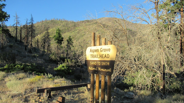
I started around 6:30 AM and hiked a little more than a mile up Fish Creek Road to the Aspen Grove Trail. I started down Aspen Grove knowing it intersected the Fish Creek Trail. The trail dropped down to a nicely flowing Fish Creek, then started heading gently up the canyon. Every single aspen tree in the area was black, burned by the Lake Fire in June, 2015. The trail was in pretty good shape but parts were overgrown with soft plants, especially near the creek. When I reached the Fish Creek Trail junction, I checked my map and I was about half a mile past where I needed to leave the trail to catch the Hell For Sure ridge. This confirmed my decision to abandon the loop idea. I turned right and continued up the Fish Creek Trail. The lower part of the trail, near the creek, was more overgrown than Aspen Grove and was hard to follow. I also found quite a bit of stinging nettle on or near the trail. Once I got away from the creek, the trail cleared up and it started to look like the San Gorgonio Wilderness I remembered. The Fish Creek Trail has long switchbacks, mostly up the side of Grinnell Mountain. I could see 10K Ridge across the creek, but with switchbacks, I was walking away from it as much as toward it.
I took a break at Fish Creek Saddle and could tell the extra miles were eating into my time. The summit of Grinnell seemed close, but was 500' above the saddle in the opposite direction of my targets. I decided to focus on my main goal and see how I felt about Grinell on the way back. I left the saddle and started straight up open country toward Lake Peak. The Lake Peak summit was a large pile of boulders, class 1+. There was an ammo box but it only had a couple of small scraps of paper. It needed a new register, but I didn't have one on me. There was a great view of Dry Lake which wasn't dry, and a good but not complete view of San Gorgonio.
The trek from Lake to Ten Thousand Foot Ridge was longer than I thought, more than a mile. Lake has a very long summit with some small boulder bumps and a lot of downed trees from the fire. I picked my way across and started down toward the saddle. I was surprised to find a party of 8 hikers, organized with an official leader. They might have been from the Sierra Club. I chatted with them as I walked past and found out they had camped at Dollar Lake and were on their way to 10K. The group was moving slowly, so I said goodbye and continued up. The slope to 10K was the only steep terrain of the day and there were a couple of faint use trails. I picked up a strong aroma of field mint on the ascent. On top, there was a notebook register in a tall ammo box. I had the summit to myself for about 10 minutes before they caught up. That gave me time for photos and to decorate the ammo box with an Eispireten sticker. The first page in the register discussed how the Tribe of Tahquitz adopted this mountain in 1925 and refers to it as TOT mountain, frequently bringing youth up as a rite of passage. I talked with the hiking group a little more on the summit before starting back. When I reached Fish Creek Saddle again, there was a second large party that looked less formal. They were also headed to 10K. I was feeling some time pressure and with many miles back to the truck, decided to skip Grinell. On the way down, I lost the trail in the vegetation around Fish Creek and ended up on the wrong side of the creek in waist high grass. I could see the trail on the other side, but had to head back upstream until I found a log across the creek. It was uneventful the rest of the way down. This trip will be much easier when the road is opened to Fish Creek Trailhead.


Congrats Tekewin--well done sir!
ReplyDeleteGloop,
DeleteThanks! It was a good day, but so much more to do in the area.