Friday, December 22, 2017

Black Star Canyon East Fork

Hiked: 12/22/2017
Distance: 8.4 miles round trip on dirt road and use trail
Summit Elevation: 1662' (high point in canyon)
Elevation Gain: 1340'
Elevation Gain (in Empire State Buildings): 1.07
Round trip time: 4 hours
Recommended water: 48 oz.
Parking/Fees: Free on Black Star Canyon Road
Difficulty: Moderate

Rod hadn't been to Black Star Canyon Falls, so I asked him if he wanted to do a quick trip to the Falls with a side trip up the east fork of Black Star Canyon. It had been five years since my last trip to the falls and I had never gone up the east fork. I won't spend much time on the hike to the falls because it has been extensively documented in many places. In the last five years, a metal sign had been installed to show people where to drop into the canyon and a small sign was placed at the fork to point people toward the falls. The sign at the fork was covered in graffiti. When we got to the falls, a couple of parties were already there. There was a little more boulder hopping than I remembered. The falls were predictably dry due to our lack of rain. We took a short break then headed back to the fork.


The fork, left to the falls, right to the east fork


On the way to the falls


Black Star Canyon Falls

We headed up the east fork and found a good use trail. This way looked almost as traveled as the main route. A little more than a quarter mile up, we ran into our first real obstacle. A large set of boulders with a natural tunnel on the left. A class 2+ stem got us up and out of the tunnel. While the canyon was fairly narrow, it wasn't filled with debris and run off like I've seen in many other Santa Ana canyons. The good use trail resumed above the boulders. The second obstacle we ran into was a little more serious. A giant 20' boulder filled the canyon. There were crumbly class 4 options on the left and right, but there was also a rope hanging down a steep dirt slope before the boulder on the left. The rope looked like 7-8mm cordelette and disappeared into the trees above. We could not see where it was anchored.


Heading up the east fork


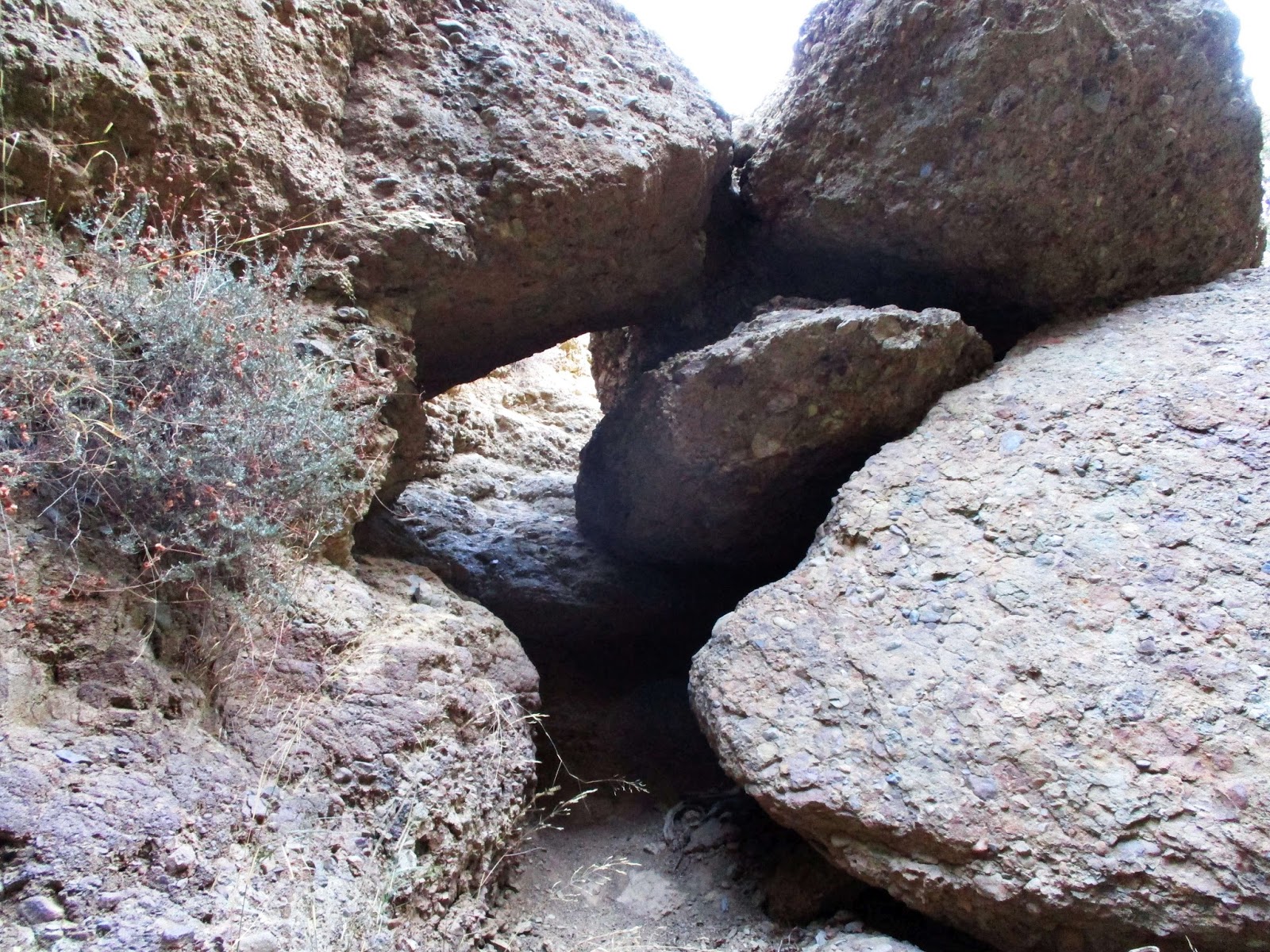
Tunnel under the first obstacle


A more serious obstacle

Rod tested the rope and without debate began climbing. The rope wasn't really necessary on the way up, though it did provide some peace of mind. At the top, it was attached to a blue rope that was tied in a tangle of knots around a healthy 4" limb. I didn't recognize the knots used, they looked haphazard. The ropes seemed to be in good shape and the limb was solid. Past the huge boulder, the use trail continued though it was less clear. Still, it was easy going all the way to the second fork. Rod needed to get back so we turned around at the second fork, but both directions looked clear at least another 150'. I was very surprised by how clear the east fork of the canyon was. On the way back, we met a couple at the bottom of the large boulder who didn't like the looks of it. Rod and I both used arm rappels to descend and the rope was very useful for this purpose. After talking to the couple, we learned they were looking for the falls and took a wrong turn at the fork. They reversed course and followed us out. Rod and I both agreed that the east fork was more fun than the main route to the falls.


Ascending the class 3 dirt slope


Where the second rope begins, about 3/4 of the way up


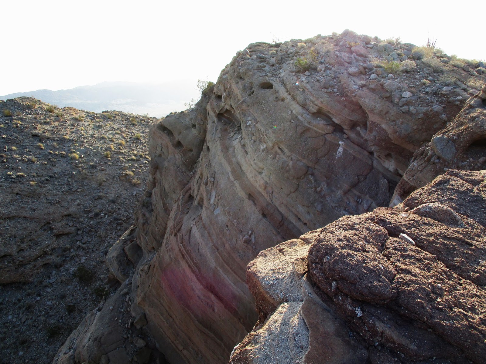
A formation that looked like an overhang on sat view


The 2nd fork where we turned around, both ways looked clear at least to start


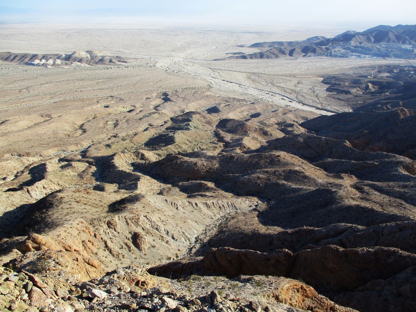
Looking down from the top of the big boulder on the way back


Update: 9/2/2018

I returned to the East Fork to explore past where Rod and I stopped last time. I returned partly for the exploration and partly to burn some calories. The rope at the dirt wall was gone so I had to climb it without aid. Well, once I reached the lower tree branches, I used them as aid. At the split where we stopped last time, I continued left. While the brush and poison oak got a little thicker, it was still manageable. The use trail had faded out some distance back and coyote scat became more common. There was nothing more than class 2 all the way up to 1931', where I stopped at a large oak tree in the narrow canyon. It was possible to continue past the oak and the boulder behind it, but I had achieved my calorie burn goal so I turned around. On the way back, I went about 100' up the right fork until I hit some thick poison oak. It is intriguing that the canyon remained as clear as it was up to the big oak.
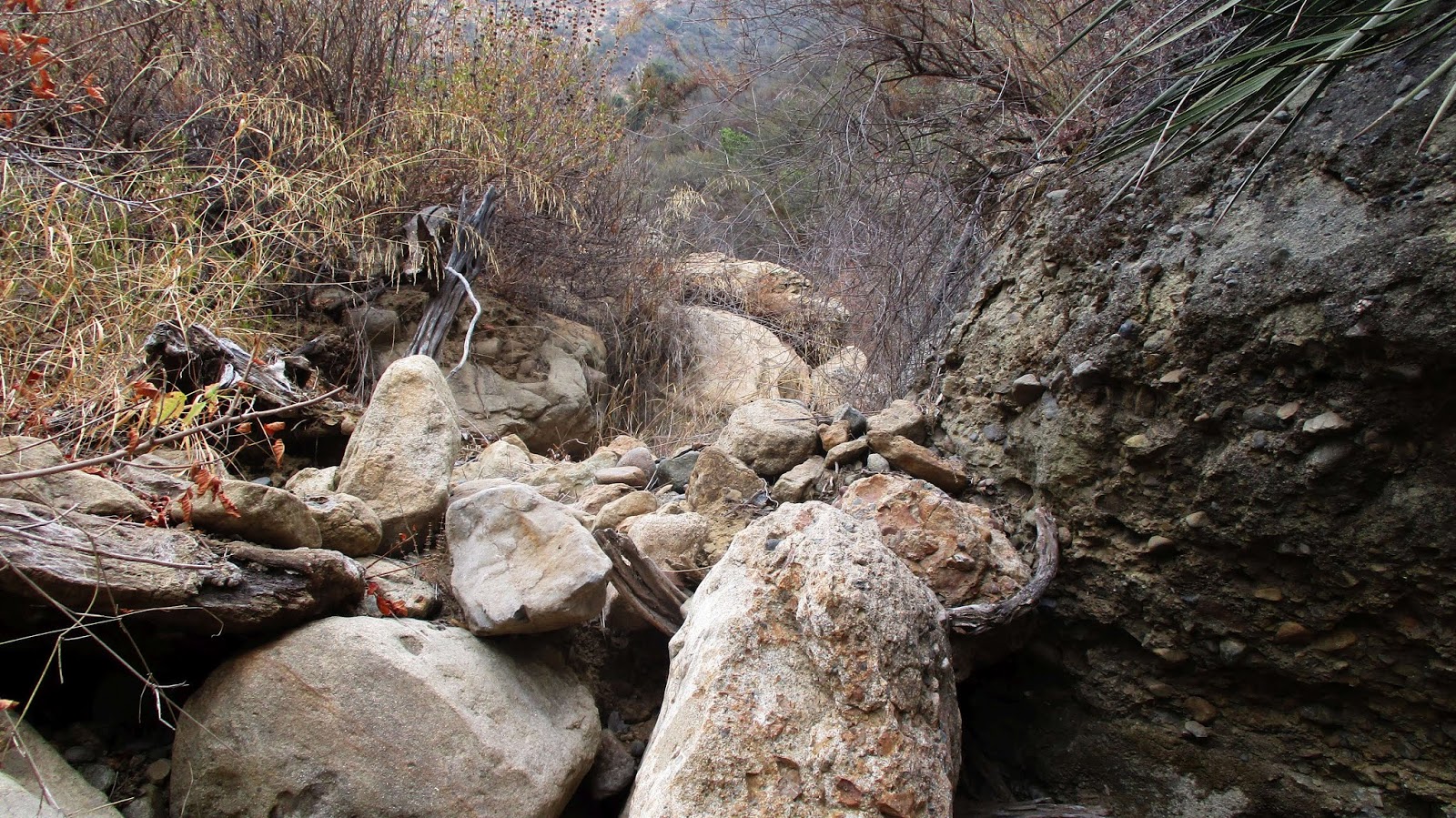


The big oak


Looking past the big oak


Descending the dirt wall without a rope

Sunday, December 17, 2017

Split Mountain West

Hiked: 12/17/2017
Distance: 5.4 miles round trip cross country
Summit Elevation: 1680'
Prominence: 420'
Elevation Gain: 1929'
Elevation Gain (in Empire State Buildings): 1.54
Round trip time: 3 hours 35 minutes
Recommended water: 48 oz.
Parking/Fees: Free on Fish Creek Wash Jeep Trail
Difficulty: Moderate (navigation)

administrative note: I posted an abridged version of this report on steemit.com (@tekewin)

Split Mountain West (SDC #90) is on the other side of Fish Creek Wash from Split Mountain East. These peaks should be done together but my lack of preparation the first time led me to summit the USGS marked Split Mountain instead of the official Split Mountain West. The trailhead is only a half mile from the wind caves trailhead used for Split Mountain East. It is a pretty rough road with deep sand and big rocks, 4x4 recommended. The alien geology took some of the sting out of making the long drive twice. I parked near the West trailhead, stopping before some big rocks in the road that might have scratched my fender.

I started up a slab on the right to drop into the wash. There were a few class 2 scrambling sections, boulders of all sizes, mud pits and mud slabs. Steep walls rose up on both sides. The topo map is not as useful here where smooth 40' contour lines hide 30' cliffs. I followed the wash a little more than a mile before I reached a three way fork. I continued straight up and over a small rise to drop into another wash with high, pock marked walls on the right. I hugged the wall until I reached another fork. This time, I went left and climbed steeply out of the wash. I angled up toward the visible high point, unable to see the true summit. When I gained the ridge and local high point, I got my first view of the double peaked summit of Split Mountain West.


The slab on the right leads to the ascent wash


Dropping in


Scramble section


Approaching a triple fork, I continued straight over the rise to enter the next wash


Looking back after climbing out


Double summits, Split Mountain West is the far one on the left

From Ben Baumann's report, I knew the farthest summit was the highest. I descended part way down the hill, then drifted to maintain elevation as long as possible. Eventually, I dropped into a shallow gully and started directly toward the highest summit. From this side, the summit presented a wall. You can go around to the other side for a class 1 walk up. Instead, I found a class 2 move to get me to a ledge, then followed it away from the summit to a point where a 3' step got me onto the summit plateau. The standard double red cans held the register. There were two register books. The first was placed in 1993 by Wes Shelberg and Paul Frieman. It was only about half full with the most recent entry from March, 2016. The other register was empty. Wes Shelberg had actually used a surveyors level instrument to verify that this location was higher than the other ridge. It turns out the summit location on peakbagger was not near the true summit (as of 12/17/2017). Many of the GPS tracks on peakbagger stopped at the lower ridge. I sent an email to Greg Slayden presenting my case for moving the summit location. Stirring this pot will probably make me quite unpopular, but my interest is in accuracy, not to force anyone to revisit the area. Like Split East, Split West doesn't get much traffic. After a short break, I visited the lower half of the double peak which had better views of the entry to Fish Creek Wash. I headed back toward the ridge I came up, but decided to try to descend the wash from a higher point than where I left it. It didn't work out quite as I expected and I ended up going down a feeder wash that required some trickier down climbing to get back on my ascent route. That just hammered home the potential navigation issues. Toward the bottom, I tried to end with a twist by exiting on the right side of the wash (going down) instead of the left where I dropped in. That led me to cliff out in two places before I had to return and exit at my original drop in point. I think the scenery on Split West was even more impressive than Split East. I picked up two mylar balloons on the way out. I really enjoyed hiking around this area and would love to come back and explore deeper into Fish Creek Wash.


Approaching the summit


I scrambled up here, then followed a ledge left to reach the plateau


Split Mountain West summit


Paul Frieman's favorite hikes, I've done 1-4 and 7 so far


Split West summit from the lower summit


Fish Creek Wash from the lower summit


Descending a side wash back to get back to the ascent route


Almost down


Other Reports:
Split Mountain East and West (Ben Baumann)

Sunday, December 10, 2017

Split Mountain East

Hiked: 12/8/2017
Distance: 4.1 miles round trip on trail and cross country
Summit Elevation: 1690'
Elevation Gain: 1700'
Elevation Gain (in Empire State Buildings): 1.36
Round trip time: 3 hours 15 minutes
Recommended water: 48 oz.
Parking/Fees: Free on Fish Creek Wash Jeep Trail
Difficulty: Moderate (navigation)

The remote trailhead for Split Mountain East (SDC #89) is the same as for the wind caves. From Ocotillo Wells, take Split Mountain Road south about 8 miles near the end of the paved road. Turn right on the Fish Creek Wash dirt road after the sign "Fish Creek Wash Area, Split Mountain". From there, it is 4 miles of dirt road winding between Split Mountain East and West. The first couple of miles can be driven with a sedan, but the road gets rougher and the sand gets deep. High clearance and 4x4 is required to safely navigate all the way to the trailhead. I drove to the parking area and headed toward the wind caves on the way to Split Mountain East. The sign says the wind caves are 1 mile away, but they were only half a mile. After checking out the cave geology, I followed the use trail that continued up past the caves. There were a few different trails and I guessed at which one wound through the jagged, other worldly terrain to connect with Split Mountain East. The trail generally followed a deep wash of dried mud, but faded in and out. Whenever I lost it, I went higher until I spotted the continuation. This added unnecessary gain. From the top of a ridge, I realized there was no connecting ridge to Split Mountain East and that I needed to cross one of the washes.


Wind caves trailhead


The wind caves


Elephant Knees formation and the badlands

I had to back track a little to find the crossing. All the terrain was crumbly and I prepared for anything I stepped on to break loose or slip. On the way to the crossing I found what looked like dried, salty mineral deposits. A class 2 dirt descent got me into the wash and I climbed out the other side to start the final assault on Split Mountain East. Only now did I get my first glimpse of the summit. It was a straightforward ridge climb the rest of the way. The register went back to 1994 with the first entry signed by Paul Frieman. This peak doesn't get many visitors. Greg Gerlach was the last one to sign in more than nine months before me. I took a break on the summit, then descended more directly back to the truck dropping in and climbing out of the major gully as needed. I was going to stay in the gully all the way out, but ran into a 25' dry fall I could not down climb. I left the gully and climbed over a high bump to bypass it before angling back down. Despite extra rambling, the round trip only took 3 hours and 15 minutes. When I got back, I loaded up more water and made an attempt on Split Mountain West. The trailhead was only a half mile away so I just walked to it instead of driving. I had a perfectly good GPS track, but my Garmin topo (and the USGS topo) had peak 1477' marked as Split Mountain. The San Diego Peaks listed Split Mountain West is actually a mile further and about 200' higher. Instead of trusting the track I downloaded, I veered off to the Garmin marked point picking up the wrong peak. There was a fresh register there placed in November, 2017 by Robert and Beth Ramsey. I didn't document the debacle since I plan to return this month to properly bag Split Mountain West.


Mineral deposits


Dried mud wash


Harder rocks embedded in the soft mudstone walls


Dropping in


Looking back after climbing out


First view of summit (far center)


Looking across at Split Mountain West


Register placed in 1994, signed by Paul Freeman


Descending the gully