Sunday, October 30, 2022

Indianhead via North Ridge

Hiked: 10/28/2022 (x2)
Distance: 6.7 miles round trip on trail and cross country
Summit Elevation: 3960'
Prominence: 760'
Elevation Gain: 3300'
Elevation Gain (in Empire State Buildings): 2.6
Round trip time: 6 hours 45 minutes
Recommended water: 88 oz.
Parking/Fees: Free at Borrego Springs Road and Henderson Canyon Road
Difficulty: Strenuous

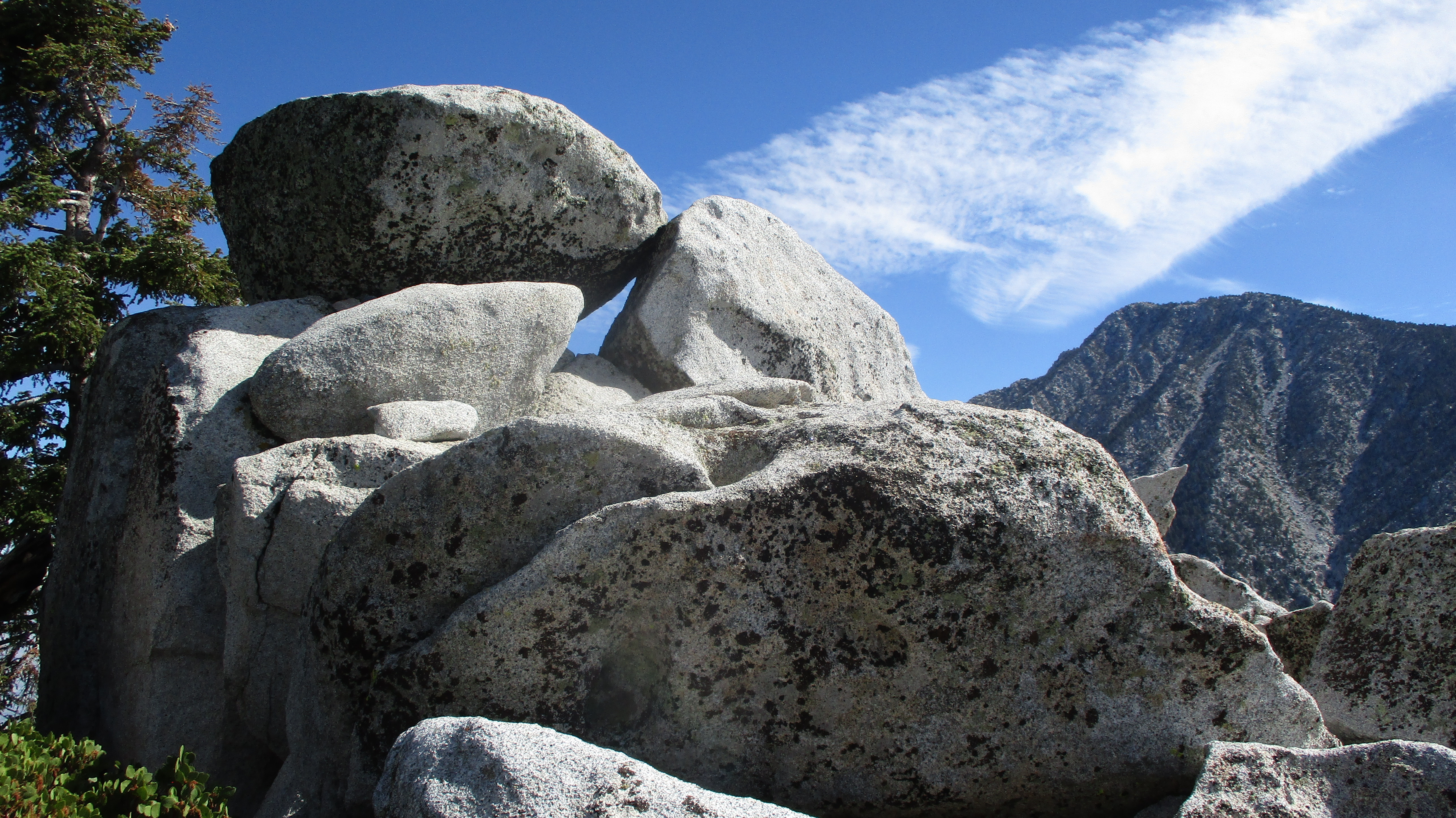
This was my second summit of Indianhead, a desert classic in Borrego Springs. My first trip was in 2013 following DPS route B, up Palm Canyon then back along the southwest ridge. This time I tried the north ridge. I drove to the intersection of Borrego Springs and Henderson Canyon, then followed the dirt road past the Jeep statue as far as north as it went. From the turnaronud, the summit wasn't visible. I followed a use trail up a wash toward Henderson Canyon. It was sandy and flat as I made my way north. When the trail faded, I continued until I reached the alluvial fan from Henderson Canyon. Approaching the main gully, I noticed some bones of a bighorn scattered around. A brief search revealed an intact skull, a spine, and a couple of legs with flesh still clinging above the hoof. The kill didn't look recent. Just right of the gully, I started climbing in the shade of the mountain. The ground was littered with large boulders, low vegetation, and a surprising amount of grass. The north side must retain water long enough for the slopes to be grassy instead of barren like the south side. This helped with traction as it grew increasingly steep.


Bighorn skull and leg


Summit ahead

Indianhead had mutiple sub-ridges extending north. Some were more rugged than others. The route crossed some of the minor ridges to avoid the worst terrain. There was a lot of low level scrambling, but only a couple of moves I'd consider class 3. The slope continued to get steeper near the top and some of the boulders grew to the size of shipping containers. At the top of the ridge, I only had a short walk to the summit. Multiple registers filled a plastic container. I signed the newest one, the previous entry from March. After taking some photos/videos, I headed for the south summit, a prow jutting into space. I had not visited it on my first trip. A faint use trail traced the bottom of the angled slabs and it was easy to get to the high point. It had a dramatic precipice and view. I returned to the main summit for food, then packed up and started down. After navigating the steep slopes down, I was about a mile from the truck when a rock in the flat wash broke loose from the sand and dropped me. I hyperextended my right thumb when I hit, leaving some swelling and a pretty purple ring around it. Bad luck on the most mellow part of the hike. While there is no easy way to the top of Indianhead, the north ridge seemed easier than DPS route 2. That impression might be due to having more experience now. The north ridge does provide shade in the morning, so requires less water. Indianhead remains one of my favorite desert peaks.


South summit

San Ysidro East across Palm Canyon


Looking north

Henderson Canyon below

Indianhead behind the dragon


Sunday, October 23, 2022

Castle Rocks and CT Overlook

Hiked: 10/21/2022
Distance: 4.4 miles round trip on trail and cross country
Summit Elevation: 8600' (Castle), 8480' (CT)
Elevation Gain: 1440'
Elevation Gain (in Empire State Buildings): 1.1
Round trip time: 3 hours 15 minutes
Recommended water: 32 oz.
Parking/Fees: Free at Fuller Ridge Trailhead
Difficulty: Moderate (combined, scramble, route finding)

Castle Rocks (HPS #43) is not an HPS Emblem, but I think it should be. CT Overlook is an unoffical Peakbagger peak but worth the short hike from Castle Rocks. The hike starts at the Fuller Ridge trailhead. From highway 243, I drove 7 miles on dirt road 4S01 (aka Black Mountain Road). There were a few sections with deep ruts so high clearance was needed. I didn't see any sedans that made it as far as Black Mountain. I started south on the PCT shaded by the ridge. There was a fair bit of deadfall across the trail. After about 1.6 miles, I saw some cairns marking a use trail up. I followed it a short distance before it disappeared and I just went up to the ridge. The giant boulders on the ridge were difficult to navigate so I retreated below the ridge on the north side until I was near the summit. There, I found the use trail again. The register was in a plastic jar just below the summit block. I did not find any marks. The summit boulder itself was class 3 and had a pretty big drop on the other side. The official HPS Guide lists the hike as class 1 easy, but that's a sandbag. Although the stats weren't big, it was not in the same category as hikes with a maintained trail. IMO, the close up view of the north face of San Jacinto should have earned Castle Rocks an emblem. It was better than half a dozen that did make the list.


This sign had fallen down, I propped it back up

Crawled under this


Tangled in boudlers before dropping below the ridge

Summit blocks


After some drone shots on Castle Rocks, I descended just below the ridge again to make my way over to CT Overlook. I don't know the origin story for the name, but it looked impressive. I reached the summit after some class 3, but there might have been an easier way up. The summit was a collection of vertically stacked slabs. The formation reminded me of Marion Mountain. I found no marks or register. While the views were not as sublime as Castle Rocks, they were still great. I started down toward the PCT through some light brush. I was startled to hear what sounded like branches cracking and a huffing noise that sounded like a bear. The sound was down slope a couple hundred feet. I yelled out "hey bear" a few times, then continued down slowly, but never saw any sign of one. Could have been my imagination. The rest of the return trip was uneventful.

CT Overlook


Looking back at Castle Rocks

Descending CT Overlook


Saturday, October 22, 2022

Black Mountain Lookout

Hiked: 10/21/2022
Distance: 1.4 miles round trip on dirt road
Summit Elevation: 7772'
Elevation Gain: 421'
Elevation Gain (in Empire State Buildings): 0.3
Round trip time: 30 minutes
Recommended water: 0 oz.
Parking/Fees: Free at Boulder Basin Campground
Difficulty: Easy

Black Mountain Lookout (HPS #81) is an easy walk on a sandy dirt road. I drove about 6 miles up forest road 4S01 to Boulder Basin Campground. Deep ruts in a few places required high clearance. No sedans made it to the top. The lookout tower is sometimes manned but was closed today. Without access to the tower, the views were somewhat limited. I jogged most of the way down. Coming down, I met three groups of people heading up with crash pads to do some bouldering. There is a long trail from the east that can be accessed from highway 243 if you prefer to make a day of it or skip the dirt road driving.


San Gorgonio

CT Overlook, Castle Rocks, and San Jacinto

Saturday, October 8, 2022

Owens Peak

HPS Star Emblem Peak
Hiked: 10/7/2022
Distance: 5.9 miles round trip on trail
Summit Elevation: 8453'
Prominence: 2173'
Elevation Gain: 3306'
Elevation Gain (in Empire State Buildings): 2.6
Round trip time: 6 hours 10 minutes
Recommended water: 96 oz.
Parking/Fees: Free on Indian Wells Canyon Road
Difficulty: Moderate

Owens Peak has a striking granite profile in the southern Sierra. It is the highest mountain in a 17 mile radius and is featured on multiple lists: HPS #49 and SPS #239. It is a P2K and was designated an HPS Star Emblem. I left home at 3:20 AM for the trailhead at the end of Indian Wells Canyon Road, though there were different signs along the way. The road had some ruts and big rocks, high clearance recommended. There was ample parking at the trailhead, though I was the only one there.

The trail follows Indian Wells Spring which was completely dry. Deadfall blocked parts of the trail, but use trails had been worn around them. At a clearing around 6000', you can continue to follow the trail or head for the saddle. I stayed on the trail. With one mile to go, I thought I had overestimated the difficulty, but the last mile packed about 1800' of gain. Many cairns dotted the trail as it got steeper. I made a mistake at 7400' and missed where the trail went left. This led me up a white boulder talus field instead of the dark boulder talus field on the main trail. I did find footprints and occasional cairns off trail so it was a fairly common mistake. I found a way to make it go, at the price of some exposed class 3 and slab work. At 8000', I rejoined the trail. It remained steep and slippery the rest of the way.

Owens on the drive in


Off route, heading up the wrong talus field

Still off route, but finding a way

At the summit, I unpacked the drone, a DJI Mavic Mini 3 Pro. I am still learning how to fly the drone, but it has some pre-programmed flight sequences that are impressive. After taking the aerials, I hung around another 20 minutes, soaking in the wonderful sights in all directions. The longest ridge on Owens is a jagged granite spine that makes it look even more imposing from highway 395. I could see Olancha further north and could barely make out Langley and Whitney through some haze. On the way down, I was able to stay on the trail and descended the dark boulders and class 2 slabs below that. I discovered where I lost the trail and built a cairn of my own to help future adventurers. Gnats became a problem below 6000' and I had to resort to my bug net until I got away from the spring. Owens was a big ball of granite fun and one I wouldn't mind climbing again some day.

Looking north over Spanish Needle, Olancha in the distance


South to Mount Jenkins and Morris Peak


On route, descending slabs

On route, descending black talus field

Owens from highway 395, taken in June 2022