Sunday, June 21, 2020

Toro Peak West and Santa Rosa Mountain

Hiked: 6/27/2020
Distance: 5.5 miles round trip on dirt road and cross country
Summit Elevation: 8070' (Santa Rosa), 8316' (Toro West)
Elevation Gain: 1263'
Elevation Gain (in Empire State Buildings): 1.0
Round trip time: 3 hours
Recommended water: 48 oz.
Parking/Fees: Free at Santa Rosa saddle
Difficulty: Easy

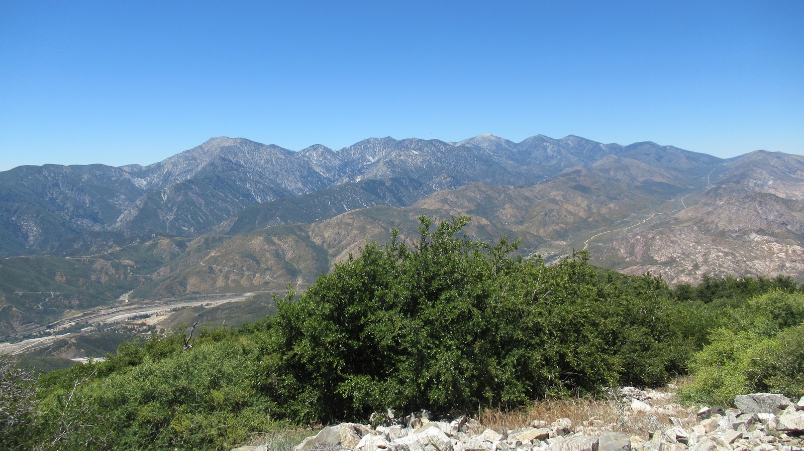
After a 15 mile warm up on Ken Point, I drove a short distance up highway 74 to forest road 7S04. This is a well maintained dirt road up to Santa Rosa and Toro Peak. Except for one spot, even high clearance was optional. The quality of the road and the fact it was a weekend actually created a different problem: traffic. There were a few turnouts and the road was wide enough in many places to allow passing. However, I had to dodge 7 vehicles on the way up and 4 on the way down. One passing resulted in a bad scrape on the right side of the 4Runner. It's a 10 mile drive to Santa Rosa, but I stopped at the saddle below it where there was space for 4-5 cars. Two cars were already there and the group had a picnic going.

It was a short hike to the top of Santa Rosa (HPS #67) where several tents were set up. Multiple camp sites were on top of the mountain. A huge fireplace was built on the summit. The summit rocks were easy and there was no register, but I did find a toy truck jammed between some rocks. When I got back to the 4Runner, the picnic people were gone. The rounb trip was just over a mile. Without a break, I headed up the road toward Toro Peak West.


Parked at the saddle


Summit


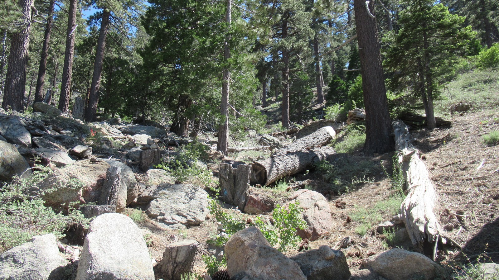
Because the Toro summit is on reservation land, the Sierra Club moved the official Toro HPS peak to Toro Peak West (HPS #58), a couple of hundred feet lower than Toro. It is also off trail so in that way is slightly more challenging than Toro which can be driven. About 1.5 miles from the Santa Rosa saddle, I spotted a cairn marking the start of ascent gully. The gully got steep quickly and pine needles made it slippery in places. I followed a use trail on the right side of the gully but another one was visible that stayed inside the gully. At the top of the gully, the west summit can be gained with simple class 2 from the spine. I expected it to be class 3 from other reports, but no scrambling was required. I signed the official register and enjoyed limited but good views from high up. There area felt very much like the San Jacinto above Mountain Station. If I had more time, I would have nabbed Toro North and maybe the true summit, but I had a long drive home so called it a day. This ended a 20+ mile hike day with 20 miles of dirt road.


Start of the gully


Going up


Toro West summit


Ken Point

Hiked: 6/20/2020
Distance: 15.6 miles round trip on trail and cross country
Summit Elevation: 6423'
Prominence: 503'
Elevation Gain: 2876'
Elevation Gain (in Empire State Buildings): 2.3
Round trip time: 6 hours 50 minutes
Recommended water: 96 oz.
Parking/Fees: Free at turnout on Highway 74
Difficulty: Moderate

Ken Point (HPS #160) is the southern terminus of the Desert Divide ridge peaks. From the summitpost.org web site, "This name was informally given by the HPS, based on a benchmark named 'Ken' (1941). It was almost certainly derived from the infamous Kenworthy Mine which once existed, 2.3 air miles to the northwest."

One possible route goes over Butterfly Peak, but I wanted a new experience, so I took the longer PCT route, starting from a turnout on Highway 74. I hiked a long gentle section of PCT, passing rocky cliffs on the ridge. It is such a well maintained trail that the gain is barely noticeable. I met a couple of parties on the trail and one southbound PCT through hiker. After a long approach, I reached the junction with a mining road and cut back toward Ken, which was not visible until I was almost on top of it.


Southeastern side of Butterfly Peak

The road was overgrown with manzanita in a few places, but you could still push through it. When I got below Ken Point, I left the road to climb through knee high shrubs. There was enough space between the shrubs to pick your way through. Part way up, I spotted some cairns and followed a faint use trail, but there were multiple paths to the false summit. From the false summit, it was a short trek to Ken Point where the benchmark and one reference mark were easy to find. The register was almost new with only a few entries. I enjoyed the wonderful views all around and loaded up on calories before starting back. Even though it was a lot of trail miles, there wasn't enough gain for it it to reach the level of a strenuous hike. The PCT made most of those miles a dream. When I got back, I packed up and drove toward Toro Peak for the second hike of the day.


False summit of Ken Point


View from the false summit


Desert Divide from Ken Point, Pine Mountain looking pointy on the right


Happy egg along the PCT


Thursday, June 11, 2020

Sugarpine, Bailey, and Monument Mountain #2

Hiked: 6/10/2020
Distance: 0.9 miles round trip on use trail (combined)
Summit Elevation: 5478' (Sugarpine), 5699' (Bailey), 5290' (Monument)
Elevation Gain: 300'
Elevation Gain (in Empire State Buildings): 0.2
Round trip time: 2 hours 10 minutes (includes driving)
Recommended water: 20 oz.
Parking/Fees: Free on Forest Road 2N49
Difficulty: Easy

From the Cajon turnout, I continued driving south on forest road 2N49. High clearance recommended. The first stop was a wide turnout with a jeep trail running up the northwest ridge of Sugarpine Mountain. It was about 0.5 miles round trip to the pedestrian summit of Sugarpine. Views weren't great except for a good view of the higher Bailey Mountain less than a mile away. No register, no benchmark.


Sugarpine Mountain summit


Looking over at Bailey

I drove more than mile to the south side of Bailey to go up the steep firebreak. It was about 0.4 miles round trip. The high point was a small boulder under a canopy of trees. There was no trail leading to the high point. I was just wandering around to see if I could get any higher when I stumbled on the register tucked under the boulder. I signed in and trudged back down. No benchmark. No views from the summit.


High point under these trees


I drove another 1.5 miles to a small turnout by Monument Mountain #2. It was a 100' walk up to the monument. There was a benchmark on top of the monument stamped "Devil Canyon No 3". The plaque on the side of the monument read "The Mojave Indian Trail" in honor of Father Garces. No register. I was planning on driving out toward Jobs Peak, but Mike said the forest service had closed that road. Instead, I drove back the way I came. It took about 90 minutes to get back to highway 138 and the familiar comfort of pavement. Six peaks on the day, 5 HPS peaks, but the truck definitely did most of the work.


Cajon Mountain and Lookout

Hiked: 6/10/2020
Distance: 3.5 miles round trip on dirt road and use trail
Summit Elevation: 5360' (Cajon), 5310' (Lookout)
Elevation Gain: 829'
Elevation Gain (in Empire State Buildings): 0.6
Round trip time: 1 hour 45 minutes
Recommended water: 32 oz.
Parking/Fees: Free on Forest Road 2N49
Difficulty: Easy

We drove up Forest Road 2N49 and parked about 1/10 mile below the junction to the road leading to Cajon Mountain. I had that turnout marked as my destination. Mike noticed the error but we decided to walk the extra bit. The road to Cajon was gated and covered in rocks, leaves, and other debris. The first part was shaded, then opened up as it started to climb. We passed the use trail to Cajon and proceeded to Cajon Mountain Lookout where a radio tower had been installed. There were even better views of the San Gabriels than from Cleghorn. We found the benchmark under some ground cover, but it appeared to be stamped "CALO". We then returned and started up the use trail. Half way to the summit, we hit a wall of buckthorn that had completely covered the trail. We pushed through about 50' of it, taking some abuse. Once we cleared the buckthorn, we were on the summit and signed the register. I didn't see any benchmarks on the Cajon high point. The buckthorn had torn Mike's GPS from its carabiner, but we were able to find it on the way back. Because we had to hike Cleghorn, Mike was short on time and decided to head back. We said our goodbyes and I prepped for the next three along the road: Sugarpine, Bailey, and Monument Mountain.


Benchmark on Cajon Lookout


San Gabriels from Cajon Lookout


Mike starting up the use trail to Cajon Mountain


Looking down on the lookout