Friday, November 28, 2014

Morton Peak, Cram Peak, Peak 4400, Peak 4030

Hiked: 11/28/2014
Distance: 8.1 miles round trip on dirt road and use trail
Summit Elevation: 4624' (Morton), 4162' (Cram), 4400' (Peak 4400), 4030' (Peak 4030)
Prominence: 724' (Morton)
Elevation Gain: 2000' (Combined)
Elevation Gain (in Empire State Buildings): 1.6
Round trip time: 3 hours 45 minutes
Recommended water: 100 oz.
Parking/Fees: Adventure Pass
Difficulty: Moderate

Morton and Cram are two lower peaks in the foothills of the San Bernardino Mountains. I drove up on Black Friday, escaping the shopping hordes, and turned on Warm Springs Truck Road from highway 38 outside Mentone. The first gate was open, so I dropped into 4WD and continued past the gate up the truck road. It is rocky, rough, and requires high clearance, but you can save 2 miles round trip by driving up to the second gate, which is usually closed. I parked near the gate and headed up the road toward Morton. After about 1.7 miles and 700' of gain, I reached Morton Peak. There is a lookout tower there that was locked, a picnic table, and a restroom. No register was found, but I did find a reference mark and the triangulation benchmark (missing the cap), underneath the tower. Since I was just warmed up, I didn't loiter. I continued back down the road where a use trail heads down the ridge toward Cram Peak. There is a small cairn marking the spot.


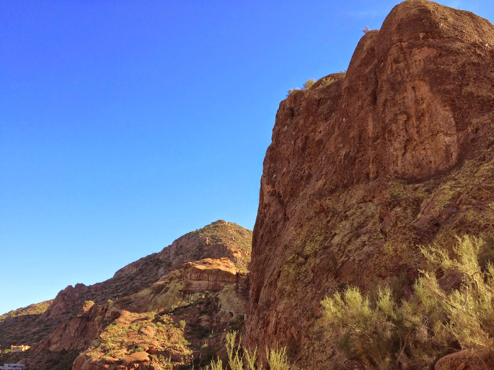
Morton Peak and Cram Peak from highway 38


1st gate trailhead, unless you have a high clearance verhicle


Morton Peak Lookout Tower


Ridge line to Cram Peak


Reference mark pointing to the triangulation benchmark


Benchmark under the tower, missing the cap

The use trail was a little brushy, but never completely overgrown. It descends to a saddle where it intersects a dirt road losing the fight against nature. It quickly melts down to a single track trail with yucca encroaching on a few sections. The trail moves up and down the ridge over several bumps before winding around Cram Peak. Near the top of Cram, I ran into a deer and watched it for less than a second before it crashed into the brush on the south side of the ridge and went into hiding. The Cram summit is a round shaped flat area with an iron post and triangle marking the top. There I found the register dating back to 2004 with less than the half the book filled. This seems like another unpopular peak, mostly frequented by list chasers and peak baggers. I added a second plastic baggie to protect the register, then returned the same way. When I hit the road again, I was looking for more action. I remembered seeing Peak 4030' on the Peakbagger map, but before I got there, I decided to head off trail to hit unnamed Peak 4400' at a bend in the road. As I got to the saddle below it, I found an abandoned road winding around the north side to the summit. Nothing was on the summit other than a few small boulders and a cigarette butt, evidence that I wasn't the first person up there. Next, I headed down and quickly climbed Peak 4030, also finding nothing of interest. It was a short day of hiking, but two more Great Lower Peaks got crossed off the list.


Approaching Cram Peak


Cram Peak summit


Looking northwest from Cram Peak


Peak 4400 climb path


Looking up Mill Creek from peak 4400


Looking down on my car and 2nd gate from Peak 4030


Monday, November 24, 2014

Camelback Mountain, AZ

Hiked: 11/24/2014
Distance: 3.5 miles round trip on trail and use trail
Summit Elevation: 2704'
Prominence: 1334'
Elevation Gain: 1150'
Elevation Gain (in Empire State Buildings): 0.92
Round trip time: 1 hour 45 minutes
Recommended water: 32 oz.
Parking/Fees: Free at Echo Canyon Park
Difficulty: Easy

Camelback is a very popular hike in the Phoenix, AZ city limits. There are two trails to the summit, the Cholla Trail, and the more direct ascent I took up the Echo Canyon Trail. This was completely unplanned. I was in Phoenix visiting Arizona State University with my daughter who is considering going to college there. After the tour, my wife and kids dropped me off at the trailhead before going to the zoo. Even on a Monday afternoon, the parking lot was nearly full and people were milling everywhere. It reminded me a lot of Cowles Mountain in San Diego, with hikers of all abilities coming up and going down in ant-like formation.

I found a place in the flow and headed north of Camels Head, a stark Sandstone block. Just before the saddle there is a difficult section made easy by the steel railing installed in the rock. Shortly after that was a second railing on a less difficult section. The saddle has a stone bench a some local infotainment signs. The rest of the trail was a 0.7 mile boulder scramble. It was short, fun, and intense. The summit was crowded as expected with no register and no benchmark. Nice views of the Phoenix area in all directions though a little hazy. Without my gear, my phone acted as both GPS (map my hike), and camera. I had on regular street running shoes and carried some water in a plastic shopping bag, looking very much like a rookie. On the way back, I texted my wife and she was still about 45 minutes away, so I explored the Camels Head. There was a use trail from the saddle between the two heading around the south side. I followed it looking for a way to up, but found nothing in my skill range. The best possibility I found was a crack in the crumbly rock near the end of the use trail. My side trip added a mile to the hike, but it was nice to get some dirt under my toes.


Camels Head in the front, Camelback in back


Steep section aided by a railing set in the rock


Less steep 2nd railing


Scrambly from here to the summit


Looking down a scrambly section


Crowded summit overlooking the Phoenix area


Panorama from summit


The best way up to Camels Head that I could find, too much for me without gear.


Camelback at sunset from the northeast

Saturday, November 22, 2014

Arrowhead Peak

Hiked: 11/22/2014
Distance: 4.8 miles round trip on use trail and cross country
Summit Elevation: 4237'
Prominence: 357'
Elevation Gain: 2470'
Elevation Gain (in Empire State Buildings): 1.97
Round trip time: 4 hours
Recommended water: 72 oz.
Parking/Fees: Adventure Pass on highway 18 turnout (San Bernardino National Forest)
Difficulty: Moderate

I parked off the Rim of the World highway (hwy 18) a short distance from Crestline and Lake Arrowhead. The mountain sports a granitic structure on the south face that looks like a purposely engineered arrowhead, but is in fact natural, perhaps inspiring the name for the lake and village. Arrowhead Peak is #24 on the Lower Peaks list and the official guide mentions the poor condition of the unmaintained trail. Multiple trip reports cite Arrowhead as the most difficult bushwhack of the Lower Peaks, maybe all Sierra Club peaks that allegedly have a trail. Nature has reclaimed most of the old Jeep trail descending from the north. I came armored and recommend long pants, gaiters, long sleeved base, long sleeved jacket, and heavy gloves. Navigation was difficult and requires finding your way through a hedge maze of spiky buckthorn and chaparral. Fortunately, I didn't notice any poison oak. I found a useful GPX track on Peakbagger.com uploaded by Patrick O'Neill. Thanks, Patrick. A trip report from January, 2014 suggested the party did some trimming and I noticed signs of it in several places. Thanks, Pat Wells and Sierra Club members on that trip. I performed some grooming of my own via machete and left the trail in slightly better shape than I found it. I took the shortcut down to the first saddle that cuts off the longest switchback, then followed the trail around the west side of bump 4422.


The giant granite arrowhead on the south face of Arrowhead Peak.
The summit is out of view to the left.


Arrowhead Peak (far summit) from the turnout on hwy 18


Into the brush, trail goes straight into the buckthorn


The lower part of hwy 18 from the first saddle


A couple of places required crawling


Descending down to the second saddle


Brush gets lighter from here to the summit


Approaching the summit, clear path on the left (east)

From the bottom of the second saddle, I went up the firebreak, veered left (east) and found a pretty clear path through the manzanita surrounding the summit. This deviates from the LPC guide. About 30' from the summit rock pile, the use trail takes a sharp right. To find the triangulation benchmark, take a sharp left at that point and go about 20'. I cleared some of the encroaching brush around the benchmark. The register is in the rock pile. It is a small book that goes back to 2002 and remains only half full. The previous visitor to Arrowhead Peak was 9 months ago in February, 2014. This is a very wild and lonely peak. I found the entries from Patrick O'Neill and Bob Burd. Conspicuously missing from the register was Mars Bonfire. Such a lonely peak. The single baggie protecting the register had a hole in it, so I wrapped it in a second baggie. I highly recommend going on a clear day because the views in all directions were beautiful. To the west are the San Gabriels, to the south, the Santa Anas, and to the east, the San Bernardinos and San Jacinto. I lingered longer than usual enjoying the views. Sadly, Arrowhead Lake is not visible from the summit or anywhere along the trail.

The way back gave me more navigational problems than the way out. I got off track on top of bump 4422 and ended up finding a direct way down the ridge to the trail. That ridge path was not apparent on the way up. When I got back to the first saddle, I followed the switchback instead of going up the shortcut and got stuck off trail after continuing past the turn. Unless you just want to explore, the shortcut is easier and more direct. There is a lot of trash just below the turnout, including a tube TV and discarded tire. The route finding problems and bushwhack were great fun. The only negative was that I came back with two ticks. I got them before they made a meal out of me. November through January are probably the best months to climb Arrowhead Peak. Spring and summer probably dish out more ticks, flying insects, thicker buckthorn, and heat.


Arrowhead Peak summit rock pile


San Gabriel mountains to the west


Harrison Mountain (front), San Bernardino Mountains (left), and San Jacinto (distant right)


Saddleback and Santa Ana mountains to the south


Arrowhead benchmark, about 50' away from the summit rock pile


Register, last visitor was 9 months ago. Lonely, wild peak.


TV thrown from the turnout


Discarded tire thrown from the turnout


Would you like to know more...?

Friday, November 14, 2014

Agua Tibia Mountain

Hiked: 11/14/2014
Distance: 16.7 miles round trip on trail and use trail
Summit Elevation: 4779' (Agua Tibia)
Prominence: 848'
Elevation Gain: 3300'
Elevation Gain (in Empire State Buildings): 2.64
Round trip time: 7 hours 45 minutes
Recommended water: 156 oz.
Parking/Fees: Adventure Pass
Difficulty: Strenuous

It was almost exactly a year ago to the day when I was last in the Agua Tibia Wilderness hiking to Wild Horse Peak. Wild Horse was great fun and I was looking forward to Agua Tibia, #4 on the Lower Peaks List and #30 on the San Diego Peaks List. I expected a long day, so I started early to avoid traffic and give myself time for Eagle Crag as a bonus if things worked out. Weather.com showed a 20% chance of rain, but it rained most of the way to the Dripping Springs Campground east of Temecula off highway 79, finally dropping off to a light mist. I decided to give it a go and headed out in pitch blackness and light rain. Few things wake me up like charging alone into a remote dark forest. It always gets the juices flowing. I wasn't surprised to be signing the hiker register alone at the trailhead. Had I known it would rain on me all the way to the summit, I might have gone looking for a different hike.

The beginning of the trail is the same for Wild Horse and Agua Tibia, but splits at a junction in less than a mile. In the dark and mist, I followed a use trail into the Arroyo Seco riverbed and wasted 20 minutes backtracking to the trail. It would be hard to make that mistake in daylight. Once on the trail, I made steady progress. The grade is gentle to moderate, especially spread out over such a long distance. Somewhere around 3000', I entered the low clouds and visibility fell to about 20'. Clouds blocked my view all the way up. All the vegetation was wet, lush, and intensely aromatic. Higher up, oaks and pine trees appeared, adding to the assortment of trees along the trail. As I neared the summit, the rain picked up turning me into a drowned rat. Fortunately, it returned to a mist as I reached the cairn for the use trail. The use trail started out reasonably but there were sections completely overgrown. Pushing through wet vegetation is like hitting yourself with water balloons. Whatever small patches of dry I still had on my body were drenched. Worse, the manzanita refused me access to the summit without a small blood sacrifice.


Dripping Springs trailhead


Rainy trail


Palomar Magee trail junction


In the clouds


Cairn marking use trail to summit


Blood sacrifice

Once at the summit, I climbed the two wet summit blocks, the higher one class 3. The register and benchmark were sort of between them in a flat clearing. The rain had finally stopped, but I had a hard time signing the register without dripping water on it. There were two registers in the cans, the newer one was placed in 2012 and didn't have too many entries. I didn't want to pull the older register out for fear of getting it wet. I placed the register back in the baggie and cans, then rested for a few minutes. Since I was about 30 minutes behind schedule and sopping wet, I decided to save Eagle Crag for another day, maybe approaching from the other direction on the Cutca Trail. On the way down, my cheap point and shoot camera fell victim to the water. The shutter stuck open and every picture after that was a dud. I went back to my phone for the remaining photos and will need to find another cheap camera for hazardous duty. I met 3 other hikers on the trail near the bottom, none looking prepared for a summit run. Despite the difficulties, it was another great day in the mountains. Agua Tibia may be the most difficult Lower Peak of the 54 I've done so far, or maybe it was just the cold November rain.


Agua Tibia benchmark


Tackling the highest summit block


Agua Tibia while descending


Neon grass in the post-rain sun


Clouds starting to break up


Bighorn metal art on highway 79