Distance: 6.7 miles round trip on dirt road and cross country
Summit Elevation: 5325'
Prominence: 2733'
Elevation Gain: 2950'
Elevation Gain (in Empire State Buildings): 2.3
Round trip time: 6 hours 35 minutes
Recommended water: 116 oz.
Parking/Fees: Free on Danby Road
Difficulty: Strenuous (route finding)
Old Woman Mountain (DPS #64) is the high point of a small remote range in the southern Mojave. The drive was over 4 hours from home, requiring a 1:30 AM alarm for a 2:30 AM departure. The trailhead was at the end of Danby Road, a dirt road typically reached from a closed section of Route 66. The road is closed because of multiple bridge failures. From I-40, I took Kelbaker road south to Route 66 and drove around the close road barriers. I crossed several open bridges, then took a dirt bypass around one that had collapsed. Google Maps suggested I follow Skeleton Pass Road, a dirt road that runs south of and parallel to the train tracks. That road had pockets of deep sand that required 4x4 mode. I reached Danby, then turned south for another 7 miles of good dirt road, stopping at an open gate.
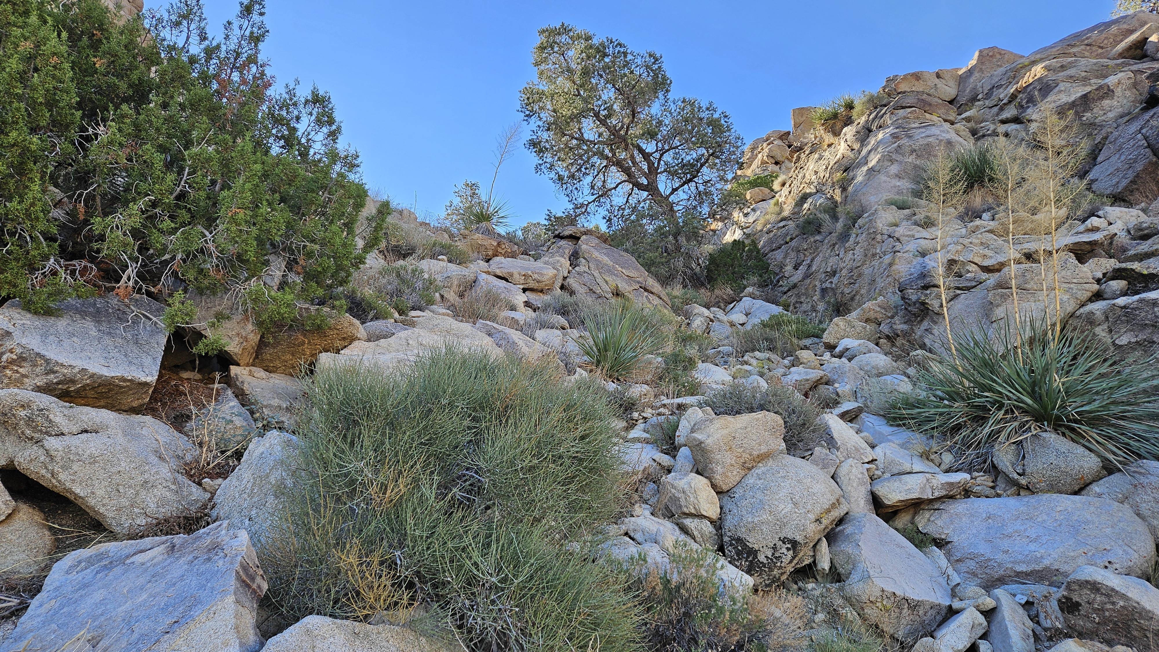
The weather was clear and cool. The high point of the Old Woman Mountains was not visible from the start. I hiked south on the road to the first of two very steep gullies. The standard route follows along the left shoulder of the gully. I kept moving further left around a giant outcrop since it seemed easiest. I kept closer to the gully on the way back, but thought my ascent route was better. The slopes of Old Woman were lush with vegetation, junipers, knee high grass and cactus. Also an occassional cat claw. The crux of the hike was the steep side hill traverse into the second gully. Fortunately, there was a line of cairns marking the traverse. A fall on the sidehill section would lead to a long, unpleasant tumble over very sharp things. I drifted wide right in the second gully, then it was about a half mile on the ridge to the summit.


Multiple registers lived in the metal ammo box. There was a good reference mark but I didn't find the benchmark. It might have been hidden under a pile of rocks. Views were dramatic toward the western peak that was only 12' lower. I unpacked my Flame Broiler bowl for lunch and sent the drone up for a few minutes. I intended to fly it in one of the ascent gullies, but felt the terrain demanded too much attention. After a 20 minute stay, I started down. I found some cairns marking the standard route down the second gully and followed. I did the same in the first gully. Although most of the route was class 2, I did get into some short class 3 sections. In between some boulders, I found the skeletal remains of either a bighorn or a deer. Out of the gullies, I detoured to the Florence mine ruins. The main shaft looked like it went back a good distance, but I didn't explore it.


No comments:
Post a Comment