HPS Star Emblem Peak
Hiked: 9/23/2017
Distance: 15.2 miles round trip on trail and cross country
Summit Elevation: 5687' (Santiago), 5496' (Modjeska)
Elevation Gain: 5432'
Elevation Gain (in Empire State Buildings): 4.34
Round trip time: 8 hours 25 minutes
Recommended water: 128 oz.
Parking/Fees: Free on Trabuco Creek Road
Difficulty: Strenuous
Before starting the fall semester, Eric asked if I had any off-trail or route finding challenges in the works. One that had been rolling around in my head a while was taking Telephone Ridge to Santiago Peak and Modjeska Peak with a possible side trip to "The Scar". Santiago is the high point in Orange County and a P4k that Eric hadn't done. The Scar is a massive drainage channel on the southeast face of Santiago. It is visible on clear days from miles away, but isolated and hard to reach. From satellite imagery, it looked like a high angle packed dirt chute.
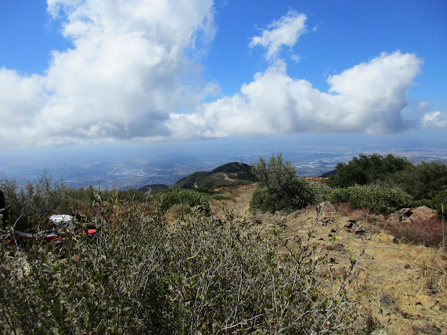
We started on Trabuco Creek Road (33.6717554, -117.5593322) around sunrise. I led us up a steep, trashy gully with a rusted out car that probably didn't save us any time. I recommend sticking to the road at the start. The road climbs up to the Joplin Trail and we followed it east to a clearing where it splits. At the clearing, the Joplin trail drops down to Old Camp while a maintenance road continues right toward the Telephone Pole Ridge. We cached a little water there for the return trip, the took the road until it ended. The weather was unusually cool for this time of year and neither of us ended up using all the water we brought. At the end of road, we dropped about 75' down to the base of Telephone Ridge. The brush was mostly light and there was a reasonable trail to follow beneath the poles. Although not recent, there were occasional signs of trail maintenance. The ridge climb was really pleasant and views back into Orange County got better by the minute. Eric found a snake skin under a rock, but it was too cool for the snakes to be out. The ridge would probably be snakey in warm weather. When we got to the spot we had planned to leave the ridge toward The Scar, we were already in fairly dense brush. It was worse off the ridge and pretty far away, so we made the game time decision to skip it. As we got close to the road, the trail drifted right of the poles into thick buckthorn. We thought maybe we had gotten off track and bushwhacked back under the poles only to find worse conditions. We headed back to the buckthorn and pushed our way through a nasty 100' section before it opened up again. We emerged onto the road and took it to the tower filled summit. Not content with the terrestrial summit, Eric sought better views but that is a story for another time. We walked to a view point I had not visited on my previous visits and checked out some view tubes. The tubes were ineffective with the usual haze covering the OC. Clouds started rising from below and would end up keeping us cool later on the descent.
Next we headed to Modjeska. I knew there was a trail that led down to the saddle between the peaks but had not been on it before. We followed my GPS track down the other side of the summit to where it started. The trail was surprising good all the way to the saddle. There is a good trail to Modjeska that also leaves saddle on Main Divide Road. A newer sign had been placed on Modjeska, but some loser had sawn it off and taken it home. On the summit, we met an odd motorcycle rider who felt compelled to explain to us the details of the government's weather warfare program, chemtrails, and the end times. We did our best not to trigger him while resting up for the descent. We returned down the trail to the saddle, then took the Joplin trail down into the canyon. The trail was slightly rutted in some places from mountain bikes, but otherwise was in fine condition. There was a lot of shade on the trail from deciduous tree coverage. There was also a lot of poison oak, often growing into the trail. I am pretty sure I brushed it several times but probably not enough to cause a reaction. It remained cool in the shade under party cloudy skies. We reached Old Camp and there wasn't much to it. It is an unmaintained campground with an abandoned broken lawn chair. We crossed water in a creek not far from the camp, but the creek next to the camp was dry. On the way out, we picked up our water cache, which turned out to be unnecessary, and hiked back to the car. This was my third visit each to Santiago and Modjeska, but my first time to summit both on the same trip. The scar remains elusive. A descent from the road seems like the best chance to reach it, although an ascent from the bottom of the canyon is a possibility. Telephone Ridge is now my favorite route to Santiago. It is guaranteed to be uncrowded and offers views along the way that can't be matched by the Holy Jim trail or Main Divide.
Would you like to know more...?
Other Trip Reports:
Santiago Powerline Ridge (Mountaineering Review)


Looks like a great trip; I still have to do Modjeska some time.
ReplyDeleteJoseph,
DeleteModjeska is still my favorite of the two Saddleback peaks. Better views without the towers.
Keith. Lost track of your email. I have embarrassing question: What to take
ReplyDeleteon Baldy to ensure good, safe footing.
BTW sign on Santiago by yours truly. MSA
ReplyDeleteMark,
DeleteThose signs are high quality. Nice job.