Distance: 9.4 miles round trip on trail and cross country
Summit Elevation: 4232' (Goat), 4695' (Clyde), 4308' (Hut)
Elevation Gain: 2657'
Elevation Gain (in Empire State Buildings): 2.12
Round trip time: 6 hours 10 minutes
Recommended water: 124 oz.
Parking/Fees: Free at turn out south of Montezuma Valley Road (S22)
Difficulty: Strenuous
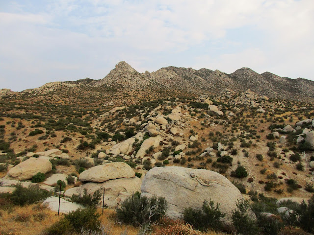
Goat Benchmark is #45 on the Sierra Club San Diego Peak List. It is a small bump at the head of Hellhole Canyon in Anza Borrego and nearly invisible until you are right on top it. There are many small boulder piles in the area and picking it out without a GPS would take superior map skills. I used a GPS. A short route with unfriendly terrain is possible from Culp Valley. I ran out of time trying to complete that route in May. This time I took the standard route that goes by White and the Thimble. This let me add a couple of other benchmarks along the way. The area around the San Ysidro Mountains is one of the favorites in San Diego county. The desert here has endless piles of boulders.
I started a little before sunrise to make the most of the cool morning. I began on the California Riding and Hiking Trail, then left the trail toward Hut Benchmark about a quarter mile from the start. I passed within feet of Hut on the way out, but didn't want to stop until I was heading back. Navigation was something of an issue but I had a GPS track to help me sidehill around the bigger obstacles. 75% of the route was sidehilling, aargh. I picked out the next ridge I needed to cross, then tried to find human or animal trails heading that way. Mostly I found animal trails. Bushwhacking was never a real problem, but it could be based on route choices. I tried taking a slightly more direct route on the way out, but I think any time savings were eaten up by additional gain and loss. In one of the canyons, I found deer parts and what looked like a juvenile or baby deer head, still with some wet brain matter inside. Insects hadn't had enough time to clean it up completely.
As far as other wildlife, I startled a couple of adult mule deer, but they were too fast for me to get any photos. Jackrabbits and birds were in abundance. Bighorn scat was everywhere, but I didn't see any. It seemed like a long time before I finally laid eyes on Goat. Once found, the summit was an easy boulder. A higher mound stands just behind it. The register went back to 2001 and was quite thin. I was the fifth party to visit Goat in 2017. It doesn't see much activity. Unless you are chasing the San Diego list, there is no reason to go there. If you end up there by accident, you are probably in serious trouble. I don't know why the US Army Corps of Engineers decided to mark it, but I really appreciated the remoteness. It had great views, being sort of Hellhole Central. Hob Benchmark and Middle Ysidro towered directly above. This is very wild country.
On the way back, it warmed up so I stayed in one of the side canyons longer and avoided unnecessary hills. I paid less attention to my GPS on the way back in favor of staying on good animal trails. I also made a couple of guesses about which bump was Clyde, climbing a couple of false Clydes before getting the real one closer to Bonny. The Clyde summit required one class 3 move with good holds in the top boulder. The last stop was Hut Benchmark. I scrambled up to take a picture of the mark on Hut's highest boulder. I didn't find a register on Clyde or Hut. Getting Goat was satisfying. It's in a tough spot and the navigation required my full attention.
Goat Benchmark 360 from Keith Winston on Vimeo.
Would you like to know more...?


Hey, you got a jackrabbit pic? Nice. They always scamper away before I can get my camera out.
ReplyDeleteSean,
DeleteThey usually run away fast, but this one was calm for some reason. Look at that shiny coat!
Wow, nice! Cool hike, Keith. Sure is a weird place for a benchmark!
ReplyDeleteHow hot was it? Early start helped, yeah, but did it get brutal?
Mike,
DeleteNot nearly as hot as Grapevine. It only got up to the mid-80s. The whole area is much higher and cooler than most of Anza-Borrego. TH was at 4000'.