Hiked: 8/18/2017
Distance: 18.7 miles round trip on trail, cross country, and dirt road
Summit Elevation: 4449' (Little Pine), 4107' (Alexander)
Elevation Gain: 3980'
Elevation Gain (in Empire State Buildings): 3.18
Round trip time: 8 hours 15 minutes
Recommended water: 156 oz.
Parking/Fees: Adventure Pass
Difficulty: Strenuous
When I completed the Lower Peaks List, Little Pine Mountain Benchmark was suspended. It was still suspended when I did this hike. The road to Upper Oso Campground opened a couple of weeks ago which is the starting point. There are two routes to the summit, the Santa Cruz Trail and Camuesa Road. The USFS listed the Santa Cruz trail as impassable, while the road was open to hikers and horses. Little Pine Mountain Benchmark is in the Los Padres National Forest northeast of Santa Barbara, more than a three hour drive from my house. It was going to be a very long day.
The first crossing of the Santa Ynez river from Paradise Road had about 6 inches of water over it. I arrived at Upper Oso Campground and found several camping spots taken, but no one was at the day use parking area. I planned to gamble on the Santa Cruz trail in part to scout it out. Also to see if I could make the impassable possible. From satellite recon, there were only a couple of cliff areas that concerned me. If I hit a spot that I couldn't bypass above or below, I planned to retreat to the nearest ridge and cross country around it. Half a mile from the start is the split for the Santa Cruz trail. Camuesa Road rises quickly to the right. There is a register at the start of the trail and I signed it. The start of the trail follows the right bank of a creek. The small stream provided a welcome murmur as company. A couple of miles later, switchbacks started up the mixed layers of exposed sediment. The Rey fire had ravaged the area, burning 32,606 acres. There were signs of trail clearing and cut branches. The trail was in good shape to this point. The next section of trail went through tall dead grass. Over my head tall. Then, it contoured right and I hit the first couple of minor washouts, none dangerous. I bypassed most above, but one I had to descend about 10' to cross. I could see the trail cut into the cliffs above thinking it might be a different story there.
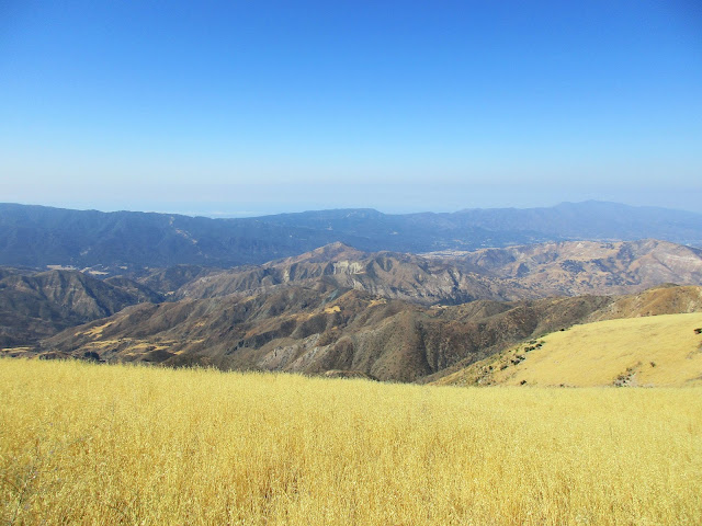
As I reached the higher trail section built into the side of the mountain, I saw the destruction. Metal support rods were exposed, bent and twisted in odd shapes. Wooden beams were broken, charred, and buried. The trail was covered in slides in some places and missing in others. This was the one major washout. Still, it was relatively easy to pick my way slowly across. Sadly, it will take a colossal effort to rebuild this part of the trail. Once I had crossed that section, there were a couple more tall grassy areas. Then the trail was overgrown and became a bushwhack to the saddle with Alexander Peak. The plants growing out of the side of the mountain naturally pushed you toward the edge that you could not always see or judge very well. This was probably a more dangerous part of the trail than the destroyed section. At the saddle, Alexander Peak looked too close not to do it. There was one bump to go over before climbing 150' to the plateau. I thought there would be a useful firebreak on the way, but it was overgrown with more tall grass. There was no benchmark or register but the view back to Little Pine Mountain was worth the effort. I returned to the saddle and continued up to the use trail that branches to Little Pine Mountain BM. The summit was a pile of ashes and burned trees. No benchmark, no register. I doubt the summit area will grow back in my lifetime.
Finally, I had to make a game time decision on whether to return on the trail or the dirt roads. In the end, I wanted to scout both routes so I returned on the roads. It is a long descent along Big Pine Road and Camuesa Road as they stayed on major ridges. Wildlife is returning to the area. I saw a red tailed hawk, a mule deer, and a gopher snake (pretty sure) on the way back. The snake was the only one willing to be photographed. The geology was spectacular. There is a weird greenish-bluish-grayish layer that draws attention as you scan the landscape. There were also pink, rust, and yellow layers. The road had some large boulders that had fallen on it, a few slides and two downed trees, but was perfectly usable for hikers. Horses would not be able to make it all the way through. At the end, Camuesa Road made a turn back upstream, adding an unwanted half mile to the hike. I went back to the register and filled in more details before heading home. Car to car was 8 hours 15 minutes. House to house was 16 hours 30 minutes.


No comments:
Post a Comment