Distance: 4 miles round trip cross country
Summit Elevation: 4504'
Prominence: 2844'
Elevation Gain: 1637'
Elevation Gain (in Empire State Buildings): 1.3
Round trip time: 4 hours
Recommended water: 64 oz.
Parking/Fees: Free on dirt road north of Bradshaw Trail
Difficulty: Moderate
I took a day off mid-week to tackle Black Butte (DPS #74), the high point of the Chuckwalla Mountains. It sports more than 2000' of prominence. The range is southeast of Joshua Tree and south of I-10. It is also directly north of the Chocolate Mountain Aerial Gunnery Range, a proving ground for the Navy. Driving to the start was a 22-mile dirt road excursion. The roads were in good shape and any vehicle should be able to make the drive, except the final 2 miles which require high clearance and 4x4. I followed the driving directions from the quality Summitpost page created by Adam Walker.
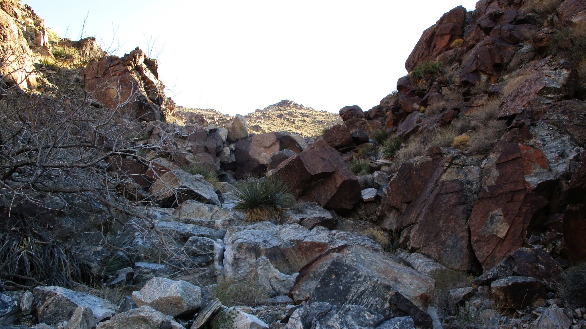
The primary route is a gully crawl ending just left (east) of the summit. Beware the cholla garden before reaching the gully. I'd honed my proficiency at desert gully crawls this year, and this one was standard class 2. There was one notable 40' dry fall obstacle with a bypass on the left. Black Butte appeared to be made of mostly black and dark red volcanic rock. Near the end of the gully, I angled up a steep slope more directly toward the long, flat, summit area.


I found three registers in the ammo box at the summit. The oldest went back to 1992 and looked kind of fragile so I didn't leaf through it. One was dedicated to the USS Cole, a destoyer that was victim of a terroist attack in 2000. I signed the newer register, where I found Adam's signature. For the return trip, I was trying to decide between the ridge east of the gully or a less steep gully farther east. I decided to take the other gully, so I drifted down the east ridge. The saddle above the gully was not visible until I crested the final drop to get there. The descent gully was not as interesting as the main one with only a couple of short dry falls. I had hoped to spot a chuckwalla and occasionally peeked into cracks between rocks, but it might have been too cold for them. Black Butte was one of the easier DPS peaks I've climbed. When I got back to the truck, I couldn't use my maps app to navigate back to I-10 so had to go on memory. It was three right turns, then a left. I got service back before the final turn and settled in for 4 hour cruise home.


1600 feet gain in 2 miles isn't too bad at all. I was surprised by that.
ReplyDeleteLong drive, eh? But a nice day far a drive in the desert. What a great time of year to hike in the desert.
Mike,
DeleteYes, beautiful day to be in the desert. Most of the driving was on single lane dirt roads, fine on the way in. On the way out, I ran into a Jeep parked on one side, but I had to drive off the road to get around it. Next, I ran into a large RV that filled the entire road. Fortunately, there was an open area where I could again pull off the road and let the RV go by. So, while you don't technically need 4x4 to get there, you might want it to avoid other vehicles on the single lane roads.