Sunday, December 6, 2020

Pinto Mountain and Mundi Benchmark

Hiked: 12/4/2020
Distance: 12.4 miles round trip cross country
Summit Elevation: 3983' (Pinto), 3186' (Mundi)
Prominence: 464' (Pinto)
Elevation Gain: 2737'
Elevation Gain (in Empire State Buildings): 2.1
Round trip time: 7 hours 15 minutes
Recommended water: 96 oz.
Parking/Fees: $35 National Park Fee (1 car for 1 week)
Difficulty: Moderate

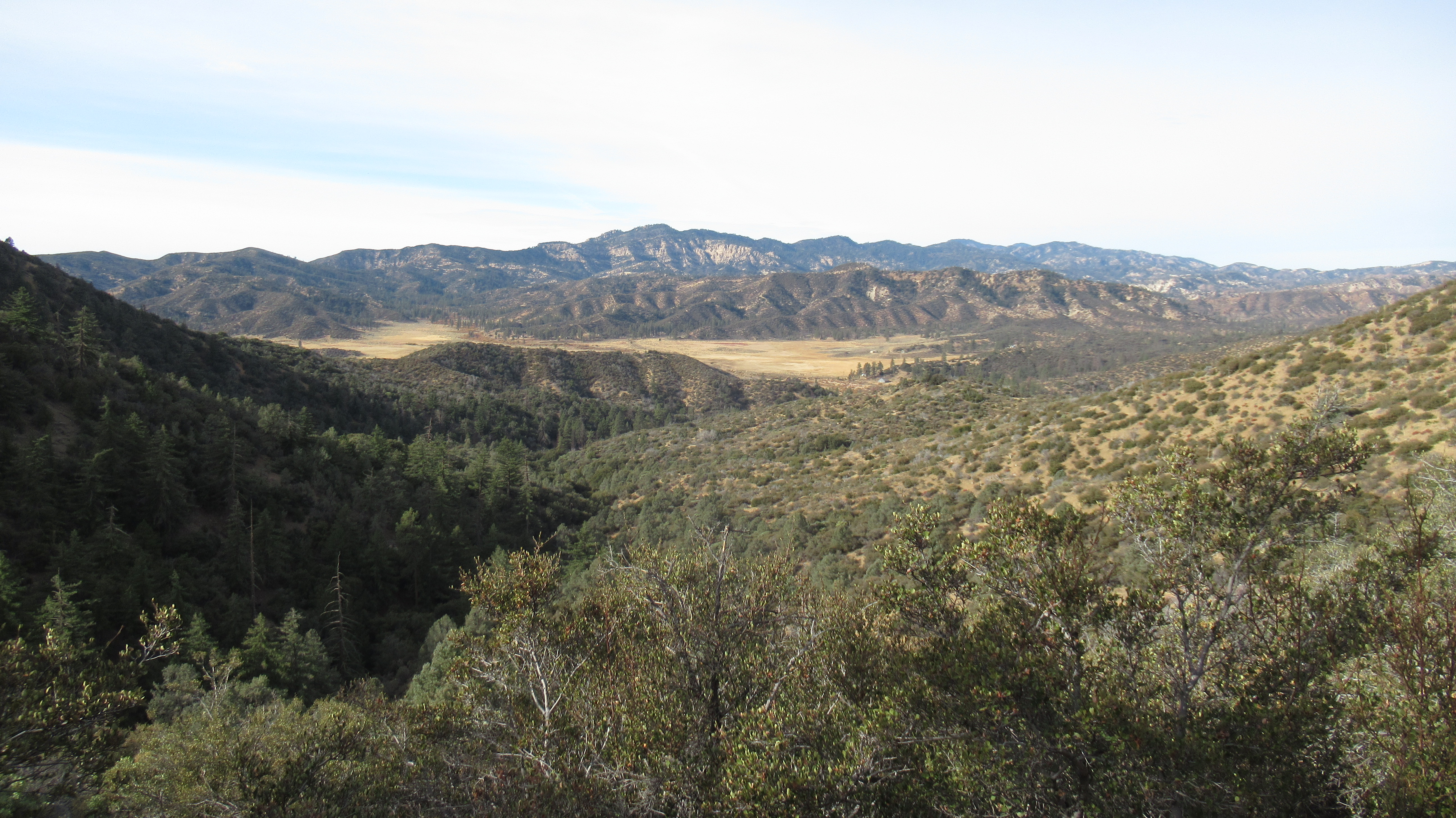
Pinto Mountain was the only DPS peak (#81) in Joshua Tree I had not climbed. It was another cross country trip that I spiced up by adding nearby Mundi Benchmark. There are two main routes to Pinto, the ridge route and the gully route. I planned to attempt Mundi on the way back, so I went up the gully route to assess the terrain. The hike started at a small parking area in Turkey Flats. The approach for both routes is at least 3 miles of open desert. It's a little longer for the gully route since it goes around the foothills up a wide canyon. The first mile is a minefield of animal burrows that collapse when you walk on them. I covered the rest of the open desert quickly, then turned up the second gully on the left toward Pinto.


Animal burrow mine field


The second gully had larger boulders though it was still mostly class 1. The navigation was much easier than Eagle Mountain and Pinto was in view most of the way. Gain was slow and steady. I left the gully at an obvious place to start up the ridge. Looking back, I was higher than expected. Parts of the lower ridge were steep class 2 but nothing tricky. After reaching the upper ridge, there were a couple of false summits to cross before reaching Pinto. Views in all directions were superb. A large cairn was built on the summit with a wire frame saguaro cactus, which doesn't grow in Joshua Tree. Pinto seems popular with multiple register notebooks in an ammo box. I found a reference mark not far away, but could not find the main benchmark. It might be buried under the cairn. The wind was blowing steadily on the open summit making it too cold to linger. I reversed course and continued down until I was out of the wind. I finally stopped to refuel and hydrate.

Starting up second gully


I looked down at four bumps to the east, unsure which was Mundi. Instead of coming down the same ridge, I took the next ridge over. I had a GPS waypoint for Mundi and was able to identify it after descending a little further. It only added 200' of gain to the trip. At the top of Mundi, there were two wooden poles with wire, but I didn't find a register or benchmark. The direct drop off from Mundi looked a little treacherous, so I went back to take the other gully down, with a little more class 2. Back in the wide canyon, it was a tedious 4 mile trudge back to the truck. There were 2 groups of tourists reading the Turkey Flats plaque when I emerged from the desert. They seemed initialy startled, then realized I was just a hiker. One of them even took a photo of the mysterious stranger with a backpack. I got a chuckle out of it.
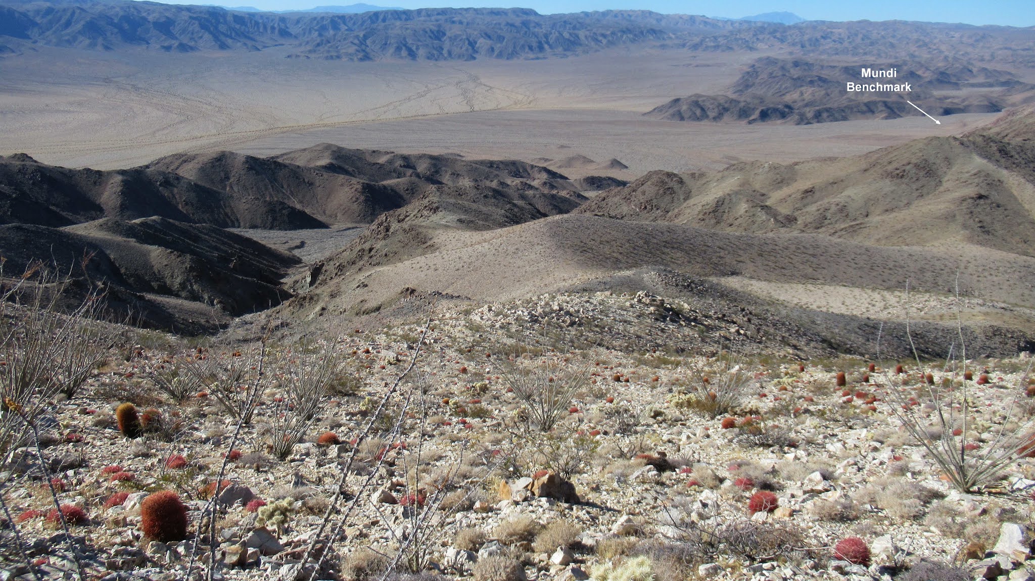


Looking down from Mundi

Looking back at Pinto


Friday, November 27, 2020

San Marcos Peak and Double Peak

Hiked: 11/27/2020
Distance: 7 miles round trip on trail
Summit Elevation: 1220' (San Marcos), 1646' (Double)
Prominence: 464' (Double)
Elevation Gain: 1455'
Elevation Gain (in Empire State Buildings): 1.1
Round trip time: 2 hours 45 minutes
Recommended water: 32 oz.
Parking/Fees: Free at Lakeview Park
Difficulty: Easy

Leisa and I drove to San Marcos to work off some turkey and apple pie. We followed a peakbagger track from TJ Kodras for a loop picking up San Marcos Peak and Double Peak. We masked up and started west toward San Marcos Peak. The route winds through some residential neighborhoods and I recommend following a GPS track to navigate through the streets in this section. After some paved road hiking, we made a sharp climb up to the towers on San Marcos Peak. The views opened up as we climbed and I was surprised with a clear view of the Pacific Ocean. I thought we were too far inland to see the ocean. The summit of San Marcos is enclosed in a barbed wire fence so we could only get as close as the fence. After a few minutes looking around, we continued along the ridge, then dropped 100' to a saddle. The wide trail follows the road to the top of Double Peak, but we took the steep dirt trail shortcut. On top is a telescope, some tables, and restrooms. A small crowd was milling around. We took a short break, then dropped off the other side, following a dirt single track back to the wide official trail, then back to the truck. It was a nice 7 mile loop with a little more gain than I expected.


San Marcos Peak

Double in the distance


Dirt shortcut to Double

Pacific Ocean

Leisa on Double Peak


Saturday, November 21, 2020

San Rafael Peak

Hiked: 11/20/2020
Distance: 11.5 miles round trip on trail and cross country
Summit Elevation: 6666'
Prominence: 760'
Elevation Gain: 3124'
Elevation Gain (in Empire State Buildings): 2.5
Round trip time: 6 hours 20 minutes
Recommended water: 80 oz.
Parking/Fees: Adventure Pass at Johnston Ridge Trailhead
Difficulty: Moderate

Madison and I drove separately down 10 miles of dirt road on Grade Valley (7N03) to reach the Johnston Ridge Trailhead. Our goal was San Rafael Peak (HPS #144). San Rafael lies in the Sespe Wilderness, deep in the heart of Los Padres National Forest. Several peaks in Los Padres require a long drive to reach the starting point and this was one of them. The drive was complicated by dozens of free roaming cattle on the road. Occasionally, one of the bulls would stop and challenge our vehicles, backing down after an insistent honk.

We set out just before 8 AM on the east bound trail under cool and partly cloudy skies. We crossed Piru Creek and walked through a stand of tall pines before reaching the Little Matau junction. It's nice country, and a welcome change from my desert heavy winter agenda. At the 5729' saddle, we left the trail for the cross country ridge traverse. As we ascended the first of several major bumps, we caught our first glimpse of San Rafael Peak. The second bump has a single cut path through the buckthorn. On the third bump, we followed animal trails too low on the left side and had to climb a very steep slope to right ourselves. The ridge gets a little tricky in places where you head away from the destination to stay on track. The final 300' gain to the summit seemed to go slowly. Views at the top were simply fantastic. Cobblestone is directly east. Topatopa, Alamo, and Thorn Point are nearby. Mt. Pinos was visible far away. We signed the register, noting the oldest entry going back to 1974(!). We took a decent break on the summit even though we were harassed by bees.


Mutau Creek crossing

Looking back at Mutau Flat

Leaving the trail for the ridge


Summit with Cobblestone behind


The way back added some gain as we continued the up and down over the bumps. While descending the final bump before reaching the trail again, we lost the use trail and thrashed through some brush. The Sierra Club lists the navigation as difficult, but I think we handled it pretty well. We thought about picking up Lockwood Peak after we got back, but the short day meant part of it would have to be done in the dark. We decided to leave it for another day. We didn't see any other people all day. I packed out a balloon with a fuzzy pink boa. Madison packed out another balloon, bottles, cans and used tissue. San Rafael was my 300th official Sierra Club peak. It was a fun outing worth the long drive.

The way back


Balloon with boa


Other Reports:
San Rafael Peak (Wild Southland)
San Rafael Peak (David Stillman)

Tuesday, November 10, 2020

Lost Benchmark

Hiked: 11/6/2020
Distance: 2.4 miles round trip cross country
Summit Elevation: 865'
Elevation Gain: 250'
Elevation Gain (in Empire State Buildings): 0.2
Round trip time: 1 hour 10 minutes
Recommended water: 16 oz.
Parking/Fees: Free on Vallecito Wash
Difficulty: Easy

The Arroyo Tapiado mud caves only took a couple of hours to explore, leaving me time to pick up Lost Benchmark. I drove south on Vallecito Wash to the next Jeep trail intersection, then parked and started across open desert toward Lost. In the distance were a few small hills, but the benchmark wasn't visible from the parking spot. In 20 minutes, I reached the first hills but had to rely on GPS to pinpoint the destination. At the summit, I found a CA Beaches and Parks benchmark and a fallen post with wire. I wasn't expecting a register and didn't find one. The view was into rougher badlands, but I can't really recommend a visit to Lost BM unless you have similarly low standards.


Saturday, November 7, 2020

Arroyo Tapiado Mud Caves

Hiked: 11/6/2020
Distance: 2 miles round trip cross country
Summit Elevation: 800'
Elevation Gain: 0'
Elevation Gain (in Empire State Buildings): 0
Round trip time: 2 hours
Recommended water: 16 oz.
Parking/Fees: Free on Arroyo Tapiado Jeep Trail
Difficulty: Easy

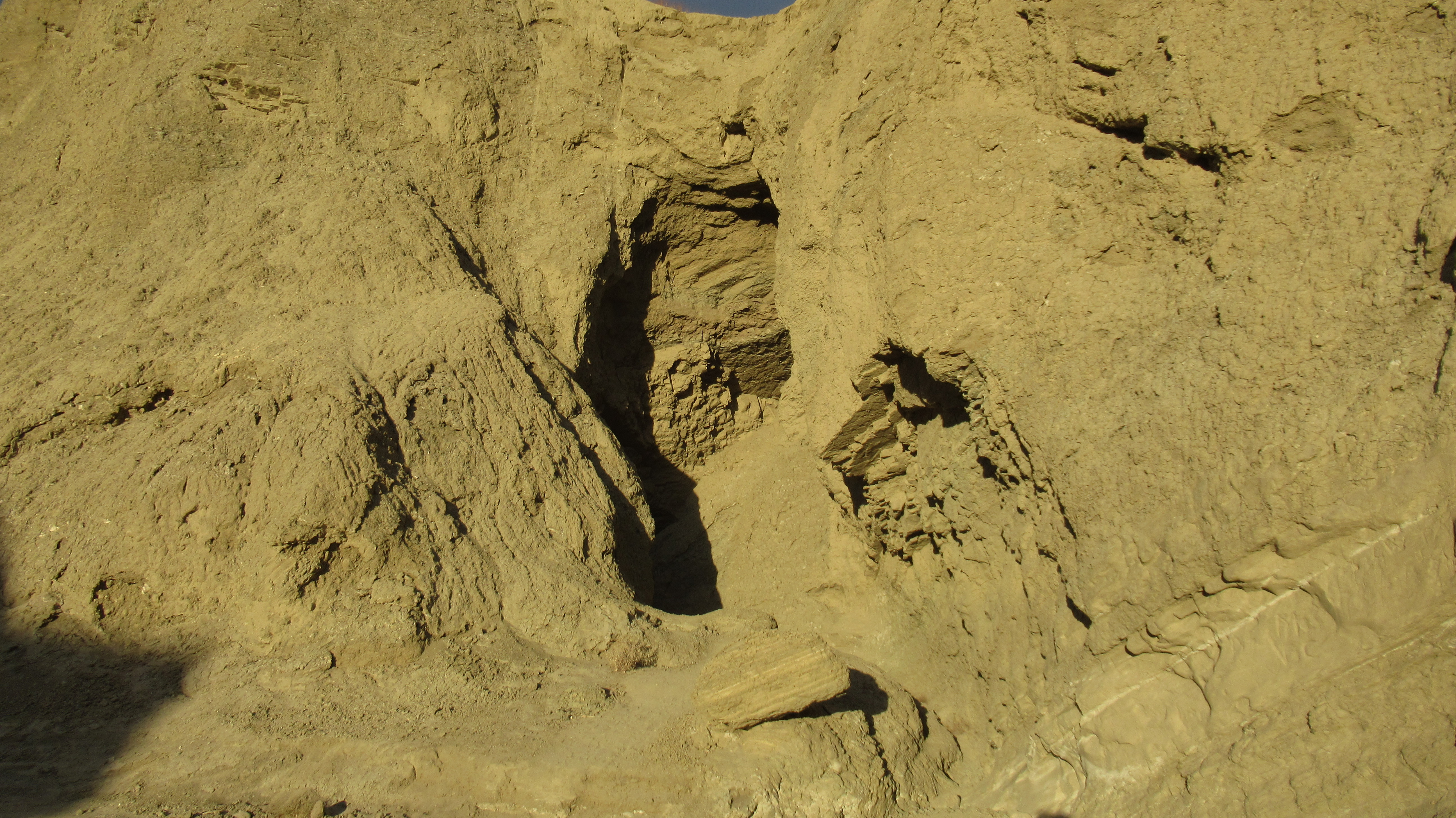
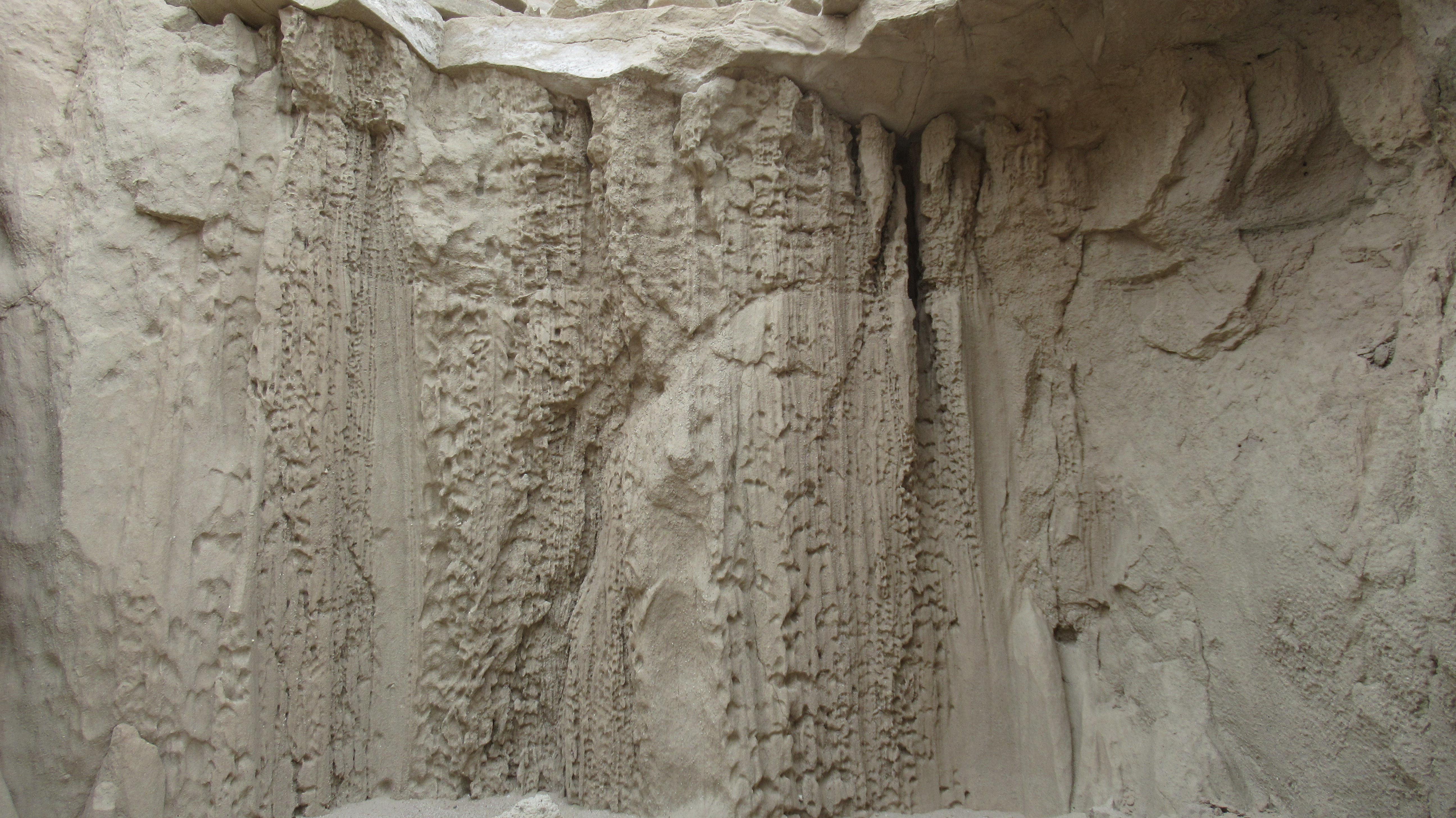
The Arroyo Tapidado mud caves are a unique geologic feature in the southern part of the Anza-Borrego Desert. Water carves slot canyons and caves out of mud that hardens between rains into phatasmagoric shapes. To get there, take highway S2 south and go east on Vallecito Wash, then make a sharp left turn in about 3 miles on Arroyo Tapiado Jeep Trail. From there, it's another 2 miles. 4x4 not needed. Once I arrived, I picked promising looking caves or slots and explored. Only two out of five tries led to long caves or slots. There are probably better caves I missed. The signs warn against exploring, calling the caves "mysterious and dangerous". The primary danger is walking on top of the mud and falling into a pocket or chute. A secondary danger is having an unstable roof or wall collapse on you. I found plenty of cave ins in the area.

Cave #1 started with a large opening that became a winding slot canyon leading through several tunnels and rooms. A couple had skylights, but none were long enough to require a flashlight. Some parts were narrow but it was an easy hike that eventually exited into badlands.


Entrance to cave #1


Cave #2 had a partially collapsed overhanging wall, mud chockstones, and required crawling in two spots. It was a little more difficult than the first one, but also more interesting. No one else was visiting the caves except one car camper in a Jeep.

Entrance to cave #2


Heart of mud