Distance: 12.4 miles round trip cross country
Summit Elevation: 3983' (Pinto), 3186' (Mundi)
Prominence: 464' (Pinto)
Elevation Gain: 2737'
Elevation Gain (in Empire State Buildings): 2.1
Round trip time: 7 hours 15 minutes
Recommended water: 96 oz.
Parking/Fees: $35 National Park Fee (1 car for 1 week)
Difficulty: Moderate
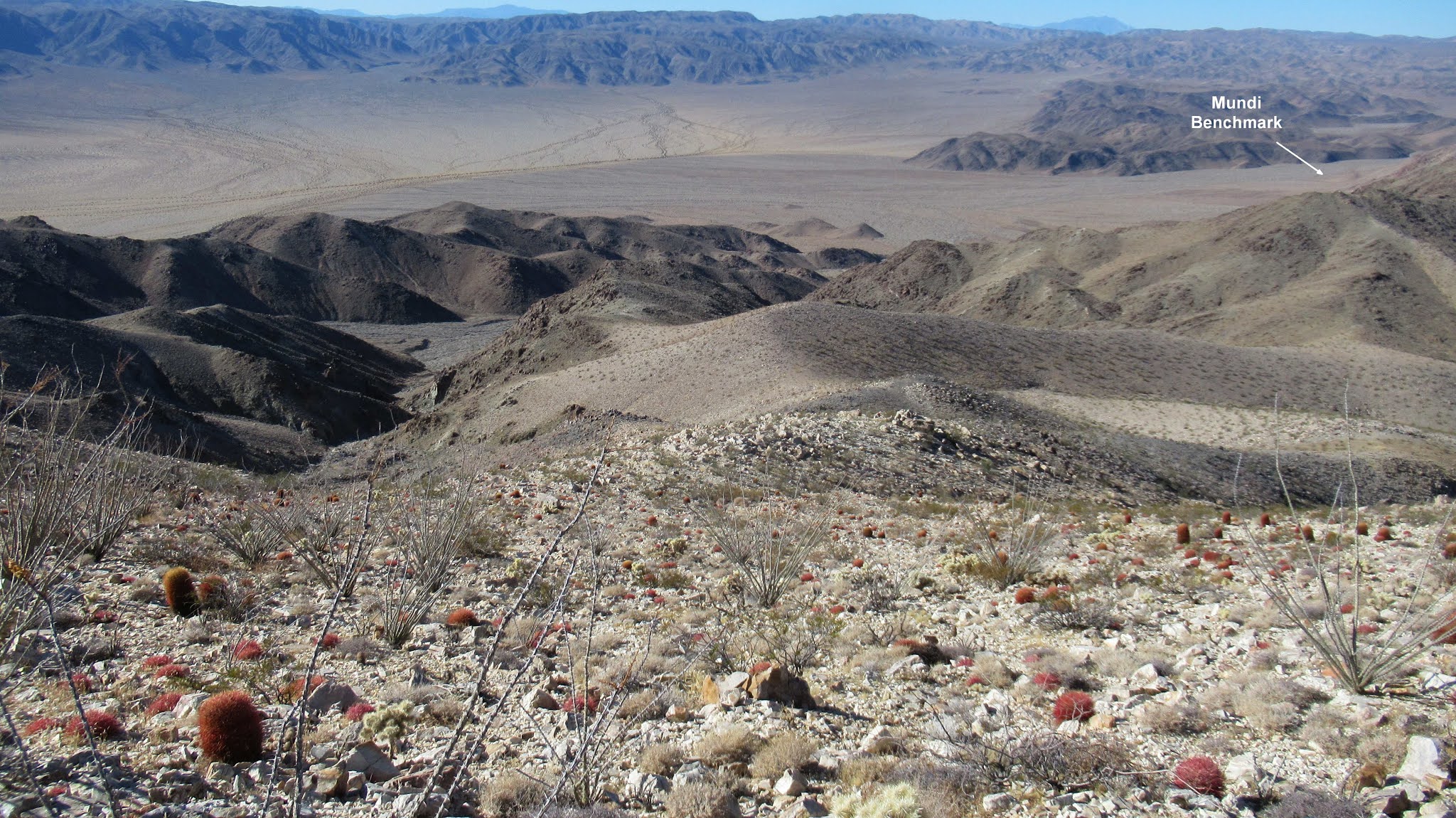
Pinto Mountain was the only DPS peak (#81) in Joshua Tree I had not climbed. It was another cross country trip that I spiced up by adding nearby Mundi Benchmark. There are two main routes to Pinto, the ridge route and the gully route. I planned to attempt Mundi on the way back, so I went up the gully route to assess the terrain. The hike started at a small parking area in Turkey Flats. The approach for both routes is at least 3 miles of open desert. It's a little longer for the gully route since it goes around the foothills up a wide canyon. The first mile is a minefield of animal burrows that collapse when you walk on them. I covered the rest of the open desert quickly, then turned up the second gully on the left toward Pinto.


The second gully had larger boulders though it was still mostly class 1. The navigation was much easier than Eagle Mountain and Pinto was in view most of the way. Gain was slow and steady. I left the gully at an obvious place to start up the ridge. Looking back, I was higher than expected. Parts of the lower ridge were steep class 2 but nothing tricky. After reaching the upper ridge, there were a couple of false summits to cross before reaching Pinto. Views in all directions were superb. A large cairn was built on the summit with a wire frame saguaro cactus, which doesn't grow in Joshua Tree. Pinto seems popular with multiple register notebooks in an ammo box. I found a reference mark not far away, but could not find the main benchmark. It might be buried under the cairn. The wind was blowing steadily on the open summit making it too cold to linger. I reversed course and continued down until I was out of the wind. I finally stopped to refuel and hydrate.


I looked down at four bumps to the east, unsure which was Mundi. Instead of coming down the same ridge, I took the next ridge over. I had a GPS waypoint for Mundi and was able to identify it after descending a little further. It only added 200' of gain to the trip. At the top of Mundi, there were two wooden poles with wire, but I didn't find a register or benchmark. The direct drop off from Mundi looked a little treacherous, so I went back to take the other gully down, with a little more class 2. Back in the wide canyon, it was a tedious 4 mile trudge back to the truck. There were 2 groups of tourists reading the Turkey Flats plaque when I emerged from the desert. They seemed initialy startled, then realized I was just a hiker. One of them even took a photo of the mysterious stranger with a backpack. I got a chuckle out of it.


No comments:
Post a Comment