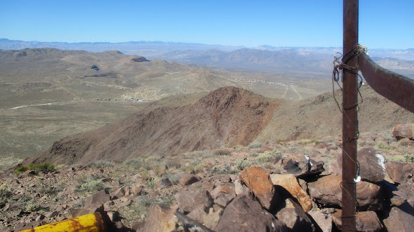
Hiked: 2/11/2022
Distance: 5.3 miles round trip on dirt road and use trail
Summit Elevation: 5261'
Prominence: 2061'
Elevation Gain: 1918'
Elevation Gain (in Empire State Buildings): 1.5
Round trip time: 3 hours 20 minutes
Recommended water: 52 oz.
Parking/Fees: Free on dirt road RM108
Difficulty: Moderate
I went back to the HPS Star Emblem list and found Red Mountain. It's a P2K, but a long drive from the OC for a day hike. Going north on the 395, I turned right on Trona Road, then an immediate right on RM108. Google named it Steamwells Road, but I saw no signs. I drove a mile or so on the dirt road to a turnaround. 4x4 not needed to this point. I could have driven to the next turnaround, but the hike was already pretty short. With the right vehicle and enough driving skill, someone might be able to drive all the way to the saddle. I followed RM108 up some steep sections to the saddle. A use trail runs south up the ridge torward the summit and parallels a south bound road. I took the use trail until it merged back into the road. With about a mile to go, the road ended and I found a second use trail marked with a cairn.
The second use trail climbed a rocky ridge, then a gentle slope to a false summit. From there, I dropped a couple of hundred feet to another saddle, and climbed the final rocky ridge to the summit. The use trail did a nice job weaving in and out of the rocks. It remained class 1 all the way. Red volcanic rocks were strewn about, but the rocks were heavily weathered and had lost their sharp edges. The summit had several yellow metal tanks of unknown purpose. There were some lookout ruins and etchings in rocks from the USMC. The original etching was from 11/10/1907 at 12 noon. Two marines apparently reached the summit then. Views were big in all directions. Part of the High Sierra could be seen to the north. The little town of Red Mountain (pop 130) sat below. I found a register in a ziplock baggie and a single crushed can. Red needs a new register and new cans or a container. The weather was warm and comfortable for this time of year. I found a triangulation mark with no stamping. After a short break, I started back the same way. This peak seemed easy, but I'll adopt the Sierra Club rating as moderate -- the easy side of moderate.


Dang teke, that's quite the road trip. Did you grab some other summits while you were in the neighborhood?
ReplyDeleteMadison,
DeleteJust the one. I had time to get something else small, but nothing nearby was compelling.