Hiked: 5/9/2020
Distance: 25.1 miles round trip on dirt road and cross country
Summit Elevation: 5265' (Chief), 6367' (Topatopa)
Prominence: 800' (Chief)
Elevation Gain: 5500'
Elevation Gain (in Empire State Buildings): 4.4
Round trip time: 12 hours
Recommended water: 196 oz.
Parking/Fees: Free outside Rose Valley Campground
Difficulty: Strenuous
"If you can do it,
get up and prove it"
-- Survivor, The Moment of Truth
It had been a while since I pushed myself. As California started to ease safer-at-home rules, I had a brief window to get in and out of Los Padres National Forest without the traffic. Having to travel back through LA traffic was always a de-motivator. Chief and Topatopa Bluff are an unnatural pairing because they are about 8 miles apart via dirt road (much closer as the crow flies). I decided to start with Chief Peak and if I felt strong on the other side, would go for the marathon to Topatopa. I drove to Rose Valley Campground and parked outside the gate since it was officially still closed (open as a trailhead). I hiked through the camp in perfect weather to pick up Rose Valley Lake Road.
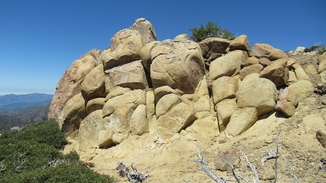
It started east, then turned south after a long stretch of up. It continued to gain quick elevation until reaching Nordhoff Ridge Road. A left turn (west) took me toward Chief, Nordhoff Peak tower was visible in the other direction. Great views opened up in Ojai Valley, coastal mountains, and the interior of Los Padres. When I reached the north side of Chief, the way up was an obvious fire break that turns into a use trail. The cliffs at the top were larger than I imagined from photos. The use trail winds below to the right, then up some fun class 2 to the summit. The benchmark was in good shape and multiple registers were there in plastic jars. The powerful views were now 360. After some fuel, I continued along the ridge southeast, expecting to find a use trail leading down the south side but there wasn't one. It was a steep, rocky descent with light brush. On this side, many of the rocks were hidden with some kind of green ground cover. It made footing dicey and slowed me down. Half way down, I angled southwest, picking my way through poodle dog and burned bushes. I was relieved after a final 10' slide down a road cut. I felt strong, so I decided to go for Topatopa Bluff and writhed along the road to the mindless groove.


 |
Approaching the Chief
|
 |
| Cliffs below the summit, class 2 route goes right |
 |
Top of the Chief
|
 |
| Channel Islands in the distance |
 |
| Nordhoff Peak at the end of the ridge |
 |
| Cross country down the south side |
The road dropped to a low point below Chief, then began increasingly long switchbacks up. I could not see Topatopa yet, but Chief gained new stature the further away I got from it. I passed the intersection with Sisar Canyon Road, then wound below Sisar Peak with a couple of radio towers visible. After rounding that corner, I got a full view of Topatopa and stopped. It was still 2-3 miles away and it was big. I was 4 hours into the hike, miles past the Chief, and I figured it would take at least 2 more hours to reach Topatopa, and every step was a step further away from the truck. I don't usually think about the return trip, but it crept into my thinking here. I took a break to contemplate my fate and decided I had come too far to back off. I got up and on my way, with the road rolling up and down in 50' foot waves. At the base of the bluff, I dropped some water for the return trip. A brutal looking use trail went up the spine to Topatopa, but I decided to stick to the trail. There was a burn warning sign at the transition to the Red Reef trail. The climb was work, but not difficult. I got a fleeting glimpse of Hines and a full view of Creampuff. I didn't have the time, water, or energy to attempt either on this trip. Before the official Topatopa, I decided to visit the highest point in the vicinity. Peakbagger has it listed as Peak 6440. There was a
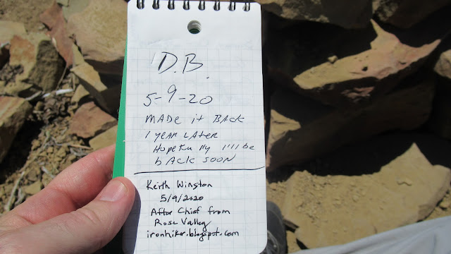
crude use trail going up. A short scramble put me on the edge of the cliff with a big drop below. It was worth the 10 minute side trip. I got back on the main trail and went over Peak 6410 on the way to Topatopa Bluff. A stone bench and fire pit had been constructed at the viewpoint with the register in an ammo box underneath the bench. I sat down and signed in, noticing how small Chief looked from here, and how far the return trip was going to be.
 |
| Chief from the other side |
 |
| First look at Topatopa Bluff |
 |
Peak 6440
|
 |
| Topatopa Bluff ahead |
 |
| Topatopa Bluff summit |
I ate most of my remaining solid food on Topatopa and started back. At the base, I picked up my water. In my mind, I broke up the return into 3 pieces: the first to Sisar Peak, second to Chief, and third to Rose Valley. Return trips always seem longer for some reason and this one sucked. Three mountain bikers passed me in the
no mans land between Chief and Sisar, the only other people I'd seen all day. After I passed Sisar, some part of my body was always muttering complaints under its breath. Competing for attention were feet, ankles and knees. I ended up munching two Aleve and two aspirin in the final 7 miles. It was enough. Dropping into Rose Valley felt great. The campground was now occupied by a half dozen families, ignoring the closure and enjoying picnics. The lock down seemed to have worn out its welcome. I can't recommend this pair of peaks in a single go, there are better ways, but I'm glad I did it.
 |
| Splash of color descending |
 |
Final look back at the bluff
|
 |
| Selfie at the end |
![]()
![]()
![]()
![]()
![]()
![]()
![]()
![]()
![]()
![]()
![]()
![]()
![]()
![]()
![]()
![]()
![]()
![]()
![]()
![]()
![]()
![]()
![]()
![]()
![]()
![]()
![]()
![]()
![]()
![]()
![]()
![]()
![]()
![]()
![]()
![]()
![]()
![]()
![]()
![]()
![]()
![]()
![]()
![]()
![]()
![]()
![]()
![]()
![]()
![]()
![]()
![]()
![]()
![]()
![]()
![]()
![]()
![]()
![]()
![]()
![]()
![]()
![]()
![]()


My one time up Chief Peak was from the opposite direction, up Horn Canyon from the Thacher School campus (which I suspect is closed these days). Silly me, I tried going up and down the rocky goat trail. Luckily, there was a series of cairns marking which way to go, but I was kind of glad nobody was around to hear me swearing loudly at what I'd gotten myself into.
ReplyDeleteTopatopa is one of my favorite peaks, although I've only been up to the very top once. I've always come up Sisar Canyon.
Robert,
DeleteThe north use trail on Chief was pretty, all other ways look tough. Really loved those views. Topatopa was nice, but I kept thinking about Hines. Someday I'll go back.
Geez. Long Day. Glad I couldn't go. LOL
ReplyDeleteThe Chief is definitely more impressive from the south-east than the other side.
Btw, I wonder if you could have shaved some distance on the way out by dropping down the Lion Canyon Trail and then taking the connector back to Rose Valley. I've taken that trail and, at the time, it was very good shape.
ReplyDeleteMadison,
DeleteLooking at the map, I think you're right, Lion Canyon trail would have been a better way back. More interesting, too. My plan was not well researched past Chief, and my knowledge of Los Padres is limited. Thanks for the tip.