Hiked: 4/24/2020
Distance: 3.3 miles round trip on trail and cross country
Summit Elevation: 5265'
Prominence: 1265'
Elevation Gain: 1088'
Elevation Gain (in Empire State Buildings): 0.8
Round trip time: 2 hours 35 minutes
Recommended water: 48 oz.
Parking/Fees: Free on Jeraboa Road
Difficulty: Easy
After Desert Angel, I looked at a few options in the area and settled on Asbestos Mountain. It was a short hike to an HPS peak (#257) and I thought I could complete the hike and be home early enough to pick up dinner. I drove up to highway 74, then went south toward Mountain Center. The trail starts at the end of Jeraboa Road. I stopped after the last intersection, but could have driven a bit further. I didn't mind the extra hiking.
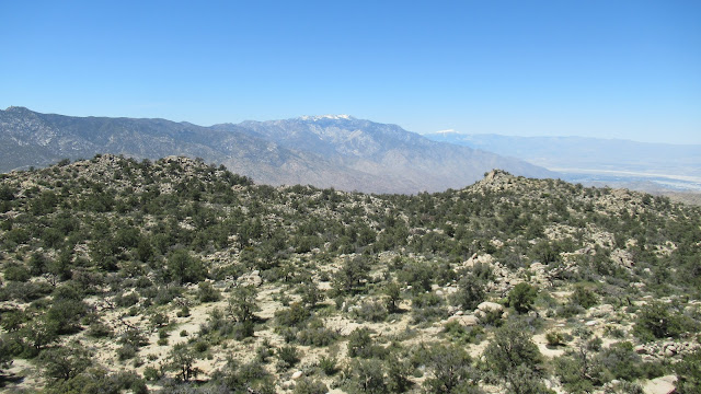
I followed the road to the end, then tried to decide between the ridge line and a more direct approach. With no prep, I didn't know where the HPS route was or the summit. There was deep saddle along the ridge so I went more directly toward Asbestos Mountain. I didn't spot a use trail on the way to the base, but it was easy to dodge the light brush. I started up not quite sure where I was headed, pausing once to let a swarm of bees move up the mountain. After a couple hundred feet, I noticed a wide gully to the left that might offer an easier way up. I scrambled to the gully and was pleased to find a set of cairns. I had stumbled on the HPS route and followed the cairns up the gully. When it leveled off near the top, I was staring at 3 possible peaks that could be Asbestos. I broke out my phone and pulled up a trip report with a GPS track. That cleared up which peak to chase. Class 2 was required to reach the summit where several register books were stuffed inside a pair of red cans. I also found the benchmark. I enjoyed a second set of amazing views on the day. I had an easier time following the complete HPS route on the way down. I came across another swarm of bees, hovering around a hole in some rocks. I was about 100' away and was careful not to get any closer. No other people were around the entire day. From the HPS page: "Named for the large asbestos deposits in the San Jacinto Mountains that were first mined in 1888".


That's an inviting name for a peak. LOL
ReplyDeleteMadison,
DeleteDidn't know there was such a thing as an asbestos mine. It was actually more fun than it looks.
Thanks for sharing your Asbestos Mountain hike, and for the helpful info on the route! 🏞️
ReplyDeleteNick,
DeleteHave fun if you haven't done it. I like the area and it's hard to get lost.