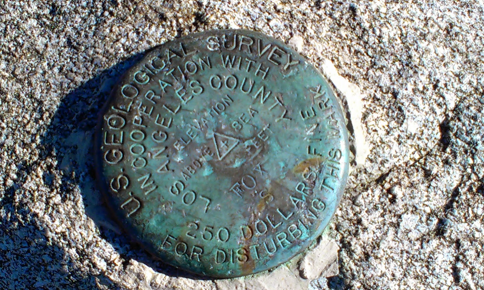
Hiked: 1/13/2013
Distance: 5.4 miles round trip on dirt road and trail
Summit Elevation: 4510'
Prominence: 610'
Elevation Gain: 1400'
Elevation Gain (in Empire State Buildings): 1.12
Round trip time: 2 hours
Recommended water: 64 oz.
Parking/Fees: Adventure Pass
Difficulty: Easy
Los Pinos is the 4th highest peak, and one of the southern most peaks in the Santa Ana mountains. It can be reached from trails north and south. I started from North Main Divide road. Getting to the trailhead is an adventure itself as you wind up a narrow road with potholes to a turn out. To get there from the OC, take Ortega Highway (74) from the I-5 about 25 miles toward Temecula, then take the first paved road on the left past the candy store (Long Canyon Road). Follow the road past the probation facility, bear right and follow the signs to Blue Jay campground, then continue past the campground a little until you see the North Main Divide sign and a closed gate (it will probably remain closed all winter) on the left. I suggest driving slowly and watching out for other cars.
There was no snow, but the ground was frozen and temps hovered around 40F.
Because of its location, Los Pinos provides a unique view of Santiago Peak and great views of San Gorgonio. I think Los Pinos would be more fun to approach from the south using the longer, more difficult ridge route.
See also:
Los Pinos via Bell Ridge
Los Pinos via Los Pinos Ridge
Monday, January 14, 2013
Saturday, January 12, 2013
Timber Mountain Winter Ascent
Hiked: 1/11/2013
Distance: 8.5 miles round trip on trail and cross country
Summit Elevation: 8303'
Prominence: 583'
Elevation Gain: 3375'
Elevation Gain (in Empire State Buildings): 2.7
Round trip time: 4 hours 45 minutes
Recommended water: 88 oz.
Parking/Fees: Adventure Pass
Difficulty: Moderate
It took two tries to bag Timber Mountain in the dead of winter. I had to turn back about 2/3 of the way in December due to the cold. I came with extra layers this time and had no issues with the cold. I was surprised by 40-50 mph wind gusts near the top of the canyon that blew my hat off several times. That was the only time I felt a little cold. I used Grabber toe and body warmers and they added a little warmth. On the way down, the toe warmers were rubbing my feet uncomfortably so I stopped and took them out. I gained some good experience in the snow. Maybe I'm ready for an ice ax (maybe not).
The Three Ts trail that leads to Timber, Telegraph and Thunder mountains was completely buried in snow and invisible, so I went straight up the ridge line from Icehouse Saddle to the Timber summit. Leaving the saddle, I had to put on the Kahtoola microspikes to have enough traction. Otherwise, it would have been too steep and slippery. The spikes performed well over all on both snow and ice. I lost the one on my left boot on the way down and had to back track a bit to find it.
I met one hiker resting at the saddle on the way up, and half a dozen on the trail on the way down, but I was alone on the Timber summit. The Sierra Club classifies this route as moderate, and in the summer, I would agree. With the added difficulty of ice and snow, it felt strenuous. The final trudge up the ridge through the snow was pretty tough.
Distance: 8.5 miles round trip on trail and cross country
Summit Elevation: 8303'
Prominence: 583'
Elevation Gain: 3375'
Elevation Gain (in Empire State Buildings): 2.7
Round trip time: 4 hours 45 minutes
Recommended water: 88 oz.
Parking/Fees: Adventure Pass
Difficulty: Moderate
It took two tries to bag Timber Mountain in the dead of winter. I had to turn back about 2/3 of the way in December due to the cold. I came with extra layers this time and had no issues with the cold. I was surprised by 40-50 mph wind gusts near the top of the canyon that blew my hat off several times. That was the only time I felt a little cold. I used Grabber toe and body warmers and they added a little warmth. On the way down, the toe warmers were rubbing my feet uncomfortably so I stopped and took them out. I gained some good experience in the snow. Maybe I'm ready for an ice ax (maybe not).
The Three Ts trail that leads to Timber, Telegraph and Thunder mountains was completely buried in snow and invisible, so I went straight up the ridge line from Icehouse Saddle to the Timber summit. Leaving the saddle, I had to put on the Kahtoola microspikes to have enough traction. Otherwise, it would have been too steep and slippery. The spikes performed well over all on both snow and ice. I lost the one on my left boot on the way down and had to back track a bit to find it.
I met one hiker resting at the saddle on the way up, and half a dozen on the trail on the way down, but I was alone on the Timber summit. The Sierra Club classifies this route as moderate, and in the summer, I would agree. With the added difficulty of ice and snow, it felt strenuous. The final trudge up the ridge through the snow was pretty tough.
Saturday, December 8, 2012
Woodson Mountain
Hiked: 12/7/2012
Distance: 7.2 miles round trip on dirt road and trail
Summit Elevation: 2897'
Prominence: 1454'
Elevation Gain: 2059'
Elevation Gain (in Empire State Buildings): 1.64
Round trip time: 2 hours 50 minutes
Recommended water: 84 oz.
Parking/Fees: Free at Lake Poway ($5 from April-October on weekends/holidays)
Difficulty: Moderate
Woodson Mountain is in the northern San Diego area. The Mount Woodson trail can be accessed from Lake Poway by parking near the back of the park and following the signs. The first part is a dirt road that connects to the trail after circling the lower end of the lake. The trail itself is in great condition and there are well marked signs at every junction making navigation a breeze.
It is a very popular hike and there were many people on the trail even through it was not a weekend. I passed three groups of hikers on the way up and met two mountain bikers on their way down. Giant boulders fill the mountain all the way up but do not block the path. No need to climb any of the boulders unless that is the reason you went. It a popular destination for rock climbers.
One unique attraction 0.2 miles from the summit is Potato Chip Rock. It juts out from a boulder and it appears to have been formed by the other half of the boulder being worn away (see photos below).

Starting out, Mount Woodson in the distance, Lake Poway ahead. Head down to the lake and around to start ascending.

Standing on Potato Chip Rock. Photo taken by someone named Ray I met near the top. There is about a 20' drop beneath Potato Chip Rock.
Would you like to know more...?
Other Trip Reports:
Woodson Mountain Redux
Distance: 7.2 miles round trip on dirt road and trail
Summit Elevation: 2897'
Prominence: 1454'
Elevation Gain: 2059'
Elevation Gain (in Empire State Buildings): 1.64
Round trip time: 2 hours 50 minutes
Recommended water: 84 oz.
Parking/Fees: Free at Lake Poway ($5 from April-October on weekends/holidays)
Difficulty: Moderate
Woodson Mountain is in the northern San Diego area. The Mount Woodson trail can be accessed from Lake Poway by parking near the back of the park and following the signs. The first part is a dirt road that connects to the trail after circling the lower end of the lake. The trail itself is in great condition and there are well marked signs at every junction making navigation a breeze.
It is a very popular hike and there were many people on the trail even through it was not a weekend. I passed three groups of hikers on the way up and met two mountain bikers on their way down. Giant boulders fill the mountain all the way up but do not block the path. No need to climb any of the boulders unless that is the reason you went. It a popular destination for rock climbers.
One unique attraction 0.2 miles from the summit is Potato Chip Rock. It juts out from a boulder and it appears to have been formed by the other half of the boulder being worn away (see photos below).

Starting out, Mount Woodson in the distance, Lake Poway ahead. Head down to the lake and around to start ascending.

Standing on Potato Chip Rock. Photo taken by someone named Ray I met near the top. There is about a 20' drop beneath Potato Chip Rock.
Would you like to know more...?
Other Trip Reports:
Woodson Mountain Redux
Sunday, November 25, 2012
Condor Peak and Fox Mountain
Hiked: 11/24/2012
Route 3 San Gabriel Mountains
Distance: 15.5 miles round trip on trail and cross country
Summit Elevation: 5476' (Condor) and 5033' (Fox)
Prominence: 600' (Condor) and 473' (Fox)
Elevation Gain: 4100'
Elevation Gain (in Empire State Buildings): 3.28
Round trip time: 8 hours
Recommended water: 184 oz.
Parking/Fees: Adventure Pass
Difficulty: Strenuous
My original plan was to climb Mount San Gorgonio, but a second winter storm left the top 2000' in a blanket of snow and ice that I was not prepared to tackle solo. The backup plan was Condor Peak (from Vogel Flat off Big Tujunga Canyon road) north of La Crescenta. I added Fox Mountain #2 since the peak was only a short distance off the main trail. Both peaks are on the Sierra Club's hundred peaks list for Southern California. I was looking for a tough hike and was not disappointed. It was a long, hard day that left me spent.
The Condor Trail was closed after the 2009 station fire and only reopened in May, 2012. It was in mixed shape. Many parts were in good shape, but other parts were completely overgrown with grass or shrubs. There were a number of places that were washed out and a burnt tree had fallen over the path at one point (see below). I kept checking for ticks at every stop but didn't find any. In the spring, this trail may be a tickfest. On the way back, I met one other solo hiker heading up. I found a lot of bighorn sheep tracks on the trail, but no other wildlife of note. Weather was perfect, unusually warm for this time of year.
The ascent to Fox Mountain summit is steep over soft dirt. Poles are handy for this one. In contrast, the ascent to Condor Peak is a steep rock scramble and poles get in the way when you need your hands to grab nearby rocks. When I got to the Condor ascent, I hesitated and did some mental math on my odds of making it up and down without an accident. After a few minutes, I decided to proceed, slowly.
Both of these peaks exemplify my favorite kind of hike. There is no road to the top and no shortcuts. The shortest route is at least 10 miles round trip for each. The other routes are in the 14-16 mile range. The only way to make it to the top is with blood, sweat, and determination. I was happy to sign both summit logs the same day.

Approach to Condor Peak summit. The trail gives up a few hundred feet of elevation before taking it all back on the ascent. The final ascent looked a little dangerous, but looked worse than it was.
Would you like to know more?
Route 3 San Gabriel Mountains
Distance: 15.5 miles round trip on trail and cross country
Summit Elevation: 5476' (Condor) and 5033' (Fox)
Prominence: 600' (Condor) and 473' (Fox)
Elevation Gain: 4100'
Elevation Gain (in Empire State Buildings): 3.28
Round trip time: 8 hours
Recommended water: 184 oz.
Parking/Fees: Adventure Pass
Difficulty: Strenuous
My original plan was to climb Mount San Gorgonio, but a second winter storm left the top 2000' in a blanket of snow and ice that I was not prepared to tackle solo. The backup plan was Condor Peak (from Vogel Flat off Big Tujunga Canyon road) north of La Crescenta. I added Fox Mountain #2 since the peak was only a short distance off the main trail. Both peaks are on the Sierra Club's hundred peaks list for Southern California. I was looking for a tough hike and was not disappointed. It was a long, hard day that left me spent.
The Condor Trail was closed after the 2009 station fire and only reopened in May, 2012. It was in mixed shape. Many parts were in good shape, but other parts were completely overgrown with grass or shrubs. There were a number of places that were washed out and a burnt tree had fallen over the path at one point (see below). I kept checking for ticks at every stop but didn't find any. In the spring, this trail may be a tickfest. On the way back, I met one other solo hiker heading up. I found a lot of bighorn sheep tracks on the trail, but no other wildlife of note. Weather was perfect, unusually warm for this time of year.
The ascent to Fox Mountain summit is steep over soft dirt. Poles are handy for this one. In contrast, the ascent to Condor Peak is a steep rock scramble and poles get in the way when you need your hands to grab nearby rocks. When I got to the Condor ascent, I hesitated and did some mental math on my odds of making it up and down without an accident. After a few minutes, I decided to proceed, slowly.
Both of these peaks exemplify my favorite kind of hike. There is no road to the top and no shortcuts. The shortest route is at least 10 miles round trip for each. The other routes are in the 14-16 mile range. The only way to make it to the top is with blood, sweat, and determination. I was happy to sign both summit logs the same day.

Approach to Condor Peak summit. The trail gives up a few hundred feet of elevation before taking it all back on the ascent. The final ascent looked a little dangerous, but looked worse than it was.
Would you like to know more?
Tuesday, November 20, 2012
Badwater Basin, Death Valley
Hiked: 11/19/2012
Distance: Drive Up
Summit Elevation: -282' (lowest in the North America)
Elevation Gain: N/A
Elevation Gain (in Empire State Buildings): N/A
Round trip time: N/A
Recommended water: N/A
Parking/Fees: Death Valley Pass ($20)
Difficulty: Easy
Badwater Basin is the lowest point in North America. My family briefly vacationed in Death Valley this week and although I didn't hike to it, I thought it belonged on the hiking blog for the negative elevation record. My GPS registered -289', while the official USGS measurement is -282'.
Distance: Drive Up
Summit Elevation: -282' (lowest in the North America)
Elevation Gain: N/A
Elevation Gain (in Empire State Buildings): N/A
Round trip time: N/A
Recommended water: N/A
Parking/Fees: Death Valley Pass ($20)
Difficulty: Easy
Badwater Basin is the lowest point in North America. My family briefly vacationed in Death Valley this week and although I didn't hike to it, I thought it belonged on the hiking blog for the negative elevation record. My GPS registered -289', while the official USGS measurement is -282'.
Saturday, November 10, 2012
Black Star Canyon Falls
Hiked: 11/9/2012, 11/16/2012
Distance: 6.6 miles round trip on road and cross country
Summit Elevation: 1650' at the Falls
Elevation Gain: 800'
Elevation Gain (in Empire State Buildings): 0.64
Round trip time: 3 hours 15 minutes
Recommended water: 64 oz.
Parking/Fees: None
Difficulty: Moderate
Black Star Canyon is filled with mystery, rumors, and ghost stories. But mainly, it is filled with boulders. Very big boulders. This hike starts on a paved road, turns into a dirt road, then after crossing 3 bridges a little more than 2 miles from the start, it descends into the canyon. From the canyon, go left which is up. All the elevation gain is done while ascending the canyon and navigating over and around large boulders and rocks. Some of the boulders are larger than cars, up to 20' high, with some piles reaching higher. There are several places on the way to the Falls where there is no easy choice on where to climb. The constant boulder scramble makes this a unique hike in the OC as far as I know. When I finally reached the Falls, it was dry. It had rained most of the day before and I expected at least a trickle. Even without a gushing waterfall, the trip was a worthwhile challenge. On the second trip, I saw two deer near the parking area, but they fled before I could get a picture.
Would you like to know more...?
Distance: 6.6 miles round trip on road and cross country
Summit Elevation: 1650' at the Falls
Elevation Gain: 800'
Elevation Gain (in Empire State Buildings): 0.64
Round trip time: 3 hours 15 minutes
Recommended water: 64 oz.
Parking/Fees: None
Difficulty: Moderate
Black Star Canyon is filled with mystery, rumors, and ghost stories. But mainly, it is filled with boulders. Very big boulders. This hike starts on a paved road, turns into a dirt road, then after crossing 3 bridges a little more than 2 miles from the start, it descends into the canyon. From the canyon, go left which is up. All the elevation gain is done while ascending the canyon and navigating over and around large boulders and rocks. Some of the boulders are larger than cars, up to 20' high, with some piles reaching higher. There are several places on the way to the Falls where there is no easy choice on where to climb. The constant boulder scramble makes this a unique hike in the OC as far as I know. When I finally reached the Falls, it was dry. It had rained most of the day before and I expected at least a trickle. Even without a gushing waterfall, the trip was a worthwhile challenge. On the second trip, I saw two deer near the parking area, but they fled before I could get a picture.
Would you like to know more...?
Monday, November 5, 2012
Nix Nature Center Loop, Serrano Ridge
Hiked: 11/4/2012 (x9)
Distance: 4.7 miles round trip on trail and dirt road
Summit Elevation: 824' unnamed bump
Elevation Gain: 850' (500' out, 350' on return)
Elevation Gain (in Empire State Buildings): 0.68
Round trip time: 1 hour 20 minutes
Recommended water: 48 oz.
Parking/Fees: $3 OC Parks
Difficulty: Easy
The loop from Nix Nature Center starts on the Little Sycamore trail to Serrano Ridge road to Camarillo Canyon trail to Stagecoach South trail back to the Nature Center. The entire loop is 4.7 miles. The Little Sycamore and Stagecoach segments have the elevation gain, Camarillo is downhill and Serrano Ridge road is flat. The loop can be done in reverse, but there are a lot of loose rocks on Little Sycamore that I would rather face going up than coming down. Part of Camarillo Canyon used to be very steep, but that part of the trail has been blocked off and replaced with new switchbacks. This hike is beginner friendly and a great place to burn some calories.
The nature center is new and worth a visit. The Rangers are friendly and the bathrooms are clean. Before I started climbing mountains, I spent a lot of time on these hills. While the area is known for rattlesnakes, I've hiked the loop at least 20 times without seeing a single one. There are two connectors to trails on the other side of the 73 (continuing to follow Serrano Ridge road, and the Old Stagecoach trail from Camarillo) if you want to extend your hike. There are also connectors to trails on the other side of Highway 133.
Distance: 4.7 miles round trip on trail and dirt road
Summit Elevation: 824' unnamed bump
Elevation Gain: 850' (500' out, 350' on return)
Elevation Gain (in Empire State Buildings): 0.68
Round trip time: 1 hour 20 minutes
Recommended water: 48 oz.
Parking/Fees: $3 OC Parks
Difficulty: Easy
The loop from Nix Nature Center starts on the Little Sycamore trail to Serrano Ridge road to Camarillo Canyon trail to Stagecoach South trail back to the Nature Center. The entire loop is 4.7 miles. The Little Sycamore and Stagecoach segments have the elevation gain, Camarillo is downhill and Serrano Ridge road is flat. The loop can be done in reverse, but there are a lot of loose rocks on Little Sycamore that I would rather face going up than coming down. Part of Camarillo Canyon used to be very steep, but that part of the trail has been blocked off and replaced with new switchbacks. This hike is beginner friendly and a great place to burn some calories.
The nature center is new and worth a visit. The Rangers are friendly and the bathrooms are clean. Before I started climbing mountains, I spent a lot of time on these hills. While the area is known for rattlesnakes, I've hiked the loop at least 20 times without seeing a single one. There are two connectors to trails on the other side of the 73 (continuing to follow Serrano Ridge road, and the Old Stagecoach trail from Camarillo) if you want to extend your hike. There are also connectors to trails on the other side of Highway 133.
Subscribe to:
Posts (Atom)