Hiked: 4/28/2017
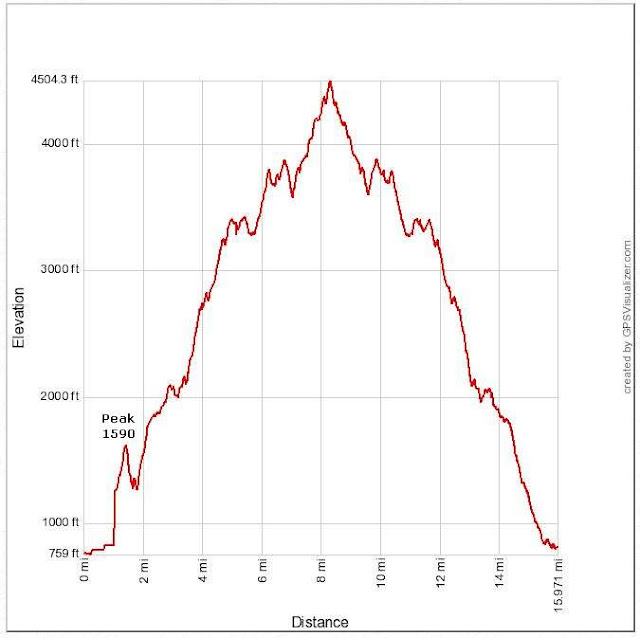
Distance: 16 miles round trip on road, trail, and use trail
Summit Elevation: 4510' (Los Pinos), 1590' (Peak 1590)
Prominence: 610' (Los Pinos)
Elevation Gain: 5423'
Elevation Gain (in Empire State Buildings): 4.33
Round trip time: 9 hours 15 minutes
Recommended water: 192 oz.
Parking/Fees: Adventure Pass
Difficulty: Strenuous
It had been a long time since my last grueling training hike, so I lined up Los Pinos Ridge in the Santa Anas. I need to do high mileage/gain from time to time to stay in the game, both physically and mentally. This hike, with a bonus peak at the start and almost 1000' of gain on the way back, was a firm test. It is best to do this one before it gets too hot because the ridge seems to reflect and magnify heat. There was very little shade and no water. The major ups and downs reminded me of the main trail to El Cajon in San Diego county, just bigger. It is easy to underestimate this hike.
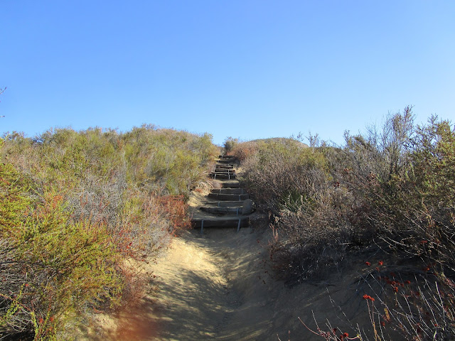
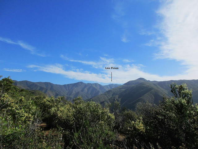
The hike starts at the San Juan Trailhead off Ortega Highway. The Los Pinos Trail starts about half a mile up Hot Spring Canyon Road in the private in-holding of Lazy W Ranch, just past the archery range. Technically, you need permission from the Lazy W Ranch to use their road to get to the Los Pinos trail. I called their number on the way (949-728-0141) and the person I spoke with was very nice about granting access. They don't really care who hikes the trail, but want to be informed. Jerry Schad listed this ridge in his Afoot and Afield in Orange County book as a 10 mile one way trek starting from Blue Jay Campground, over Los Pinos, then descending the ridge. He gave the one way descent his toughest difficulty rating. Schad's write up mentioned that the trail was overgrown, but it was mostly clear except in a few spots. I walked through the Lazy W not seeing anyone and headed up the signed trail. In less than a mile, I reached a saddle where a use trail on the left went to Peak 1590. I decided to do this first, knowing I would not feel like the side trip on the way back. I dropped my pack, taking only a pencil in case there was a register in need of one. I ascended the good use trail about 350' to the summit where I found no register or marks. From the summit of 1590, I could see Los Pinos far up the canyon and knew I was in for a grind. Once I got back on the Los Pinos trail, I noticed some inspirational signs probably placed by the camp. The signs disappeared near the top of the first bump. The ridge trail rolled up and down, then through an overgrown grassy field before reaching the first of three major bumps. I picked up dozens of fox tails from the grass and had to step carefully in case any vipers were in my path. None were. The trail that switchbacked up the major bump looked very overgrown so I took a steep, direct use trail instead. I continued up the ridge to the peak where the ridge turns west. Just after the turn, I stopped for a break and dropped a water cache for the return trip. Half way to Los Pinos, I was already drenched in sweat and tired.
During my break, I noticed a tick on my leg, not yet attached. I ended up killing three ticks before the day was over. The next part of the trail led up to the most prominent bump at 3907'. On the other side, it dropped more than 300' to a saddle before going up again. The constant up and down was a mental drain, giving up gain, then climbing again, over and over. Finally, the end was in sight. I had three minor bumps to overcome to get to Los Pinos. I don't know if it was the heat, but I felt a half-step slow all day. When I reached the summit, I signed the register. I planned to finish the sandwich I brought, but there were a lot of flies on the summit, so I decided to descend to the first attractive boulder and eat there. Along the way, I started feeling overheated. It was killing my appetite. I found a small bit of shade and forced most of the sandwich down before going on. In addition to the 3 major bumps on the way back, there were 4 minor bumps, and several I didn't count. I humped it over the major bumps and rested again at the water cache. I checked my thermometer and it read 90 degrees. It was at least 5 degrees above the expected high in Rancho Santa Margarita. Heat reflection. I took time to clean out my shoes and continued the descent. I was glad I had done Peak 1590 at the start. It was a relief to get back to the car. This was my third and toughest summit of Los Pinos in Orange County. I had now climbed it along all three major ridge lines, completing the "Los Pinos triad": the West Ridge (standard route), Bell Ridge, and Los Pinos Ridge. It was a nice day and a great training hike despite the suffering -- although I guess that was the point.
Other reports:
Pinos Ridge (Mountaineering Review)


No comments:
Post a Comment