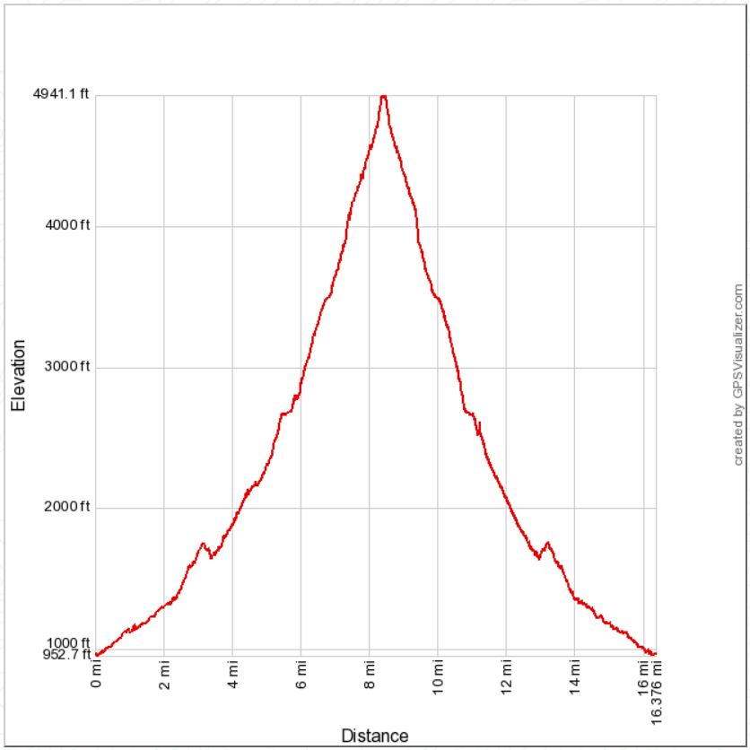
Distance: 16.4 miles round trip on trail and cross country
Summit Elevation: 4957'
Prominence: 637'
Elevation Gain: 4681'
Elevation Gain (in Empire State Buildings): 3.8
Round trip time: 10 hours 30 minutes
Recommended water: 204 oz.
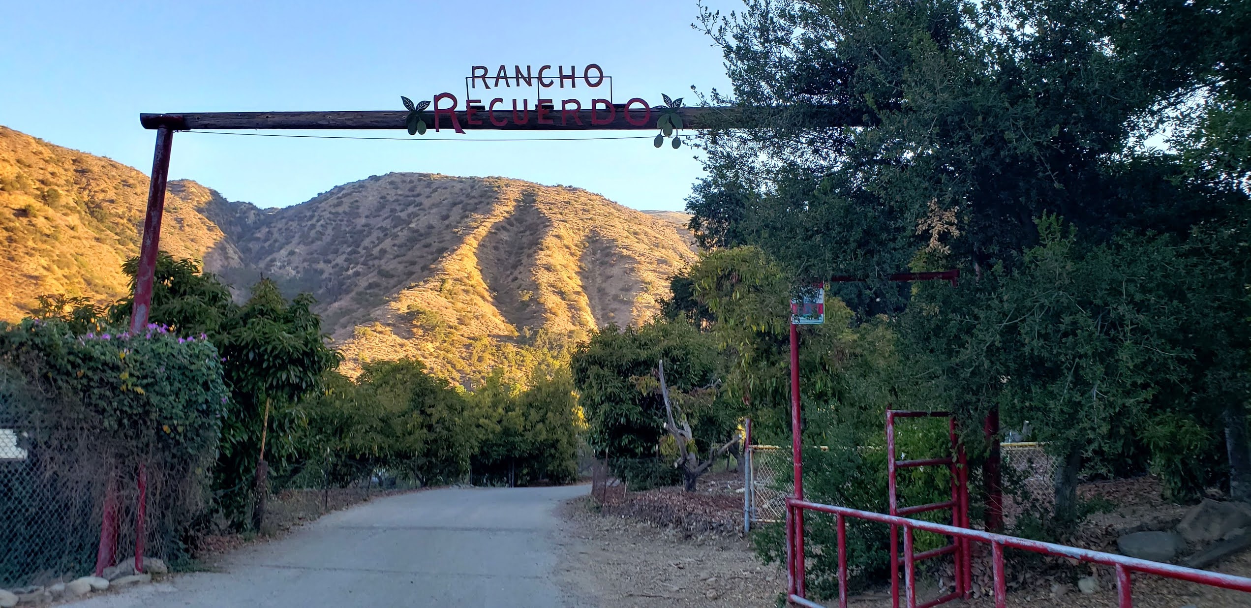
Parking/Fees: Free at Santa Paula Canyon Trailhead on Ojai Road
Difficulty: Strenuous
Santa Paula Peak (LPC #1) has been suspended from the Sierra Club Lower Peaks List for years. The main route went through farmland on private property and was shut down, allegedly as a health safety precaution. The alternate route was challenging, along the Santa Paula Creek East Fork, using an abandoned trail from the canyon to Santa Paula Peak. While it remains officially suspended, Peakbagger re-listed it, which was enough motivation for me to make the attempt.
My first attempt was on 5/28 and I forgot to load a GPS track, resulting in multiple navigation errors. I ran out of time and water the first time, turning back 500' below the summit -- farther away than it sounds. I learned from the first attempt and came back with multiple GPS tracks and hard won knowledge of most of the route. Navigation was difficult even with a GPS. There are three distinct sections of this hike. The first is an easy 3.5 miles and 700' climb to Big Cone Campground on a well maintained trail. There are several stream crossings along the way with plenty of shade until you leave the canyon. I dropped a water cache at Big Cone and continued up the East Fork of Santa Paula Creek.


The second section was the East Fork of Santa Paula Creek, roughly 3 miles and 1400' of wild canyon with an occasional use trail. While marked with ribbons and infrequent cairns, it was still easy to get off track. Parts of the East Fork can be difficult if you lose the use trail. Half a mile past the campground, I startled a bear bathing in one of the pools. The creek was noisy so it probably didn't hear me until I was close. It scampered up a gully, turning to watch me a few times before disappearing behind a boulder. I was glad it didn't run directly up canyon. At one mile past the camp, I ran into a lot of deadfall. Further up, light scrambling blended with bushwhacking was needed. There might be three ways to get around an obstable and it was important to choose the one that required the least energy. The reason is once you exit the canyon, you still have 2000' of gain to go. Every step got harder.


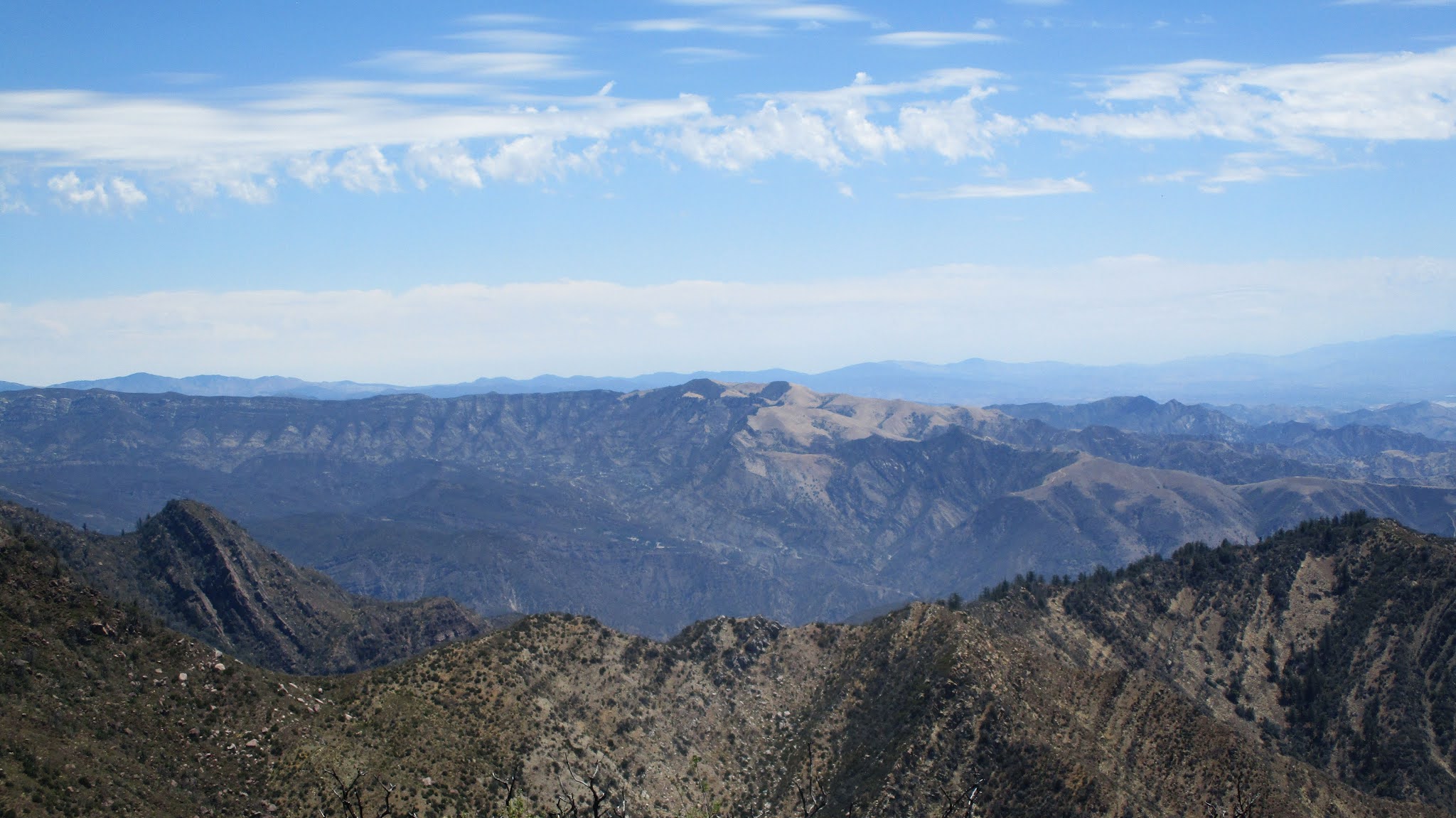
The last section goes from the upper canyon to Santa Paula Peak. The lower part of the unmaintained trail was criss-crossed with animal trails that were just as viable. There was also some ribbon branching away from the main trail; one branch is supposed to go to Cienega Campground. I followed some short switchbacks and two long ones, avoiding more deadfall and poison oak. The most recent reports described a long stretch of the upper trail as completely washed out. The Peakbagger report from Richard Luher mentioned a cross country shortcut he took to bypass the washout on the way down. I decided to take his shortcut both up and down. It was 300' up a 45 degree talus slope. With aid from a few trees, I bear crawled up the slope until I met the trail again. Since I didn't see the washed out part of the trail, I don't know if it was a good decision. I continued along the upper trail through dense and flowering poodle dog with unavoidable contact. Soon, I emerged at the north saddle with fantastic views. The trail wound around the east side of the mountain and climbed the east ridge. I had chosen the coolest day in the last two weeks for this attempt but still started to foam in the heat. The summit had the foundation of an old lookout tower. I found the slightly battered benchmark intact, and also an unexpected memorial to someone named Ned Treuenfels. Didn't find a register. The payoff in scenery was worth the struggle. I looked down over Camarillo and Oxnard to the Pacific Ocean. Santa Paula Canyon was far below. The inner sanctum of the Los Padres was spread out to the north. I spent 20 minutes enjoying the summit before starting the descent. It was six hours up, four and a half down. The scabs and bruises will go away. The memories won't.


Would you like to know more...?
Congrats. Good adventure. Did you see a bear on the 2nd attempt as well as the 1st attempt?
ReplyDeleteMadison,
DeleteI was alert along that part of the canyon, but no signs of the bear the second time. All the photos until I left the canyon were from the first trip and that saved me time on the second trip. My friend Ben Baumann saw a bear and a cub near the same place when he did the hike in January. I am guessing the same bear. There were piles of bear scat on the trail going up Santa Paula, some old, some fresh. Just north of the peak is a whole section of Los Padres labelled Bear Heaven.