Distance: 0.8 miles round trip cross country
Summit Elevation: 8603'
Elevation Gain: 495'
Elevation Gain (in Empire State Buildings): 0.4
Round trip time: 1 hour
Recommended water: 16 oz.
Parking/Fees: Free on Bear Butte Road
Difficulty: Easy
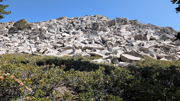
We got back from Givens around 3 PM. I couldn't talk Leisa into making a run for Bear Butte, a short cross country romp from the nearly dirt road. In addition to tagging the peak, I wanted to fly an air mission with a view to Huntington Lake. This one would be solo. It was a short drive to Bear Butte Road, the same road that leads to the trailhead for Rancheria Falls. I drove past the trailhead up two more switchbacks, then started looking for a place to park. I found a small turnout on the opposite side of the road north of the peak. From my parking spot, I started cross country over fallen trees and knee high shrubs. I went over a boulder field, more shrubs, and a second boulder field. Both fields were class 2 with a little route finding. The summit had no marks and no register. It did have three massive hooks in the rocks no longer in use. Someone had scratched out "KIEL 07" on one of the boulders. A single 6' pine tree was growing near the summit. I suspect someone planted it, but I guess a mysterious wind could have dropped a seed there. Really nice view of Huntington Lake and Kaiser Peak. I made a couple of passes with the drone, then packed up and descended the same way. I got back to the cabin well before dinner.


No comments:
Post a Comment