Thursday, June 12, 2025

Little San Gorgonio and Wilshire Mountain

Hiked: 6/11/2025
Distance: 9.5 miles round trip on dirt road, use trail, and cross country
Summit Elevation: 9133' (Little San Gorgonio), 8832' (Wilshire)
Elevation Gain: 4461'
Elevation Gain (in Empire State Buildings): 3.5
Round trip time: 8 hours 40 minutes
Recommended water: 132 oz.
Parking/Fees: $5 Adventure Pass or Annual Pass
Difficulty: Strenuous

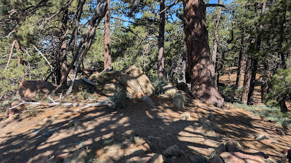
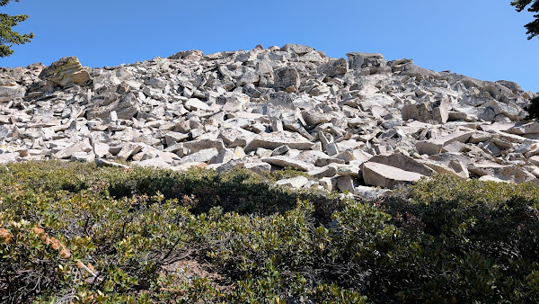
Little San Gorgonio (HPS #28) is one of many peaks on Yucaipa Ridge. It's also one of two peaks I failed last year (the other was Palo Verde and that wrong was righted). Wilshire Mountain (HPS #36) was my bonus goal, based on time and resources. Temps were warm, and I doubted any lingering show was hiding in the shadows of the northern slopes, but I took microspikes just in case. I got my online day hike permit and set out from the Vivian Creek trailhead around 6:30 AM. There were only two parking spots open when I arrived. I took the same gully shortcut as my first trip and transitioned to the major drainage feeding Mill Creek. Instead of frozen puddles, a trickle of water was flowing. I left the drainage and faced the steep (45-50%), loose dirt gully. I stayed right as I ascended, using trees and brush to assist. Even large rocks on the slope were mostly unstable and I didn't trust them. Above the first gully, the route to the ridge over a boulder field was well marked with cairns. Once on the ridge, there was a use trail that ran mostly along the south side toward Wanat Peak.


Shortcut


Obstacles


Wanat Peak

During the side hill traverse under Wanat Peak, I lost the use trail. There were three gullies to cross to reach the saddle below Little San Gorgonio. I went too high on the traverse which made it more difficult and dangerous with no upside. I did a little better on the way back, but was never sure I was on the use trail. The final march up the burned ridge was on a well defined use trail and a relief. Views were splendid. Both San Gorgonio and San Jacinto loomed large. There were no marks. I found a pair of register cans, but no register inside. It needs a new register. After some photos, I felt like I had enough motivation and provisions to go for Wilshire Mountain.

Final push to Little San Gorgonio


Summit, San Jacinto behind

Big San Gorgonio


I started along the ridge, reaching an unnamed bump filled with radio towers and scientific equipment. There was a sign noting the land and equipment were private property to discourage vandalism. The unnamed bump was the terminus of a rough bulldozed road. Since Wilshire was the next big bump, I stayed on top of the ridge, crossing the road a few times. I didn't have a precise GPS location for Wilshire, but eventually, I stumbled on a clearing with a couple of registers. The original nested cans had been smashed and were hard to open. It held a couple of old registers. A newer can had a fresh register going back to 2023. An 8' class 2 boulder was the high point and was dutifully climbed. I took a longer break on Wilshire, emptied my boots of debris, and prepared to return. It was about 400' up getting back to Little San Gorgonio. The descent toward Wanat went quickly, the traverse went slowly, and my pace remained slow dropping down the final slope. I took a couple of unplanned butt slides on the slope, triggering impressive rock slides below. When I got back to the stream, I took off my boots and cooled my feet in the water. It was a welcome respite from the warm afternoon sun. I cruised back on the same route, feeling worked. I wanted a difficult hike and Little San G scratched that itch and then some.


Looking back at Little San G

Wilshire Mountain summit


Summit block


Mill Creek below


Friday, June 6, 2025

Hexie Mountains High Point

Hiked: 6/4/2025
Distance: 9.1 miles round trip cross country
Summit Elevation: 4759'
Elevation Gain: 1300'
Elevation Gain (in Empire State Buildings): 1.0
Round trip time: 4 hours 35 minutes
Recommended water: 80 oz.
Parking/Fees: $35 National Parks Fee or Annual Pass
Difficulty: Easy

The Hexie Mountains are a small range in the western part of Joshua Tree. It's isolated from most park traffic since it's past the end of Geology Tour Road. I drove about 2 miles south of Geology Tour Road and parked on the side of Berdoo Canyon Road. High clearance was needed and I used 4x4 for deep sand, likely overkill. The first two miles were open desert. I eventually dropped into the main ascent gully. While there were no trails, I did see human footprints in the sand. The gully had a lot of twists and turns and some interesting black and white volcanic rock. The only obstacles were cactus and catclaw, but there was always and easy way around. I hit a couple of small dry falls (<10'), but they could also be easily bypassed. It amazed me how gentle the gully was that got me within a few hundred feet of the summit. The angles were so slight that it felt like I was walking on flat ground most of the time. The summit had no benchmark, but there was a register in a glass jar inside a painted can. The register appeared to be placed by Bob Burd in 2010. There were only a couple dozen parties that had signed in since then. I was the second visitor this year. Nice 360 views of this part of JT. The only animals I saw were enormous jack rabbits. Enormous. One was almost coyote sized. Of course, it was gone before I get a photo. While I usually prefer more challenging adventures, I had a great time on this leisurely hike in the desert. Despite being 9 miles of open desert, it didn't really rise to the level of a Moderate outing. The only thing that might have been tricky was finding the truck on the way back. There weren't many landmarks and I could only see the truck when I was within 500' of it. Without GPS, heading for Little Berdoo Peak on the horizon would have gotten me close. Keep navigation in mind if you go without a GPS.


Entering the gully


Easy bit of class 2 that can be bypassed


Summit


Sunday, June 1, 2025

Old Iron Mountain

Hiked: 5/27/2025
Distance: 0.4 miles round trip on dirt road
Summit Elevation: 5903'
Elevation Gain: 83'
Elevation Gain (in Empire State Buildings): 0.1
Round trip time: 10 minutes
Recommended water: 0 oz.
Parking/Fees: Free on Mormon Emmigrent Road
Difficulty: Easy

After Iron Mountain in El Dorado County, I had extra time since Mormon Emigrent Road was paved, so I drove a couple miles further to pick up Old Iron Mountain. This one also had a dirt road going to the top. This time, I left my pack in the truck and started a slow jog up the road. The summit was unimpressive. No benchmark, no register and minimal views. It did have a couple of grave markers of interest. One was a grave stone for Baby Girl, deceased 2023. I guessed Baby Girl was a dog, but I did no digging to confirm. The other marker was for Freedom. No death date on the marker, circa November, 2024. I jogged back to the truck and called it a day.

Summit


Here are a couple bonus photos of the lake:

Iron Mountain El Dorado County

Hiked: 5/27/2025
Distance: 1.3 miles round trip on dirt road
Summit Elevation: 6241'
Elevation Gain: 315'
Elevation Gain (in Empire State Buildings): 0.2
Round trip time: 45 minutes
Recommended water: 0 oz.
Parking/Fees: Free on Mormon Emmigrent Road
Difficulty: Easy

We had a week long family reunion at Lake Tahoe. I took off one morning to pick up the Iron Mountain in El Dorado County, about a 2 hour drive southeast. There wasn't much info on it, but it was close to a drive up. From highway 88, I took Mormon Emigrent Road and parked at the start of a dirt road that headed up the mountain. Mormon Emigrent Road was paved, at least as far as I went. It was a short hike and I could have done it without my pack, but since I dragged it up here, I took it. I followed the road about half way, then left it for open country. This Iron appeared to be part of a lumber operation and most of the trees had been cut and removed. The summit had a small rock in the middle of the wasteland. Views were so-so. After the summit, I wandered over to the abandoned fire lookout where only the foundation remained. It looked like there used to be a benchmark at the lookout, but it was missing. I took a more direct route back to the truck.

Twilight on Emerald Bay

Snow on Mormon Emigrent Road


Starting toward Iron, the fire lookout is the bump on the left

Barren summit

Fire lookout remains