Route: DPS Route C
Distance: 9.6 miles round trip on trail
Summit Elevation: 3848'
Prominence: 2339'
Elevation Gain: 3173'
Elevation Gain (in Empire State Buildings): 2.5
Round trip time: 8 hours
Recommended water: 132 oz.
Parking/Fees: Free on Arlington Mine Road
Difficulty: Strenuous
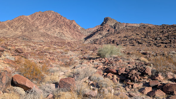
My goal for the day was the Palen Mountains High Point (DPS #85). I was uneasy attempting this solo, due to the combination of a long approach on a rough dirt road, difficult terrain, and isolation. It was too far from home for a day trip. Instead of driving up the night before, I decided to leave at 2 AM, drive to the trailhead, climb it, then spend the night in Blythe. To get started, I drove up Midland, then took Arlington Mine Road. It got rougher the further I went, eventually hitting deep sand and rocks. High clearance was necessary, 4WD recommended for the sand. When the road conditions slowed me to 5 mph, I parked since I wasn't saving much time. I had also been driving for 5 hours. I parked about 1.5 miles before the wilderness boundary. I planned to use DPS route C (gully route) since there was a full bighorn skull along the way. I hiked the road until it descended into a wash, then went over a small rise and skirted the larger wash to the east. As I got into the eastern gully, I met the famous pink boulders, cheerful pastel companions most of the way.
More than half way up, I hit one class 3 dry fall that could not be bypassed. There was a ramp on the right side that let me get most of way up before having to scramble. There was enough catclaw to pay attention to route details. Despite that, I came home with my share of scratches. Alex Obbard had marked a waypoint where a bighorn skull could be found (I included it in my GPX, too). It was impossible to miss, mounted on top of a large boulder. Below the skull were other remains: a couple of legs, hips, and the spine. Looked like the bighorn skeleton had been there a long time. There were bits of use trail I could make out once in a while. One went around a difficult section of the upper gully. When I reached the ridge, there were only a couple of rocky obstacles between me and the summit. There was solid class 3 scrambling on the ridge, with a modicum of exposure. The longest scramble was the final one to reach the summit, though I later found an easier way down. An ammo box held the old, but sturdy, register (circa 2000). It was less than half full. Palen only gets a handful of parties each year, though I was the second already for 2025. The benchmark was stamped "Red Top", and the official topo maps use the same name. I'm not sure when the Palen Mountains were named. The summit was small. The views in all directions were rewarding. I flew the drone a little, then started down. The descent in the upper gully was at least as slow as coming up. It got easier past the dry fall, but I didn't relax until I was back on the road.


Glad to see the skull is right where I left it! When I came across it in 2023 it was down under some brush in a crack between some boulders. Not usually one to mess with nature but in this case I felt like being perched on boulder was a more dignified resting place for a desert monarch of that size.
ReplyDeleteAnonymous,
DeleteI had read about the skull and kept my fingers crossed that I would find it. I'm glad you put it on that perch. Definitely the largest bighorn skull I've seen and most of the skeleton was nearby. One of many highlights on one of my favorite desert mountains.