Friday, January 31, 2025

Loma Alta

Hiked: 1/29/2025
Distance: 3.3 miles round trip on trail
Summit Elevation: 1073'
Elevation Gain: 600'
Elevation Gain (in Empire State Buildings): 0.3
Round trip time: 1 hours 15 minutes
Recommended water: 16 oz.
Parking/Fees: Free on Jacks Peak Road
Difficulty: Easy

I spent the week in Monterey, CA with my wife who was there for a conference. I was able to work in a short hike to Loma Alta, the high point on the Monterey Peninsula. This peak was #295 on the California Coastal Peak list (not a Sierra Club list). I drove almost to the top in Jacks Peak County Park. A round trip was possible in less than a half mile, but I extended it by hiking a loop on the extensive local trail network. It was cold, cloudy, and views from the summit were blocked by tall pines and oaks. The trails were wide and smooth. After returning to the starting point, I descended down the Iris trail, intersected the Rhus trail, then took the Pine trail back along the side of the road. I jogged most of the uphills to get the blood pumping. The best views of Monterey Bay were from the Pine trail, but even those were quite limited. It wasn't much, but it got me outside for a while.


View from the topo BM

Loma Alta summit (aka Jack's Peak)


Best view of the Bay

Friday, January 24, 2025

West Ord Mountain

Hiked: 1/22/2025
Distance: 3.3 miles round trip cross country
Summit Elevation: 5525'
Elevation Gain: 1500'
Elevation Gain (in Empire State Buildings): 1.2
Round trip time: 2 hours 30 minutes
Recommended water: 48 oz.
Parking/Fees: Free on OM113A road
Difficulty: Easy

West Ord was the third peak of the day. I followed Kathy Wing's GPS track (thanks!) that included the hard to spot dirt road leaving highway 247. The road was not in great shape and high clearance was needed at a minimum. I parked at the cattle guard and walked over it to get around a barbed wire fence. I angled for the low part of the ridge, then followed it up and over the first bump. I continued up, unsure of where the summit was. In fact, the summit remained well hidden until I was nearly on top of it. GPS was helpful on this one. The open desert had few obstacles, but I carelessly kicked a cactus and my right shin went numb for about 10 minutes as I plucked out the needles. After climbing a second bump, I hiked across a mostly level section, up to the highest saddle, then south to the rocky knob that was West Ord. A wooden pole marked the top, and an old, fragile register was in a pair of cans. I spent a few minutes looking for non-existent marks, then took roughly the same route down. Of all the Ords, East Ord remains my favorite. None of the peaks this day were particularly challenging, but they added up to a pleasant day in the desert.


Summit


Truck below


Thursday, January 23, 2025

Sidewinder Mountain

Hiked: 1/22/2025
Distance: 2 miles round trip cross country
Summit Elevation: 5273'
Prominence: 1473'
Elevation Gain: 1363'
Elevation Gain (in Empire State Buildings): 1.1
Round trip time: 2 hours
Recommended water: 48 oz.
Parking/Fees: Free on 4WD dirt road
Difficulty: Easy

Sidewinder was my second peak of the day. From the wash boarded Lucerne Valley Cutoff road, I took an unnamed (as far as I can tell) dirt road near Benchmark 3276. The road used to lead to guzzlers, but I did not see a standing guzzler on the drive in. I drove to the end of the road in 4x4 mode. I'm not sure I needed it, but there were some rocks and unevenness. The last 500' were the worst. The only other vehicle parked there was an offroad 4-seater. No one was there when I started. I began heading up the ridge by the parking area, though I saw use trails crossing the dry creek, heading to a different ridge. At the top of the first hill, I could visualize the rest of the route, though only a false summit was visible. Black volcanic boulders littered the grassy ridge. A steady 20mph wind picked up and was an unwelcome companion all day. The route was very steep in places, but the grass kept things firm. I was able to follow a faint use trail all the way to the top, where there were a couple of class 2 moves. Views were quite nice from the summit. I found two reference marks, but could not locate the main benchmark. I signed a small register that went back to the 1990s. It was loose in a jar, so I wrapped it in a ziplock before putting it back. It was another short hike, but I worked up a lather. When I got down, there was guy packing up stuff in the offroad 4-seater. We chatted for a minute. He was quite impressed that I had reached the relatively easy Sidewinder summit. He was a hunter, looking for some kind of bird I didn't recognize. Oddly, he was also from the OC. I was on my way around 11:00 AM, giving me a shot at my bonus peak, West Ord Mountain.

Target practice on a Benz

Offroad vehicle at the end of the road


False summit

Class 2 near the top


Iron Mountains 3065

Hiked: 1/22/2025
Distance: 1.1 miles round trip cross country
Summit Elevation: 3065'
Elevation Gain: 450'
Elevation Gain (in Empire State Buildings): 0.3
Round trip time: 45 minutes
Recommended water: 0 oz.
Parking/Fees: Free on Hillview Truck Trail
Difficulty: Easy

Another Iron Mountains High Point, BLM land in San Bernardino County like the one I did earlier this month. The drive in was on very good dirt roads, high clearance and 4x4 not needed. This Iron Mountain was the easiest by far and had nothing unique about it to recommend. Low angle open desert with volcanic rocks. It's situated east of Barstow and was on nobody's to do list (except Bob Burd, of course). I visited because it checked another box on my Iron Mountains in California list. It was very cold to start, 27F. There was a fallen radio antenna on top, and a fallen wooden marker that I stood back up. No register, no marks. On the way down, I found an empty desert tortoise shell. I've never seen a live desert tortoise in the wild. That would be something.


Summit


Tuesday, January 14, 2025

Cranes Peak, Peak 1540, Peak 1340

Hiked: 1/13/2025
Distance: 4.5 miles round trip on trail and cross country
Summit Elevation: 1054'
Elevation Gain: 1295'
Elevation Gain (in Empire State Buildings): 1.0
Round trip time: 2 hours 15 minutes
Recommended water: 32 oz.
Parking/Fees: Free at South Clevenger Trailhead
Difficulty: Easy

Looking for a quick hike that wasn't too far away, I stumbled on Cranes Peak in Escandido. Several PB reports showed ascents from the side of highway 78, but John Strauch reported going up the Clevenger South trail, then descending along the ridge. I thought that made the trip more interesting, so I downloaded his track. The parking lot for the trail can hold about 10 cars. I made great time up the switchbacks to the official end of the trail at Peak 1540. I looked for any kind of use trail from there, but found nothing, so I went down on the trail to a point where I could see a way to point 1423. I left the trail in knee high grass and dropped into a gully, before pushing through some soft plants up to 1423. I don't know why, but I expected the brush along the ridge to be sparse where I could go around most of it. Instead, I was walking through waist high grass and brush, poking my hiking stick in front of me every step to scare off snakes. On the way to Peak 1340, (the topo marks it 1360), there were some thin spots and animal trails that made it go a little easier. However, getting down to Cranes involved more deep grass and light bushwhacking. While the physical effort merited an easy rating, be aware of the brush involved. It was a short, but steep, 100' gain from the saddle up to Cranes Peak. There were nice views down San Pasqual Valley, sprawling orchards, and San Pasqual Academy below. There was no benchmark or register. I had no desire to bull my way back up the ridge, so I decided to climb down to highway 78 and return along the road. I walked/jogged my way back to the amusement of the motorists zooming by.


Peak 1540

Looking back at the trail and Peak 1540 from the ridge

Peak 1340


Looking up at Cranes Peak


Down the gully to highway 78


Tuesday, January 7, 2025

Iron Mountains High Point

Hiked: 1/5/2025
Distance: 9.7 miles round trip cross country
Summit Elevation: 3309'
Elevation Gain: 2706'
Elevation Gain (in Empire State Buildings): 2.1
Round trip time: 7 hours
Recommended water: 112 oz.
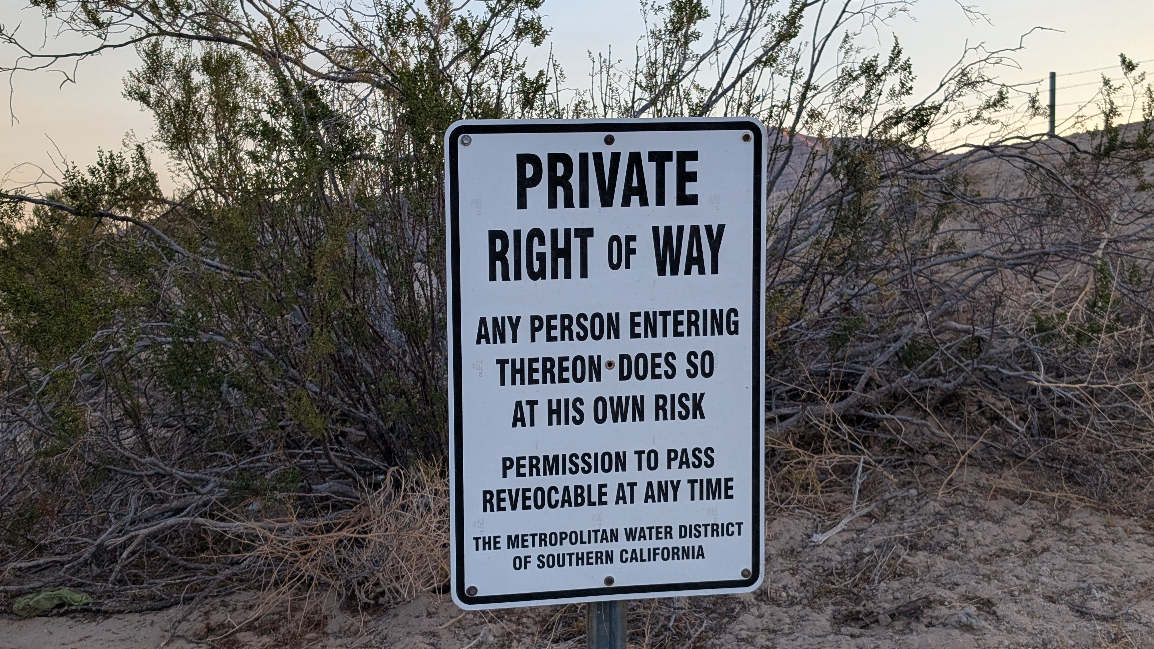
Parking/Fees: Free on West Iron Portal Road
Difficulty: Strenuous

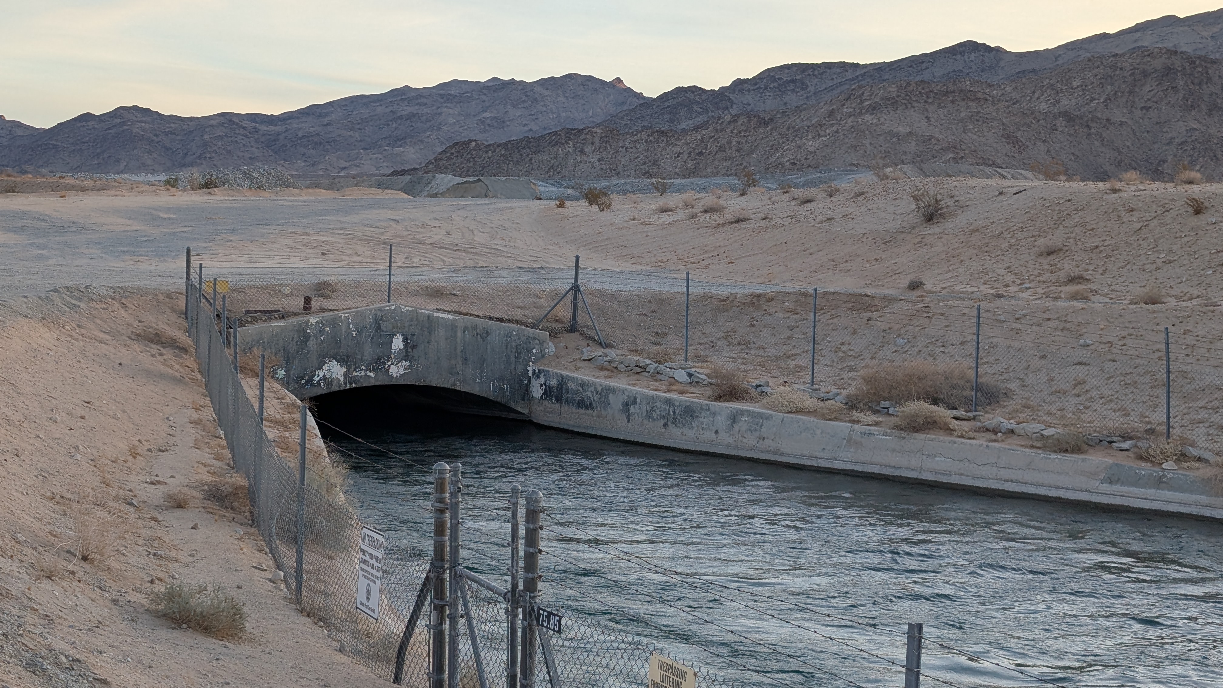
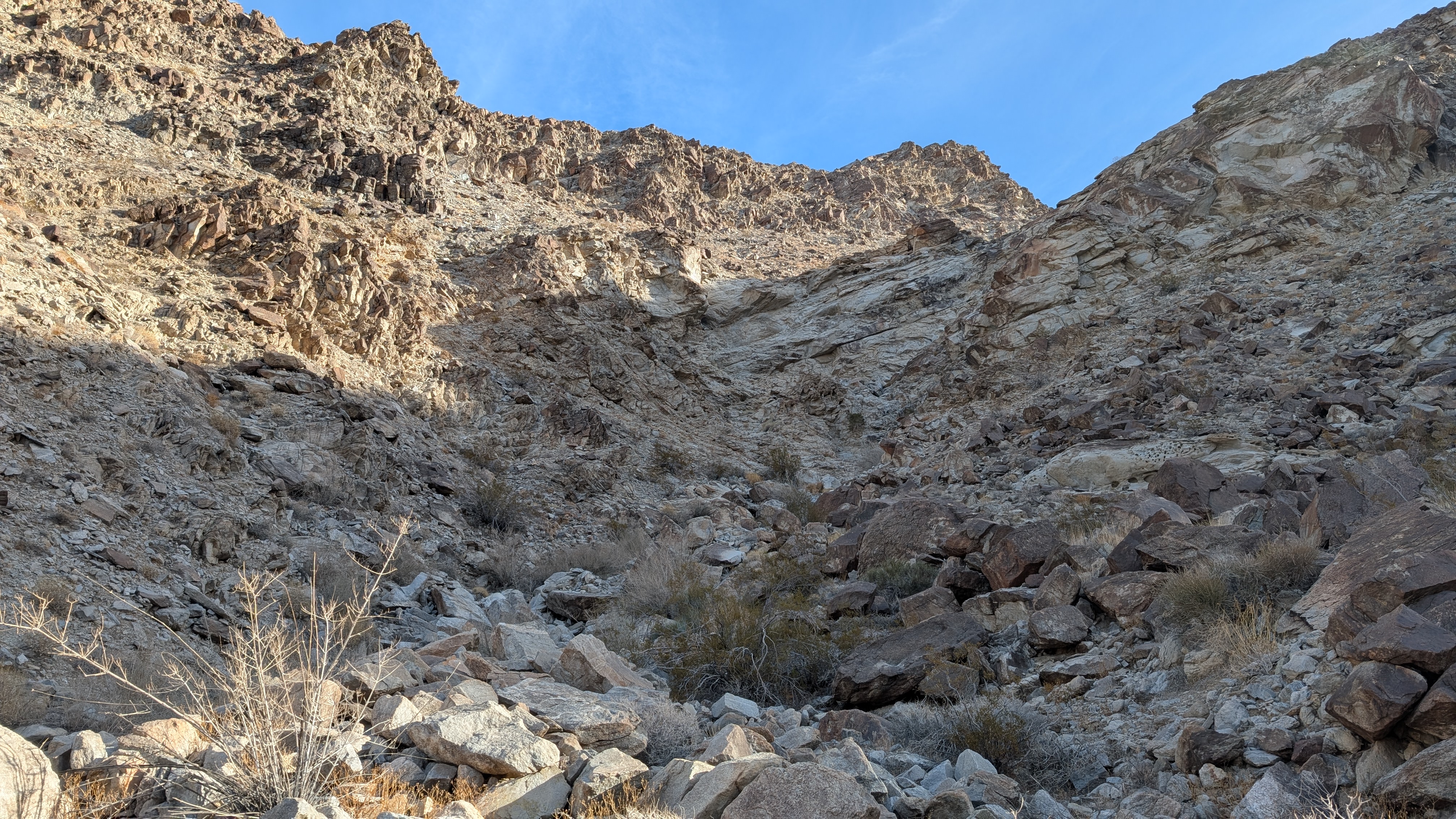
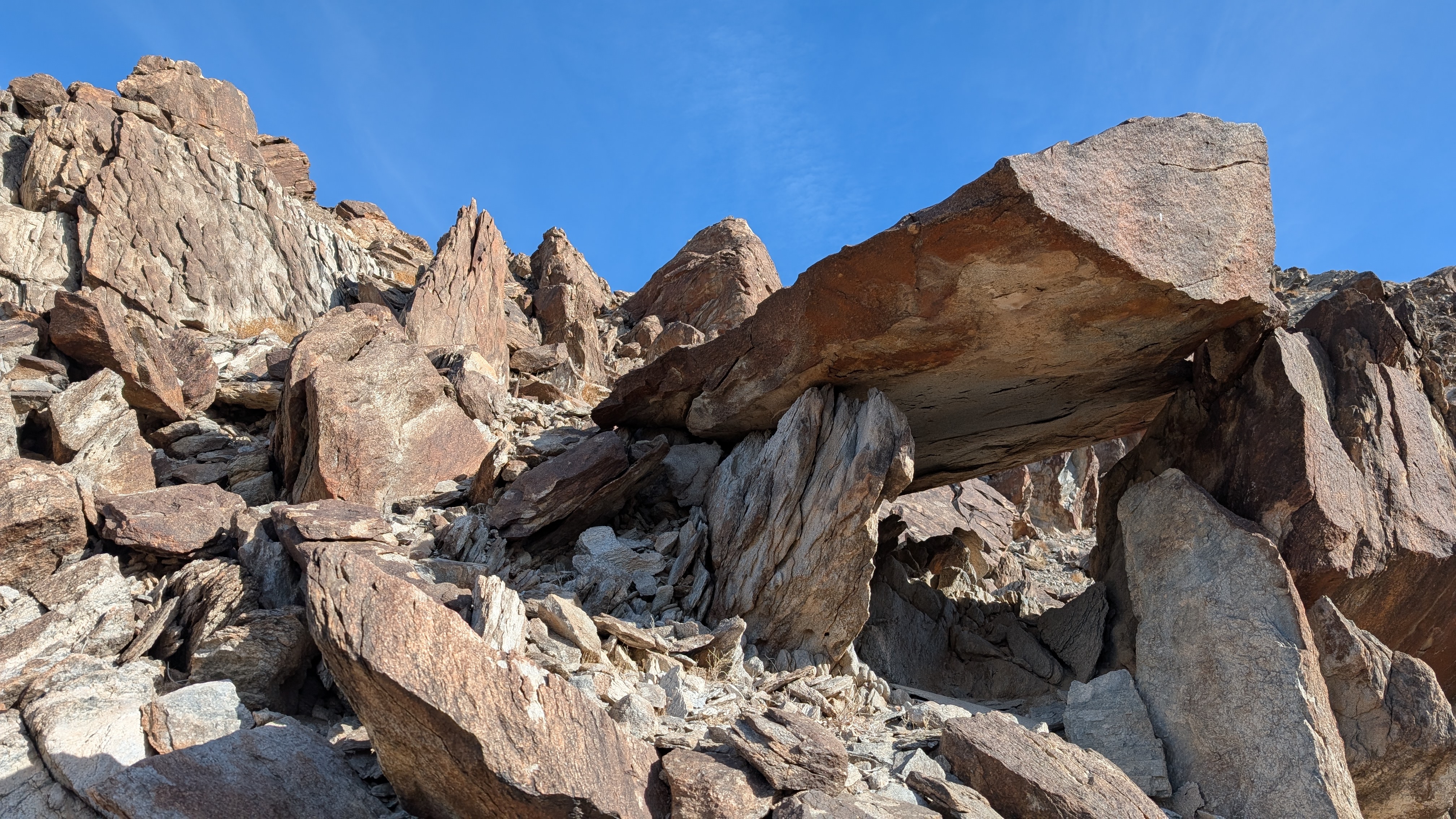
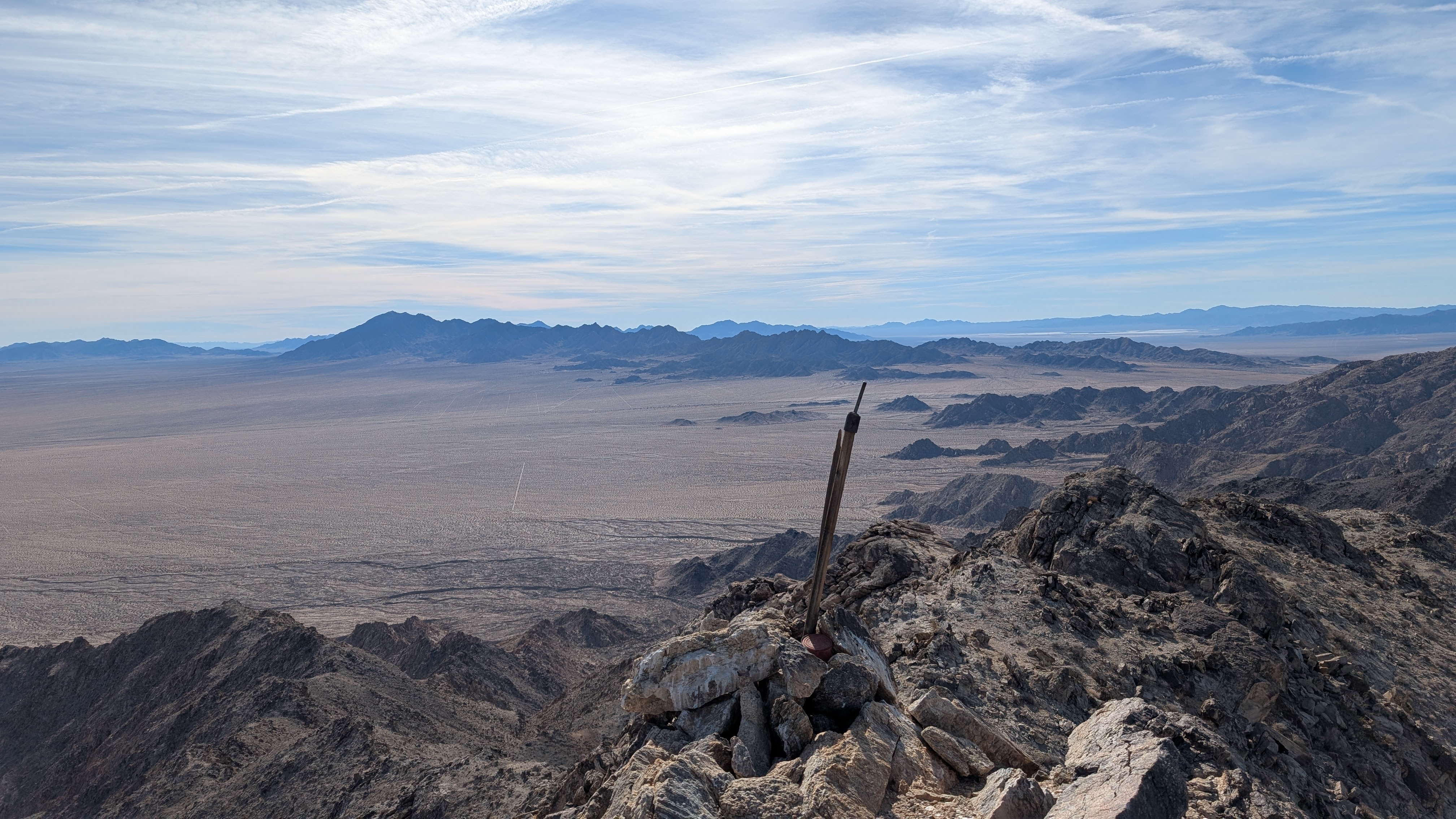
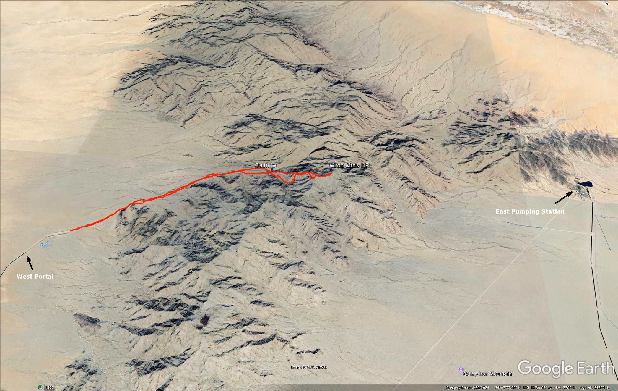
To kick off 2025, I headed to the small Iron Mountains range northeast of Joshua Tree. One of my ongoing side projects was to climb all the "Iron" Mountains in California. This range was unique in that a 7+ mile tunnel runs under it as part of the Colorado Aqueduct system. It delivers water from the Colorado river to Lake Mathews in the Inland Empire. A pumping station on the east side pushes water up and through the Iron Mountains. The tunnel runs just north of the high point and exits at the West Portal. I started at the end of the dirt road alongside the aqueduct on the west side. The road was signed as private, but open to use. It was very smooth and I was able to cruise at 30-40 mph to the end.


West Iron Portal

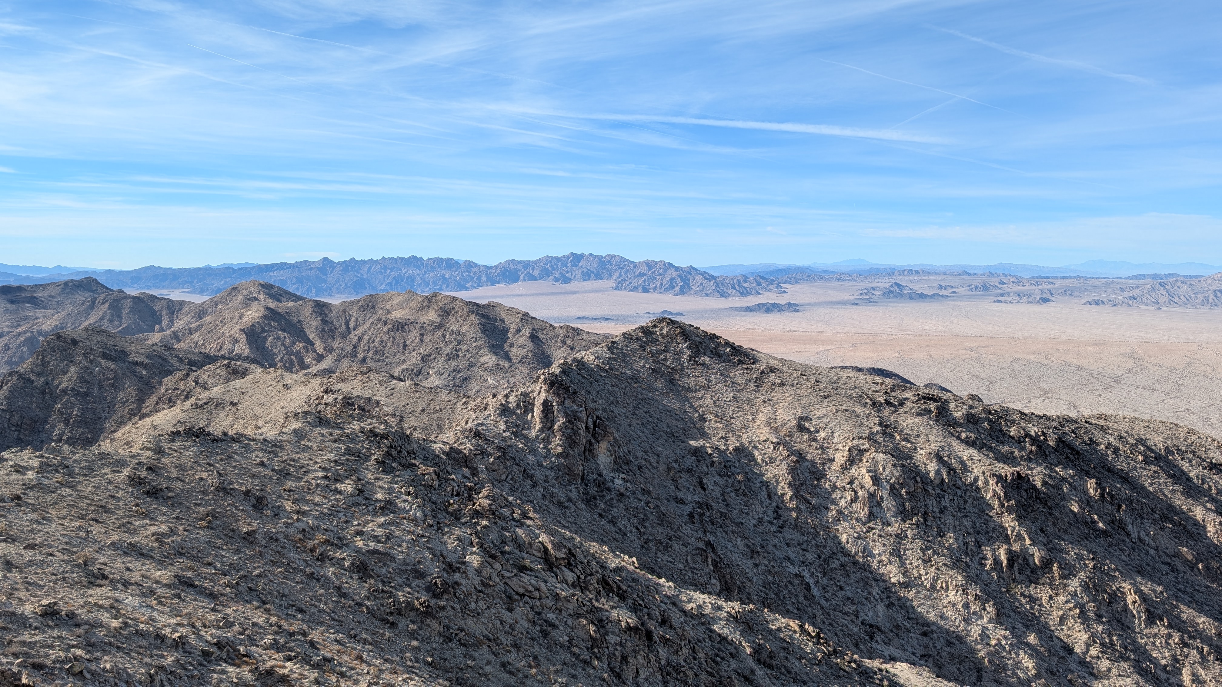
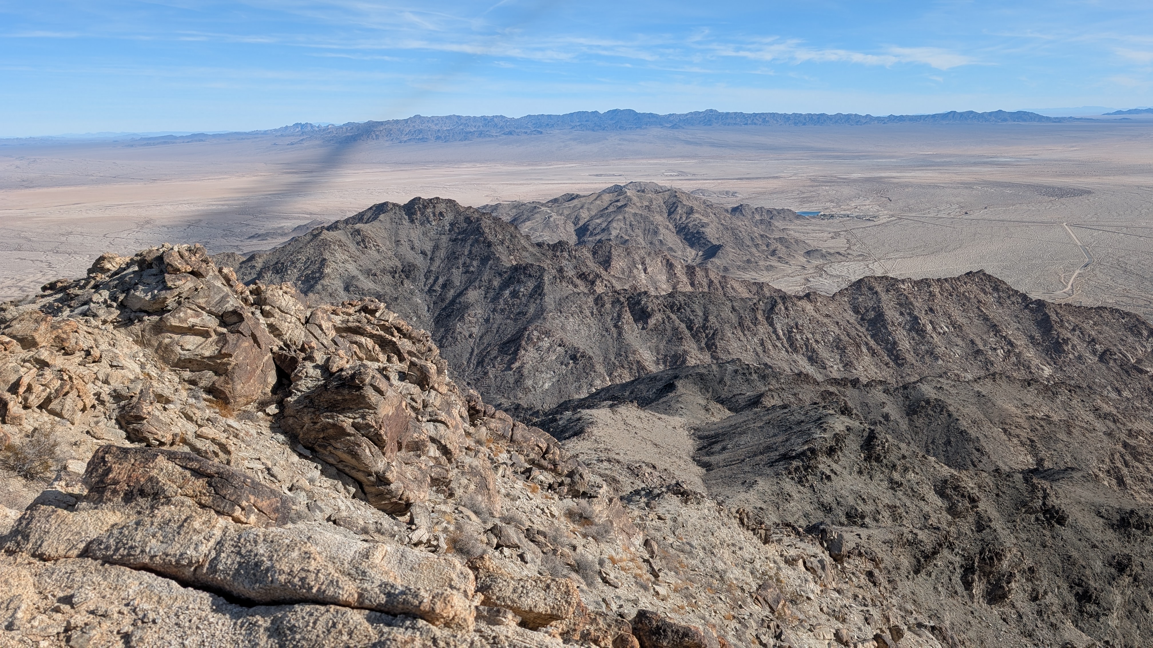
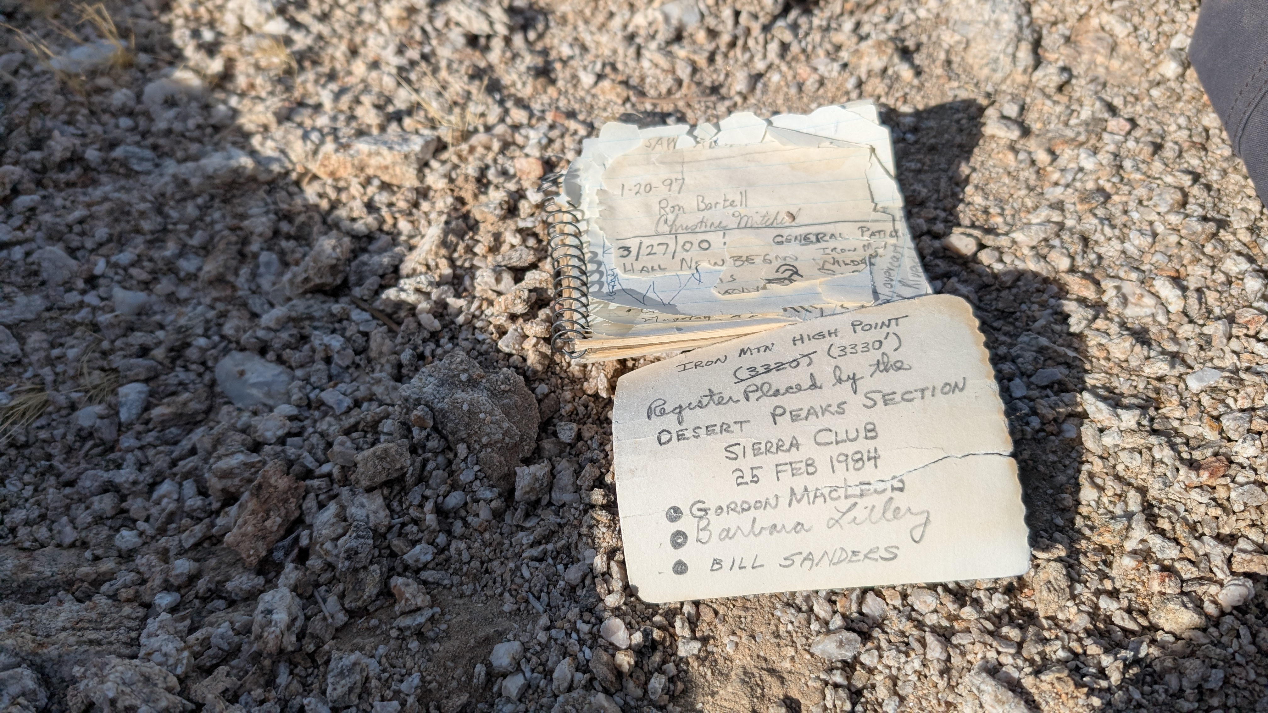
The first couple of miles were flat, open desert, as I passed the outstretched arms of jagged ridges. Then, it got rockier with bowling ball sized rocks and many deep washes (10-30') to cross. I thought I'd give the main gully a try, and return down the ridge. It was slow going in the gully with large boulders and thorny brush. As I entered a steeper section, I decided I'd make better time on the ridge. I began scaling the north wall of the gully and was surprised it went class 2. Most of the rocks were solid, but they were not anchored well to the mountain. Everything felt ready to break loose. Back on the ridge, there was more scrambling to a false summit. The final bit had me drop off the ridge to side hill on loose dirt around some obstacles. There was an ancient register from 1984, brittle, and only half full. I was careful with it since some of the pages had come loose. I searched for a benchmark, but didn't find one. The summit area was narrow and short, but had great 360 views. These Iron Mountains were very gray without much color variation. The wind picked up, so I only stayed on top a few minutes. I stopped to eat on the way down once I was out of the wind. The ridge descent was easier than the gully: four steep class 2 slopes. When I got back to the gully, I built a small cairn at the foot of the ridge. It was fine desert day and another Iron Mountain in the books.
Crossing one of many deep washes


Climbing out the gully

Final approach

Summit


East pumping station below


Taking the ridge down


Would you like to know more...?