HPS Star Emblem Peak
Hiked: 3/29/2019
Distance: 10.8 miles round trip cross country
Summit Elevation: 5405' (Minerva), 5813' (Quail)
Prominence: 2293' (Quail)
Elevation Gain: 1935'
Elevation Gain (in Empire State Buildings): 1.5
Round trip time: 6 hours
Recommended water: 72 oz.
Parking/Fees: $30 National Parks (per car, good for 7 days)
Difficulty: Moderate
Mike Martin invited me to Joshua Tree to hike Mount Minerva Hoyt and Quail Mountain. Quail is the high point in Joshua Tree and a P2K. Both are HPS peaks. It had been four years since my last visit to Joshua Tree, sweeping up LPC peaks. We left early enough to start at sunrise. Every camping spot was full and the park was very crowded. But, we didn't see anyone once we started cross country toward Minerva Hoyt, named after the "Apostle of the Cacti" and key person to get Joshua Tree declared a national park.
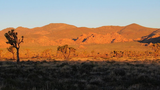
We parked in a paved turnout just north of Cap Rock. It was 37F at the trailhead and there was frost on the plants. We started west across Lost Horse Valley, flat for the first couple of miles. The valley was filled with tiny wildflowers and knee high grass and scrub. Joshua trees were scattered and blooming, but cactus was sparse. In the distance, a wall of rock towers and boulders stood between us and the direct line to Minerva Hoyt. We aimed for a low gap in the wall. When we arrived, we scrambled through a couple of boulder filled gullies, emerging at the base of the mountain. Part way up the ridge, we noticed a faint use trail that led up to the top. The final bit was quite steep ending in what looked like dark volcanic outcrops near the summit. We found multiple small registers in a glass jar, full of recent visitors. The views into the park were exceptional, maybe the best of the day. Quail Mountain rose several hundred feet above, and looked to be only a mile away, though the connecting ridges were not direct. The wind had picked up on the higher slopes and kept me on the uncomfortable side of cool. We rested behind some boulders and had a few snacks before pushing on to Quail.
We dropped off Minerva Hoyt to follow the connecting ridge to Quail. The 15mph wind was blowing steadily north to south and we were pelted on the ridge. We got some respite on the final approach as Quail blocked the wind. The summit was long, with the high point and HPS register on the south side. The benchmark (stamped Jo) is on the north side. We went to the high point first and signed in, then sat below the rocks for a break. The filled register books attested to the popularity of Quail, just not today. Minerva Hoyt looked small from this vantage point. Juniper Flats stretched out to the south. We walked to the benchmark where another register lived in a white can. We signed in again, then packed up for the descent. We took the long east ridge all the way down to a wash that we followed a good distance, eventually veering back into Lost Horse Valley. Returning this way, we completely avoided the wall of rocks. Another idyllic day in JTNP.


No comments:
Post a Comment