Distance: 6.2 miles round trip cross country
Summit Elevation: 3433' (Elder), 3121' (Palms), 1402' (Wash)
Elevation Gain: 2438'
Elevation Gain (in Empire State Buildings): 1.95
Round trip time: 6 hours 15 minutes
Recommended water: 80 oz.
Parking/Fees: Free on Collins Valley Jeep Trail
Difficulty: Strenuous
The gate to Anza-Borrego's Coyote Canyon closes seasonally every year from June 1 to October 1. This prodded me to make an attempt on Elder BM (SDC #64) and Palms BM (SDC #72) before the gate closed. Matt Hanan and Steve Andrews joined me for this adventure. I plotted a starting point on a jeep trail near Wash BM, several miles north of the third crossing. We met at Christmas Circle in Borrego Scprings and took Di Giorgio Road north until it turned into Coyote Canyon Road. The second crossing was dry, removing any concerns we had about making it to the trailhead. The third crossing had about six inches of water. There was a half mile of rough road after the third crossing, 4x4 recommended but high clearance may be good enough.
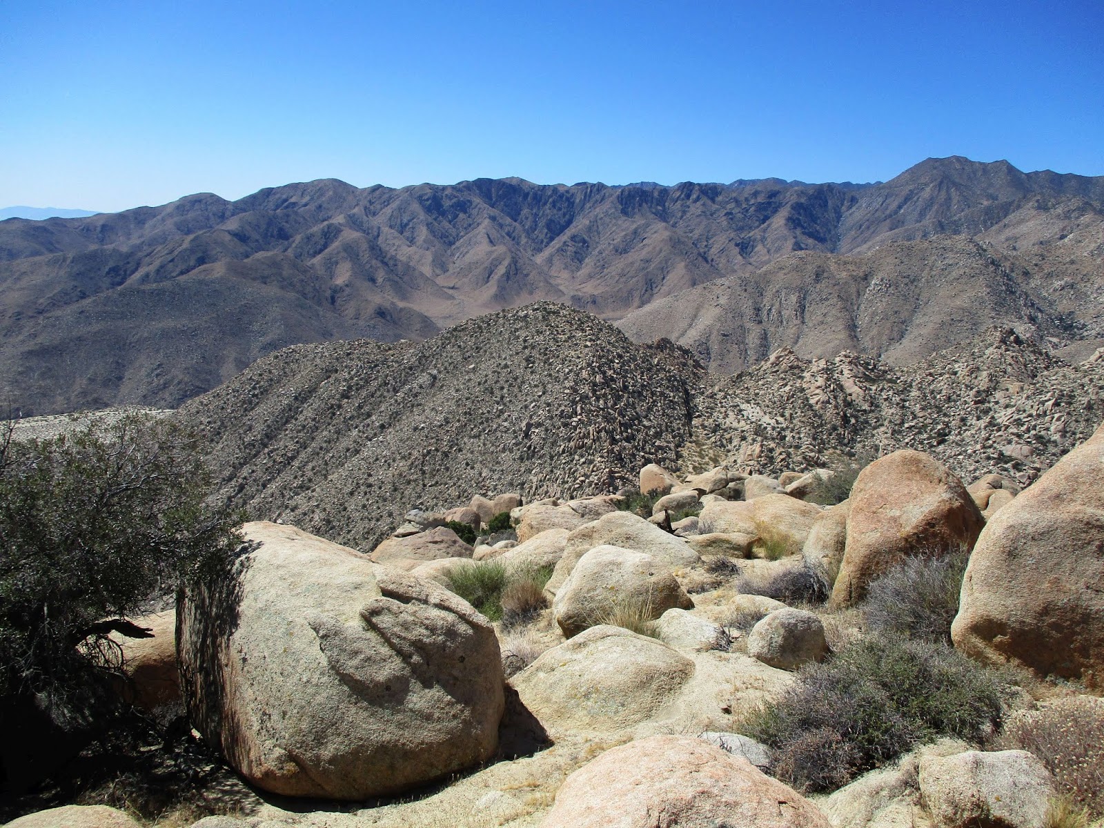
Wash BM was under a dead tree near our parking spot. We walked over to snap it before gearing up. It was a participation trophy. The plan was to ascend the gully between Palms and Elder to a plateau, climb both peaks, then return down the gully. About 3/4 of a mile of open desert sat between the truck and the ascent gully. Coyotes howled in the distance and the ground was fertilized with sheep scat, though we never saw one. We started up the left side of the gully, eventually wandering back and forth based on the path of least resistance. We tried to keep the 1200' ascent at class 2 and mostly did. After reaching the plateau, we stopped for fuel and water.


Wash BM

Matt and Steve starting up the gully

Mid-section

Steve on a semi-truck sized boulder near the top
Matt and Steve wanted to tackle the toughest peak first and that was Elder. We headed for another gully right of Elder and continued our class 2 boulder hopping. At the top of the gully, we made a left turn on the shoulder of Elder. The terrain got easier as we neared the top. Elder had a class 1 boulder and beneath it was both the register and benchmark. From Elder, we could see the tiny black smudge of the truck in Collins Valley. Every named bump and formation in the area was visible. Collins Benchmark and Square Top were dominant while the jagged spire of Elder North drew reverence. The team was not up for Elder North on this trip, but I would like to make a separate excursion with rope to stand on the class 5 summit. As far as I know, no one has reached the true summit of Elder North.

Elder from the plateau

Lots of juniper trees along the way


Elder BM, the shadow cast from a large permanent slab

Elder register

Elder North looking sharp and serrated

Powerful Collins Benchmark
Palms from Elder

Collins Valley

Formidable Square Top
We returned to the plateau and agreed on a similar strategy for Palms. We started toward the saddle, avoiding the freakish boulders on the north ridge. Steve had some leg cramping and opted to wait for us back at the gully. Matt and I found a good place to start our climb and we left the plateau but still angled toward the saddle. When the way was clear, we turned toward the summit which was long and flat. The summit was on the south side with a large class 3 boulder as the clear high point. We each climbed the high point, then spent time looking around for the register and benchmark. The register was under some rocks on top of the large oval boulder that also had guide wires. There were remnants of a register in a small glass jar inside the red cans. We left a new register book on Palms in a snack sized ziplock baggie, not quite large enough to contain it. It could use a full sized ziplock baggie. Matt spotted the reference mark on a low rock near the oval boulder. It pointed back to the oval rock but we found no signs of the triangulation benchmark on or around the oval boulder. The views on Palms were exemplary with different angles on the landscape compared to Elder. We were pleased with our route up Palms and backtracked the same route down. When we got back to the gully, Steve was nowhere to be found. We guessed he started down. I yelled down the gully for him but got no reply. If some mishap occurred, we might never find him in the patchwork of boulders. Matt and I started down taking gravity assisted class 3 segments that we avoided on the way up. About half way down, we spotted Steve picking his way down the center of the gully. We caught up with him near the bottom. While waiting for us at the gully, Steve said his legs were getting stiff and he wanted to get moving again before they got cold. It all worked out. I was undecided about rating this hike moderate or strenuous but the difficult terrain tipped it to the lower end of strenuous. As a group, we collected three mylar balloons. It was a picturesque hike, full of wonderment. With summer approaching, it may be too hot to do anything more on the San Diego list until October.

Palms from the plateau


Matt on the summit boulder

Palms reference mark, could not find the benchmark

Boulder with the register

On the Palms summit boulder

From the summit of Elder


No comments:
Post a Comment