Distance: 13.3 miles round trip on trail and cross country
Summit Elevation: 3720'
Elevation Gain: 3330'
Elevation Gain (in Empire State Buildings): 2.66
Round trip time: 6 hours
Recommended water: 128 oz.
Parking/Fees: Free on Williams Canyon Road
Difficulty: Strenuous
Deep in the Santa Ana Mountains lies a peak I dubbed Hard-Silver Summit because it is the highest point on the wide ridge that separates Harding Canyon to the south and Silverado Canyon to the north. In Peakbagger, it has the pedestrian name "Peak 3720". To get to the trailhead, take Santiago Canyon Road north from Cooks Corner, then go east on Williams Canyon Road. Park as close as possible to the coned off Silverado Ranch Road going left, anywhere that isn't private property. Hike up Silverado Ranch Road until it turns into a dirt road, Silverado Truck Trail. There are "No Tresspassing" signs, but I ran into the property owner on the way up. He stopped in his truck for a brief visit and had no problems with hikers. He seemed to be more concerned about hunting and fishing. He asked where I was headed but hadn't heard of Peak 3720.
After about half a mile, I made a right turn onto Silverado Truck Trail before getting to the property owners' house. The road started out wide, got increasingly overgrown as I went, and eventually reduced to a single track. About a mile from the start, I found a sign indicating the start of Cleveland National Forest land. An unused and open gate stood shortly past the sign. The trail climbed steadily cutting north and south between peaks on the ridge. The single track narrowed to the point that contact with the brush was unavoidable. It was still easy to follow and the soft plants didn't slow me down. But, I soon noticed some ticks on my pants. I brushed them off and went on, only to pick up several more. I became vigilant and when the day was over, I had a new personal best in collecting ticks: 21. I found the last one in my left boot just before driving home. I suggest drenching your clothes in Permethrin before hitting this trail.

Warning sign, not a problem for hikers at this time
Interesting geology near the start

Turn right before the Ranch House

Cleveland National Forest boundary, about a mile from the start

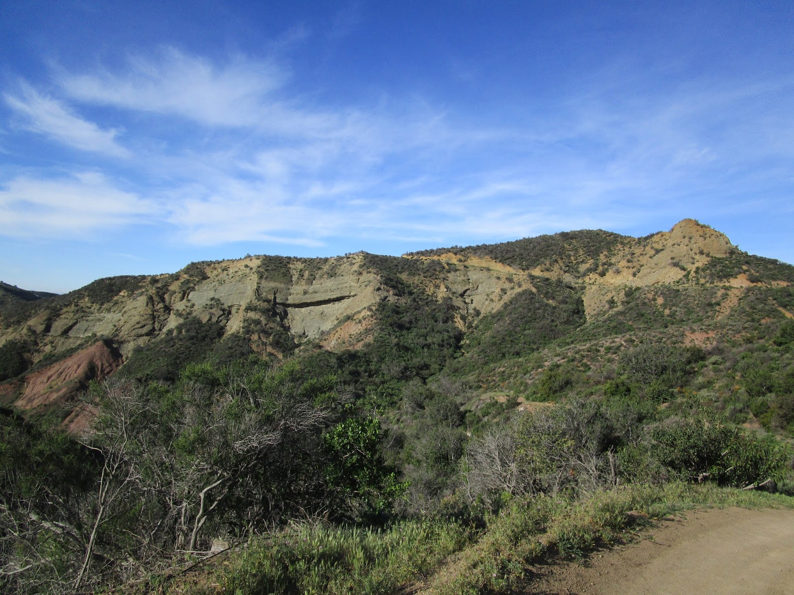
Looking up Silverado Canyon

Looking up Harding Canyon past a random marker

Basking western patch nosed snake
When I reached the base of Hard-Silver, I looked at the ridge line but didn't see any hint of a use trail. I found a small path to get to the ridge, but assumed it was an animal trail and continued around to the north side. That was a mistake. When I got below the false summit, I started heading directly up, picking my way through dense chaparral. It only got worse as I climbed and eventually it just got completely choked and I had to descend. On the way back, I checked out the ridge and discovered a mostly hidden trail skirting the very edge. The use trail had several obstacles, including some trees that needed to be crawled under and some that needed to be climbed over. Still, it was nothing like the snarl on the wild slope. From the false summit, I had to hunt around for the continuation of the trail and found it heading right. There was some light bushwhacking to the pile of rocks at the high point. The views were nice, even with the sun and low clouds leaving a washed out look on the landscape. It's remote and mostly a pristine part of forest. The trip back was uneventful. By bushwhacking on the north slope, I made this a more taxing hike than it should have been. Elevation gain without my error would have been below 3000'. I marked a waypoint in the GPS track (available on Peakbagger) where the use trail starts. It looks like the trail that comes up Halfway Canyon from Silverado Canyon goes through and would be a much shorter (and steeper) trip than starting at Williams Canyon Road.
Update 3/27/2016
I started up Halfway Canyon Road to find the start of the trail leading up to the Blue Light Mine and Hard-Silver, but the upper part of the road was blocked. It is owned by the Irvine Water District and marked with a clear sign that says "No Forest Access". There is no shortcut this way.

Almost there

Veiled use trail up to the false summit

One of several obstacles on the use trail

Final push

Undecorated summit

Looking south down Harding Canyon

Looking north to Modjeska Peak (left)

Two of the 21 ticks I brushed off, #21 was in my left boot


You're a tick magnet! Math Rambo would be stoked on that Western Patch-Nosed snake.
ReplyDeleteMadison,
DeleteI've never seen so many ticks! Maybe it was the season or the area, but I checked myself every 5 minutes. I think it's a tie between patch-nosed and rattlesnakes for the most common I've seen. I just posted this trip on the San Gabriel forum.
Just did this peak this morning and was glad to have your waypoint for the start of the summit use trail. Keep up the good work!
ReplyDeleteCraig,
DeleteThanks! Great to know it was useful.