HPS Star Emblem Peak
Hiked: 12/1/2013
Distance: 15.5 miles round trip on trail and dirt road
Summit Elevation: 5687'
Prominence: 4387'
Elevation Gain: 4016'
Elevation Gain (in Empire State Buildings): 3.21
Round trip time: 6 hours 30 minutes
Recommended water: 112 oz.
Parking/Fees: Adventure Pass
Difficulty: Strenuous
The Holy Jim trail is probably the most popular route to Santiago Peak in Orange Country. I had been on Santiago before, climbing on Main Divide Road from the north, but the Holy Jim trail was new to me. The temperature was in the mid 60F range at the trailhead, so I left my top layer in the car. It did cool off to probably the high 50s later, but it was never too cold. The road to get to the trailhead was bad, worse than I remember. Potholes and large rocks make it one of the worst dirt roads I've been on in the last few years. Noel brought a Toyota 4-Runner to make that part of the trip and I left my car near Trabuco Creek Road.
The trail starts out with a few stream crossings, some with trickles, climbing mildly out of the canyon. It continues a mild grade and frequent switchbacks all the way. The gain seems less than it is because of the grade and makes for a gentle descent on the knees coming down. What makes the trip strenuous, in my opinion, is simply the distance. The Holy Jim trail winds up and across the canyon, often heading away from the peak before winding back toward it. Most of the lower section is shaded. After a little more than 4 miles, the trail hits the first junction with Main Divide Road. At that point, you can go left and follow the road all the way to the peak, or go right and pick up the Upper Holy Jim trail in about a half mile.
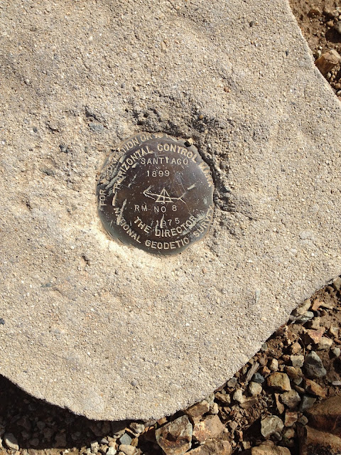
The Upper Holy Jim trail is signed and cuts back sharply against the road. It is mostly unshaded with fewer trees, slicing through head high manzanita. Finally, it opens up to very nice views east of San Jacinto and San Gorgonio. The views from the upper trail are probably better than the tower clogged peak of Santiago. The upper trail hits Main Divide Road again near a road switchback, and there is no choice but to follow the road the rest of the way. The reference mark (no. 8), placed in 1899, is near one of the highest buildings on the peak. The benchmark was either inside a fenced enclosure or was bulldozed for one of the towers. When we got to the top, Noel and I took a few photos and ate lunch before heading down. We had only seen a few hikers and mountain bikers on the way up, but the trail was filled with them on the way down. Don't expect much solitude on the trail on weekends.
See Also:
Santiago Peak via Telephone Ridge


No comments:
Post a Comment