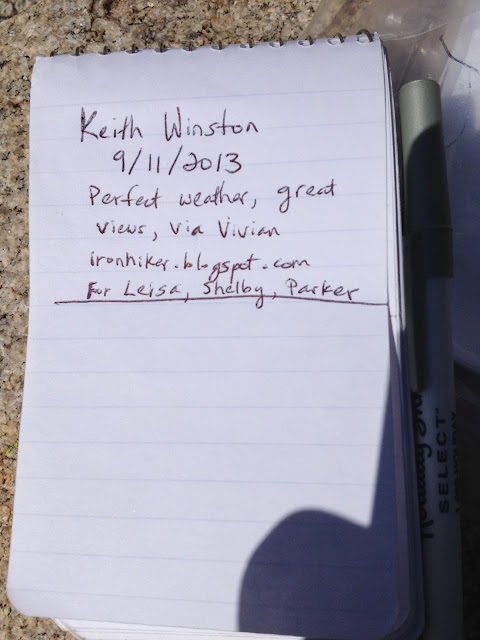
Hiked: 9/11/2013
Distance: 20.9 miles round trip on trail and cross country
Summit Elevation: 11205' (Jepson Peak), 10866' (Dragons Head)
Prominence: 125' (Jepson Peak), 186' (Dragons Head)
Elevation Gain: 6430'
Elevation Gain (in Empire State Buildings): 5.14
Round trip time: 11 hours 20 minutes
Recommended water: 216 oz.
Parking/Fees: Adventure Pass
Difficulty: Very Strenuous
Dragons Head and Jepson Peak are high altitude peaks (>10,000') in the San Bernardino Mountains near San Gorgonio. They are both on the Sierra Club Hundred Peaks List, both off trail, and a long distance from any trailhead. Dragons Head is usually approached from the Fish Creek trail, and that was my original plan (along with Bighorn Peak), but I decided to approach it from the Vivian Creek trail instead to save 1.5 hours of round trip drive time since Fish Creek is on the east side of the mountains. The trade off was an extra 2000' of elevation gain since Vivian Creek starts lower than Fish Creek.
I left the house at 4:34 AM, and arrived at 6:10 AM, just after the gate opened at Vivian Creek trail. The trailhead is now closed from 10 PM to 6:00 AM. I plan to sign a petition to restore 24 hour access. At the least, it creates safety issues. There was only one other vehicle in the lot. During the day, I saw one camper and 4 other solo hikers like myself. I didn't take many photos of the trip going up since I had been on Vivian Creek trail in June and captured that part of the trail.
It was much more pleasant in September. It was much cooler, 57F to start and never exceeded 70F. In fact, my hands were cold the first few hours until I got into some direct sunlight. There were no biting flies, water was plentiful, everything was more green, and the ground was damp from early week rains but firm, not muddy. Freshly dropped pine needles filled the air below the tree line. Water was flowing strongly at Vivian Creek and High Creek Camps. Water was also flowing in the small stream at Halfway Camp. With cool temps, I had packed in too much water, so I cached some under a tree on the ridge at 9900'. The lighter pack helped the rest of the day. Before I reached the first trail junction above 11000', I left the trail and headed toward Jepson. I don't think this saved me much time. Worse, I scrambled up some boulders to a false summit that I thought was Jepson, only to find out that Jepson was the next peak over. I found no benchmark, but signed the register in the chained ammo box.
Next, I headed toward Dragons Head. I got back on the trail and followed the Mineshaft Saddle sign at the junction on Sky High Trail. I followed it around San Gorgonio until I was directly above the saddle with Dragons Head. Then, I descended down to the saddle and up the use trail. The use trail is narrow, with sudden death on the left and serious injury on the right. However, it is mostly class 1 and well placed ducks mark the upper section. The views are impressive, with the tarn and Bighorn Peak close by, a great view into the Valley, San Jacinto, Saddleback, and more. Only views to the north are blocked by San Gorgonio. The cliffs on the east side are so severe, it reminds of something you might see in the Sierras or the Grand Canyon. Hikin' Jim calls it the Dragons Maw and I am sticking with that term. I signed the summit register, ate some snacks, and took in the views before heading back. Dragons Head was my 50th Sierra Club recognized peak. The 700' climb back up to Sky High Trail seemed to take forever. The return trip was uneventful, except for punishing my knees.
It's only a thousand feet down, not a couple of thousand as I stated in the video
Equipment update: The Leki Khumbu trekking pole failed again on descent with the middle locking mechanism giving way. Maybe I got a pair of lemons, but I plan to replace them before the my next trip. The Vasque Mindbender trail runners were finally broken in and treated my feet well, but when I got home, I saw that one part of the heel had come unglued. I've had some bad luck picking equipment this year.


Great, post, Keith.
ReplyDeleteThat looks like a lot of steep, scrambling fun! I've had my eyes on that area for a while now, but haven't been able to make it out there.
I am only a few hikes in on my Mindbenders and will keep an eye on them. My Blurs over the years held up very well.
Derek,
ReplyDeleteIt was a very fun trip. You can save some gain by going from Fish Creek but it is 18+ miles to Dragons Head from any direction. A friend of mine recommended Vasque and they are comfortable, but maybe not as durable as I expected.
Awesome report!
ReplyDeleteAwesome report! You could climb San Gorgonio as well, and the peaklet you climbed is informally known as Big Draw Peak.
ReplyDeleteNathan,
DeleteGlad you liked the report. I haven't heard the name "Big Draw" before. I'll look it up.
I climbed San Gorgonio about three months before this hike, but there's still a lot of other mountains in the range I want to climb.