Hiked: 2/22/2013
Distance: 11.2 miles round trip on trail
Summit Elevation: 3326' (Old Sugarloaf), 3227' (Sugarloaf)
Prominence: 546' (Old Sugarloaf), 247' (Sugarloaf)
Elevation Gain: 2450' (combined)
Elevation Gain (in Empire State Buildings): 1.96
Round trip time: 4 hours 15 minutes
Recommended water: 80 oz.
Parking/Fees: Adventure Pass
Difficulty: Moderate
By missing the Old Sugarloaf use trail cairn, I made this harder than it had to be. I started at the Old San Juan Trail just before Blue Jay Campground. To get there, follow the same directions as Los Pinos Peak, but stop just before the campground. There are about 4 parking spots on the side of the road. I thought I would make it clear in the title that I was in the Santa Ana Mountains because every state has about 10 peaks named Sugarloaf.
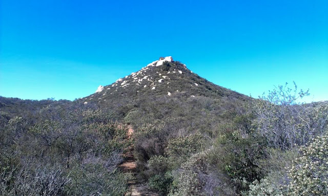
The trailhead is higher than either peak, so it resembles a canyon hike, losing about 700 feet of elevation before climbing toward Sugarloaf with a use trail to the summit on the right. There were several deer that greeted me near the trailhead before sprinting away into the canyon. To shorten my hike time, I jogged parts of the trail. The first half of the hike is well shaded with plenty of tree cover. I ran into several unmarked trail junctions and learned along the way that the shortest route is any one that heads directly toward Sugarloaf. It was a pretty short climb to the boulder filled summit of Sugarloaf. Red cans with summit logs were hidden under one of the large boulders. I signed the log and considered climbing up the two largest boulders. The lower of the two is a class 3 scramble, but the only way to the higher boulder was to jump from the lower one. It looked dicey so I skipped it this time. Back on the trail, I circled behind Sugarloaf and dropped down to a saddle where the use trail to Old Sugarloaf also begins on the right.
Unfortunately, I missed the Old Sugarloaf use trail and went a good half mile beyond it and started rounding a tall bump. I backtracked and looked for any excuse of a use trail. When I thought I found a faint one heading up the bump, I took it but had to bushwhack my way to the top of the unnamed bump at 3000'. There was no path to Old Sugarloaf from the bump, so I got discouraged and started back, thinking I would not bag Old Sugarloaf today. The bump side trip cost me about 45 minutes. On the return trip, I spotted a broken cairn and the use trail and moved up as quickly as I could, feeling some time pressure. The summit trail to Old Sugarloaf was more difficult than Sugarloaf and had a few short scrambles. Another red can held the summit log, but the can was half full of water and the pen didn't work. I emptied the can, returned the log and took a short break before heading down. At the bottom, I repaired the cairn and added a few more rocks to make it more clear for the next hiker.
See also:
Sugarloaf Redux


We're thinking of doing this trip tomorrow. I'll say thanks again for publishing all your reports. It seems you often have the best descriptions I can find.
ReplyDelete-gimpilator
Glad you found the report useful. It might be a little muddy out there, but have fun! BTW, I sent you an email through peakbagger.com. Impressive list of big mountains you have climbed.
Delete