Hiked: 3/15/2013
Distance: 8.8 miles round trip on dirt road and cross country
Summit Elevation: 5843'
Prominence: 946'
Elevation Gain: 3844'
Elevation Gain (in Empire State Buildings): 3.07
Round trip time: 6 hours
Recommended water: 136 oz.
Parking/Fees: Adventure Pass
Difficulty: Strenuous
Rattlesnake Peak in the San Gabriel Mountains is the baby brother of Big Iron Mountain which remains in view the entire trip. It is considered one of the tougher peaks in the range with plenty of elevation gain, yucca hazards, and loose dirt. To get to the trailhead, follow highway 39 north out of Azusa as if heading toward Iron Mountain, except follow Shoemaker Road to the left instead of continuing on E Fork Road. Stop at the closed gate.
There are two main approaches to Rattlesnake Peak, the south ridge route (most popular), and the east ridge after going through two tunnels. It can also be done as a loop in either direction. Rod and I started up the south ridge which starts in a gully on the left side of the road at GPS coordinates N34.24946 W117.76476. There was a cairn marking the start of the use trail that I improved slightly.
Soon after leaving the road, the use trail faded away and I had to consult the GPS to determine which way to go. The GPS showed the way to a steep wash on the left where the dirt was so loose that it frequently meant taking a step and sliding back a few inches. Eventually, the use trail returned and after reaching the south ridge, it was clear where to ascend. There were plenty of intimidating bumps, some rock scrambling, and a few interesting places where the path led along the edge of a cliff. About half way up, we cached some water to pick up on the return. We were the only humans on the mountain all day, though we did see a few large horned lizards and a red velvet ant along with the usual squirrels and birds.
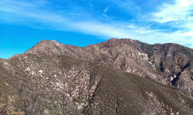
Most of the vegetation was burned, but it was hard to tell how recently. There was no bushwhacking, and very little brush or tall grass. It was pretty barren most of the way, except for a healthy yucca "garden" we encountered. Big Iron Mountain dominated the northeast the entire hike, with snow-capped Mt. Baldy behind it.
After passing several false summits, Rod and I planted a "rattlesnake flag" at the peak, signed the summit log and took some photos. The most recent log entry was from the prior Sunday. After a short rest and snack break, we returned on the south ridge. The east ridge would have to wait for another day.

Start of the use trail that leaves on the left side of the road near a deep road cut


A horned lizard wonders why we are trespassing on his mountain


On the summit

Rod on the summit, Iron Mountain and Mt. Baldy in the background

USGS benchmark labelled "Fang" instead of "Rattlesnake", placed in 1930.


I just did it twice, but slowly due to being out of shape. The first time 3 weeks ago, I just did route 1 ( from the south) out and back by myself. I broke a pole and had a couple of falls because I was hurrying, but was fine and really enjoyed myself. It was cool, I guess around 50 farenheit and no bugs. The first 40 feet is real steep (be sure to bring hiking poles). Then you climb along above the road at first. Then to the left (just follow the trail, my directions are only approxamate). This part is steep again. You get to a ridge and at the arrow constructed of rocks, you turn left. Take a good look at it because you don't want to miss it on the way back. Now you just follow the ridge.
ReplyDeleteI just want to mention that this hike is "real" steep, in fact you may find yourself sliding. It is best to do it with someone, not alone.
ReplyDeleteHoward,
DeleteCongrats on getting Rattlensnake (twice). It's a tough hike. I've only done the same south ridge route you did, though I want to go back and do the east ridge.
Did this one today. Thanks for the writeup. The picture of little rattlesnake helped.
ReplyDeleteRattlesnake is hard and beautiful, but IMO Monrovia peak up the front from town is much harder: 5800 vertical and significant hand usage. Rattlesnake minimal hand usage for me. I don't know why people call this the 2nd hardest hike in the San Gabriels. There are others that are tougher
For me the hardest part of Rattlesnake was coming down on that slippery slope. I fell 4 times.
joe schmoo,
DeleteRattlesnake is a great peak, but I agree not the 2nd hardest in the range. Good job getting it. I haven't done Monrovia, but if you did it going over Clamshell, I agree. Plus, many off trail scrambles are far more difficult. Coming down steep slopes is tricky. I fell more coming down Big Iron.