Distance: 4.8 miles round trip on dirt road and use trail
Summit Elevation: 2697'
Prominence: 697'
Elevation Gain: 2326'
Elevation Gain (in Empire State Buildings): 1.86
Round trip time: 4 hours
Recommended water: 64 oz.
Parking/Fees: Free on Calcite Mine Road
Difficulty: Moderate
A late start got me to the Calcite Mine Road around 10 AM at the southern tip of the Santa Rosa Mountains. I was here for Travelers Peak (SDC #80). I drove up the road (4x4 recommended) about a mile to a convenient turnaround. With the right vehicle and driving skills, it might be possible to drive all the way to the mine, but I didn't want to risk it. It was about 1.1 miles to the Calcite Mine. Slot canyons and broken terrain lined both sides of the road. I didn't find any adits, just large cuts in the earth. I marveled at the rock formations before continuing on a good use trail above the mine. Brush and cactus were nowhere to be found in this barren landscape. Only a few hardy shrubs and a couple of obstinate ocotillo (Fouquieria splendens is not a true cactus).

Starting point

Slot along the side of the road


Just above the Calcite Mine

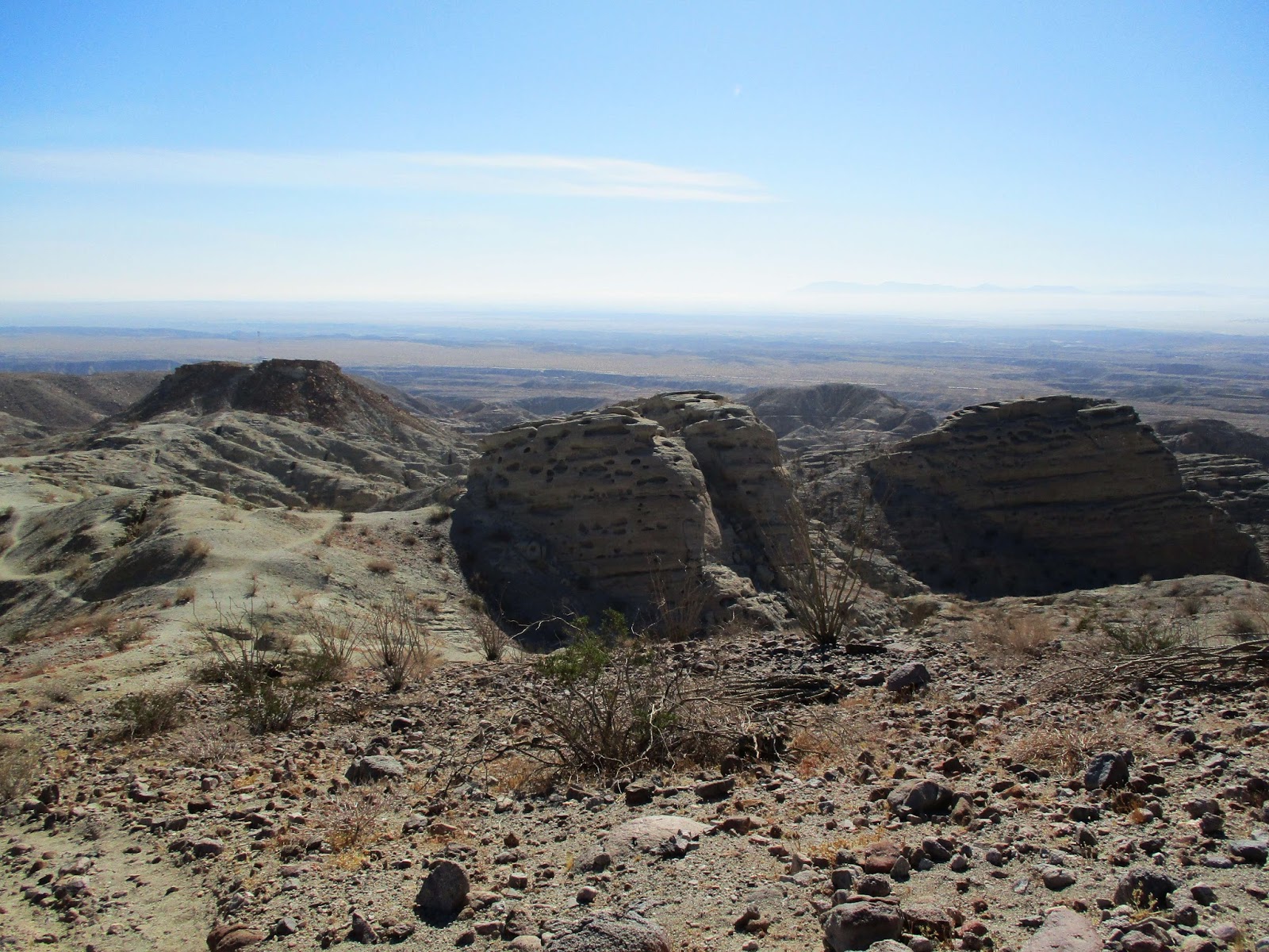
Severe erosion has taken a toll on the soft rock and everything I touched fell apart. There were a couple of major bumps to clear in the midsection of the hike. The first serious one was littered with exposed boulders requiring some route finding to keep things at class 2. To my pleasant surprise, the use trail persisted as I got higher and the views got better. It also got steeper. From the Calcite mine, it is only 1.3 miles to the summit, but over 1500' of gain in that short distance. There was one bump where I lost the use trail and followed my own imaginary switchbacks to get over it. Despite being higher up, I never got a clear unbroken view of the ridge line to the summit. I trusted the use trail would connect and it did. The crux was at a knife edge section where there was a semi-exposed class 2 scramble. Holds were large, but I had to test every one to make sure it would hold my weight. Pretty exciting.


Class 2

Beautiful and barren


Crux class 2

Final approach
Past the 45-degree crux scramble, it was only a quarter mile to the summit. The well preserved benchmark read "Palm" and was placed in 1939. I'm not sure when the it became Travelers Peak. The register cans held two books, the oldest from 1979 and started with Wes Shelburg. I took my time with the summit ceremony, then started down. It took about the same time to get down as to ascend. Travelers was a true desert gem.

Benchmark stamped "Palm"


Looking north toward Rosa Point, Coyote Mountain distant left

Salton Sea


My buddy Adam Walker was here March 2017


Heading down


A final look back from highway S22


That is one of the most fun desert ropes I've ever done. Some great photos you got! I guess this peak gets some failed attempts too, because I know someone who has tried it twice with no summit. For anyone who has extra time in the area, check out the little slot canyons east of the road below the mine.
ReplyDelete-gimpilator
gimpilator,
DeleteI am not surprised about failed attempts. It takes more time than people probably expect. I'd like to go back and explore the slots around the mine and also north of the peak. So much to see and never enough time. I was happy to see the original register preserved from 1979.
Cool pics. It must have been nice not having to worry about cholla bombs.
ReplyDelete