Wednesday, January 17, 2024

Unplanned Break

On New Years Day, we woke up at Lava Lava Beach Club in the end cabin. It was another glorious day on the Big Island and we set out on the semi-private beach to a spot where we usually found sea turtles. We settled at the spot but no turtles were around. Leisa wanted to stay on the beach a while longer and I returned to the cabin to get in a quick jog. I headed down the road toward the Kings' Shops mall. When I reached Waikoloa Beach Drive, I turned around and jogged back to the cabin. I checked my distance and it was only 0.9 miles. I decided I needed more steps so I started back down the road for another lap. Before I reached the turnaround, I stopped jogging and decided to cross the lava field between the road and Waikoloa Marriot. The black lava was soft but broken and sharp. I hopped over the field easily, not the slightest challenge compared to the boulder scrambling I typically do in the mountains. I got across the lava in minutes to a 2' dirt barrier between the field and the Marriot parking lot. Feeling energetic, I jumped on top of the barrier with my left foot and landed on my right.

When I landed, my right foot was turned slightly inward. The running shoes I wore had zero lateral support. My ankle rolled under my foot and I heard a pop. A bolt of pain shot from the right side of my ankle about 4 inches up the side of my leg. I muttered explitives I can't even remember, then started limping from the parking lot back to the road. With each step, I tried to access how bad the injury was. Every step was painful and after a dozen or so steps, I realized this was more than a simple ankle roll. I limped a half mile back to the cabin and immediately iced it. Swelling had already begun. When Leisa got back, I showed her the damage. We found an urgent care in the afternoon, but it was closed since it was New Years Day. We were half way through our vacation, but our activities were going to be limited the next few days. A double drag.

On January 2, we went back to urgent care and they sent me to the ER of Queen's North Hawaii Community Hospital. After x-rays, I was diagnosed with a closed avulsion fracture of the lateral malleolus of the right fibula. They put me in a boot and sent me on my way. The fibula is the smaller of two bones that runs between your knee and ankle. The tibia is the larger bone and a break in the tibia would have been much more serious. The fracture was at the bottom of the bone, so the ankle was stable. After a second set of x-rays, and a second review by my doctor at home, no surgery was needed. Rehab would consist of 4 weeks wearing a boot, and 2-4 weeks of physical therapy (overlapping the last week in the boot). When I wrote this, I was wearing the boot, two weeks and two days after the accident. Physical therpary starts tomorrow.

This was my first ever broken bone. I plan to rehab the hell out of it and be back in the mountains in the second half of February.

Aloha

Update 1/30/2024
I abandoned the boot for a flexible brace. I am in week 2 of physical therapy and it hurts so good. I do PT at home every day and I'm working in hip and ham machines at the gym to keep my legs from withering completely. Yesterday, I bought a pair of Saloman Ultra X 4 Mids with better ankle support than my Merrells. The ankle brace fits into the boot without fuss and I took them to an easy local trail for a two mile break in. I was feeling some minor pain on the way back, but consider it a success. I have another month or so of physical therapy, followed by a few more weeks to fully heal. Beyond that, I have to overcome the psych issue of trusting the ankle again. I am planning an off trail hike with my San Gabe friends at the end of February, but might have to take the road and meet them on top if I'm not feeling it. That will be a true test in multiple dimensions.


Tuesday, January 16, 2024

South Point, HI

Hiked: 12/31/2023
Distance: 0.5 miles round trip on trail
Summit Elevation: 0'
Elevation Gain: 25'
Elevation Gain (in Empire State Buildings): 0
Round trip time: 15 minutes
Recommended water: 0 oz.
Parking/Fees: Free on South Point Road
Difficulty: Easy

This was a travel day, going from super wet Hilo to sunny Kona. We wanted to take the southern route to see a different part of the island. The first stop was Punalu'u black sand beach. I expected the sand to be hotter than regular sand but it wasn't. There were a few turtles sunning on the beach in an enclosed area and we saw a few heads pop up in the water. There were no restrooms at the beach, but there was one a short walk away at the camp site. It was a super nice beach and a draw for a lot of tourists, even through it was pretty far out of the way.

Beach with camp site in the distance


Next, we drove to South Point. The last ten miles or so are on a very narrow road, one lane at points. There were more people headed there and coming back than I would have guessed. We parked at the end of the road and walked a quarter mile on dirt and sand to reach the southernmost point in the United States. The point is well south of the Florida Keys. The shore was filled with shells, the rocks jagged, and the sea rough. Local fishermen were lined up along several sections. There was a jump off point on the western side where the sea was calm, but neither of us wanted to make the 40' leap, even with a ladder to get back up. We spotted a couple of snorklers on the western side bobbing in the swell.


Wednesday, January 3, 2024

Pu'u Huluhulu, HI

Hiked: 12/30/2023
Distance: 2.5 miles round trip on trail
Summit Elevation: 3440'
Elevation Gain: 161'
Elevation Gain (in Empire State Buildings): 0.1
Round trip time: 1 hours 10 minutes
Recommended water: 16 oz.
Parking/Fees: $30 National Parks Fee
Difficulty: Easy

Our second hike in Volcanoes National Park was Pu'u Huluhulu. It was the first summit on a very long trail where the floor is lava every step. The lava here came from an eruption of Mauna Ulu in 1969. There were places were the lava was broken or had collapsed into air pockets. It was genrally solid and 8-16" thick, though it occurred to me that it could collapse into other unseen pockets. Of course, it didn't and we enjoyed a mostly flat walk up to the summit. Like Kilauea-Iki, the trail was marked with large cairns of black lava rock. The trail continued for at least another dozen miles, but we were content to bag the nearest peak and turn around. A metal disc was on the summit with arrows to visible volcanoes. The smaller volcanoes did make me appreciate the size of Mauna Loa. Mauna Loa had been closed since it erupted in 2022. If we ever make it back, I'd really like to bag Mauna Loa.


Saturday, December 30, 2023

Kilauea Iki Trail and Thurston Lava Tube, HI

Hiked: 12/30/2023
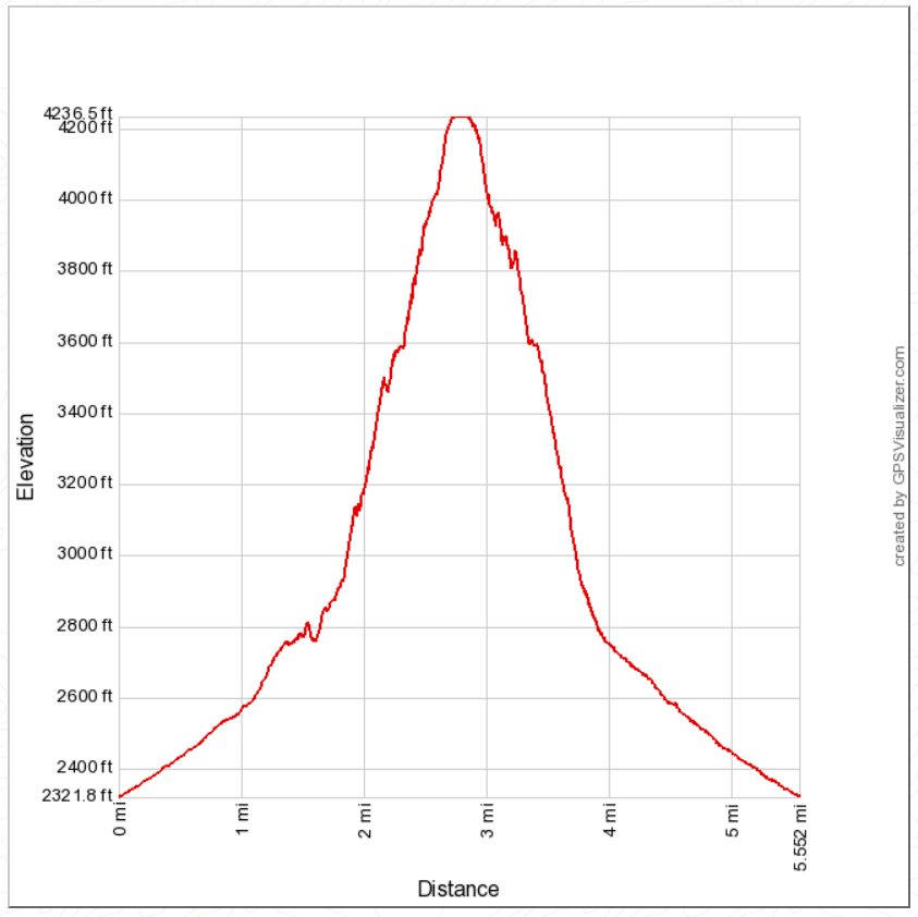
Distance: 3.9 miles round trip on trail
Summit Elevation: 3498' (crater rim)
Elevation Gain: 600'
Elevation Gain (in Empire State Buildings): 0.5
Round trip time: 1 hours 50 minutes
Recommended water: 24 oz.
Parking/Fees: $30 National Parks Fee
Difficulty: Easy

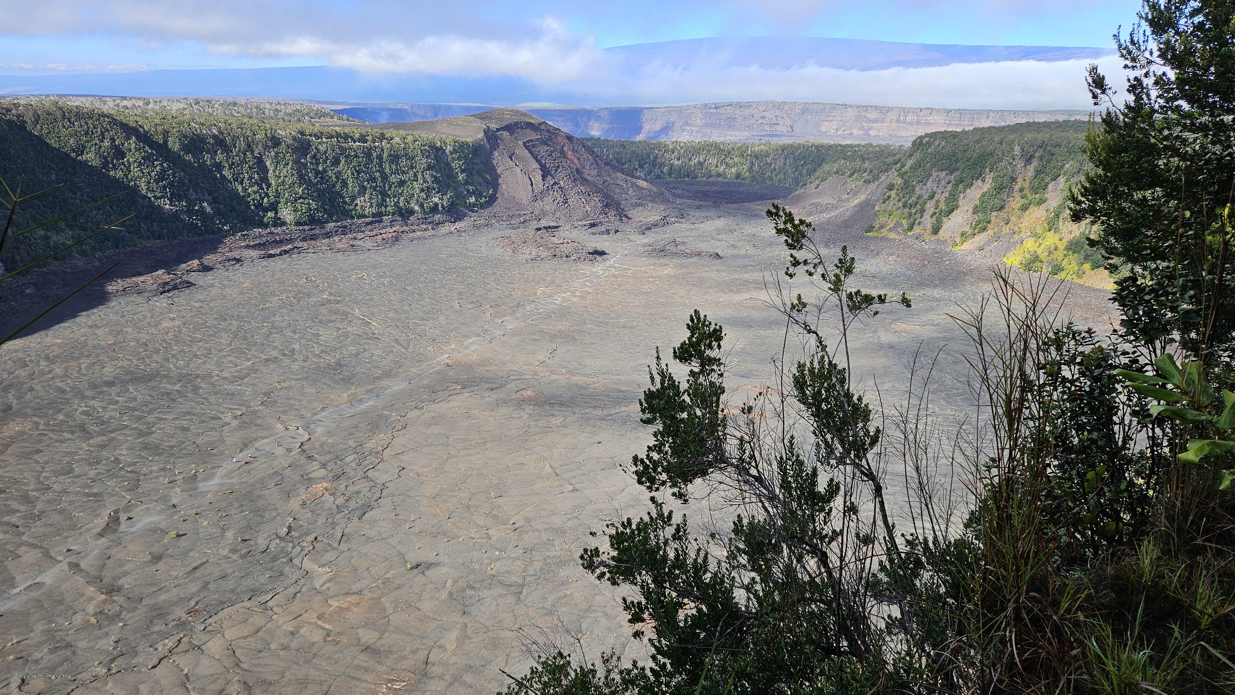
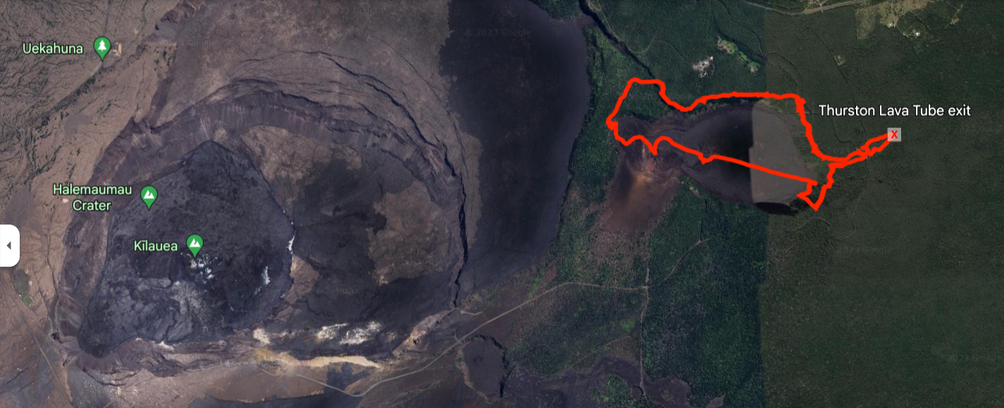
Leisa and I were back on the Big Island to ring in the new year. This was our second trip to the Big Island. We didn't make it to Volcanoes National Park the first time, so we dedicated a day to it. Our first hike was the Kilauea Iki trail. It started on the crater rim of a dormant caldera, not the active one. The trail dropped gently into the caldera, then followed large cairns of black lava rock through the center. It was unique terrain. There were a couple of steam vents along the way and I stopped to peer into one, but there wasn't much to see. At the other end, we climbed out. Back on the rim, we walked a short distance over to the Thurston Lava Tube. Dim lighting along the wall was enough that we didn't need headlamps. The lava tube was short and kind of disappointing. This was a very popular loop hike and I recommend starting early. When we finished, the parking lot was full and rangers were waving people away.


Steam vent

Exiting

Lava tube


Looking down the caldera, Mauna Loa in the background


Kilauea Hale Ma'uma'u crater

Saturday, December 9, 2023

Zzyzx Peak

Hiked: 12/1/2023
Distance: 2.8 miles round trip cross country
Summit Elevation: 2270'
Elevation Gain: 1091'
Elevation Gain (in Empire State Buildings): 0.9
Round trip time: 2 hours 15 minutes
Recommended water: 20 oz.
Parking/Fees: Free on Zzyzx Road
Difficulty: Easy

This was a bonus peak on the way home from Old Dad. I exited on Zzyzx Road southbound from I-15, crossed over the freeway and parked in a dirt turnaround. With about two hours of daylight left, I thought I could get up and down before dark. I was somewhat concerned about leaving my truck alone for two hours, but geared up and got moving. According to Wikipedia, "Curtis Howe Springer made up the name Zzyzx and gave it to the area in 1944, claiming it to be the last word in the English language. He established the Zzyzx Mineral Springs and Health Spa in 1944 at the spot, which was federal land."

The terrain was open with little vegetation. I crossed two small drainages before heading up the boulder filled gully toward a saddle in the first line of foothills. From the map, it looked like I could follow this gully to the ridge just south of the summit. However, after passing the foothills, the ridge looked like easier going. I took a sharp turn east to gain the ridge, then followed it in a semi-circle to the summit. The summit was only a mile from road as the crow flies, but 1.4 miles on my route. On top, I found a wooden post and wire that had fallen, but no marks, and no register. I had great views of the local mountains and the long, thin line of concrete that was I-15. I tagged the summit and immediately started down, racing the sun. As soon as I was back in the gully, I was in shadow, but there was still plenty of ambient light. I got back to the truck at dusk.

Credit to Tallywa for sign photo


Heading for the saddle

Moving up the gully

On the ridge, following it around to the summit

Summit with fallen post

Looking south down I-15


Saturday, December 2, 2023

Old Dad Mountain

Hiked: 12/1/2023
Distance: 5.3 miles round trip cross country
Summit Elevation: 4252'
Prominence: 1218'
Elevation Gain: 2088'
Elevation Gain (in Empire State Buildings): 1.6
Round trip time: 5 hours 30 minutes
Recommended water: 72 oz.
Parking/Fees: Free on South Powerline Road
Difficulty: Moderate

I decided to endure the long drive to the Mojave for an attempt on Old Dad (DPS #79). I wanted to get it the same year I bagged Old Woman Mountain. I left the house around 3:15 AM with a planned start around 7:30 AM. I followed the driving directions from the Desert Peaks guide from Kelbaker Road. I timed my arrival to drive the dirt road section in daylight so I could assess any danger of deep sand. The road turned out to be in good shape with only a little deep sand the last mile, easily devoured by the Tacoma 4x4.

I parked at the entrance to the wash running along the eastern side of the mountain. I followed the flat, open desert hugging the base of the mountain. Staying close made for some unnecessary ups and downs over minor gullies. I continued until I found the main ascent gully. Climbing the east face looked improbable. Once I started up, I spotted cairns that did a fine job of marking the route. The rock on Old Dad was weathered limestone. Mostly solid, but some bore sharp edges. Sharp rock ended the career of my gloves and also punctured my puffy jacket. The main route followed a series of ledges, with bits of scrambling to reach the next ledge, Chutes and Ladders style. I couldn't always spot the next ledge and got off route a few times. Off route usually meant cliffing out or making exposed class 3 course corrections. Half way up, there was a long traverse north to skirt under cliff bands, well marked with cairns. When I reached the ridge, it was an easy walk over to the summit that jutted out slightly from the mountain side like a small pyramid. I got a glimpse of either a deer or a bighorn on the west side of the summit. It ran over the edge before I could identify it. Views were impressive in all directions. The benchmark was in great shape and several registers were found in an ammo box. The oldest one went back to 1975 and was falling apart. The newest one was placed in 1994. I hung out on top for a while to absorb the desert goodness. Descent was uneventful. I highly recommend taking a GPS track as a route finding aid. Old Dad was immensely satisfying. It was engaging with expansive views as a payoff.

Old Dad from Powerline Road

Main ascent gully, takes a hard right

Main route


Benchmark 1934


Summit


Keyholes off-route

Almost down