Hiked: 7/27/2017
Distance: 3.6 miles round trip on trail
Summit Elevation: 7999' (Sunrise Point)
Elevation Gain: 858'
Elevation Gain (in Empire State Buildings): 0.68
Round trip time: 1 hour 30 minutes
Recommended water: 24 oz.
Parking/Fees: $30 National Parks (per vehicle, one week pass)
Difficulty: Easy
The morning Navajo Loop hike wore out the kids, or more likely wore out their interest in additional hiking for the day. Leisa was game so we went back to Sunrise Point with a plan to descend to the Tower Bridge formation along the fairyland loop trail. There were a lot of people in the park now and the parking lot was overflowing. Near the top of the trail, an NPS trail crew was at work smoothing out the rough spots on the fairyland trail. It was apparent from the cemented foot and horse prints that this trail melts in the rain, then solidifies the footprints like an anonymous Hollywood walk of fame. It was lightly raining when we started with a 30% chance of PM thunderstorms. Bristlecone pines were sparse and the forest was less dense than the main Bryce amphitheater. About half way down, we spotted the Chinese Wall, a long line of tall, connected hoodoos. At the bottom, a sign marked the short spur trail to the Tower Bridge. It was a double arch with a tall spire on the right side. Quite a sight. The rain stopped on the way down, leaving us a short, but hot and humid hike out of the canyon. Bryce Canyon trails offer big unearthly views in exchange for modest effort. A good trade for anyone.
Thursday, July 27, 2017
Rainbow Point, Rainbow Jr, Natural Bridge, UT
Hiked: 7/27/2017
Distance: 0.4 miles round trip cross country
Summit Elevation: 9115' (Rainbow Point), 9009' (Rainbow Jr)
Elevation Gain: 150'
Elevation Gain (in Empire State Buildings): 0.12
Round trip time: 20 minutes
Recommended water: 0 oz.
Parking/Fees: Free on Highway 63 Turnout
Difficulty: Easy
We drove to southern end of Bryce Canyon National Park and the end of Highway 63 to Rainbow Point. This is a great view spot to take in the entire canyon and get a good look below the rim. It is also the highest point in Bryce. Near Rainbow Point, a gentle ridge slopes up from the highway and ends in what looked like an even better view spot at Peak 9009, or as I called it, Rainbow Jr. This peak was not in peakbagger and not on my radar, but I had a "hold my beer" moment. Leisa was kind enough to allow me to stop at a turnout on the way back and walk to the summit of Peak 9009. The ascent was class 1, but there was a knife edged sliver about 1' wide to cross in order to reach the summit. The payoff was big, giving me much better views below the rim and a 360 view that Rainbow Point didn't have. I forgot to bring my 360 camera, missing a big opportunity. Oh, well. A few more miles up highway 63, we stopped at the Natural Bridge, which is really just an arch.
Distance: 0.4 miles round trip cross country
Summit Elevation: 9115' (Rainbow Point), 9009' (Rainbow Jr)
Elevation Gain: 150'
Elevation Gain (in Empire State Buildings): 0.12
Round trip time: 20 minutes
Recommended water: 0 oz.
Parking/Fees: Free on Highway 63 Turnout
Difficulty: Easy
We drove to southern end of Bryce Canyon National Park and the end of Highway 63 to Rainbow Point. This is a great view spot to take in the entire canyon and get a good look below the rim. It is also the highest point in Bryce. Near Rainbow Point, a gentle ridge slopes up from the highway and ends in what looked like an even better view spot at Peak 9009, or as I called it, Rainbow Jr. This peak was not in peakbagger and not on my radar, but I had a "hold my beer" moment. Leisa was kind enough to allow me to stop at a turnout on the way back and walk to the summit of Peak 9009. The ascent was class 1, but there was a knife edged sliver about 1' wide to cross in order to reach the summit. The payoff was big, giving me much better views below the rim and a 360 view that Rainbow Point didn't have. I forgot to bring my 360 camera, missing a big opportunity. Oh, well. A few more miles up highway 63, we stopped at the Natural Bridge, which is really just an arch.
Navajo Loop and Queens Garden, UT
Hiked: 7/27/2017
Distance: 3 miles round trip on trail
Summit Elevation: 8015' (Sunrise Point)
Elevation Gain: 885'
Elevation Gain (in Empire State Buildings): 0.7
Round trip time: 1 hour 30 minutes
Recommended water: 16 oz.
Parking/Fees: $30 National Parks (per vehicle, one week pass)
Difficulty: Easy
This was our first trip to Bryce Canyon National Park, Utah. The park is famous for its hoodoos, pinnacles of weathered rock, standing in unearthly and uneven columns. The Navajo Loop to Queens Garden trail is considered a must do. The route starts at Sunset Point, descends into the canyon, takes the Queens Garden trail and short spur, ascends to Sunrise Point, then back to Sunset Point along the rim trail. The entire track is wide, smooth, and family friendly. However, our kids were quite unfriendly when we woke them up at 6:00 AM for breakfast. While Bryce doesn't attract as many people as Zion, we still wanted to beat the crowds. After much grumbling and groaning, we got Shelby and Parker up and made it to Sunset Point at 7:30 AM. There were no cars in line to enter the park when we went through, and only a small number of other hikers on the trail.
The view into Bryce is stunning, a rival to the Grand Canyon on a much lesser scale. The forest surrounding it reminded me a lot of the north rim of the Grand Canyon. The strange formations are mostly a product of freeze-thaw cycles at high elevation, plus normal erosion from wind and wet winters. We started our descent on the Navajo Loop trail and quickly submerged into the pines and hoodoos. Dozens of golden mantled squirrels begged for attention and dropped food. It's a short hike and soon we started up to Queens Garden, named because one of the hoodoos allegedly looks like Queen Victoria. I didn't see the resemblance. At the end of the Queens Garden spur, I scurried up a ridge to get some photos on the other side. Then, we followed the trail up to Sunrise Point. Parker got bored along the way and started climbing gullys and rocks. There is some potential to be developed there. It was hard to pick out Thor's Hammer on the way down, but I was able to get a pretty good shot of it from the rim on the way back. On the way out of the park, the line of cars to get in was at least 20 deep.
Distance: 3 miles round trip on trail
Summit Elevation: 8015' (Sunrise Point)
Elevation Gain: 885'
Elevation Gain (in Empire State Buildings): 0.7
Round trip time: 1 hour 30 minutes
Recommended water: 16 oz.
Parking/Fees: $30 National Parks (per vehicle, one week pass)
Difficulty: Easy
This was our first trip to Bryce Canyon National Park, Utah. The park is famous for its hoodoos, pinnacles of weathered rock, standing in unearthly and uneven columns. The Navajo Loop to Queens Garden trail is considered a must do. The route starts at Sunset Point, descends into the canyon, takes the Queens Garden trail and short spur, ascends to Sunrise Point, then back to Sunset Point along the rim trail. The entire track is wide, smooth, and family friendly. However, our kids were quite unfriendly when we woke them up at 6:00 AM for breakfast. While Bryce doesn't attract as many people as Zion, we still wanted to beat the crowds. After much grumbling and groaning, we got Shelby and Parker up and made it to Sunset Point at 7:30 AM. There were no cars in line to enter the park when we went through, and only a small number of other hikers on the trail.
The view into Bryce is stunning, a rival to the Grand Canyon on a much lesser scale. The forest surrounding it reminded me a lot of the north rim of the Grand Canyon. The strange formations are mostly a product of freeze-thaw cycles at high elevation, plus normal erosion from wind and wet winters. We started our descent on the Navajo Loop trail and quickly submerged into the pines and hoodoos. Dozens of golden mantled squirrels begged for attention and dropped food. It's a short hike and soon we started up to Queens Garden, named because one of the hoodoos allegedly looks like Queen Victoria. I didn't see the resemblance. At the end of the Queens Garden spur, I scurried up a ridge to get some photos on the other side. Then, we followed the trail up to Sunrise Point. Parker got bored along the way and started climbing gullys and rocks. There is some potential to be developed there. It was hard to pick out Thor's Hammer on the way down, but I was able to get a pretty good shot of it from the rim on the way back. On the way out of the park, the line of cars to get in was at least 20 deep.
Saturday, July 15, 2017
Morena Butte, Morena Butte South
Hiked: 7/15/2017
Distance: 9 miles round trip on trail and use trail
Summit Elevation: 3920'
Prominence: 700'
Elevation Gain: 2064'
Elevation Gain (in Empire State Buildings): 1.65
Round trip time: 4 hours 40 minutes
Recommended water: 64 oz.
Parking/Fees: Free at turnout on Lake Morena Drive
Difficulty: Moderate
A couple of weeks ago, I bruised my right knee. The bruise faded in a few days, but the knee didn't feel 100%. Last week, I went to the gym and tweaked it hard lugging dumbbells around. I had been invited on a canyoneering trip down Big Santa Anita Canyon and did my best to rehab in time. I iced it morning and night and wore a compression sleeve to work. The first day it hurt just to walk normally. The night before the canyoneering trip, I had to pass because it wasn't ready for serious off-trail work and rappels. Until now, I'd been lucky and hadn't had to deal with injuries. It was very frustrating, compounded by the slow healing that comes with age. I looked for a consolation prize with a trail. Morena Butte, #52 on the SDC list, seemed reasonable.
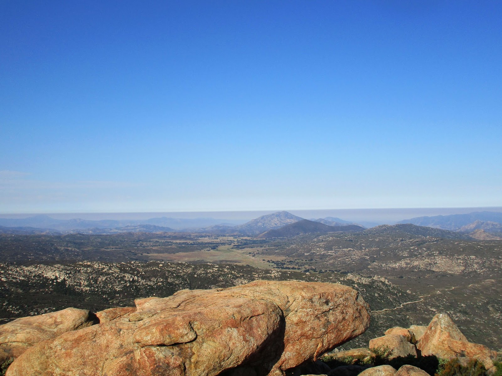
I drove to the turnout on Lake Morena Drive where the PCT passes by. There were two parking areas. One might be inside Lake Morena Park and the other one just outside. I parked in the outside turnout and started up the very smooth trail. It wasn't long before I got a look at Morena Butte. The trail wanders over the intervening ridge. Sometimes the trail moved parallel to the Butte and sometimes away from it, but eventually it went over the ridge into a shallow valley. The PCT then climbed up to the south ridge where a use trail leads up. The use trail was in good shape with plenty of cairns. It goes over to the west side of the butte and climbs behind the south summit ending at the giant south summit slab. It was easy to get to the highest boulder on the south summit where I found a tiny register in a tin can. It looked more like a geocache than summit register. Signatures went back to 2007. I found a spot to sign in and flipped through it, not finding many familiar names.
The Morena Butte summit is a three-headed snake, but only two are listed in Peakbagger. None of the heads are venomous. The south summit was the highest. I followed some cairns down the giant slab and into the shrubs on the way to the Sierra Club summit. There I found the official Sierra Club full-sized register. I signed in and found more names I recognized than from the tiny register. The north summit doesn't have the best views but it does have a great view of Lake Morena and Morena Reservoir. I only stayed a short time before packing up and heading toward the west summit. I didn't find a use trail over to it, but the brush was thin and not even waist high. I made short work of the trip and followed some cairns to the top where two boulders could argue for the high point. The northern most boulder looked like it might be higher. It was a 10' class 3 rock covered in bird poo. I started climbing, but saw a swarm of flying red ants on the top that I would have to disturb to stand on it. I decided to leave them be and check out the other boulder. To my surprise, there was a plaque set in the boulder. Some kind of ode to friendship signed "KMRJDE". The Internet didn't turn up anything on the plaque. The west summit has especially good views into Hauser Canyon. I didn't find any benchmarks anywhere. I could have returned on a different trail to make a loop, but instead returned to the south summit and followed the PCT back to the car. All three summits are worth a visit and without much additional effort. My knee held up with minimal pain. I think it's on the mend.
Distance: 9 miles round trip on trail and use trail
Summit Elevation: 3920'
Prominence: 700'
Elevation Gain: 2064'
Elevation Gain (in Empire State Buildings): 1.65
Round trip time: 4 hours 40 minutes
Recommended water: 64 oz.
Parking/Fees: Free at turnout on Lake Morena Drive
Difficulty: Moderate
A couple of weeks ago, I bruised my right knee. The bruise faded in a few days, but the knee didn't feel 100%. Last week, I went to the gym and tweaked it hard lugging dumbbells around. I had been invited on a canyoneering trip down Big Santa Anita Canyon and did my best to rehab in time. I iced it morning and night and wore a compression sleeve to work. The first day it hurt just to walk normally. The night before the canyoneering trip, I had to pass because it wasn't ready for serious off-trail work and rappels. Until now, I'd been lucky and hadn't had to deal with injuries. It was very frustrating, compounded by the slow healing that comes with age. I looked for a consolation prize with a trail. Morena Butte, #52 on the SDC list, seemed reasonable.
I drove to the turnout on Lake Morena Drive where the PCT passes by. There were two parking areas. One might be inside Lake Morena Park and the other one just outside. I parked in the outside turnout and started up the very smooth trail. It wasn't long before I got a look at Morena Butte. The trail wanders over the intervening ridge. Sometimes the trail moved parallel to the Butte and sometimes away from it, but eventually it went over the ridge into a shallow valley. The PCT then climbed up to the south ridge where a use trail leads up. The use trail was in good shape with plenty of cairns. It goes over to the west side of the butte and climbs behind the south summit ending at the giant south summit slab. It was easy to get to the highest boulder on the south summit where I found a tiny register in a tin can. It looked more like a geocache than summit register. Signatures went back to 2007. I found a spot to sign in and flipped through it, not finding many familiar names.
The Morena Butte summit is a three-headed snake, but only two are listed in Peakbagger. None of the heads are venomous. The south summit was the highest. I followed some cairns down the giant slab and into the shrubs on the way to the Sierra Club summit. There I found the official Sierra Club full-sized register. I signed in and found more names I recognized than from the tiny register. The north summit doesn't have the best views but it does have a great view of Lake Morena and Morena Reservoir. I only stayed a short time before packing up and heading toward the west summit. I didn't find a use trail over to it, but the brush was thin and not even waist high. I made short work of the trip and followed some cairns to the top where two boulders could argue for the high point. The northern most boulder looked like it might be higher. It was a 10' class 3 rock covered in bird poo. I started climbing, but saw a swarm of flying red ants on the top that I would have to disturb to stand on it. I decided to leave them be and check out the other boulder. To my surprise, there was a plaque set in the boulder. Some kind of ode to friendship signed "KMRJDE". The Internet didn't turn up anything on the plaque. The west summit has especially good views into Hauser Canyon. I didn't find any benchmarks anywhere. I could have returned on a different trail to make a loop, but instead returned to the south summit and followed the PCT back to the car. All three summits are worth a visit and without much additional effort. My knee held up with minimal pain. I think it's on the mend.
Saturday, July 8, 2017
Sheephead Mountain
Hiked: 7/7/2017
Distance: 3.5 miles round trip on trail
Summit Elevation: 5896'
Prominence: 576'
Elevation Gain: 1034'
Elevation Gain (in Empire State Buildings): 0.82
Round trip time: 2 hours
Recommended water: 48 oz.
Parking/Fees: Adventure Pass
Difficulty: Easy
The last peak of the day was Sheephead Mountain, #7 on the Sierra Club San Diego Peaks list, and #193 on the misnamed Hundred Peaks Section list. I had checked the Cleveland National Forest site to make sure Kitchen Creek Road was open. I was the only car at the trailhead. The first part of the hike is along a dirt road, then a single track that connects with another dirt road also named Kitchen Creek. This part of San Diego county is relatively high (>5000') pine forest. It was very tranquil, in stark contrast to the desert. I headed down the second Kitchen Creek road to a barbed wire gate with a no trespassing sign. This was documented in several trip reports and is generally ignored. The road skirts the edge of the national forest and hikers only need to walk about a quarter mile to the clipped use trail. I continued past the fence and followed Michael Sullivan's GPS track to locate the use trail. I had read the use trail was overgrown and came prepared with clippers. There was only one spot that was really overgrown, next to a large boulder just as the trail started to ascend. It looked like you should go forward but the trail actually turned right. That delayed my ascent a few minutes while I searched around for the continuation. After that, the trail was mostly clear. It was a light bushwhack at best. The trail was steep for about 0.4 miles before it topped out at the first set of summit boulders. A San Diego county benchmark was set into one of them and an empty cairn marked another. The high point and namesake "sheephead" boulders were only 100' further. The boulders are supposed to look like a pair of ram horns.
At the base of the boulders was a red ammo box containing the register. I signed in, then took a look at the large summit boulders. The right boulder is the highest. The easiest way up appeared to be directly up the right boulder. A single class 3 move was required to get onto the right boulder and around the left one. Once I was on the right boulder, there was a crack midway and plenty of holds. Class 2 the rest of the way to the top. Pictures make it look tougher than it is. I climbed around on both summit boulders, then returned to the lower boulders to rest. On the way down, I spent time thoroughly clipping the section of trail that was overgrown and piling the cuttings over the wrong way. At least the next visitor should be able to easily spot the trail continuation. My round trip time includes breaks and clipping time. I realized later that Sheephead, #7 on the San Diego Peak list was my 77th completed and I did it on 7/7/17. A lucky hike!
Would you like to know more...?
Distance: 3.5 miles round trip on trail
Summit Elevation: 5896'
Prominence: 576'
Elevation Gain: 1034'
Elevation Gain (in Empire State Buildings): 0.82
Round trip time: 2 hours
Recommended water: 48 oz.
Parking/Fees: Adventure Pass
Difficulty: Easy
The last peak of the day was Sheephead Mountain, #7 on the Sierra Club San Diego Peaks list, and #193 on the misnamed Hundred Peaks Section list. I had checked the Cleveland National Forest site to make sure Kitchen Creek Road was open. I was the only car at the trailhead. The first part of the hike is along a dirt road, then a single track that connects with another dirt road also named Kitchen Creek. This part of San Diego county is relatively high (>5000') pine forest. It was very tranquil, in stark contrast to the desert. I headed down the second Kitchen Creek road to a barbed wire gate with a no trespassing sign. This was documented in several trip reports and is generally ignored. The road skirts the edge of the national forest and hikers only need to walk about a quarter mile to the clipped use trail. I continued past the fence and followed Michael Sullivan's GPS track to locate the use trail. I had read the use trail was overgrown and came prepared with clippers. There was only one spot that was really overgrown, next to a large boulder just as the trail started to ascend. It looked like you should go forward but the trail actually turned right. That delayed my ascent a few minutes while I searched around for the continuation. After that, the trail was mostly clear. It was a light bushwhack at best. The trail was steep for about 0.4 miles before it topped out at the first set of summit boulders. A San Diego county benchmark was set into one of them and an empty cairn marked another. The high point and namesake "sheephead" boulders were only 100' further. The boulders are supposed to look like a pair of ram horns.
At the base of the boulders was a red ammo box containing the register. I signed in, then took a look at the large summit boulders. The right boulder is the highest. The easiest way up appeared to be directly up the right boulder. A single class 3 move was required to get onto the right boulder and around the left one. Once I was on the right boulder, there was a crack midway and plenty of holds. Class 2 the rest of the way to the top. Pictures make it look tougher than it is. I climbed around on both summit boulders, then returned to the lower boulders to rest. On the way down, I spent time thoroughly clipping the section of trail that was overgrown and piling the cuttings over the wrong way. At least the next visitor should be able to easily spot the trail continuation. My round trip time includes breaks and clipping time. I realized later that Sheephead, #7 on the San Diego Peak list was my 77th completed and I did it on 7/7/17. A lucky hike!
Would you like to know more...?
Subscribe to:
Posts (Atom)