Distance: 3.5 miles round trip on trail
Summit Elevation: 5896'
Prominence: 576'
Elevation Gain: 1034'
Elevation Gain (in Empire State Buildings): 0.82
Round trip time: 2 hours
Recommended water: 48 oz.
Parking/Fees: Adventure Pass
Difficulty: Easy
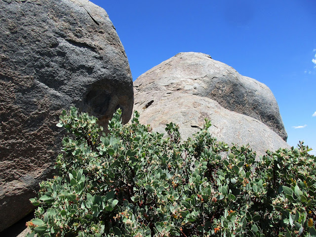
The last peak of the day was Sheephead Mountain, #7 on the Sierra Club San Diego Peaks list, and #193 on the misnamed Hundred Peaks Section list. I had checked the Cleveland National Forest site to make sure Kitchen Creek Road was open. I was the only car at the trailhead. The first part of the hike is along a dirt road, then a single track that connects with another dirt road also named Kitchen Creek. This part of San Diego county is relatively high (>5000') pine forest. It was very tranquil, in stark contrast to the desert. I headed down the second Kitchen Creek road to a barbed wire gate with a no trespassing sign. This was documented in several trip reports and is generally ignored. The road skirts the edge of the national forest and hikers only need to walk about a quarter mile to the clipped use trail. I continued past the fence and followed Michael Sullivan's GPS track to locate the use trail. I had read the use trail was overgrown and came prepared with clippers. There was only one spot that was really overgrown, next to a large boulder just as the trail started to ascend. It looked like you should go forward but the trail actually turned right. That delayed my ascent a few minutes while I searched around for the continuation. After that, the trail was mostly clear. It was a light bushwhack at best. The trail was steep for about 0.4 miles before it topped out at the first set of summit boulders. A San Diego county benchmark was set into one of them and an empty cairn marked another. The high point and namesake "sheephead" boulders were only 100' further. The boulders are supposed to look like a pair of ram horns.
At the base of the boulders was a red ammo box containing the register. I signed in, then took a look at the large summit boulders. The right boulder is the highest. The easiest way up appeared to be directly up the right boulder. A single class 3 move was required to get onto the right boulder and around the left one. Once I was on the right boulder, there was a crack midway and plenty of holds. Class 2 the rest of the way to the top. Pictures make it look tougher than it is. I climbed around on both summit boulders, then returned to the lower boulders to rest. On the way down, I spent time thoroughly clipping the section of trail that was overgrown and piling the cuttings over the wrong way. At least the next visitor should be able to easily spot the trail continuation. My round trip time includes breaks and clipping time. I realized later that Sheephead, #7 on the San Diego Peak list was my 77th completed and I did it on 7/7/17. A lucky hike!
Would you like to know more...?


No comments:
Post a Comment