Monday, June 17, 2024

Pine Mountain #1

Hiked: 6/11/2024 (x2)
Distance: 3.2 round trip on trail
Summit Elevation: 9652'
Elevation Gain: 1840'
Elevation Gain (in Empire State Buildings): 1.4
Round trip time: 3 hours
Recommended water: 48 oz.
Parking/Fees: Free on Forest Road 3N06
Difficulty: Moderate

I drove past Guffy Campground to a small turnout where the Pine Mountain ridge met the road: the start of the North Backbone Trail. Pine was a backup plan when I discovered the ACH was closed at Vincent Gap. Sean Green and I had done the entire North Backbone years ago, but this trip was just for Pine. I dropped from the road to the ridge, then began the first of two steep slopes on the way to the Pine summit pleateau. The gain piled up quickly and the views expanded at an equal rate. The trail was somewhat loose, filled with dirt and scree. True to name, coniferous trees lined the ridge, increasing in age the higher I went. It's beautiful country, less harsh than the whitethorn and yuccas that plague the lesser peaks. The crux was the second slope, higher angle with easy scramble sections. The rock along the ridge was pretty decayed and holds had to be tested. When I got up the second slope, the forest filled out a little and I managed to briefly lose the trail. The forest had little ground cover and it was easy to get back on track. A few blobs of hard packed snow covered the trail in the upper reaches. It was easier to go around them than over. The summit had no benchmark but it did have an ammo box with a couple of registers that entropy had converted into a pile of loose sheets. The massive views south to Dawson, Baldy, and Iron were chef's kiss. The wind was calm enough to fly the drone, my first flight since I had the gimbal repaired. It followed me down part of the steepest slope and handled the obstacles like a champ. I hope to get back to the deeper parts of the ACH soon.


Wednesday, June 12, 2024

Table Mountain

Hiked: 6/11/2024
Distance: 0.6 miles round trip on road and use trail
Summit Elevation: 7516'
Elevation Gain: 150'
Elevation Gain (in Empire State Buildings): 0.1
Round trip time: 15 minutes
Recommended water: 0 oz.
Parking/Fees: Free at Table Mountain parking lot
Difficulty: Easy

Table Mountain was my first stop on a planned tour of several peaks north of the Angeles Crest Highway. Table Mountain is primarily a ski area, but there was also a disc golf course spread around the area. The summit housed some kind of government facility. I parked in the parking lot and followed the paved road to the summit. In addition to a tower, the summit had an intact benchmark set in a cement block. There wasn't much else to see. On the way down, I followed a trail that is part of the disc golf course. The entire trip took 15 minutes, a mild warm up. Mount Lewis was supposed to be next on my list. I was surprised when I got to Vincent Gap and saw the gates on the ACH closed. I didn't expect it to be closed in mid-June. The rest of my planned summits were blocked. I sat in the truck for awhile trying to come up with a backup plan. I remembered Blue Ridge road was open when I passed it, so I decided to drive down the road and hike to Pine Mountain on the North Backbone Trail. It was relatively short and a beautiful part of the forest. I turned around and headed toward Blue Ridge.


View from the summit toward the government facility


Disc golf tee

Monday, June 10, 2024

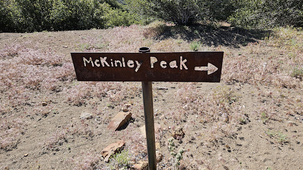
McKinley Mountain and Cachuma Mountain

Hiked: 6/7/2024
Distance: 20.6 miles round trip on dirt road and use trail
Summit Elevation: 6225' (McKinley), 4697' (Cachuma)
Elevation Gain: 5323'
Elevation Gain (in Empire State Buildings): 4.2
Round trip time: 8 hours 10 minutes
Recommended water: 128 oz.
Parking/Fees: Free at Cachuma Saddle
Difficulty: Strenuous

The day started as a one-day attempt on Santa Cruz Peak, deep in the Santa Barbara back country, Los Padres National Forest. The plan was to ride a rented e-bike 8 miles on the dirt road to McKinley saddle, hike Santa Cruz, and ride back. That all changed when the motor on the e-bike made a grinding sound and conked out just below Cachuma, only 2.5 miles from the start. Several reboots, no luck. Battery still showed full power, but no pedal assist or throttle response. I parked the bike and hiked up to the Cachuma (LPC #6) summit to contemplate what to do with the rest of the day. It was my second summit of Cachuma, this time in sunshine. My last visit was in clouds and rain. I enjoyed the wonderful views in all directions, signed into a register in a small ammo box. Coming down, I did the time math in my head, concluding I could hike to McKinley Mountain (HPS #172) and back, but wouldn't have enough daylight for Santa Cruz. It would have to wait for another day.


Cachuma summit

Cachuma benchmark


Small ammo box with register


I continued south on Forest Road 8N08, curling around major bumps, dropping to around 4200'. Then came a section of partly rutted road that gained 1500' up to McKinley Springs Campground. There were several camping spots, all empty. A horse trough was on one side with green algae water. A cistern was on the other side with spring water running from a pipe. With altered plans, I didn't need any water, but it was nice to know it was running. Not far above the campground was an open space with a trail leading to the dominant San Rafael Mountain. An overgrown road continued on toward Santa Cruz, but I took the use trail to McKinley. It had a steep start, then mellowed out. A little brush intruded on the trail, but it had been cut back in most places. It looked like the summit might be enclosed by trees, but a pile of rocks rose above it to offer a nice 360. Black painted cans held a new register. I did not find any marks, but there were cement base blocks from an old fire lookout. Santa Cruz looked very brushy from my vantage point. After a brief stay on top, I started down. Bugs had been a nuisance all day. A few mosquitoes, but mostly gnat swarms. I finally broke down and dug out the bug net. When I got back below Cachuma, I checked the e-bike and it was still dead. It was downhill all the way back, so I had no problem coasting at 8-9 mph. I was back at the trailhead in no time. When I returned the bike the next day, the owner said he would give me a free rental to make up for it. Now, I need to plan my next foolhardy attempt.


Hells Half Acre


Wildflowers on the way to McKinley

Summit rocks

Looking down on Santa Cruz Peak

Cachuma Lake in the distance


Cistern with running spring water


Cachuma on the way back


See also:
Cachuma Mountain (2016)

Saturday, June 1, 2024

Buena Vista Peak

Hiked: 5/27/2024
Distance: 2 miles round trip on trail
Summit Elevation: 7605'
Elevation Gain: 525'
Elevation Gain (in Empire State Buildings): 0.4
Round trip time: 1 hours 10 minutes
Recommended water: 16 oz.
Parking/Fees: $35 National Parks Fee (one vehicle for 7 days) or Annual Pass
Difficulty: Easy

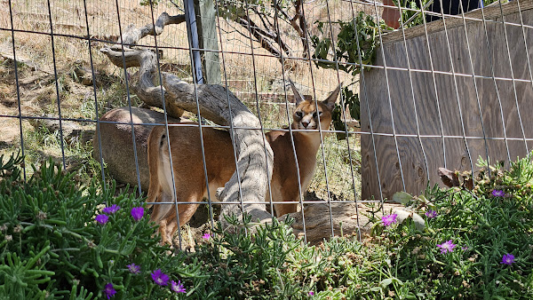
It was Memorial Day and our last day in Sequoia. Leisa had climbed Buena Vista before, but it was new to me. We got up in the dark and drove to Panorama Point to take in the sunrise. Leisa brewed some coffee while we waited for the sun. We spent about 30 minutes watching it come up over the Sierra Nevada. Then, we went back to our hotel room and packed up. We drove to the Buena Vista trailhead to hike it before we started the trip home. It was a short hike: two miles round trip with litte gain. There were large boulder formations along the way and several large boulders on the summit. True to its name, Buena Vista was a "good view". Buck Rock was prominent and sun reflected off the roof of the lookout tower. I climbed the class 2 summit boulder and we spent about 15 minutes enjoying the ambiance. We met a few other parties coming and going. With Buena Vista in the books, we decided to take a guided tour at Cat Haven on our way out of the mountains. Cat Haven is a not-for-profit sanctuary that cares for large cats that were born in captivity. They had snow leopards, jaguars, mountain lions, African lions, one cheetah, and two tigers. Most were awake and active and I had never been so close to a tiger or jaguar. Amazing and frightening cats. The guide had a bottle of blood that he sprayed at the cats for a treat. They are 100% carnivores. It was a great way to end our long weekend.

Panorama Point

Shell Mountain and Mt. Silliman


Big Baldy


Summit block

Cat Haven