Distance: 14.2 miles round trip on road and cross country
Summit Elevation: 4864' (Magic), 3842' (Garfield)
Elevation Gain: 2729'
Elevation Gain (in Empire State Buildings): 2.1
Round trip time: 5 hours 20 minutes
Recommended water: 92 oz.
Parking/Fees: Free at Santa Clara Truck Trail
Difficulty: Moderate
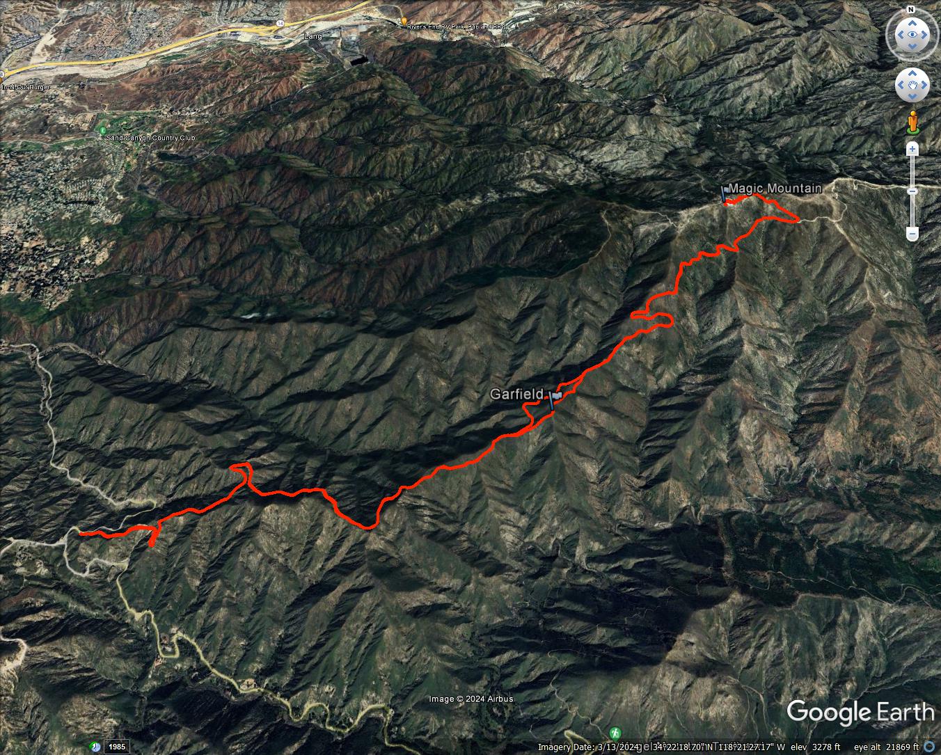
I had a day open up unexpectedly, so decided to head to Magic Mountain. I've wanted to visit the real Magic Mountain for some time. I made a bike attempt from the east last year, but a key gate was closed and I didn't have time to complete the longer distance. This time, I was split on whether to do a bike or hike. With high wind gusts forecast, I settled on a hike. This time, I started from Bear Divide and a western approach. I parked just before Bear Divide where the Santa Clara Truck Trail (forest route 3N17) crosses Sand Canyon. This was a road hike all the way. The high winds never materialized. A bike would have been faster, though I would have been pushing it a lot the last couple of miles.
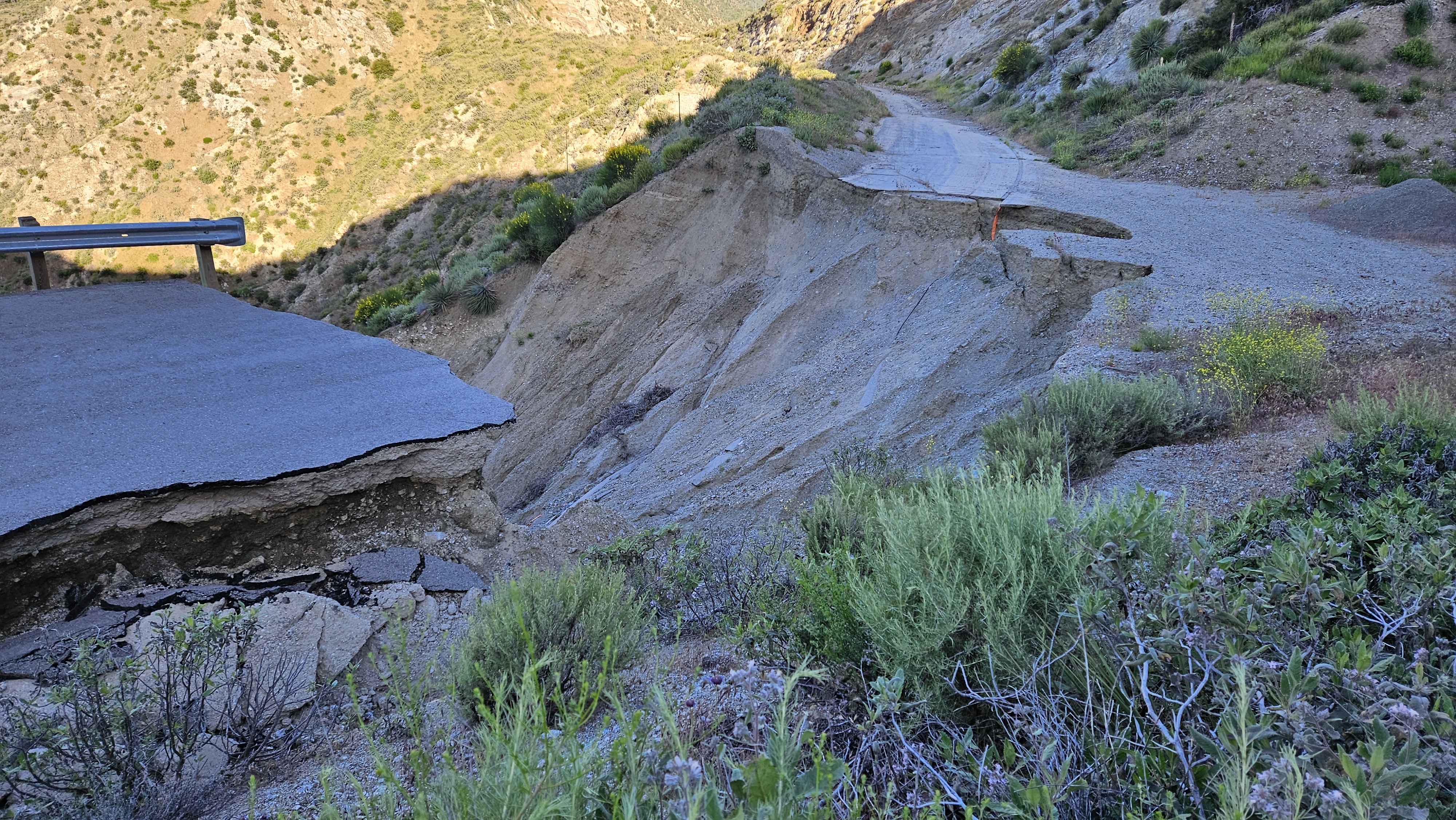
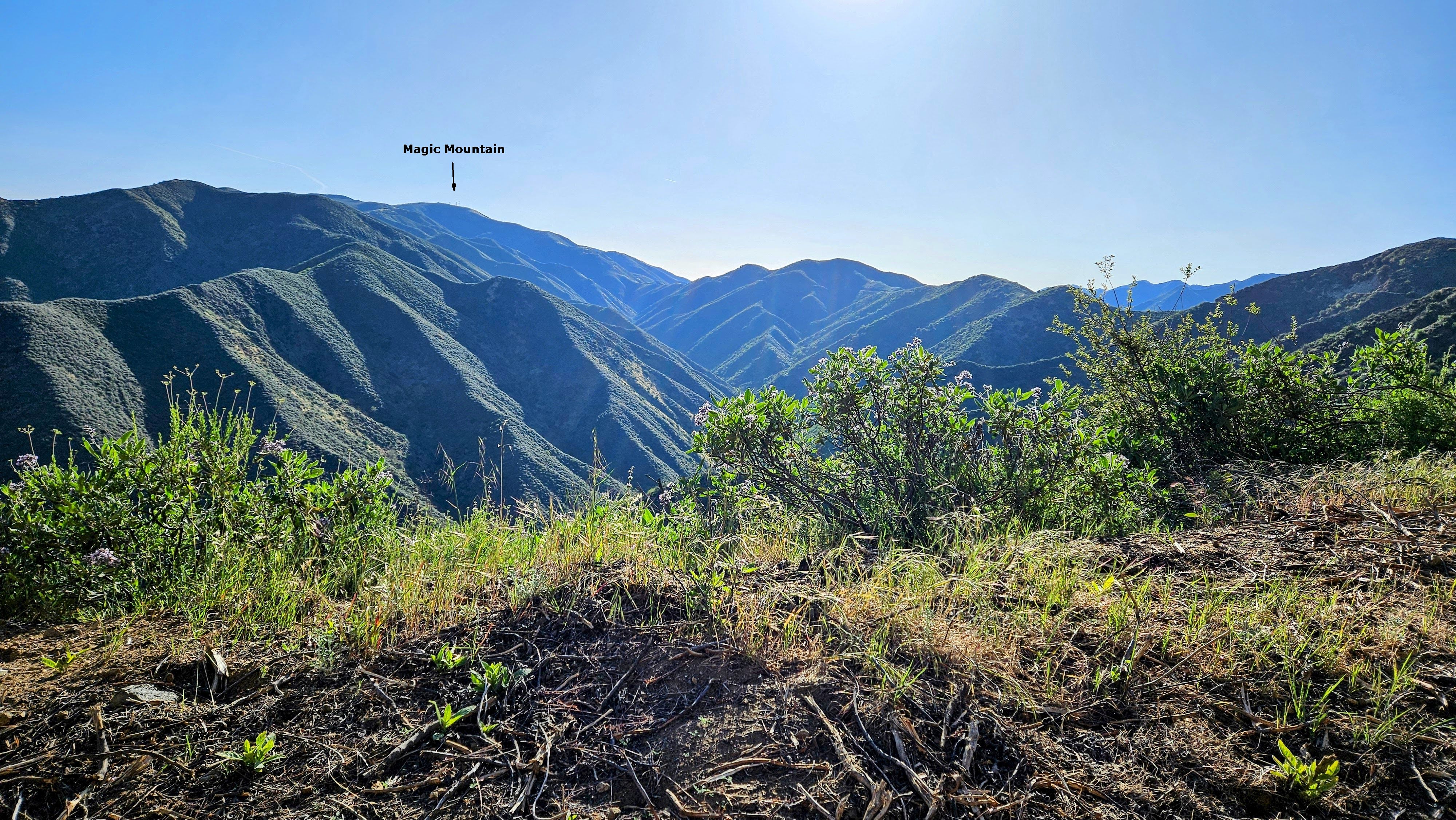
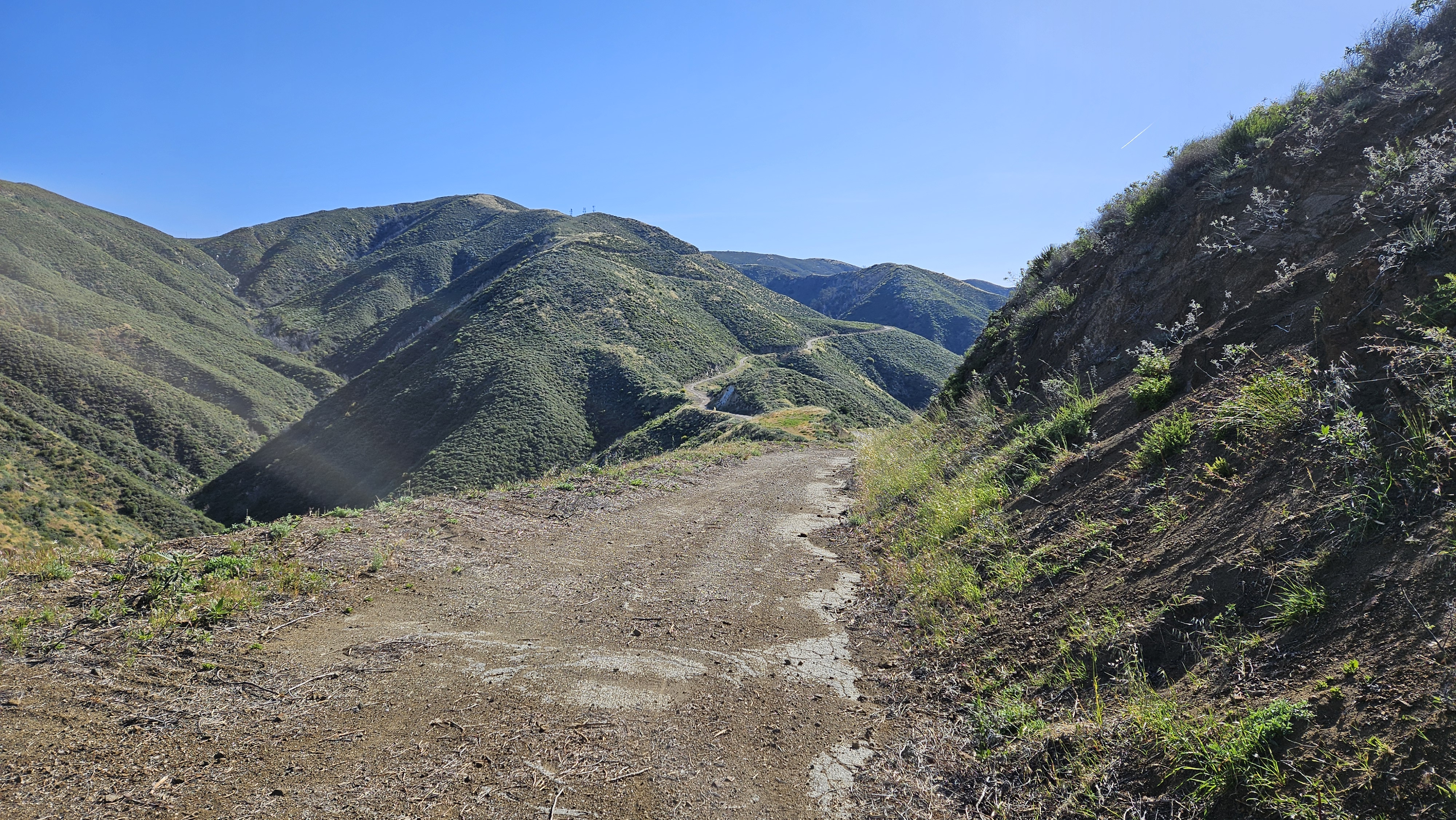
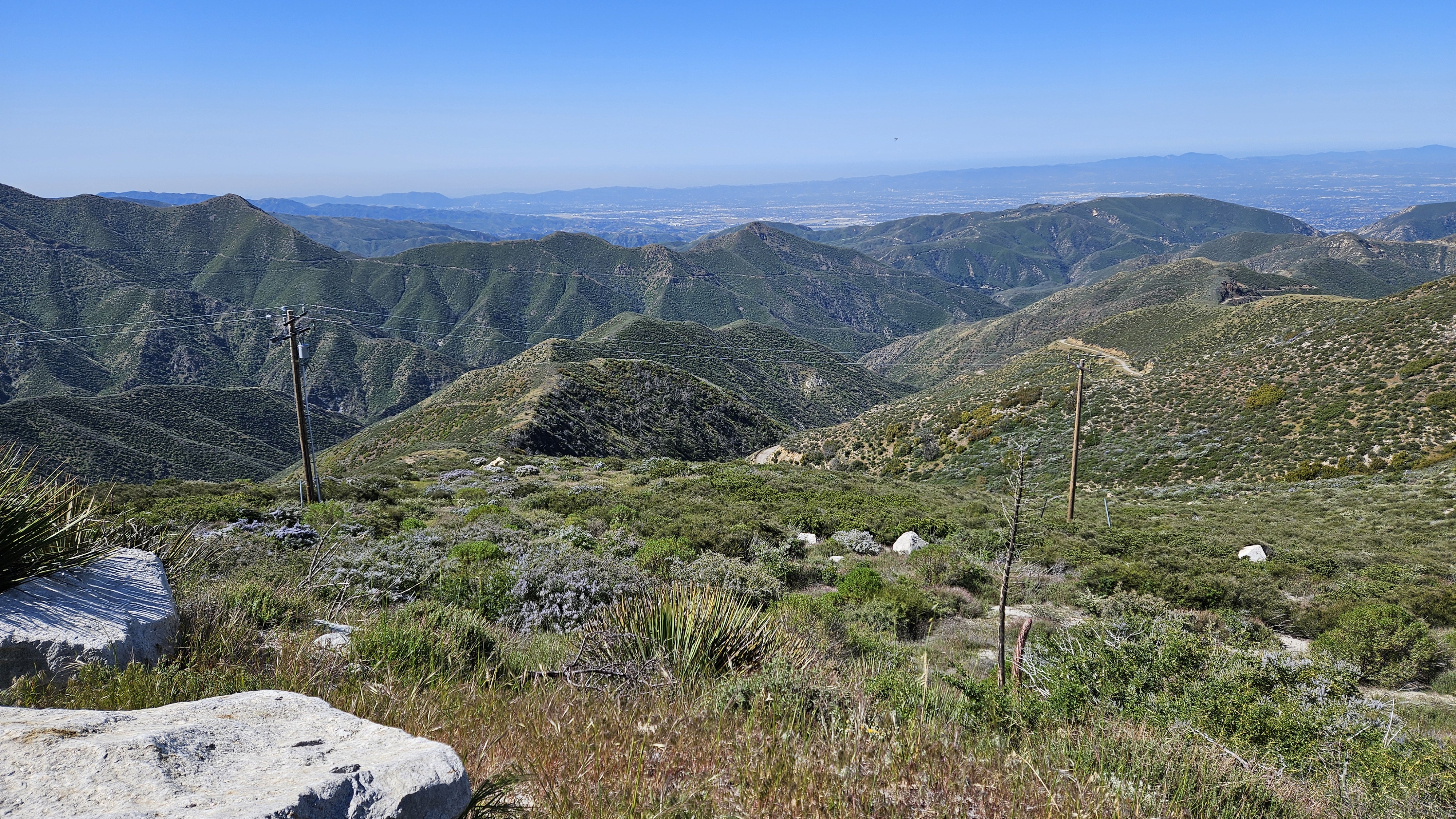
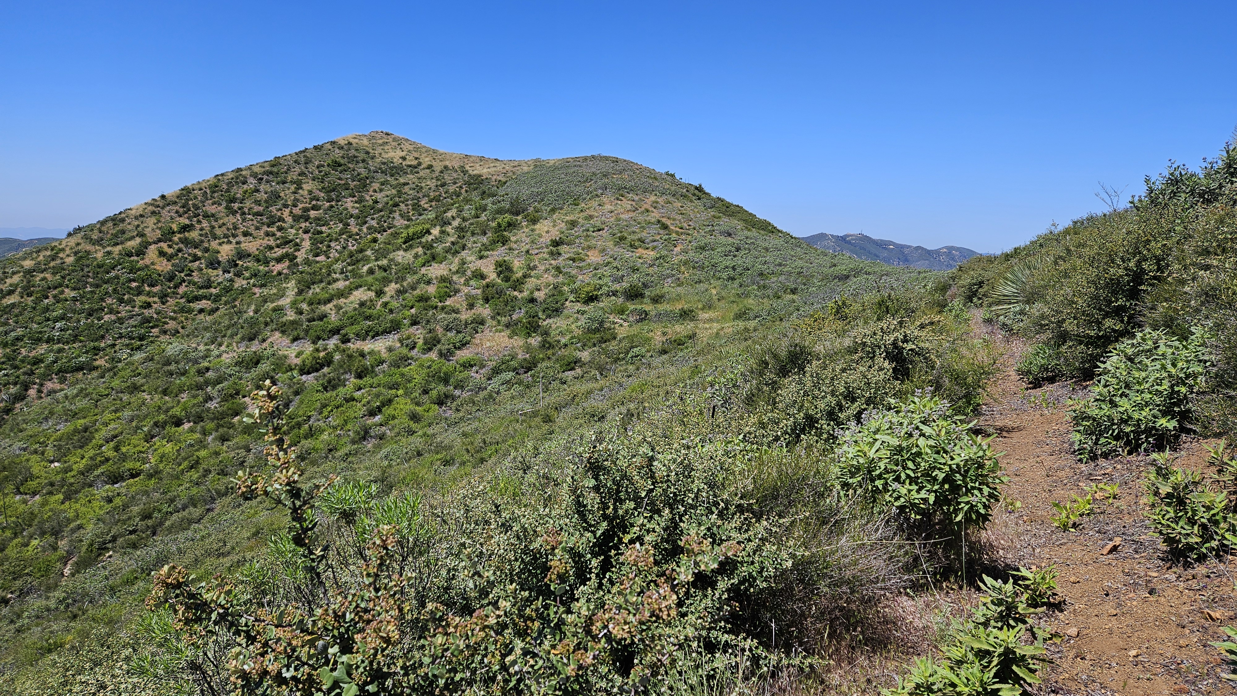
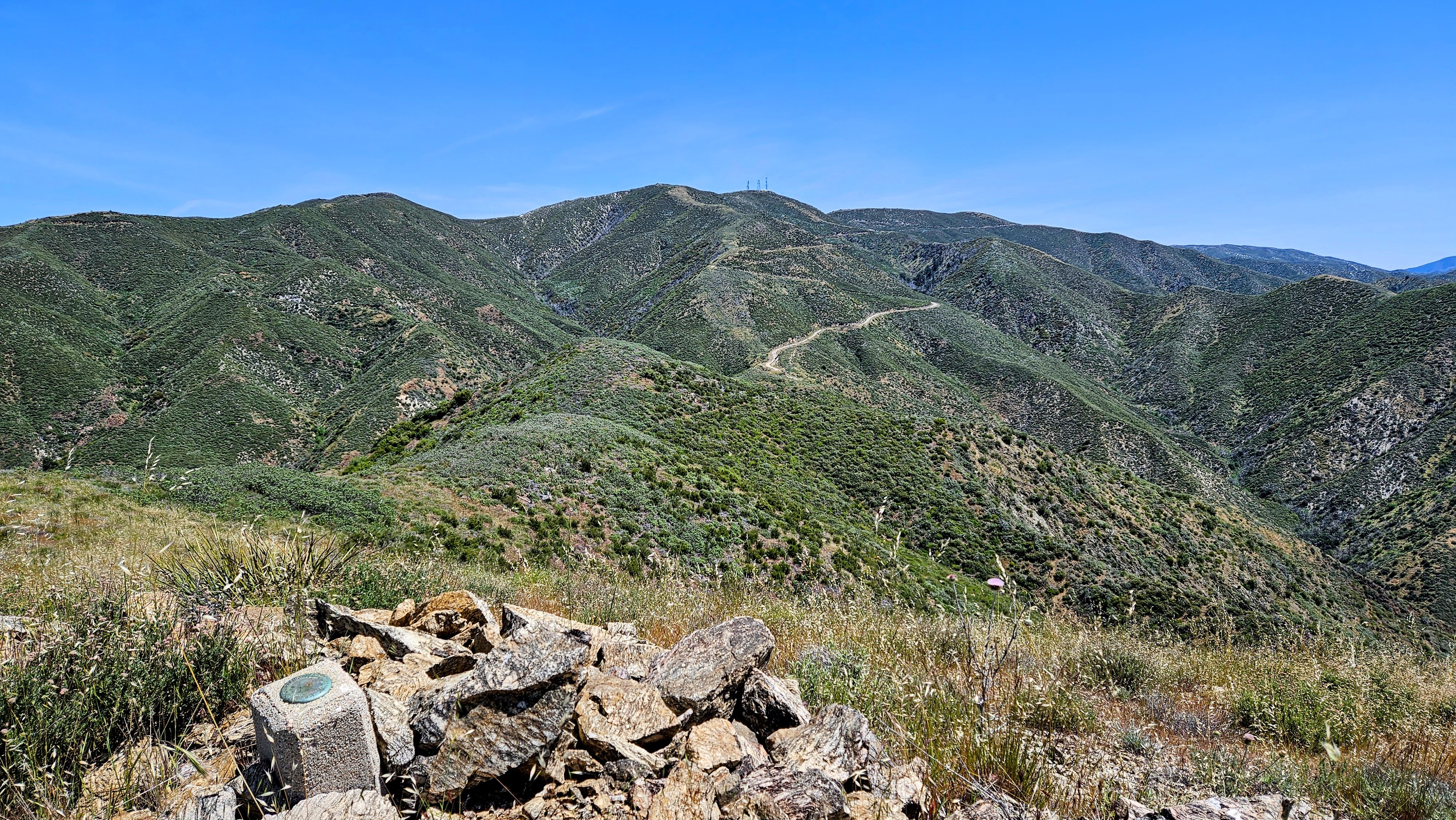
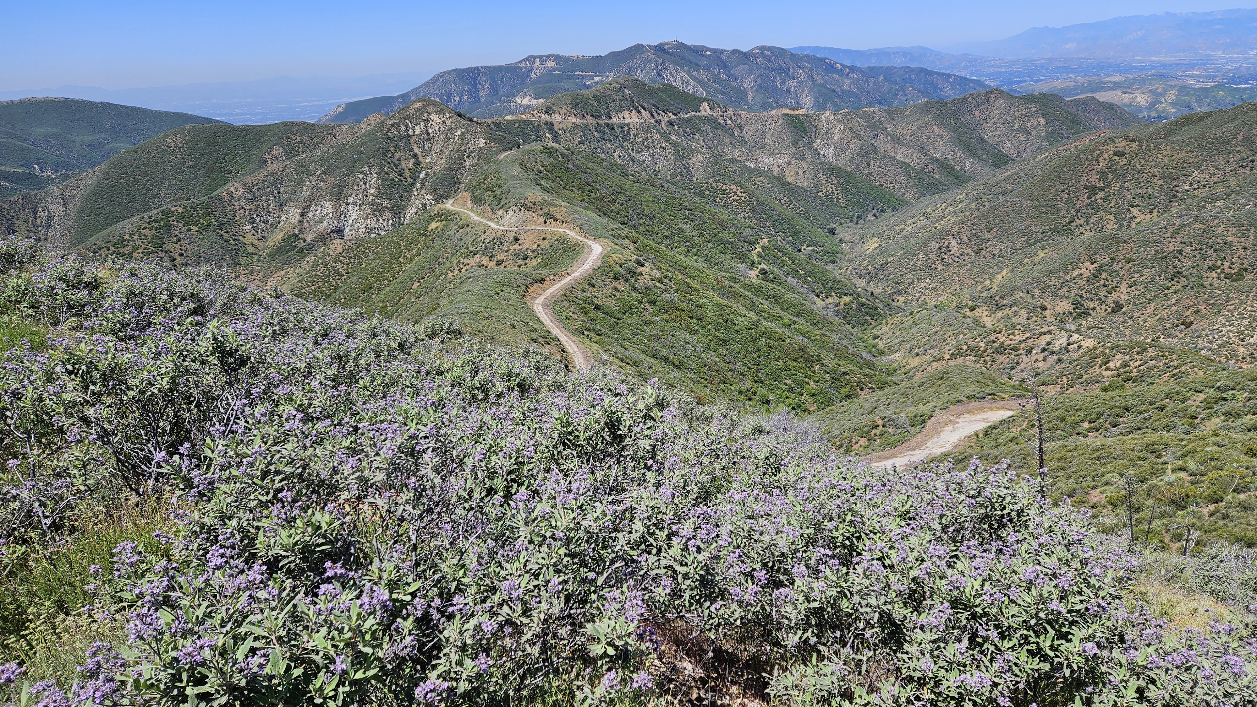
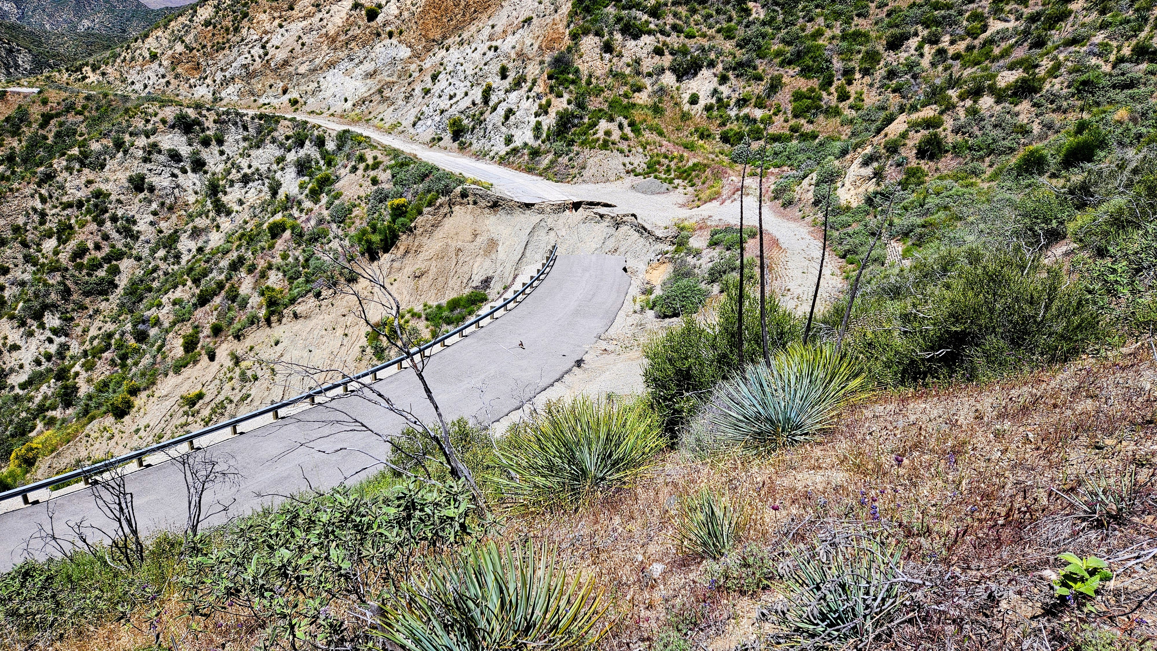
I started about 7:30 AM, solo on the road. After a half mile, I came to a huge washout. I had seen photos of the washout, but it was from years ago and I didn't know if the road had been repaired. Turns out no. Other than rockfall scattered across the road in places, this was the only major damage. The ascent angles on the road were easy so I concentrated on keeping my cadence even going uphill. I took short breaks for calories every hour, making great time. I realized about half way that the distant peak with three towers was Magic. It looked pretty far away in the early going. My optional bonus peak was Garfield Benchmark, not far off the main road. The Dagger Flat Trail passes below it from the east side. As I passed Garfield, I studied the west ridge for a use trail. I didn't see anything but the brush looked no higher than waist level. Mendenhall Peak and the Pinnacle were in constant view on a parallel ridge. The road went about 0.4 miles past the summit where it intersected the Magic Mountain Truck Trail. From there, it was less than a half mile to the top.


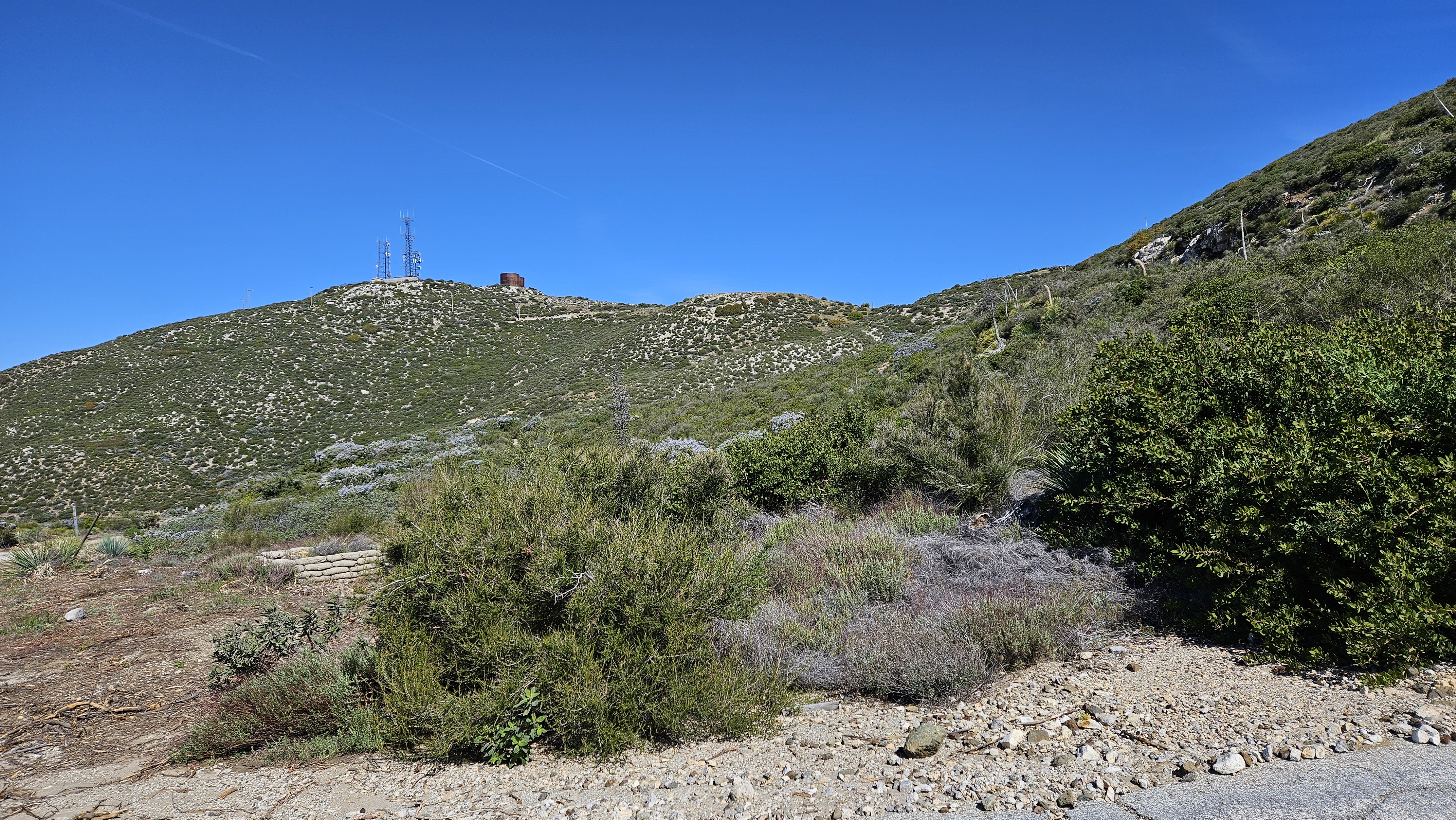

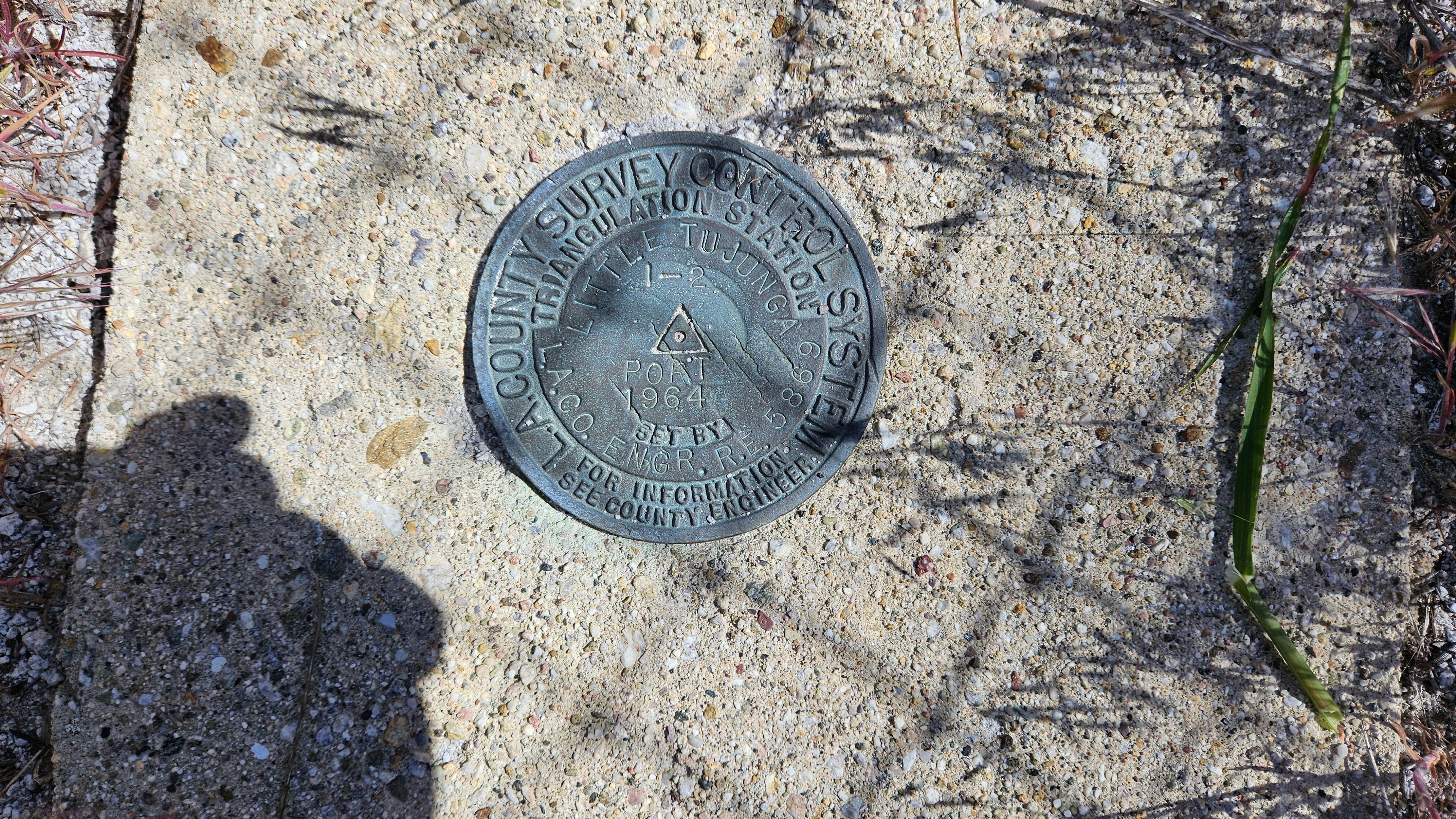
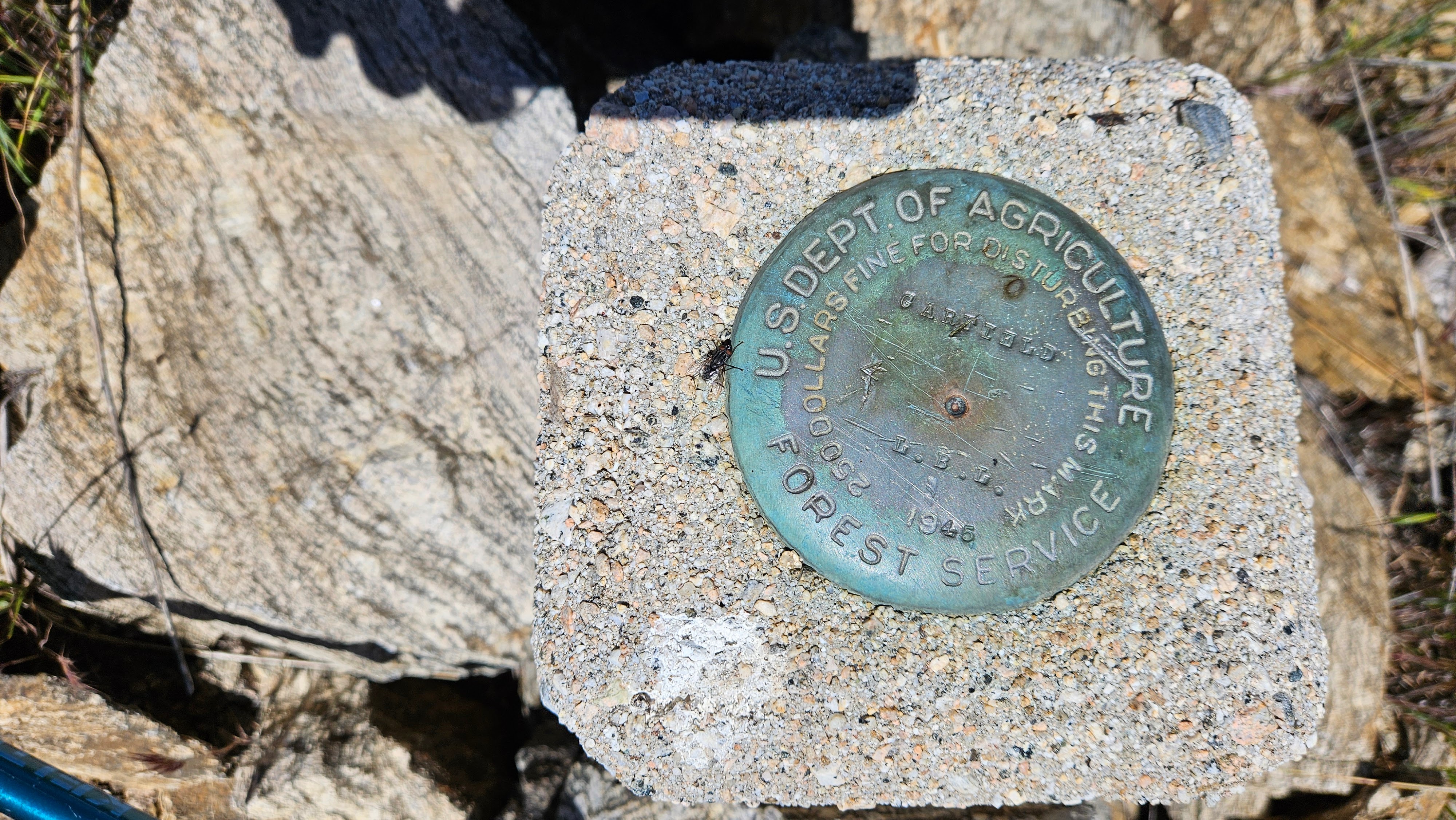
I saw two Nike missile launch pads on the east side just below the summit. There were also two water towers and three radio towers. The summit was fenced. I walked along the perimeter of the fence and stumbled on an LA County Engineering benchmark on the west side, just outside the fence. It was named "Little Tujunga" and placed in 1964. If there was a USGS mark, I didn't find it, or maybe it was inside the fence. Didn't find a register. After taking photos, I returned to one of the Nike silos for a break. Soon, I started back at a steady clip. When I got the junction with the Dagger Flat Trail, it looked a little overgrown. I decided to continue up the road a bit. I spotted a better section of the Dagger Flat Trail and left the road to grab it. From there, it was about 0.3 miles to Garfield. I left the trail to climb the ridge to Garfield, stepping slowly through waist high grass and soft plants. I kept stabbing where I could not see the ground with my pole to check for snakes. No surprises. Garfield had an intact benchmark in a small cinder block. No register. Garfield rose about 150' above the road. Next, I decided to descend the west ridge instead of going back. I was going to have to wade through tall grass and minor bushwhacking either way. There was enough of an animal trail on the west side that I got down without much fuss. The diversion probably cost about 30 minutes. I was amazed to have waded through so much grass with no ticks. I did several checks along the way. The rest of the descent was easy and I got back in time to avoid the worst of the traffic home.

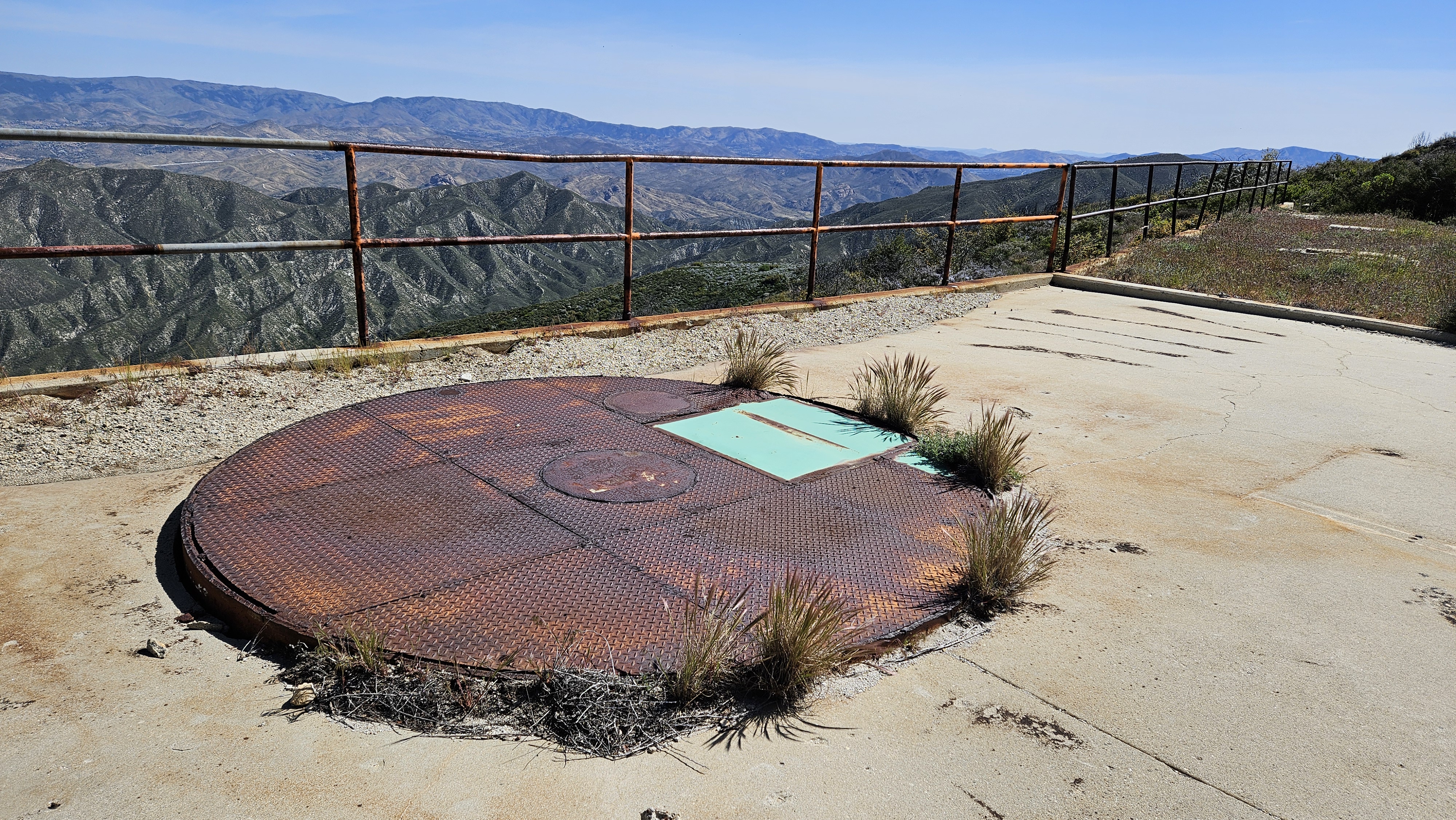


Those aren't Nike missile launch pads. It's true that the peak was originally part of a Nike missile battery, but then it was converted into a test facility for the Apollo lunar module's maneuvering thrusters. The thrusters would be mounted over the holes, and water would come down from the tanks and out onto the mountainside to keep it from catching fire. Nike missile pads are cool, but the lunar module is cooler.
ReplyDeleteI haven't been up there since before the fire in 2016. Good to see the place is still intact, apart from the big washout.
Robert,
DeleteThanks for the additional info! That would explain the two large water tanks for a relatively small installation. The towers and property are cleared maintained. I am guessing technicians drive up from the other side.